
16 Michigan Waterfalls You Should Visit in 2016
Manido Falls, Gogebic County
Michigan’s Upper Peninsula is home to more than 200 waterfalls, and the Lower Peninsula is home to one named waterfall. Over the years we’ve enjoyed visiting as many waterfalls as we can, ranging from small roadside drops to towering cascades reached after miles of hiking. Marquette County and Alger County are blessed with many waterfalls, including some of the most accessible and stunning drops in the state. Most people have been to or have at least heard of Tahquamenon Falls, but as we head in to the new year we wanted to share 16 Michigan waterfalls you should visit in 2016. This list focuses on waterfalls that can be reached by just about anyone, and includes many of the state’s biggest drops. A few bonus waterfalls have been thrown in as well, as it is often hard to pick just one when there is a collection of two or more falls within a one or two mile stretch of the same river. We hope you enjoy this list, and consider adding one or more of these beautiful locations to your vacation plans for next year!
Hungarian Falls – This collection of five or more drops on Dover Creek is one of the best hidden gems in the Upper Peninsula. Reached after a short drive and a short hike near Lake Linden, the Upper Falls is a 30 foot drop before the water reaches a small pond. After that the creek drops over an old concrete dam and makes several more drops before the Middle Falls (shown above). This 25 foot drop is incredibly scenic, as falling rock over the years has created a gorge below the falls. The biggest drop is yet to come, though, as the Lower Falls drop 100 feet into a gorge below. It’s hard to see this entire drop from the trail that ends at the crest of the waterfall, but the view of Torch Lake and the surrounding area is amazing. Faint trails lead to the Lower Falls from below, but we’ve so far had no success in making it all the way there due to fallen trees and steep or wet banks – we’ll be back to try again soon. For more pictures see our full post on Hungarian Falls or check it out on our list of 10 Hidden Gem Waterfalls in the Upper Peninsula.
From M-26 in Lake Linden, turn north onto 6th St. Take the left fork and head uphill on Golf Course Rd., looking for the second dirt road on the left. Due to conditions, you may want to park on the main road and walk in from here (it’s maybe a quarter mile on level terrain). If the road looks good or you have a high clearance vehicle you can proceed to a parking area near the old dam. Head to the right for the Upper Falls, then retrace your steps and follow the creek downstream to see the remaining falls.
Bond Falls – This is the second-largest waterfall in Michigan, and thanks to improvements made in 2003 it is universally accessible. A state scenic site, Bond Falls features an incredible 50 foot drop at a point where the Middle Branch of the Ontonagon River is 100 feet wide. A short, paved path leads from the parking lot to a boardwalk that provides a stunning view of this falls – there’s a reason it has been prominently featured in Pure Michigan campaigns! Chris and I remember visiting many years ago, when the parking area was above the falls and a steep set of stone steps led down to a much wilder waterfall. Now it’s much easier to visit, and with its location it is a convenient stop when traveling to just about any attraction in the Western U.P.
From M-28 there are two ways to reach the falls: coming from the east turn south on Calderwood Rd. and follow it to Bond Falls Rd. and the falls, coming from the west head south on US-45 at its intersection with M-28 and follow it south to Bond Falls Rd. Coming from the south, you’ll want to head north on US-45 from its intersection with US-2 and turn right on Bond Falls Rd. Large Michigan DNR signs help lead the way from all directions. A Michigan recreation passport is required for entry (or self-register and pay for one once you arrive).
Agate Falls – Not far from Bond Falls is Agate Falls, a beautiful waterfall that can be easily reached from a roadside park on M-28. A short, paved trail leads to an observation platform that offers a partial view of the upper section of the falls. Our full post about Agate Falls gives details on how to follow the path downhill if you are able, to get a better view of the falls from below. The Middle Branch of the Ontonagon River is about 60 feet wide here, and the waterfall features a 40 foot total drop. Hopefully, this site will eventually get improved access like its neighbor.
Agate Falls is reached from the roadside park along M-28 about 7 miles east of US-45. Park and follow the foot trail that goes under the highway bridge and follow that to the overlook – the “path” to the bottom of the falls is off to the right of the platform (steep, uneven terrain).

Ocqueoc Falls – This is the only named waterfall in the Lower Peninsula, and it is also one of the country’s most universally accessible cascades. Visitors can hike, bike, or cross country ski up to sox miles of trail on the Ocqueoc Falls Bicentennial Pathway, and there is also a state forest campground down the road. Since the total drop here is minimal, the falls are a popular spot for swimming and wading in the summer months. Check out our full post on Ocqueoc Falls for more pictures and video, and check out our Presque Isle County Outdoor Activities post for more ideas of things to do when you’re in the area.
Turn onto Ocqueoc Falls Highway from M-68, 10 miles east of Onaway and 11.5 mile west of Rogers City. The parking area for the falls and the campground will be reached shortly after turning.
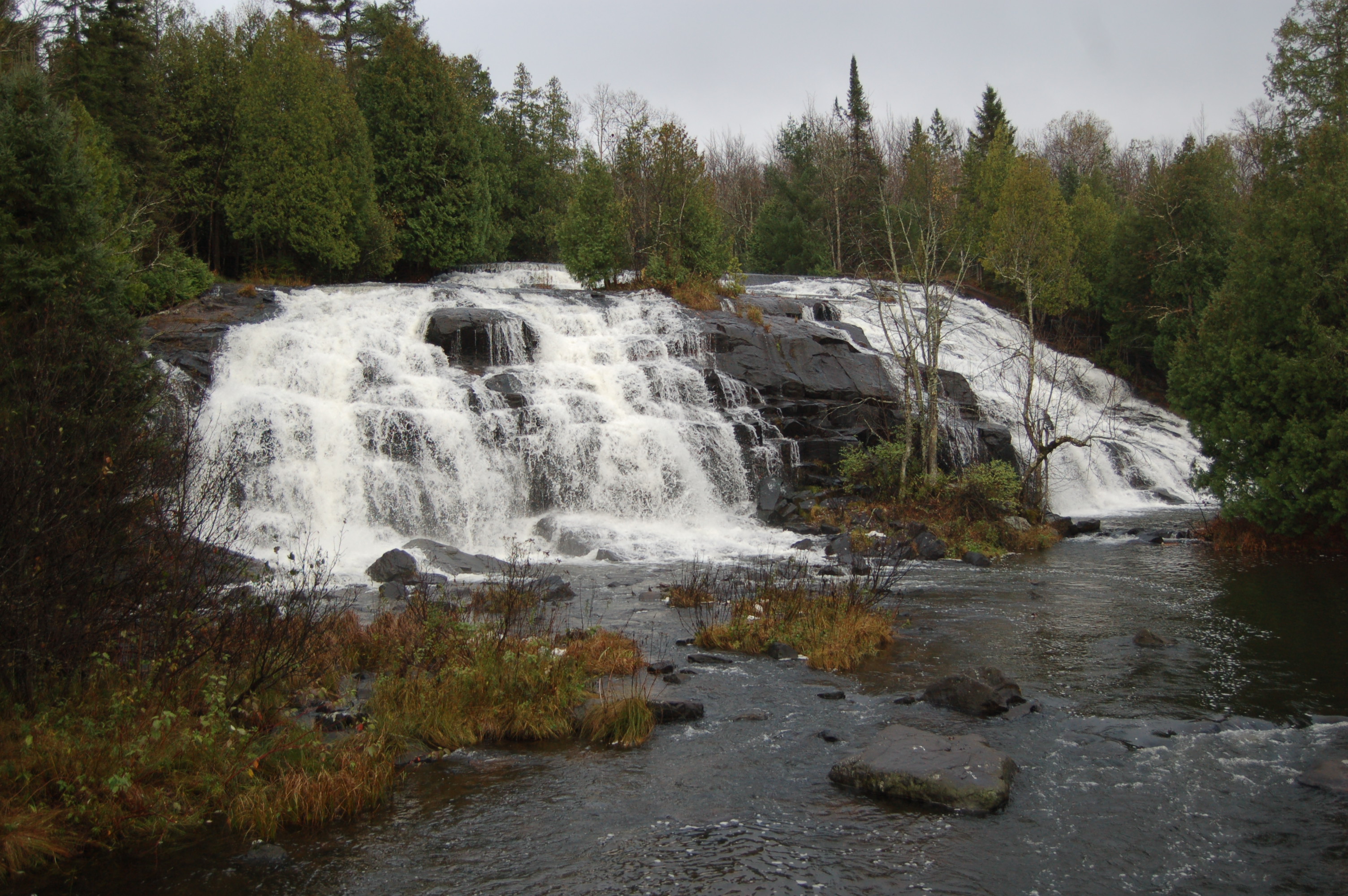
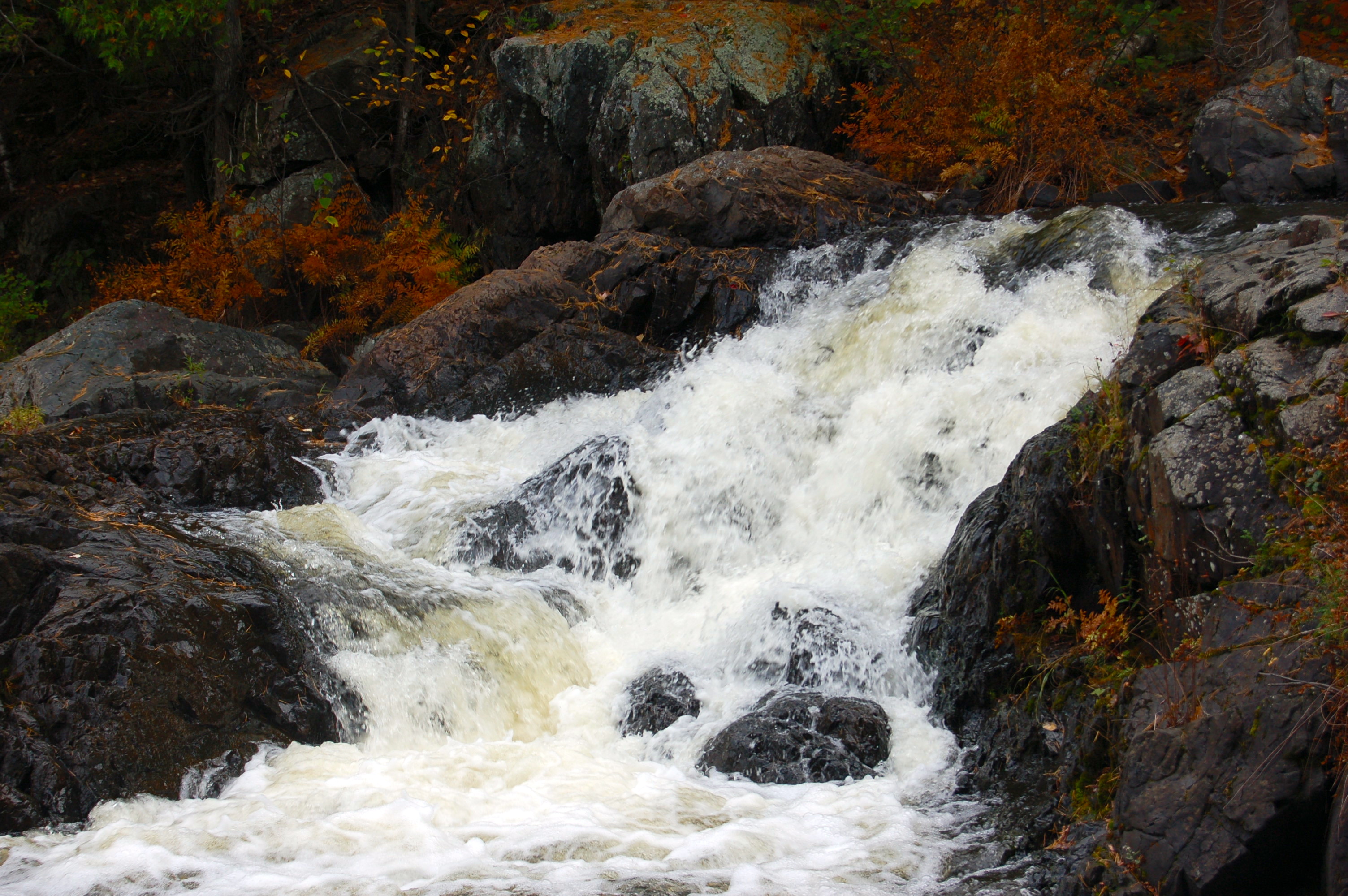
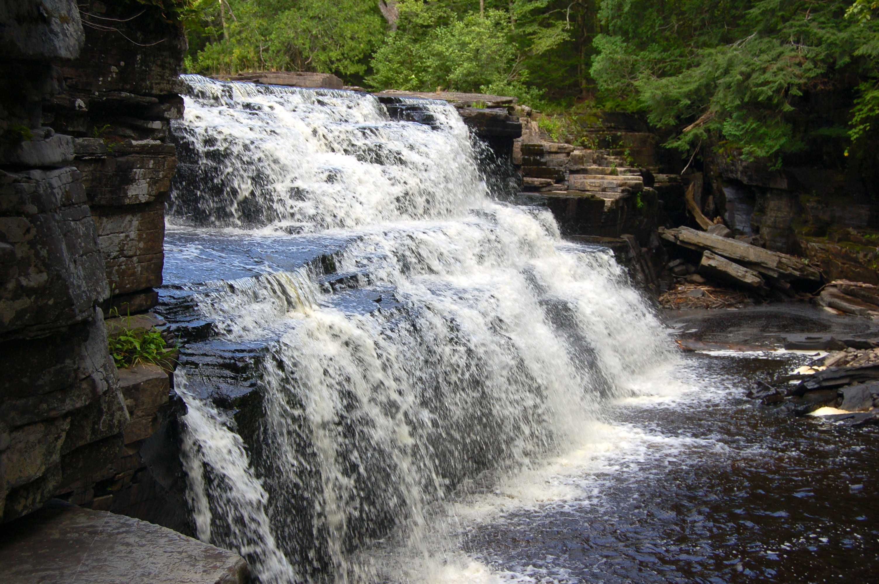
Black River Scenic Byway Falls – We’re cheating a bit here since this is actually 5 different waterfalls, but it’s hard to pick a favorite here and if you’re going to visit one why not see them all? From the south the first waterfall is Great Conglomerate Falls, a 20 foot high waterfall divided into two segments by a large conglomerate rock. Next up is Potawatomi Falls, a wheelchair accessible drop of 30 feet reached after a hike of 1/8 mile. From the same parking lot a trail leads to Gorge Falls, a scenic drop of 25 feet where the river is suddenly narrowed before dropping into a gorge. Sandstone Falls (pictured) may only be 15 feet tall, but it can be one of the most powerful drops on the river. The final drop before Lake Superior is Rainbow Falls, a 30 foot drop that can be partially viewed from the west side (1/2 mile hike) or in full from the east side (1 mile hike from harbor parking). All five of these waterfalls lie within a three mile stretch before the Black River reaches Lake Superior, and while water levels tend to be lower in the fall the changing colors of the leaves makes for an incredible backdrop.
From Hwy. US 2 in Bessemer take Powderhorn Rd north. At the T in the road at the stop sign, make a left hand turn on Black River Rd. Follow Black River Rd. north for a little more than 10 miles and watch for the signs for each parking area.
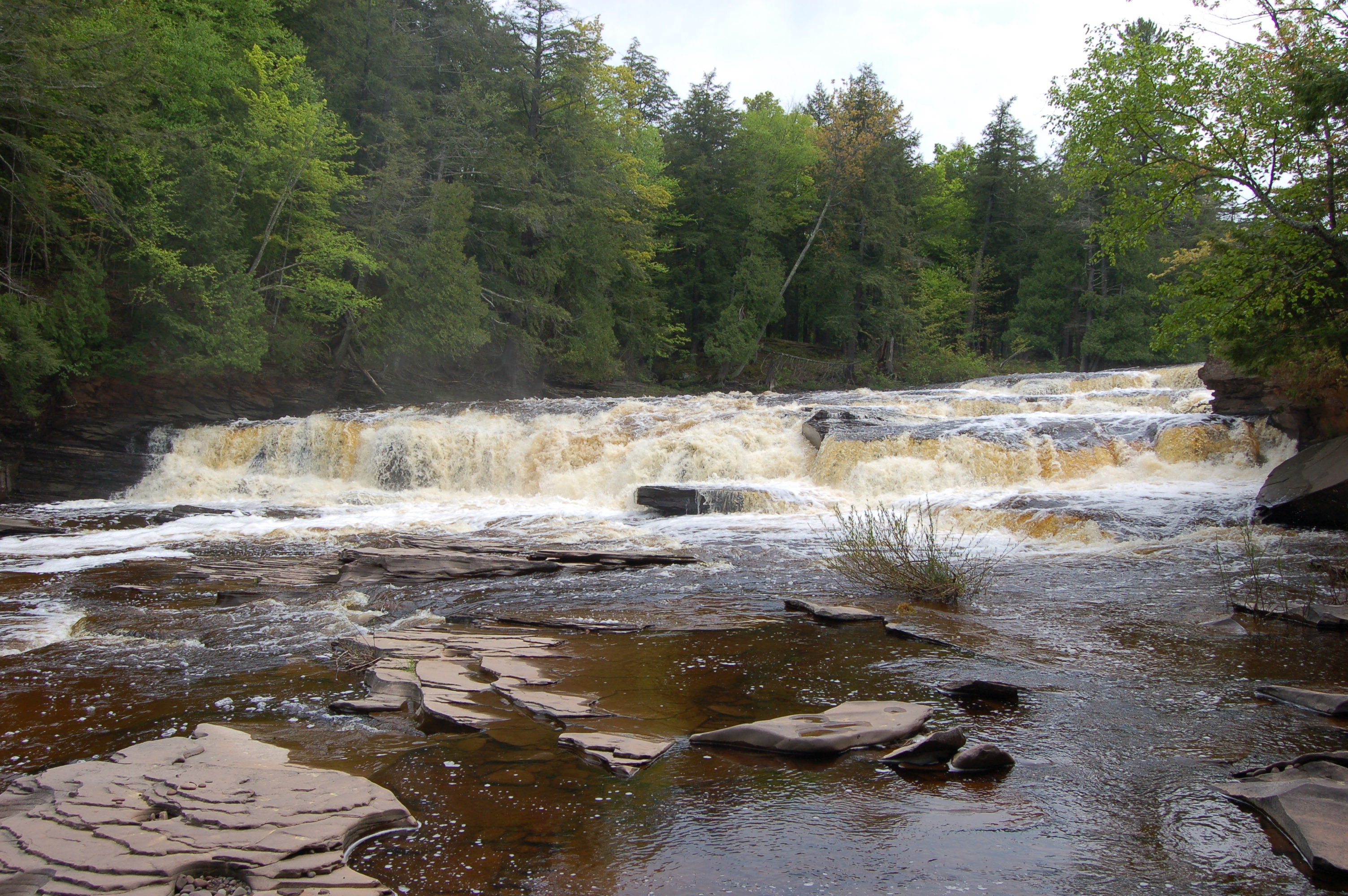
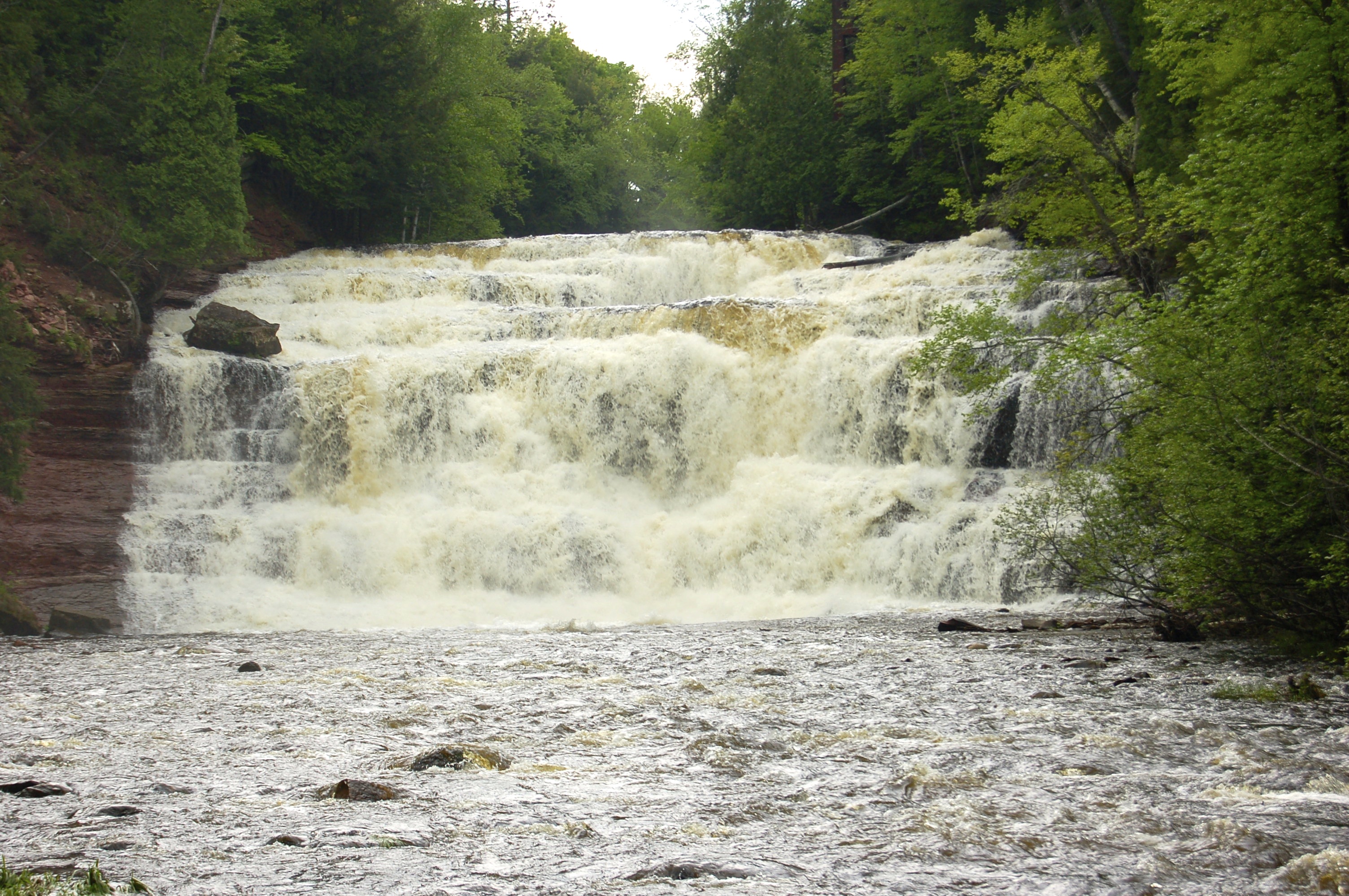
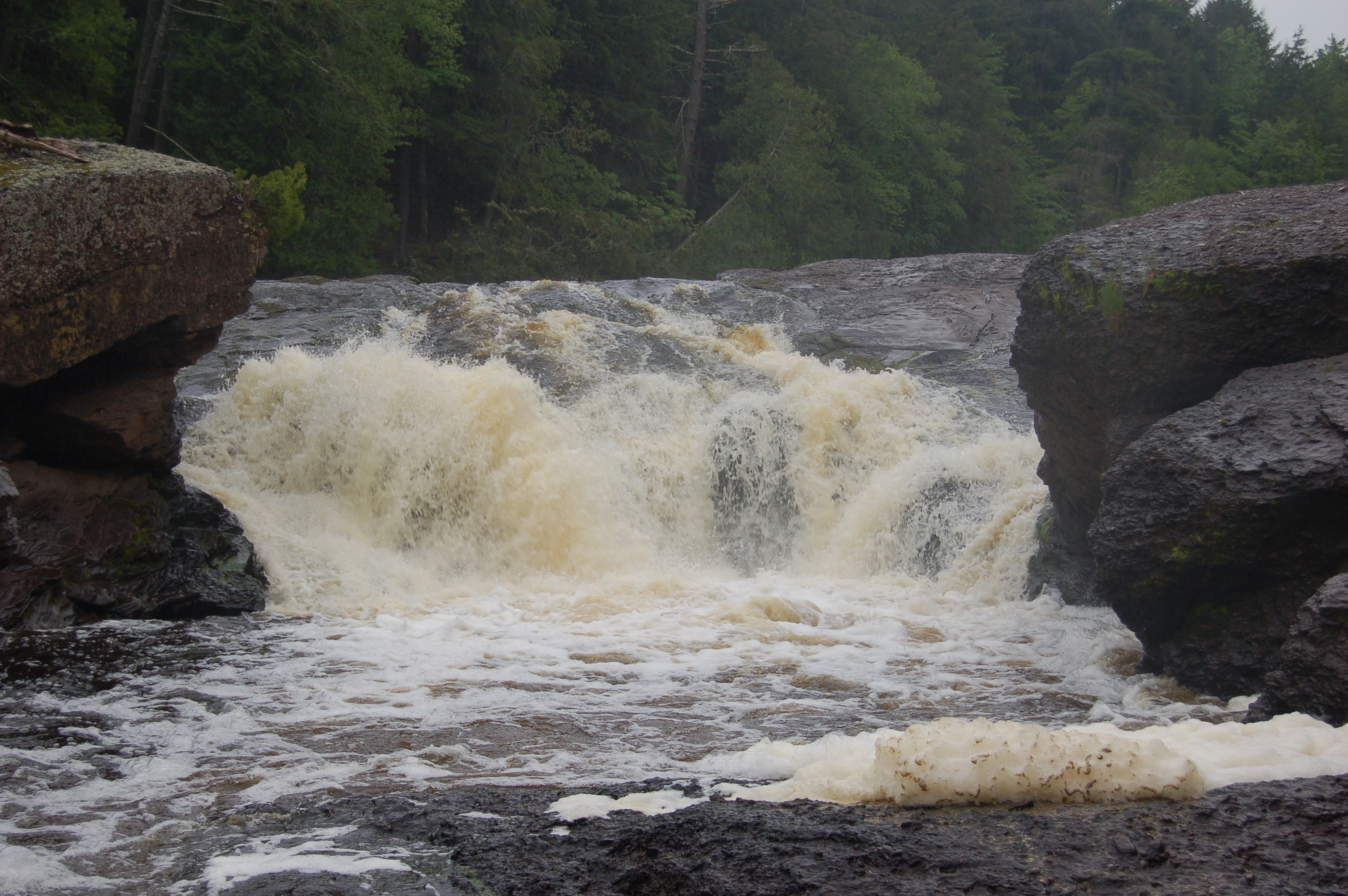
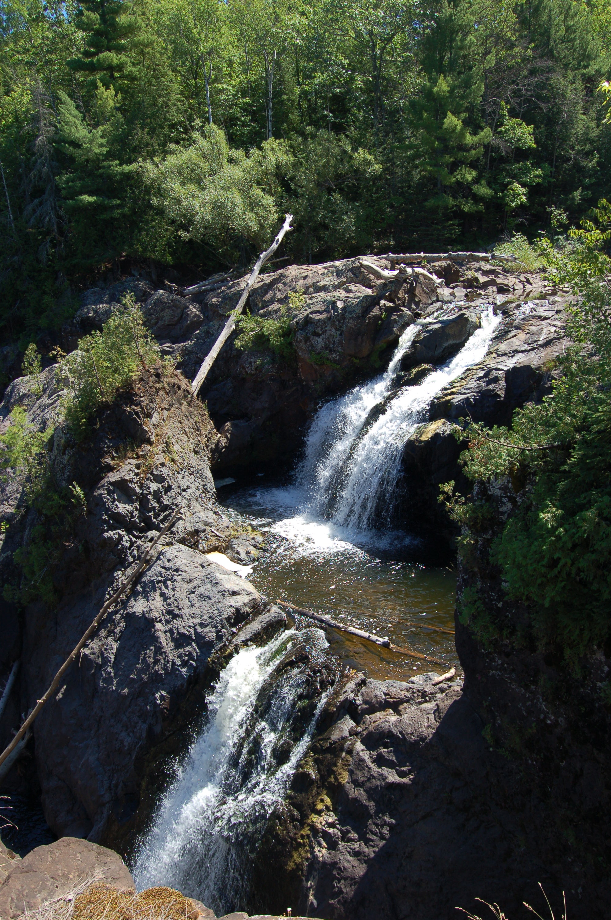
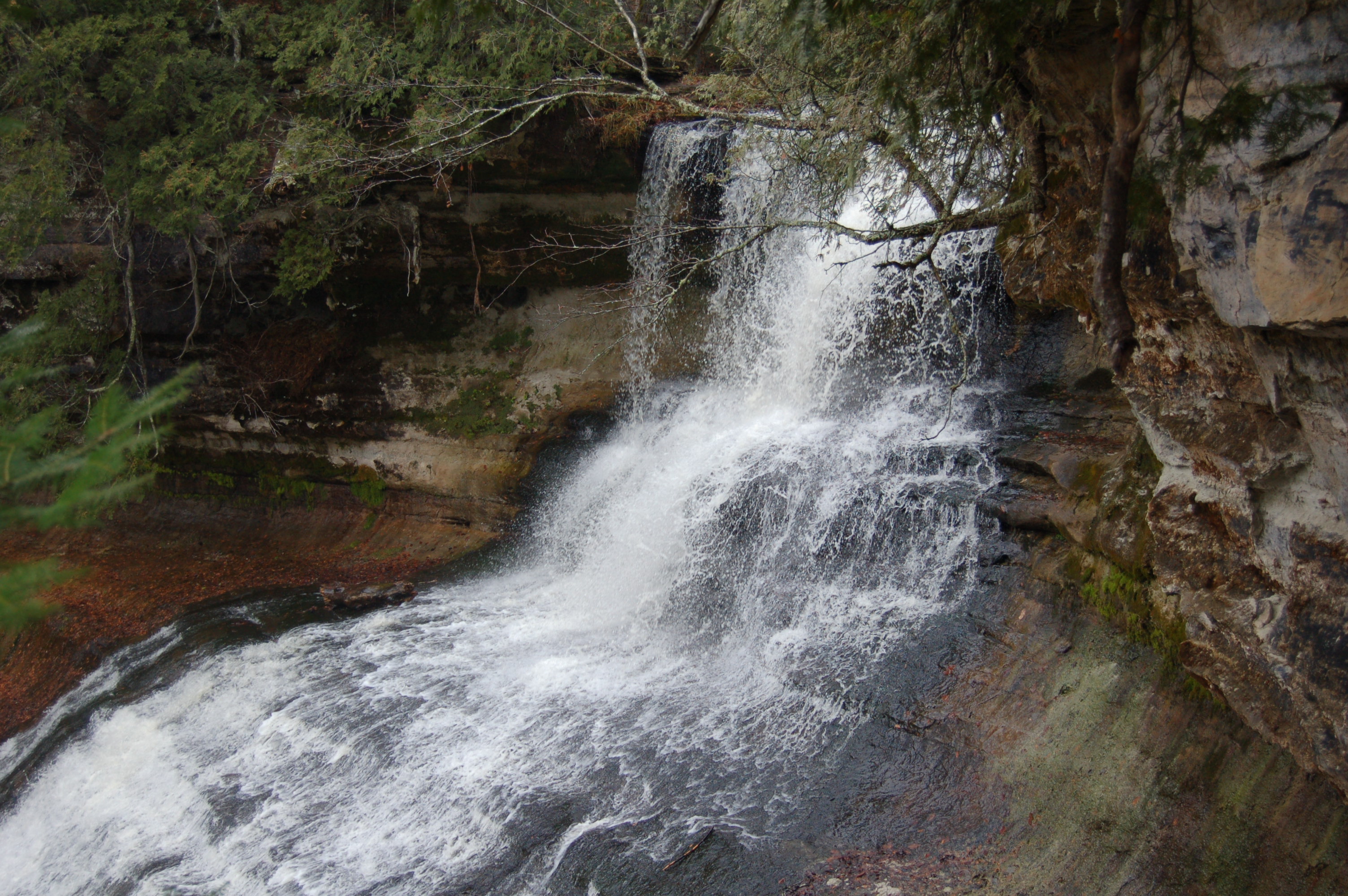
Manabezho and Manido Falls – Just like the falls on the Black River, it’s hard to separate these two thundering waterfalls on the Presque Isle from each other. Located on the western end of Porcupine Mountains Wilderness State Park these falls can be viewed from either side of the river (one has a boardwalk and one only a dirt trail) and are impressive at any time of year. Manabezho Falls is a drop of 25 feet at a point where the river is 150 feet wide. Manido Falls is only a few hundred feet upstream and features a total drop of around 20 feet that is spread out over several drops. The videos below give a better idea of how impressive these falls are.
From the east end of the Porcupine Mountains Wilderness State Park, take South Boundary Rd. more than 25 miles to its end at CR-519. Head north on CR-519 and take the right fork (campground is left fork) after the ranger station to reach the parking area. From Wakefield, take M-28 around Sunday Lake from its intersection with US-2, then head north on CR-519 and follow it for almost 20 miles to its end at the state park.

Superior Falls – Located on the Montreal River as it forms the border between Michigan and Wisconsin, Superior Falls is accessible thanks to the efforts of XCel Energy. The power company has granted access and there is a well-worn footpath that leads to the falls from the shore of Lake Superior. The hike downhill to the lake is steep and quite strenuous, but this waterfall was definitely worth the effort for us. Water levels may vary since the river is dammed above the falls. Be sure to check out the tall rock cliffs on the Superior shore here as well – this is a popular stretch for kayakers.
From US-2 west of Ironwood (and no longer in MI but in WI) head north on County Rd. 112, also called Hoyt Rd., and follow it across the Montreal River and back into Michigan. The road to the falls is marked and will be the second left after the river/border.
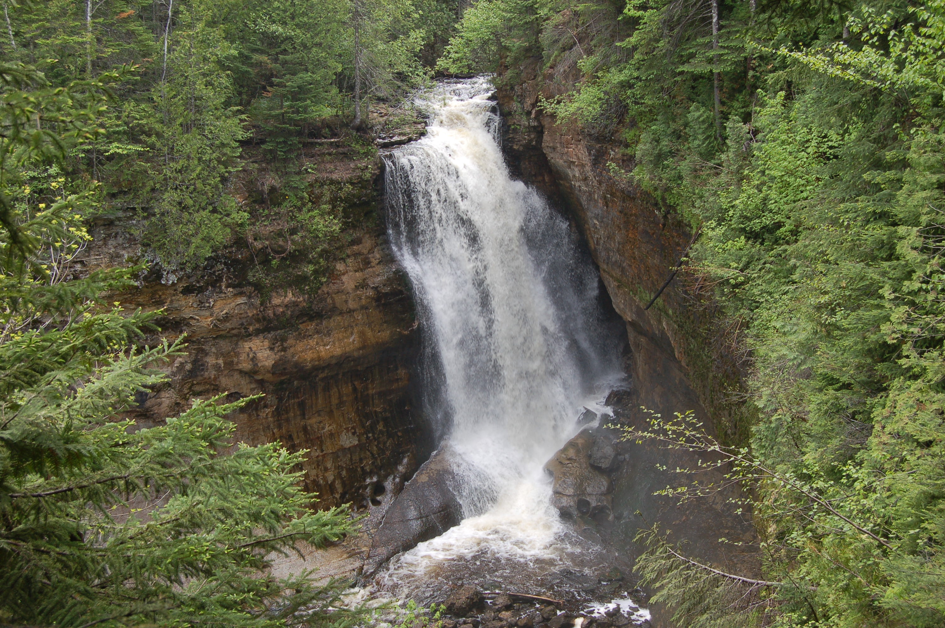
Sable Falls – One of the main attractions on the eastern end of the Pictured Rocks National Lakeshore, Sable Falls is reached after a 1/4 mile walk that is mostly stairs that lead down to the creek. This waterfall makes a drop of 75 feet in several sections, as the creek rolls over sandstone that continues to be worn down year by year. The trail continues towards Lake Superior (about 1/2 mile) and from the parking lot trails lead to Grand Sable Dunes (1 mile) and to the visitor center (2 miles; Beech Forest Trail).
From Grand Marais, head west on H-58 for about a mile to the well-signed drive that leads to the parking area for Sable Falls. Restrooms and picnic tables can be found here as well.
Miners Falls – This thundering cascade is one of the must-visit locations at the Pictured Rocks National Lakeshore. The Miners River drops 40 feet here, fanning out as it falls after being constrained to about 10 feet wide at the crest of the falls. The trail to Miners Falls is fairly smooth and level, and will take 15-20 minutes each way to hike. If conditions are dry, it is possible to follow faint trails down below to the bottom of the falls – this seems to be a somewhat popular fishing area seasonally.
From Munising, head east on H-58 for about 7 miles. Head north on H-13 (Miners Castle Rd.), following the sign for Miners Castle/Miners Beach etc. There is a well-signed road on the right after 3.5 miles that is marked for Miners Falls, turn there and proceed about 1/4 mile to the parking area.
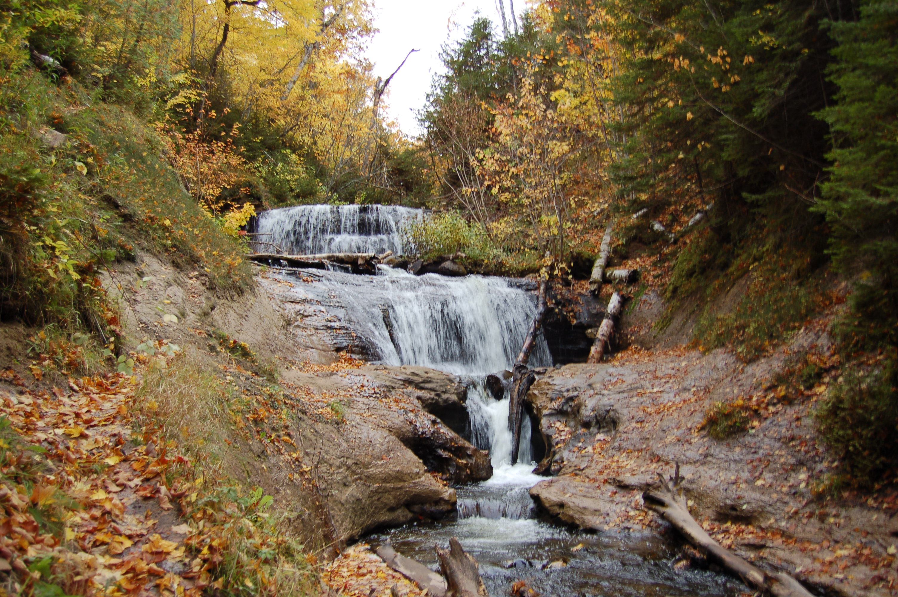
Dead River Falls – It wasn’t until our third visit to Dead River Falls that we discovered there was a lot more to the area than the falls closest to the parking area. Our post on Dead River Falls shows off more pictured from the area, and all of the other waterfalls that can be found by following the trail upstream past the first few 3-5 foot drops, across a small creek and up a hill. This trail won’t be for everyone as it is steep and rough, but after the first big uphill section it is much easier the rest of the way.
From M-28/US-41 in Marquette, head north on CR-492/Wright St. and go about a mile to Forestville Rd. Take the left on Forestville Rd., then follow it about 3 miles to its end at a parking area by the hydro plant. Follow the path uphill to get to the falls, and be sure to check out Reany Falls – which you passed on your drive in.
Gabbro Falls – This is still one of our favorite hidden gem waterfalls in the entire state, and we try to tell others about it any chance we get. The Black River drops twice here before making a sharp turn into a gorge, and this wild waterfall is something amazing to behold in person. Gabbro Falls features a total drop of 40 feet, and is best observed from the top as the gorge below prevents a full view. Unlike the Black River Falls on the Scenic Byway, you’ll likely be alone here and able to take in a Michigan gem undisturbed.
From US-2 near Wakefield, head north on Blackjack Rd. for a couple miles, pass the ski resort and head up the hill. Look for a path into the woods on the left, and a gate with parking room on the right.
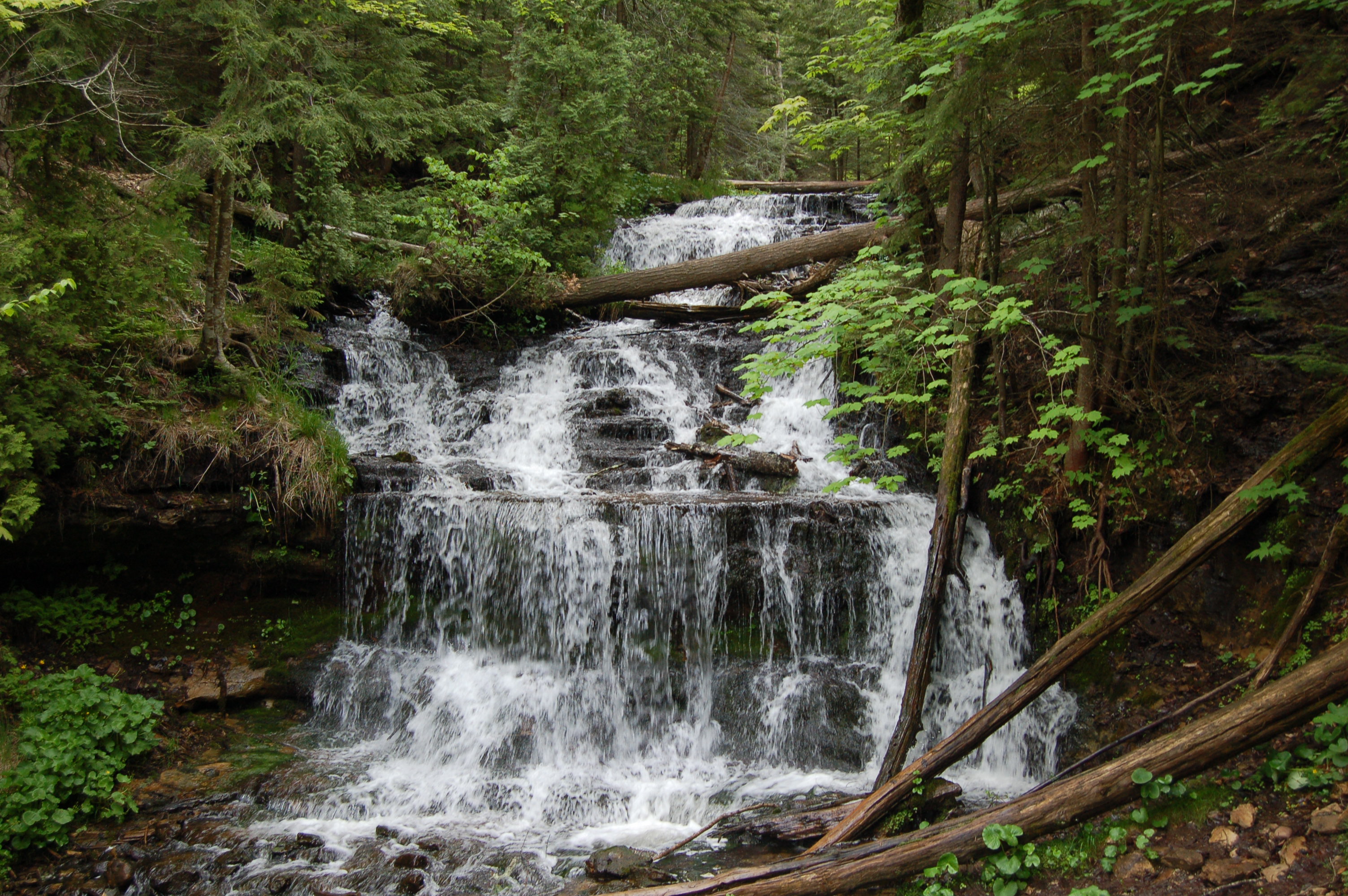
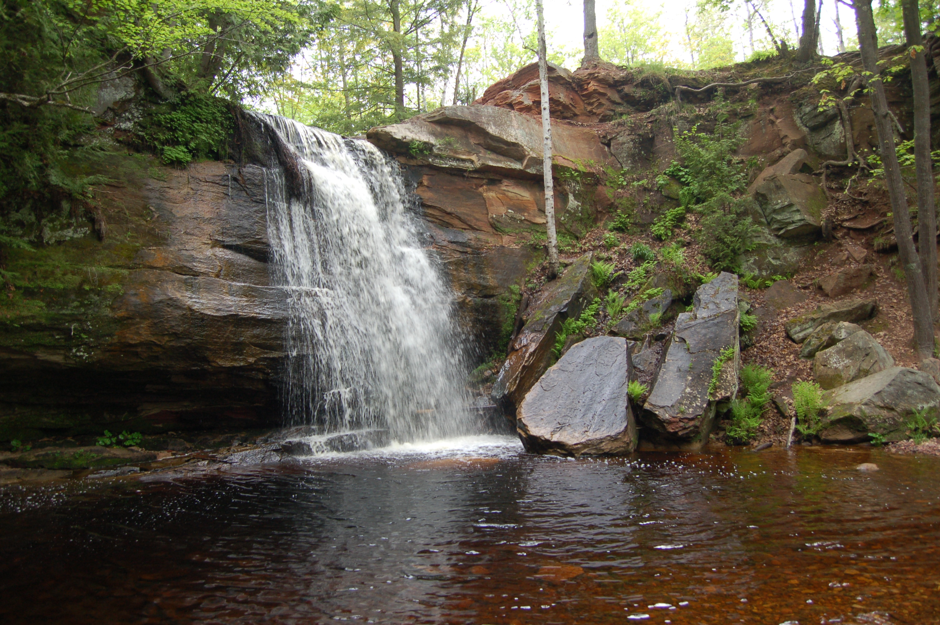
Wagner Falls – This state scenic site features a beautiful waterfall that can be reached by a short hike that is level and easy. Wagner Falls is a stepped 20 foot drop on Wagner Creek, and despite the fact that it is located near two busy highways it is quiet and incredibly picturesque. This has become one of our favorites thanks to its near-perfect setting and ease of access, as well as the fact that it is rarely busy here even with that easy access.
South of Munising, M-28 and M-94 intersect. Take M-94 south and watch for the parking area on the left after a few hundred feet. Park and follow the footpath into the woods for less than a quarter mile and enjoy the view from a wooden viewing platform near the falls.
Laughing Whitefish Falls – Another state scenic site, this is one of the tallest waterfalls in Michigan and one that is pretty easy to get to. The river is only 15 feet wide at its crest, but it fans out as it drops 100 feet over a stepped rock face. The one-mile hike to Laughing Whitefish Falls is mostly level and smooth as it passes through a forest on its way to this stunning cascade. Pictures don’t really do it justice, but it is best to visit in the spring or after heavy rain.
From M-94 east of US-41, head north on Sundell Rd. for about 3 miles to the park entrance road. Take that short dirt road to a parking area, there are restrooms and a picnic area as well.
Canyon Falls – A roadside park is home to the trailhead for Canyon Falls, a stunning 15 foot drop into a boxy canyon that is one of Michigan’s largest and most scenic. An easy trail leads about a mile to the falls, and you’ll pass some smaller drops on the wild river before you reach the viewing platform for the big one. A rough trail continues on past this platform to two more waterfalls, see our full Canyon Falls post for more details.
On US-41 south of Baraga and north of M-28 is the well-signed Canyon Falls Roadside Park. There is plenty of parking as well as a picnic area and restrooms.

Bonanza Falls – One of our favorite discoveries from years of waterfall hunting, Bonanza Falls lies just outside the Porcupine Mountains Wilderness State Park on the Big Iron River. The river is about 100 feet wide here, and while the drops aren’t any higher than 10-15 feet this waterfall is more about uniqueness, setting and access. The upper drops can be seen after a 40 foot walk from the parking area, and a short climb downhill provides access to the lower falls. In spring the falls become a roaring, powerful cascade as shown in the picture. The rest of the year, the lower water levels make it possible to wade into the river or rock hop for better views. This is also a prime spot for wildlife viewing given its secluded location and lack of visitors.
From M-107 in Silver City, just east of the Porcupine Mountains Wilderness State Park headquarters, head south on M-64 and look for a dirt road on the west side after about a mile. There will be a sign denoting the area’s history with silver mining and the sign calls this Greenwood Falls.
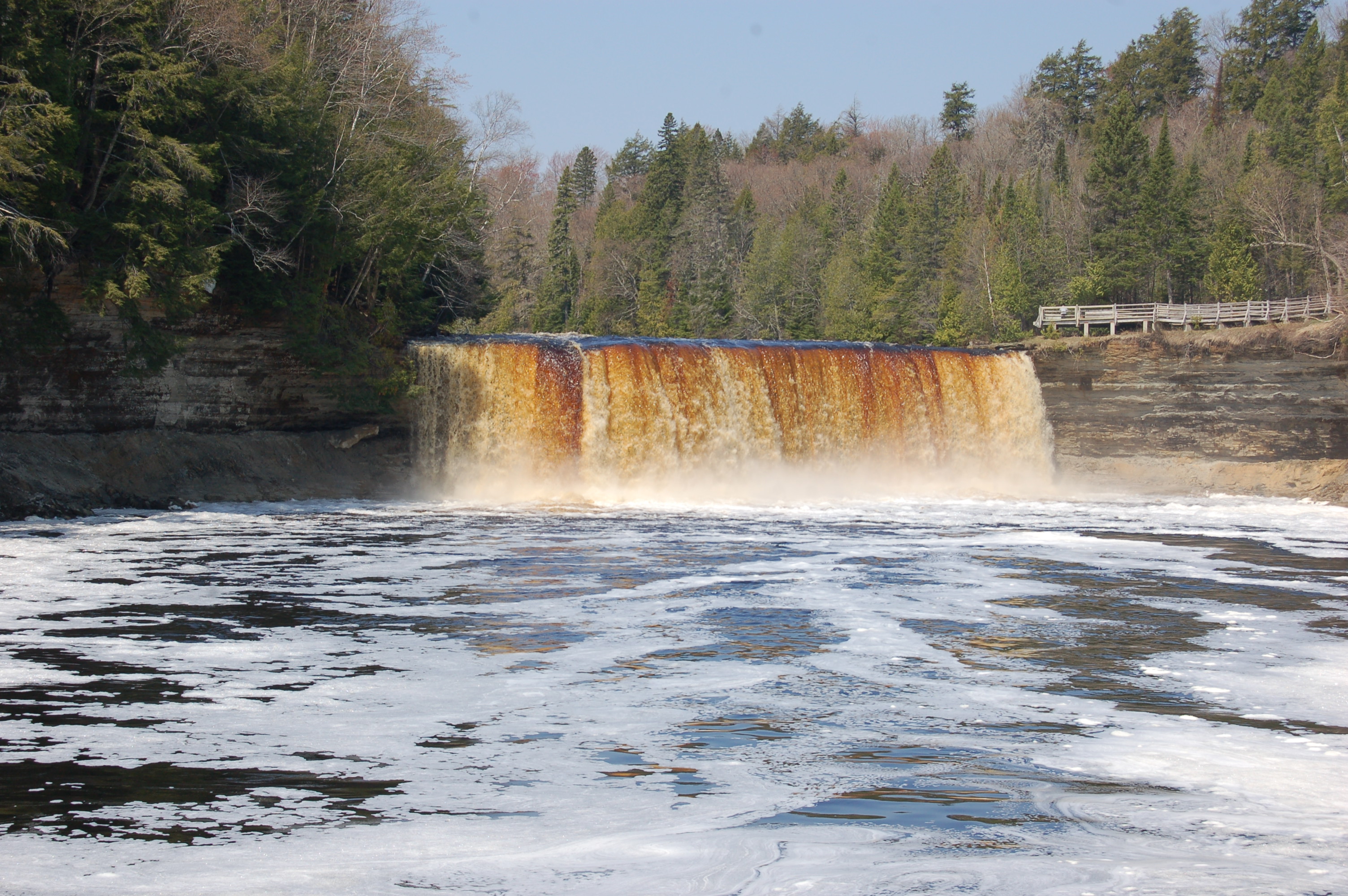
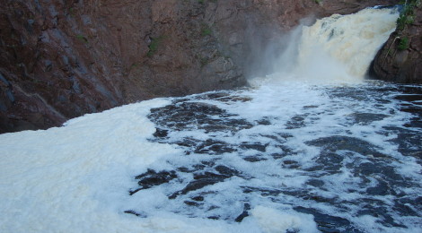
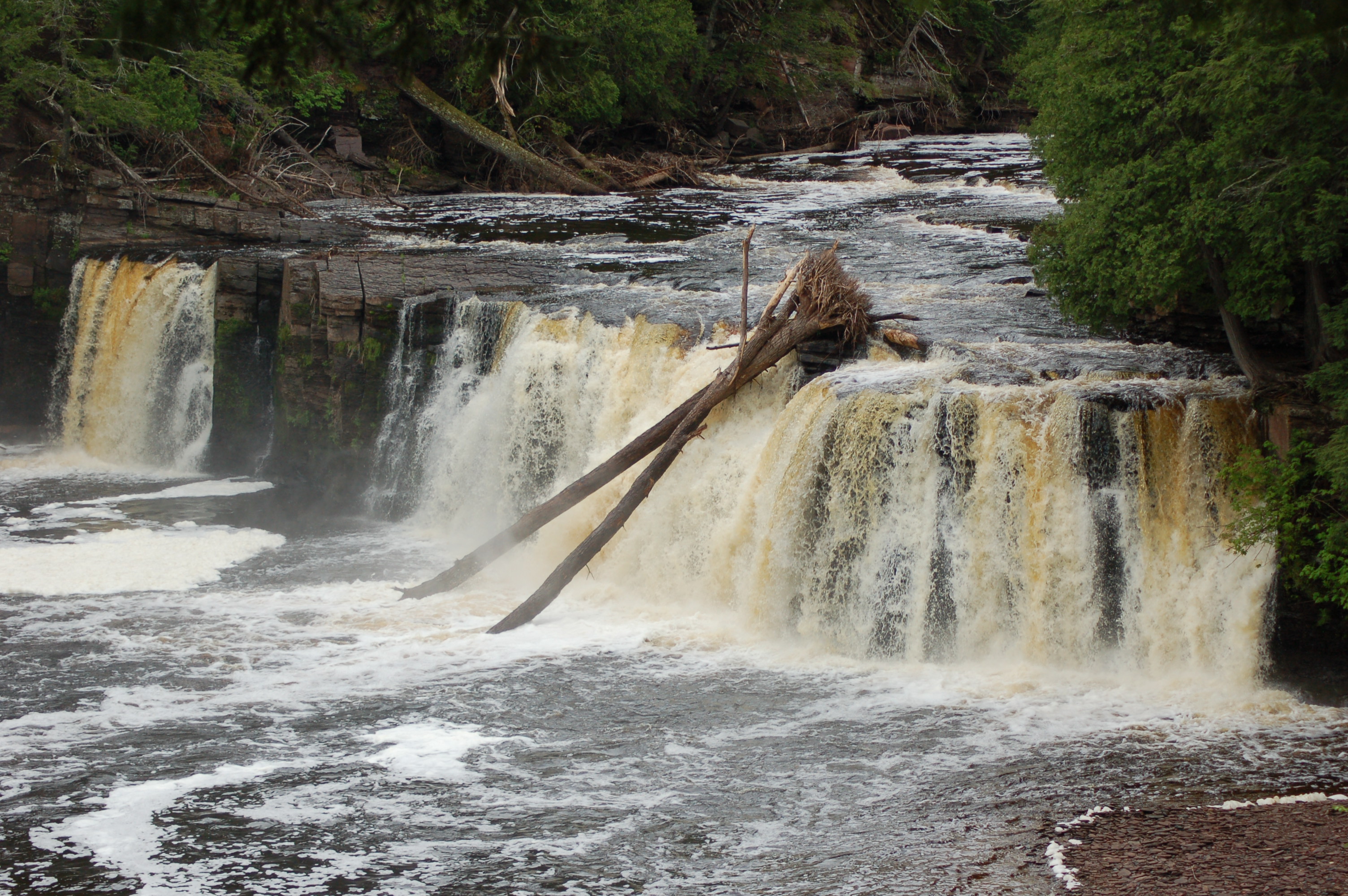
Tahquamenon Falls – Finally, we have to recommend that everyone visits Michigan’s largest waterfall, which is also one of the largest falls east of the Missisippi River. Tahquamenon Falls State Park is an 800-acre paradise for nature lovers and Michigan’s second-largest state park. The Upper Falls can be reached from a level, paved trail followed by stairs that put you at the brink. The drop is 50 feet, and the river is 200 feet wide here, which makes for a constant roar of water. The copper color comes from tannins in the cedar swamps that drain into the river. The park has five campgrounds with 350 campsites, a gift shop, and a brewery/restaurant. The Lower Falls is a collection of several drops ranging from 5-20 feet on both sides of an island. You can rent a rowboat to get to the island for a closer view, or follow the 1/2 mile trail (paved, then boardwalk) to two viewing platforms on the side of the river.
From Newberry, head north on M-123 for 20 miles to the state park entrance for the falls (Lower, then a mile later, Upper). From Paradise, take M-123 to the west for about 4 miles to the state park entrance (Upper, then a mile later, Lower).