
Bond Falls Scenic Site – One of Michigan’s Most Spectacular Waterfalls

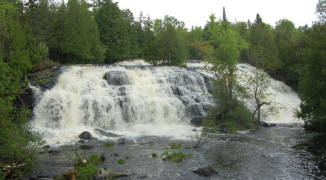
When it comes to waterfalls in Michigan, Tahquamenon Falls in the eastern Upper Peninsula gets most of the attention due to its size and scenic beauty. In the western U.P., Bond Falls Scenic Site features the largest and most impressive waterfall as the middle branch of the Ontonagon River makes a 50-foot drop below a dam and reservoir. The river here is more than 100 feet wide, and several viewing platforms make for great panoramic views.

Improvements in 2003 put a parking lot in closer to the falls (caution: the drive downhill is very steep), with handicap accessible sidewalks and boardwalk so the falls can be enjoyed by all visitors. Before that, visitors had to park up near the dam and walk downhill to take in Bond Falls. That option is still available today, as there is a parking area and small store (Bond Falls Outpost) near the dam and several paths leading downhill on the other side of the road.


There are some cascades and smaller drops between the dam and the falls, depending on water levels. The two photos above are examples of some of these drops.
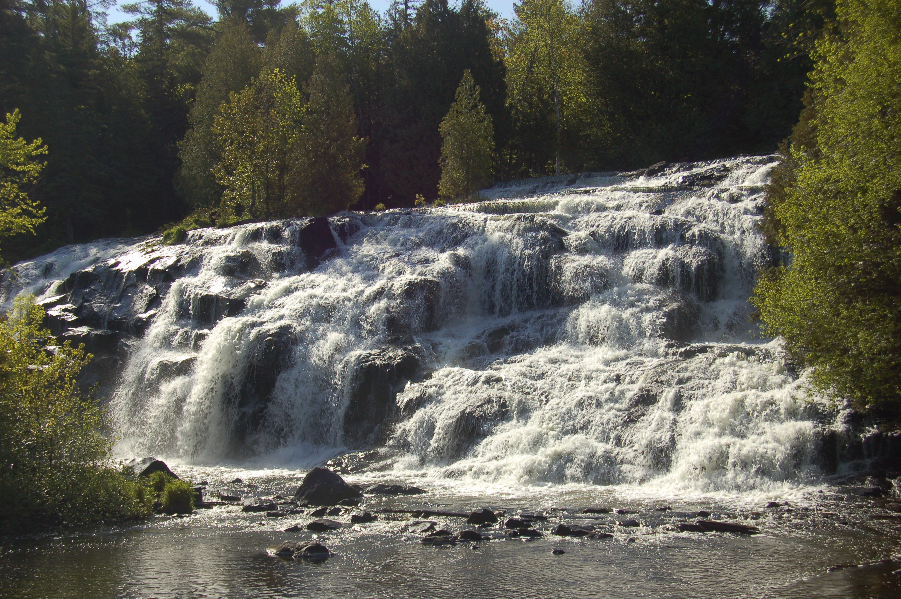
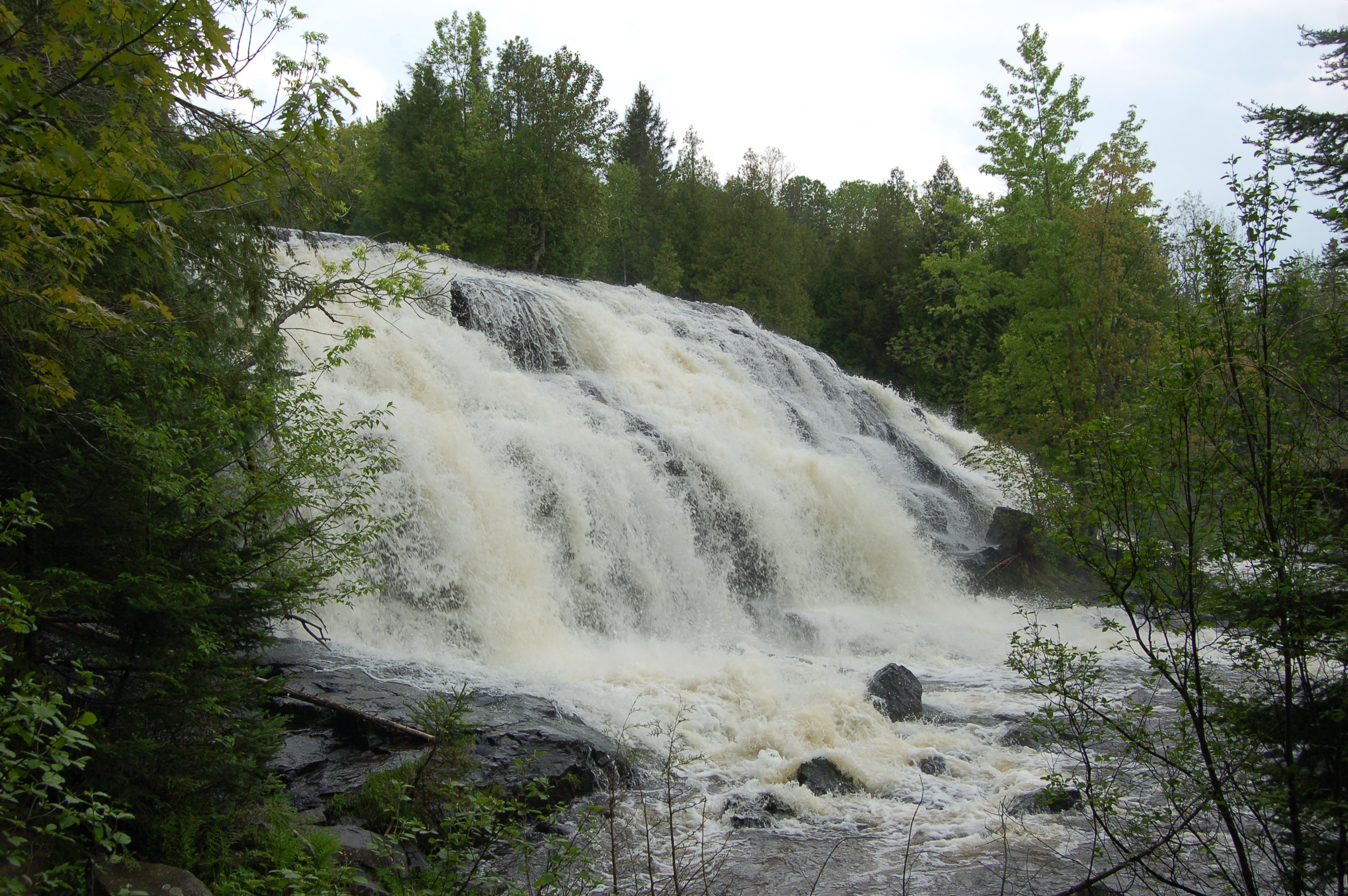
From the parking lot at the bottom of the hill, the path to the falls is only a short walk and soon leads to breathtaking views of the right side of the falls. The entire waterfall is split into two halves by a handful of trees which makes it hard to get full, wide photos but also adds a lot of color to the area. Management of the dam ensures that there is always water flowing here, but it can vary quite a bit from time to time – the photo above is from the fall of 2008 while the one below is from June of 2010.

The boardwalk wraps around to the left side of the falls for more great views, and there are some faint footpaths that go up the hill on this side. For all the thundering glory of Bond Falls, the river calms down quite a bit downstream as it winds under the boardwalk and continues its journey to Lake Superior. Agate Falls is also located on this branch of the river, and is about a 15 minute drive away. The video below gives a good look at all views of the falls and was shot in June of 2013.
Directions: Bond Falls Rd. is located off of US-45, north of Paulding and south of M-28/Bruce Crossing. It is about a five mile drive to the falls from this direction. You can also reach the falls from M-28 near Trout Creek, east of US-45. This route takes a little longer as more time is spent on winding country roads. Both routes are well signed from the highway, and there will also be signs for the nearby Bond Falls campground.
Be prepared for: bugs, bugs, bugs (as you can see in video above). Sidewalks and boardwalk are smooth and flat, some steep climbs and rough trail possible if you feel like doing more exploring.