
Pictured Rocks First Timers Guide: 10 Things to See and Do
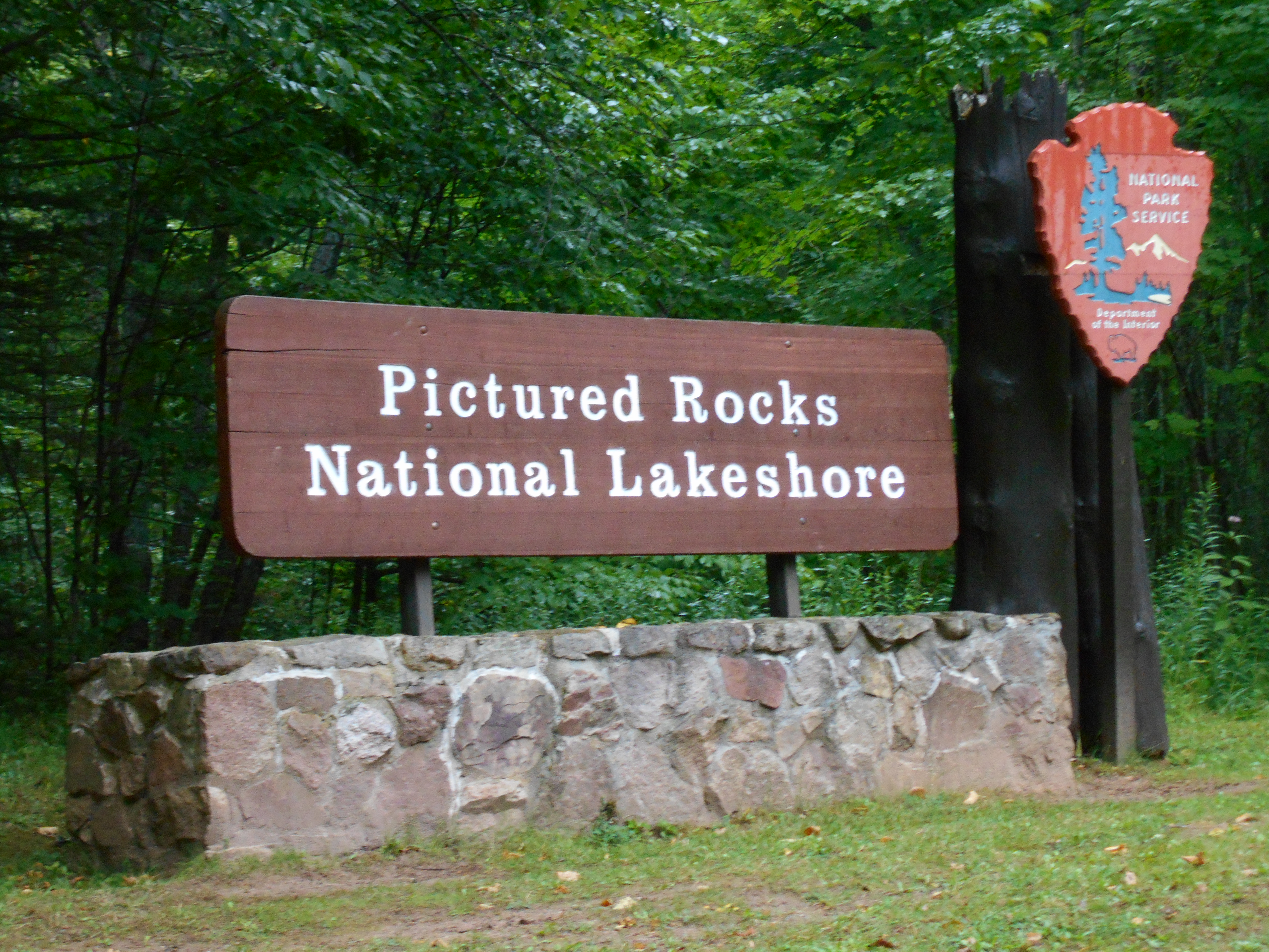
One of the common questions we get from friends and relatives traveling to the Upper Peninsula centers around what to see and do at Pictured Rocks National Lakeshore. We absolutely love this national park and have had many opportunities to explore it. That often makes it hard to give an answer until we know more details like length of trip, mobility concerns, hiking ability, and other preferences. We are always happy to help and I thought it would be a good time to put together a Pictured Rocks First Timers Guide highlighting what we consider to be the 10 “can’t-miss” attractions. This list covers waterfalls, natural formations, beaches, historical attractions, and more. We also tried to make sure that everything on this list is easily accessible (with notes for any stairs or other possible concerns) for visitors of all ages while doing a good job on including a mix of highlights that give the full Pictured Rocks experience. Attractions are listed from the western end of the national lakeshore in Munising and proceed east to Grand Marais. It’s impossible to see everything in one visit, so look for future posts with more information on kayaking, longer hikes, remote waterfalls, and backcountry camping. Be sure to check out the map below for easy directions to each stop.

1. Take a boat cruise with Pictured Rocks Cruises – The best way to see the cliffs at Pictured Rocks is from the water. Several boat trip options are available, but for the best overall experience we recommend everyone start with a tour through Pictured Rocks Cruises. There are many departure times each day, the cruise passes by highlights like Grand Portal, Chapel Rock, Bridal Veil Falls, Battleship Row, and more. Up close views of the cliffs will showcase the varied colors and remind you why this place continues to draw record crowds. For an added treat, make sure you take one of the extended trips that goes all the way out to Spray Falls. Find out more at https://picturedrocks.com/.

2. Munising Falls – One of the easiest waterfalls to visit in the entire state, Munising Falls is a 50 foot plunge over a sandstone cliff. The parking lot is just a few blocks from downtown Munising, and a paved trail leads 800 feet to great views of the waterfall. There is a small visitor information center at this site as well.
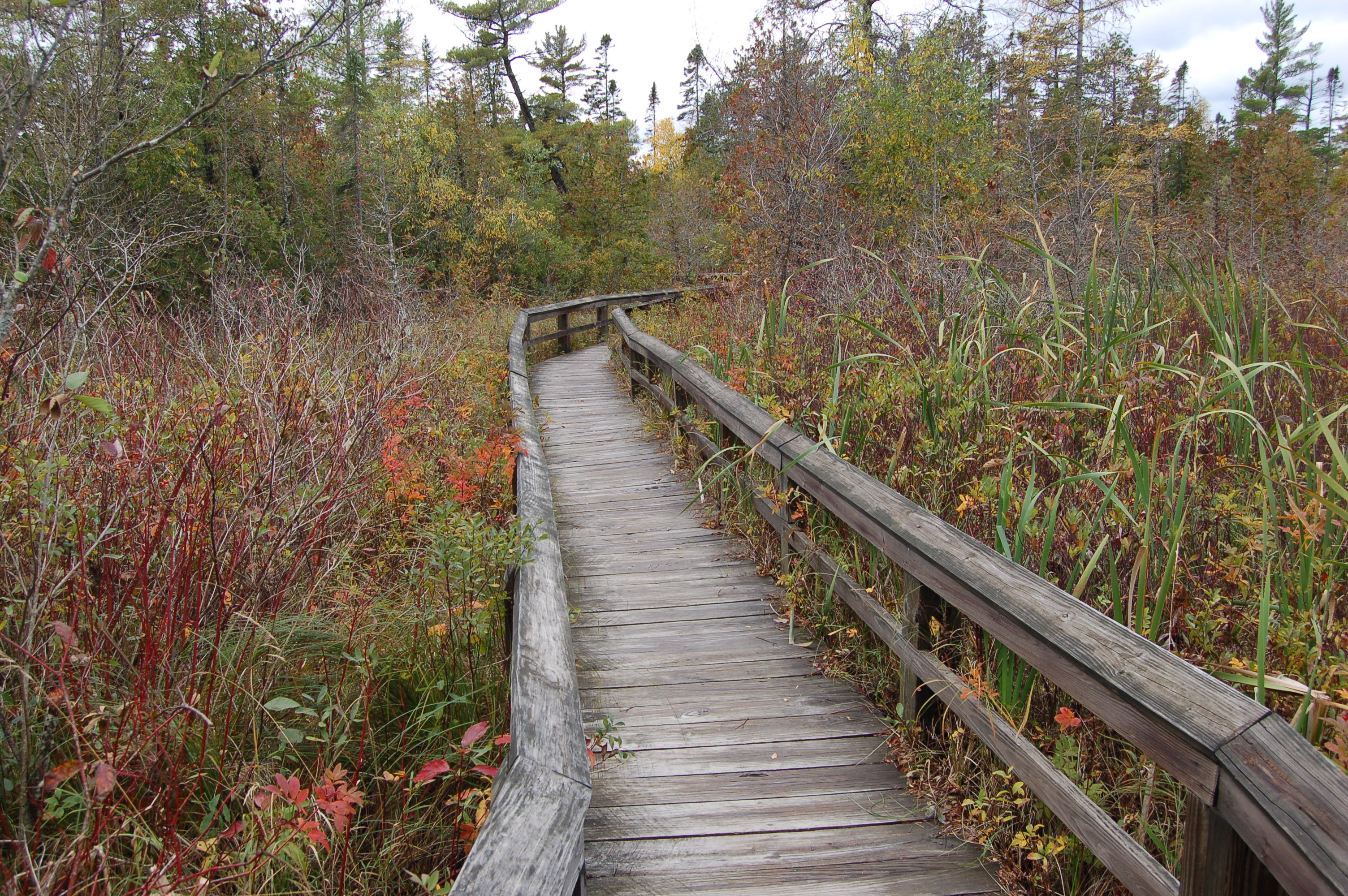
3. Sand Point Marsh – Just down the road from Munising Falls is a parking area for Sand Point Beach and the Sand Point Marsh Trail. The NPs says this about the half-mile long boardwalk trail: “Old beach ridges, a cattail marsh, small ponds, and white cedar and black spruce swamp communities dominate the scene. The best times for wildlife activity are early or late in the day.” Possible wildlife sightings here include foxes, snowshoe hares, herons, beavers, snakes and more. Interpretive signs along the trail point out the plants you can see and tell the history of how this trail was constructed in 1989.
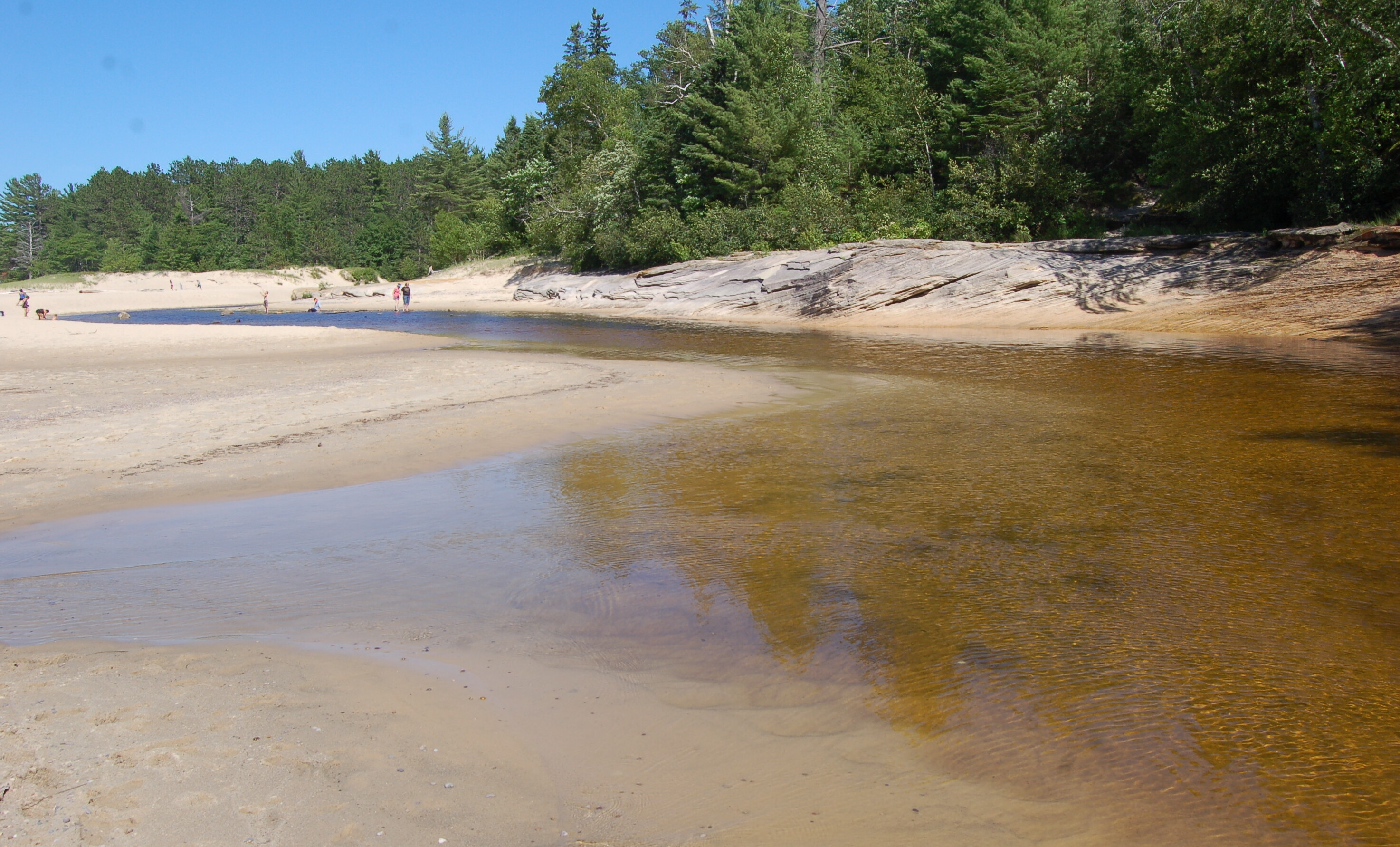
4. Miners Beach – A mile of sandy beach on Lake Superior makes Miners Beach a popular swimming spot within the national lakeshore. From here you can see the Pictured Rocks cliffs, passing tour boats, and watch the Miners River on the last part of its run to the lake. On the far eastern end of the beach you will find Elliot Falls.

5. Miners Castle – The most recognizable rock formation at PRNL is Miners Castle, and it also happens to be the only one you can drive to. The main overlook platform is a 50 foot walk from the parking lot, and another trail leads right up to it with some great views of the cliffs!
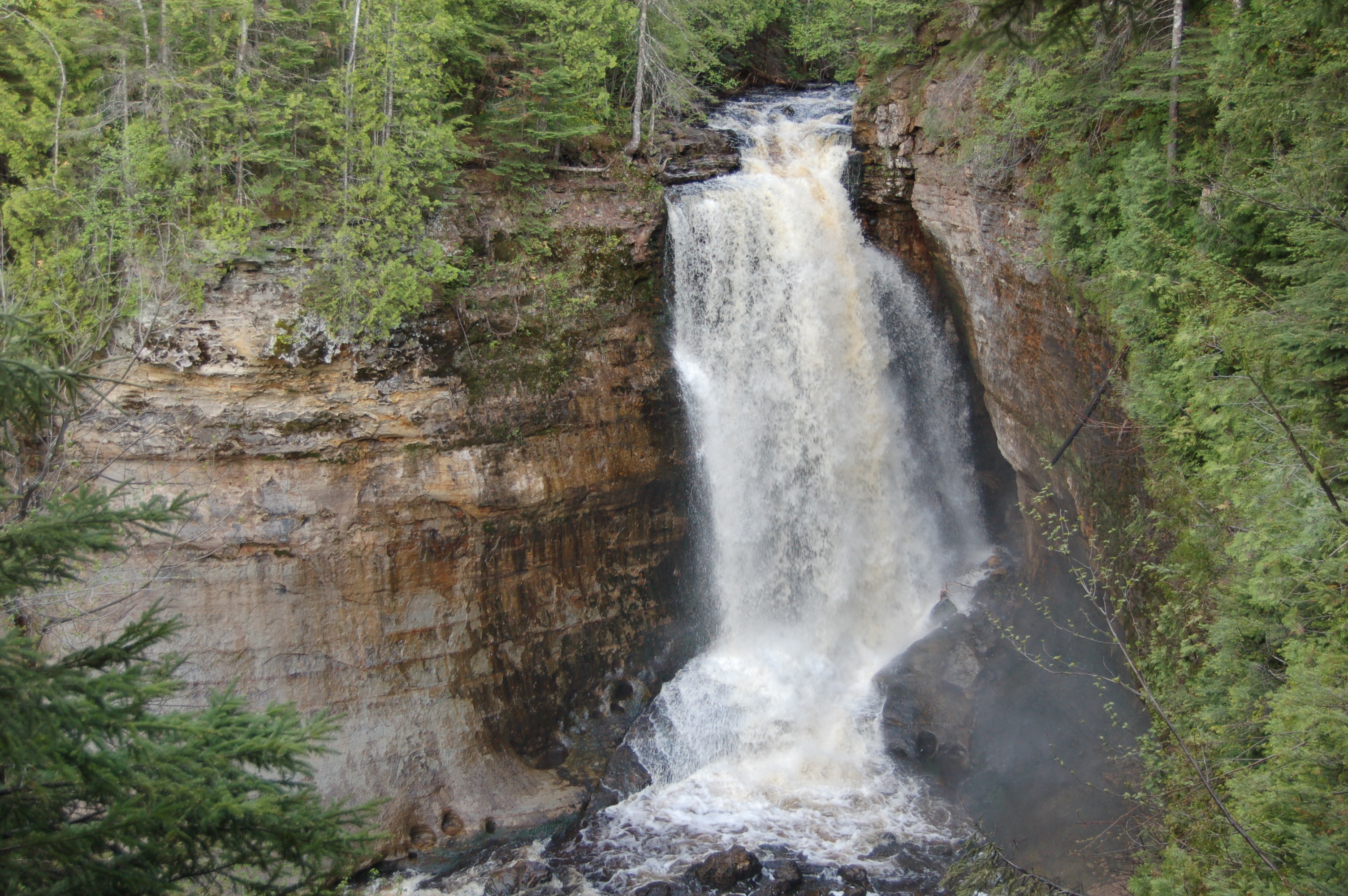
6. Miners Falls – Reaching this thundering 40 foot waterfall requires a 3/4-mile hike on a well-worn gravel path. There is an observation deck at the end of the trail to see the falls from. The hike to Miners Falls is one that just about everyone should be able to handle, and the reward is well worth the effort.

7. Lake Superior Overlook and Beach – Just a short walk from the parking lot leads to a beach that seems to go on forever. At this point you are east of the high cliffs, and just a little west of Grand Marais. Take a stroll along the beach and marvel at all the different rocks, or have a picnic and take a break from your drive on H-58.

8. Hurricane River/Au Sable Point Light Station – From the parking lot at the Hurricane River day use area it is a 1.5 mile hike out to the Au Sable Lighthouse. This is one of the first hikes we ever did in the park (1997) and it remains one of our favorites. The trail is a wide and flat two-track that parallels the shoreline. Several shallow-water shipwrecks may be visible on the beach near the lighthouse, highlighting how dangerous Lake Superior was for early wooden vessels. The NPS has the lighthouse open for tours and tower climbs during select hours in the summer.
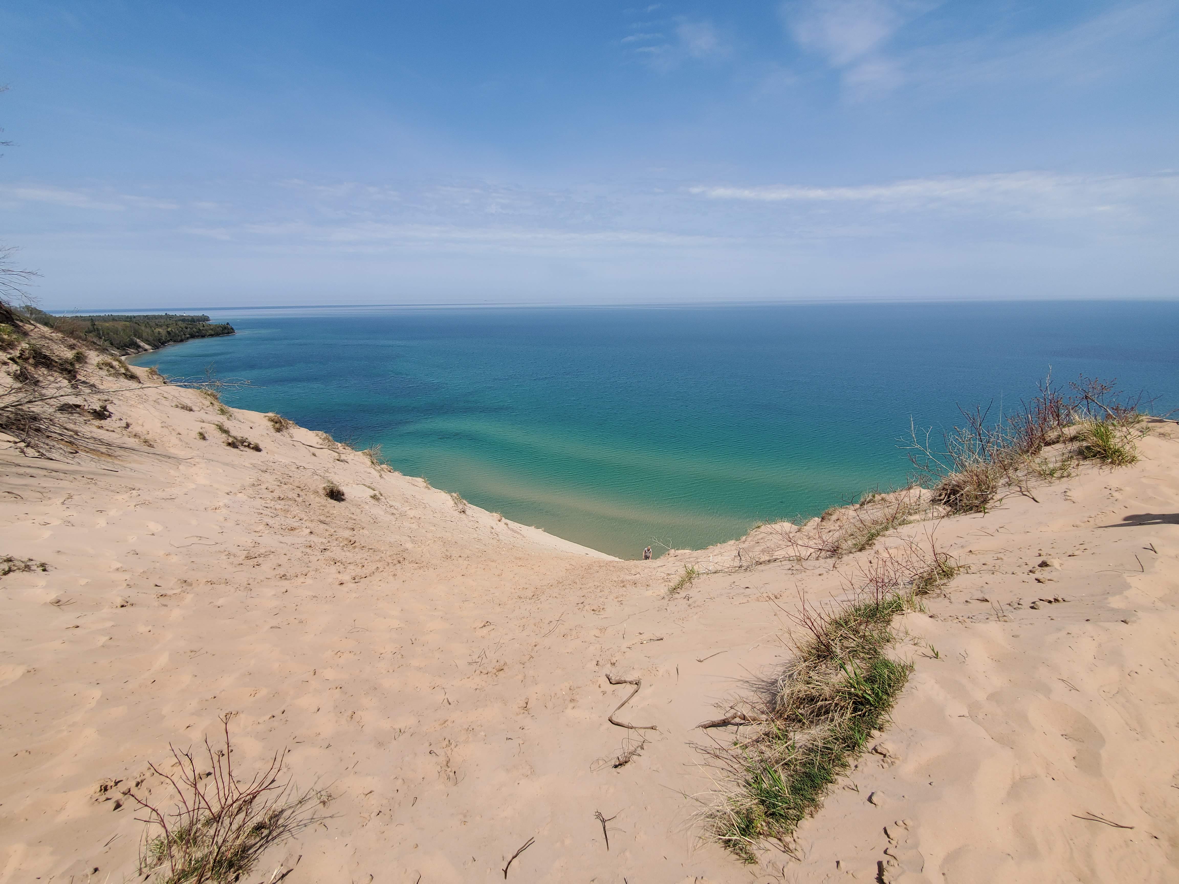
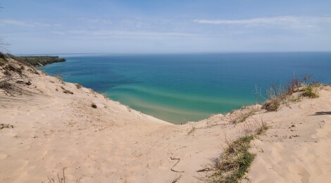
9. Log Slide Overlook/Grand Sable Dunes – The Log Slide Overlook has become one of my favorite places to take friends to on their first visit to the lakeshore. This is a place that has that “wow” factor as you get to the top of the dune and look out at the blue water and the towering sand. Showing that Pictured Rocks National Lakeshore is more than just sandstone cliffs, the views here are sure to inspire. Getting to the overlook requires a 1/4-mile hike on a well-worn path through the woods from the parking area.

10. Sable Falls – The easternmost waterfall in the national lakeshore, Sable Falls is a great waterfall to add to any trip. Sable Creek makes a total drop of around 75 feet as it tumbles over sandstone in multiple sections. A short walk and 168 stairs lead to viewing platforms of this stunning waterfall. For those who want to see the Grand Sable Dunes from below, a trail continues on from Sable Falls for about a quarter mile to Lake Superior.
Be sure to check out more Pictured Rocks coverage with our 8 Pictured Rocks Day Hikes, Photo Gallery: Kayaking Pictured Rocks with Uncle Ducky Outdoors, Photo Gallery: Pictured Rocks National Lakeshore, and Munising Tourist Park Campground – Stunning Lake Superior Views Close To Pictured Rocks National Lakeshore posts.