
Pictured Rocks 50th Anniversary: 50 Things To Do At Michigan’s National Lakeshore
Pictured Rocks is one of Michigan’s treasured natural resources, and in 1966 the United States government took steps to preserve it for future generations by making it the country’s first official national lakeshore. A record number of people visited in 2015, checking out the miles of colorful sandstone cliffs, stunning waterfalls, breathtaking beaches and historical sites. Cliffs and dunes tower more than 200 feet above lake level, and 90 miles of hiking trails call to those looking to explore (40+ miles of that is on the North Country Trail). Many of the park’s top attractions are universally accessible, and boat tours run out of Munising for those who want a view from the water with no hiking involved. Those who enjoy kayaking should place visiting the lakeshore high on their bucket list – it is an amazing experience showcasing some of Michigan’s most memorable shoreline. 2016 is a big year for the national lakeshore, as the NPS hopes to have a million visitors to help celebrate a big anniversary. We’d like to give you plenty to do when you visit, so enjoy Pictured Rocks 50th Anniversary: 50 Things To Do At Michigan’s National Lakeshore.
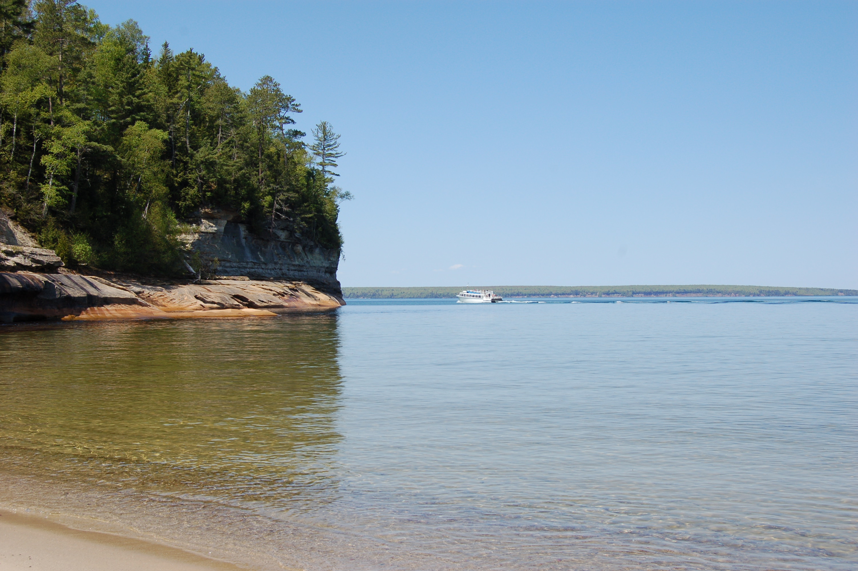
Pictured Rocks Boat Cruises – The best way to see the towering, colorful cliffs is from a boat and Pictured Rocks Boat Cruises offers a wide variety of daily trips. You’ll also see landmarks like Miners Castle, Chapel Rock and Grand Portal Point and if the conditions are right waterfalls like Bridalveil Falls and Spray Falls will be flowing. Visit http://www.picturedrocks.com/ for details on trips, rates and hours of operation.
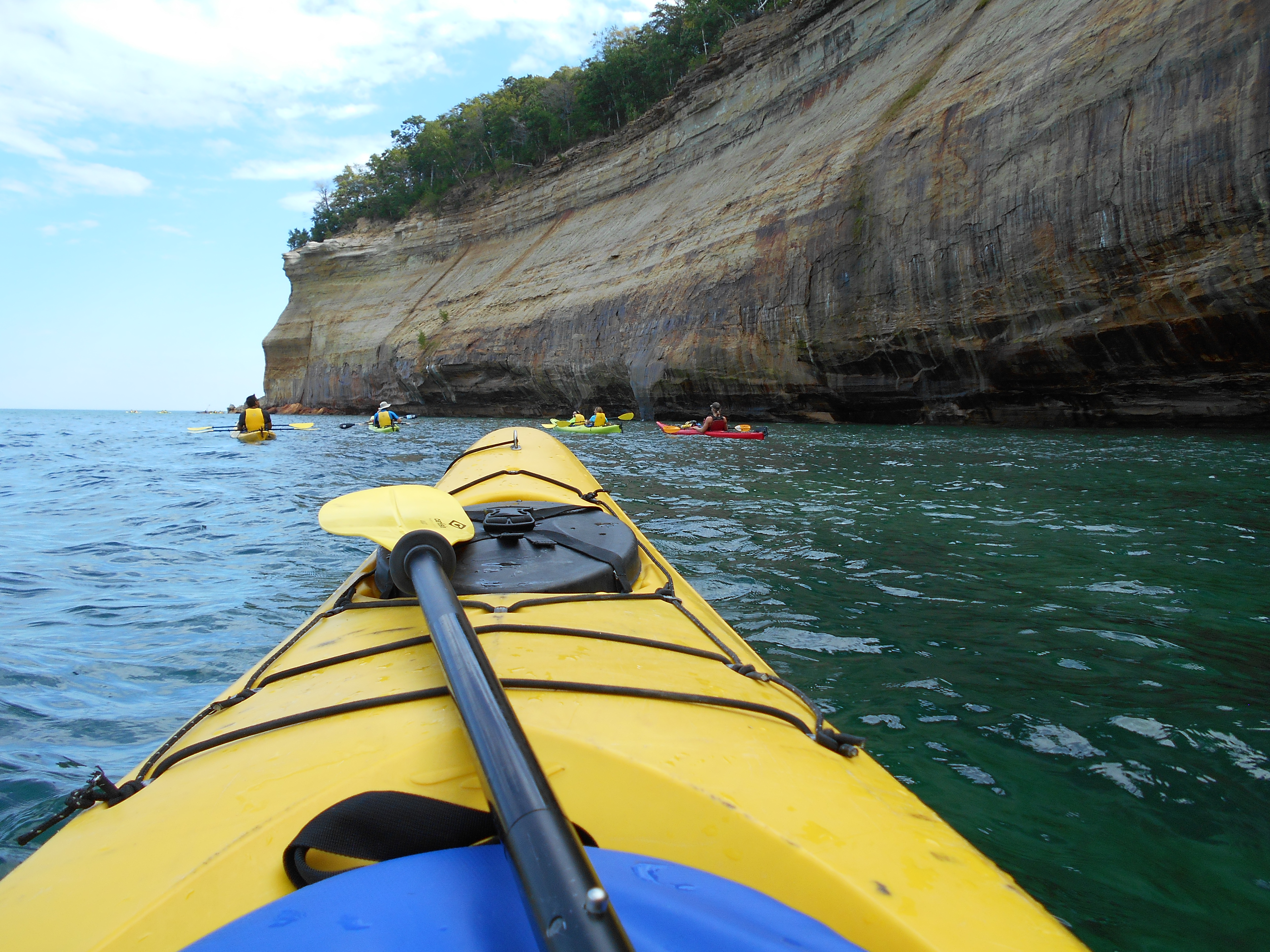
Kayaking Pictured Rocks with Uncle Ducky Outdoors – If you want to see Pictured Rocks from the water but want a more hands-on experience, taking a kayak trip with Uncle Ducky Outdoors is the way to go. They offer everything from a beginner “Taste of the Rocks” trip to a full day “Paddle and Hike” option with experienced guides and the right equipment for success. Head over to http://www.paddlingmichigan.com/ for more information.
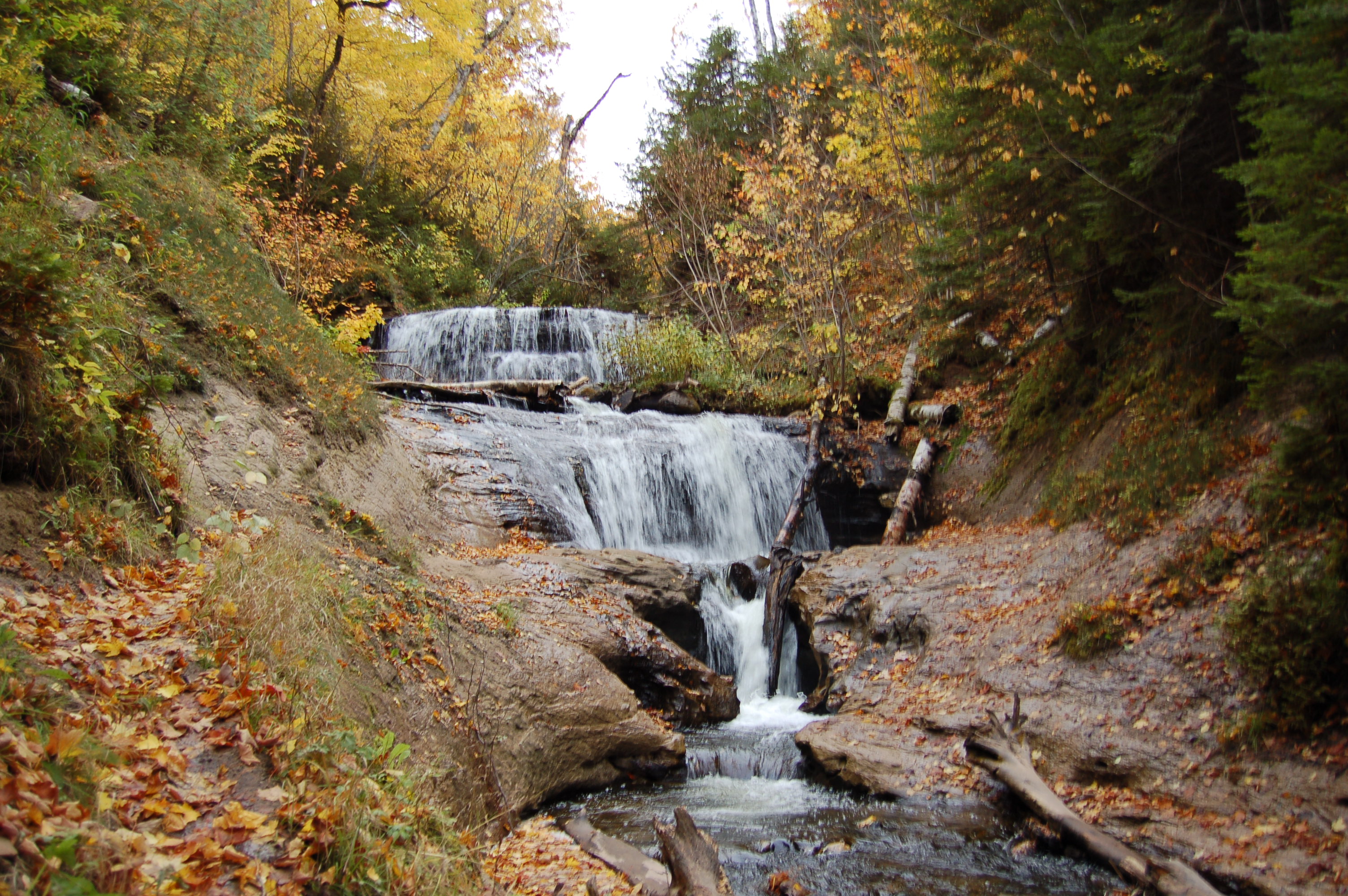
Sable Falls – One of the highlights of the eastern end of Pictured Rocks National Lakeshore is a visit to Sable Falls, a waterfall that drops 75 in several sections. Sable Creek narrows as it drops toward Lake Superior, forcefully rushing over sandstone. It is a short walk to this waterfall, most of that being wooden stairs that eventually lead to a viewing platform. Take H-58 west from Grand Marais for about a mile to the parking area and trail.
Spray Falls – A 70 foot plunge into Lake Superior, Spray Falls is reached by a 2.5 mile or longer hike from the interior of the park. It is best viewed from the lake on a Pictured Rocks Boat Cruise or while kayaking. A shipwreck lies underwater at the base of the falls.
Miners Falls – This 50 foot plunge of the Miners River is one of the lakeshore’s most scenic and powerful. Miners Falls is reached after a hike of a half mile on a level, scenic trail through the woods to reach the falls. Head east of Munising on H-58 then head north on Miners Castle Rd., taking a turn marked for Miners Falls after a few miles.
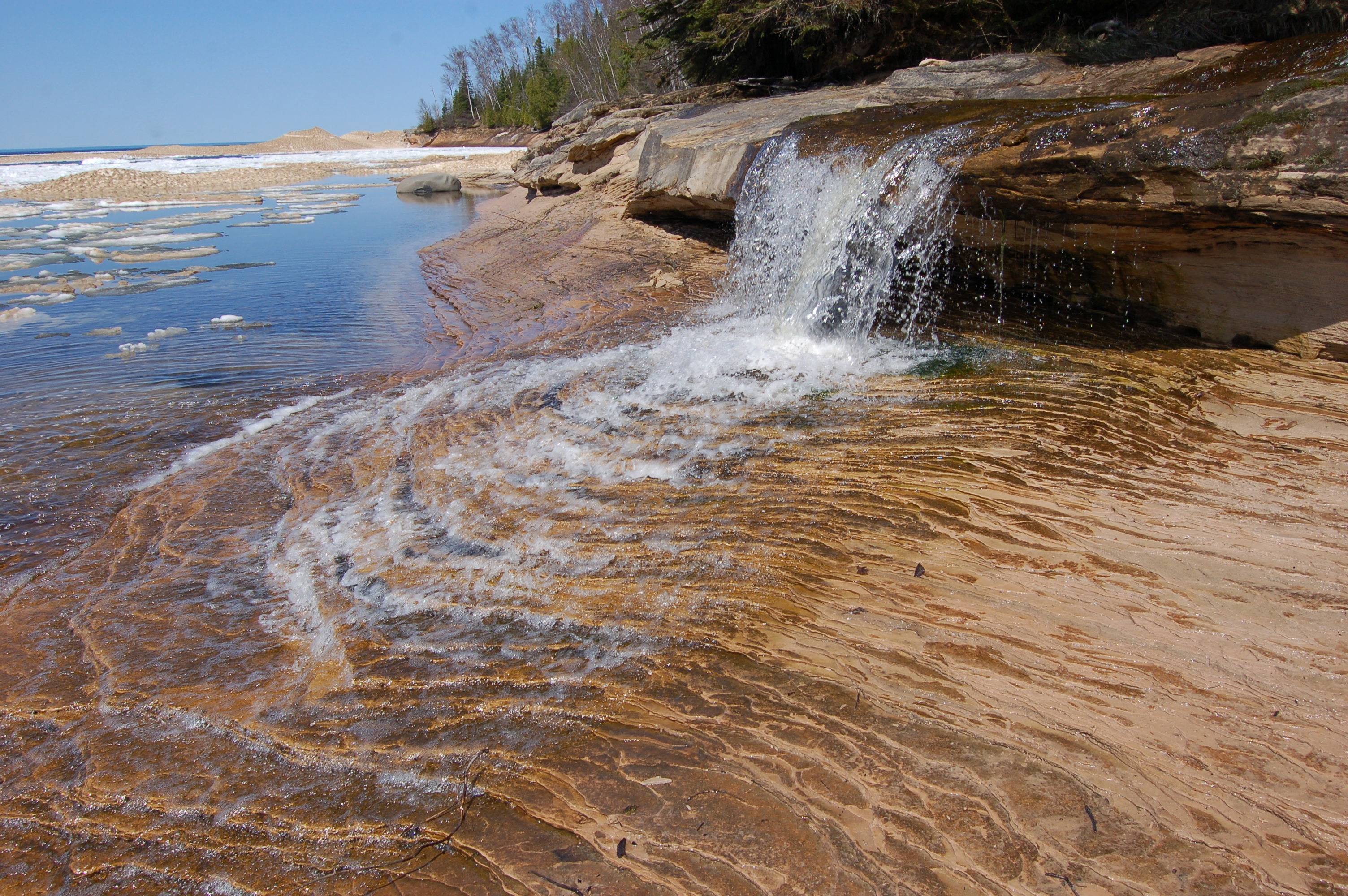
Munising Falls – Located a mile away from downtown Munising, this 50 foot waterfall is a scenic plunge over a sandstone cliff and it is reached from a short, universally accessible trail. A visitor center is located in the same parking lot. The water flow varies here seasonally, so try and check it out in the spring or after heavy rain – or in the winter when it becomes a solid column of ice. Head east from Munising on H-58 then turn left Washington St. and follow it for a mile to the parking area for Munising Falls.

Mosquito Falls – This small but scenic waterfall is reached after a 1.5 mile hike from the Chapel trailhead. Mosquito Falls drops a total of 15 feet in a few sections as Mosquito Creek drops over rock shelves in a spot that is popular for otters and other small mammals. From Munising, take H-58 east for about 20 miles, then take the turn marked for the Chapel/Mosquito area and follow it to the parking area.

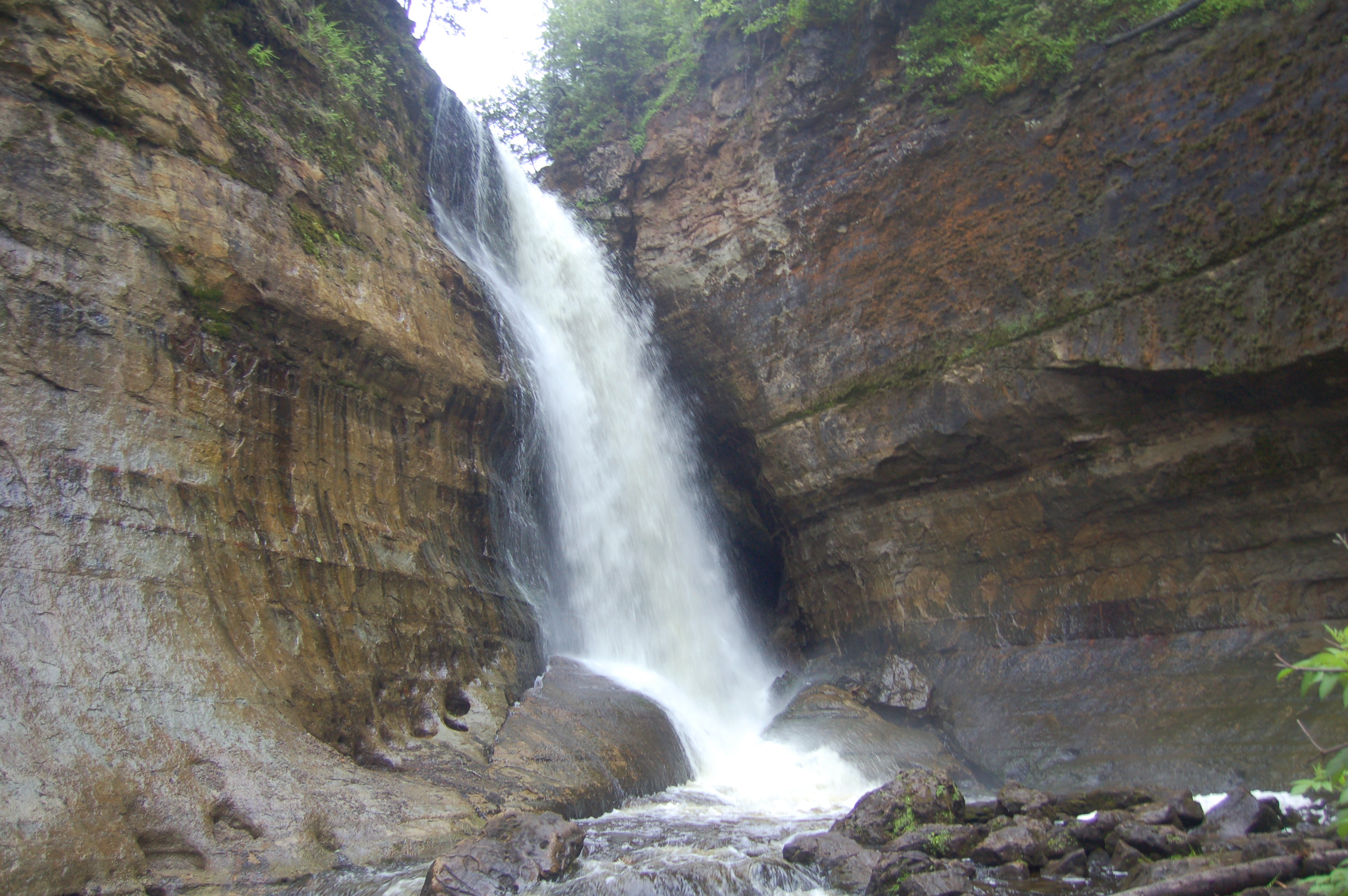
Chapel Falls – It takes a hike of about two miles each way to get to this wild waterfall, but it is a stunning drop of around 80 feet as the creek drops down to Chapel Lake. There are two viewing platforms from which to see the falls. From Munising, take H-58 east for about 20 miles, then take the turn marked for the Chapel/Mosquito area and follow it to the parking area.
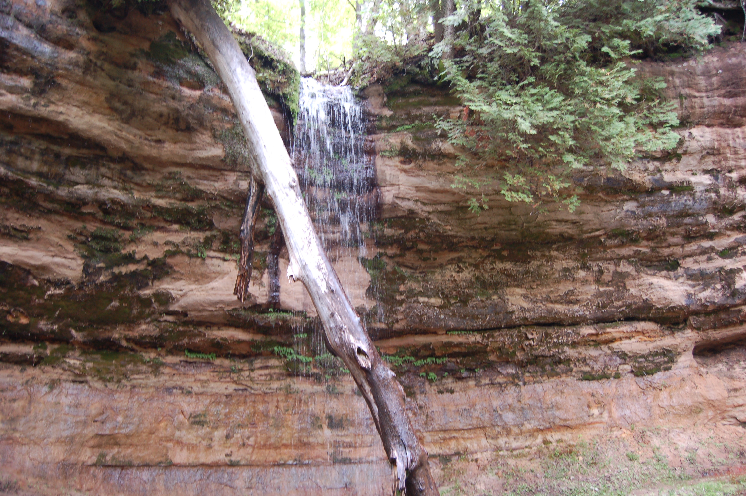
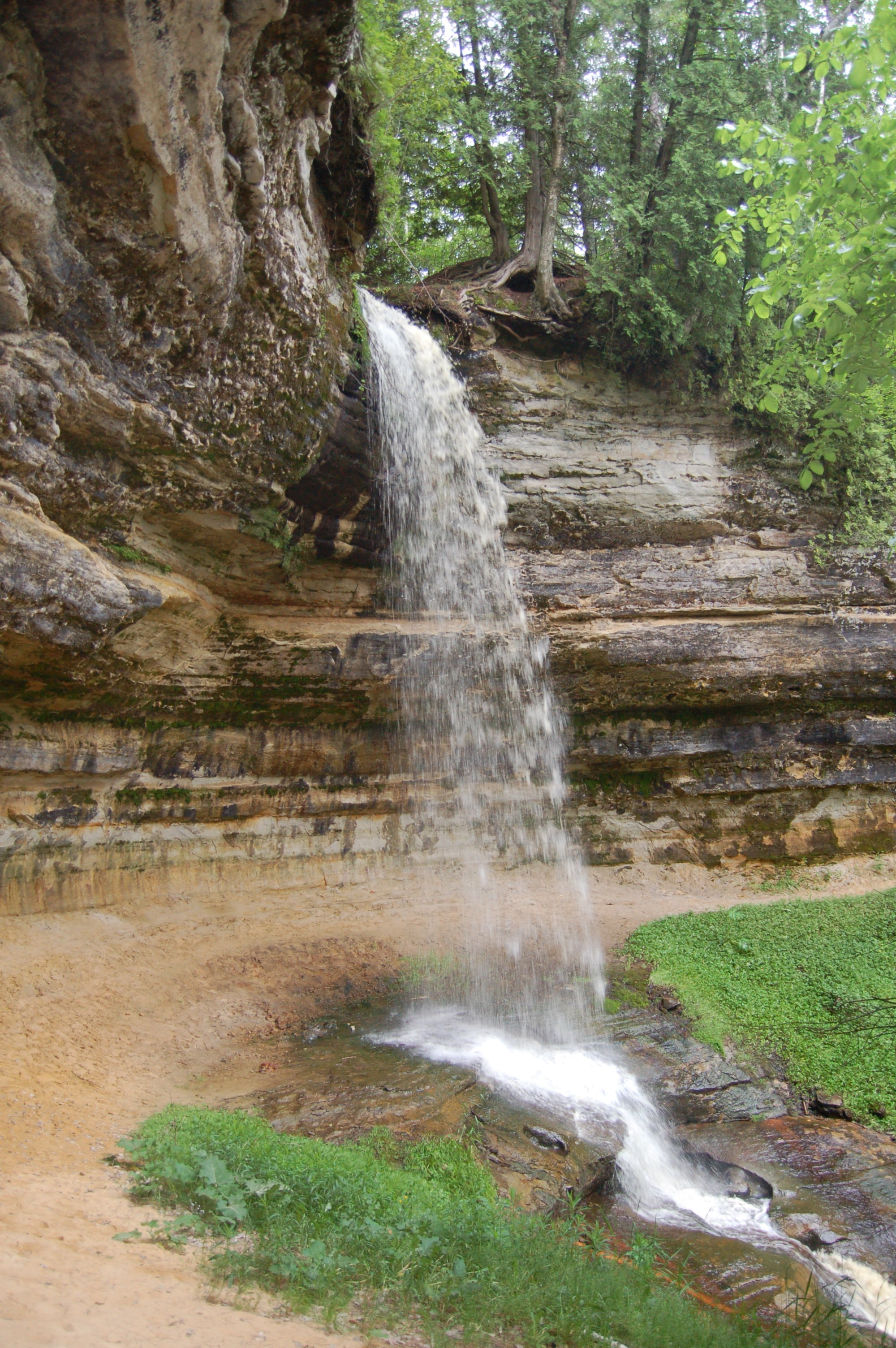
Potato Patch Falls – This seasonal waterfall features a thin drop of 30 feet over a sandstone cliff. Potato Patch Falls is reached from a short, but uphill hike and is set up very similar to the larger Munising Falls. After the initial drop, the water continues to slide another 20 feet downhill on its way to Lake Superior. Take H-58 east from Munising then head north on Miners Castle Rd. Take the fork to the right for Miners Beach, then turn right at the T intersection (left leads to Miners Beach) and follow it to the parking area. Head uphill into the woods.
Elliot (Miners Beach) Falls – Referred to as the most photographed waterfall at Pictured Rocks National Lakeshore, this is mainly a spring runner and is best viewed then or after a heavy rain. It is a small but incredibly scenic drop reached after a short hike from the Lakeshore trailhead parking lot. Take H-58 east from Munising then head north on Miners Castle Rd. Take the fork to the right for Miners Beach, then turn right at the T intersection (left leads to Miners Beach) and follow it to the parking area.
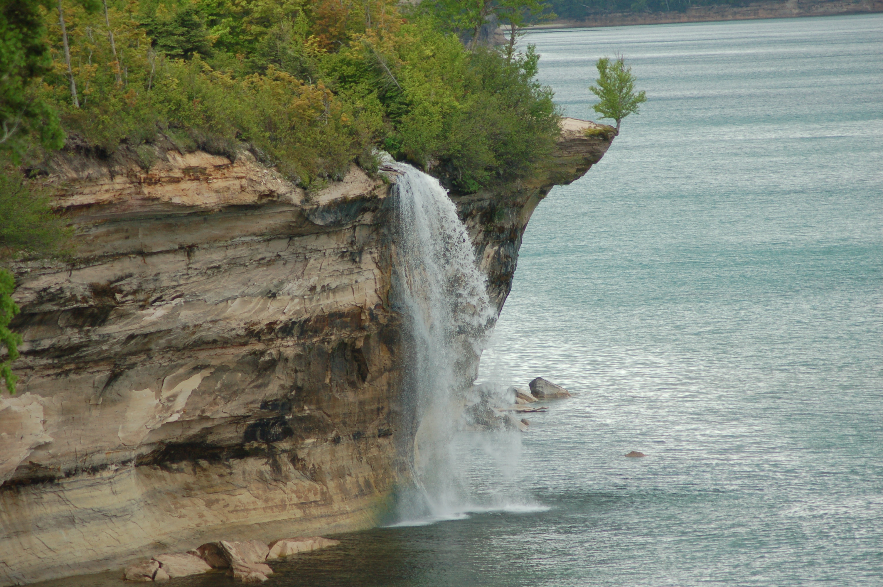
Bridalveil Falls – A 140 foot foot drop down a cliff face, Bridalveil Falls is a seasonal waterfall that is best viewed from Lake Superior. From land, it can be seen at a distance from Miners Beach or the Miners Castle overlook.
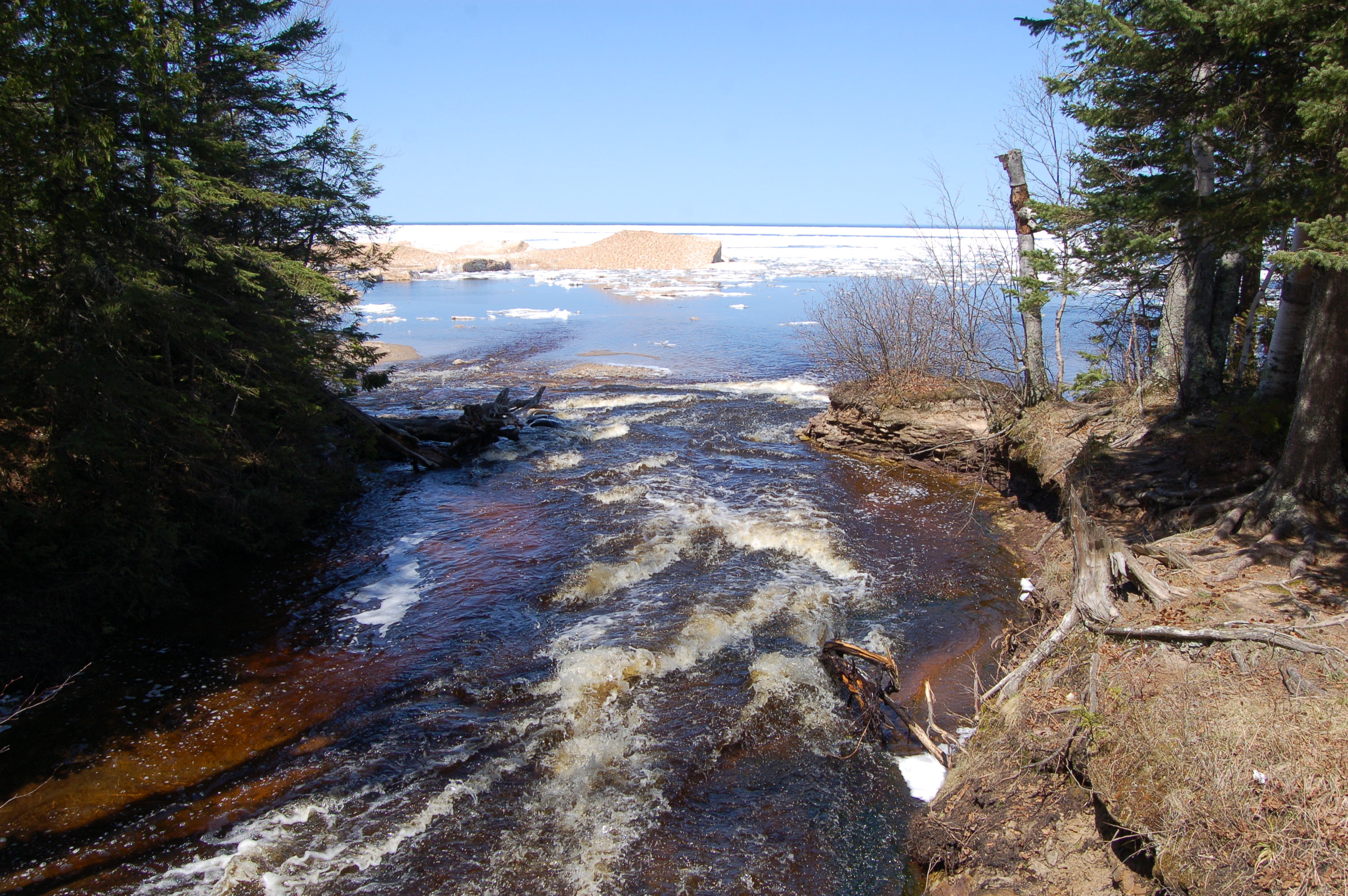
Hurricane River – This river next to a day-use parking area offers scenic views, two minor waterfalls and a wooden footbridge. It is a great spot for a short hike, picnic or rest break. There is a campground here, and a trail that leads to the Au Sable Light Station.
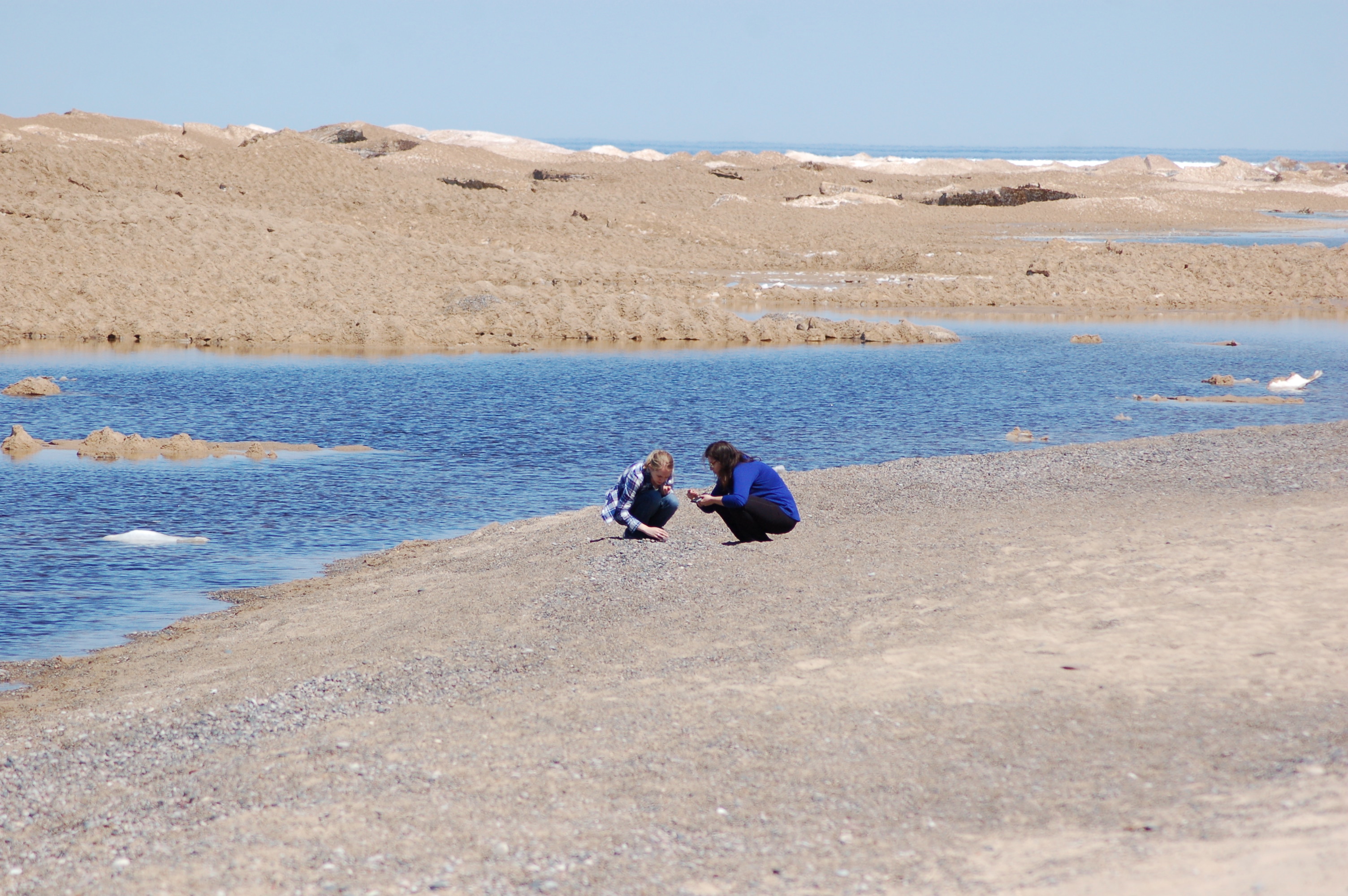
Lake Superior Overlook, H-58 – One of the improvements made when H-58 got paved from end to end was the addition of this scenic area that showcases undisturbed beach on Lake Superior. There is a parking lot with room for 20 cars, parking for large vehicles and fully accessible restrooms. Two wooden platforms provide views for all, and this is an amazing place to look at all of the rocks and other things that have washed ashore.
Miners Beach – One of Pictured Rocks National Lakeshore’s most popular beaches, Miners Beach can be found at the point where the Miners River flows into Lake Superior. The water here tends to be a bit warmer than other spots on the lake, and the beach provides plenty of open space. It is a popular launch location for kayaks, and provides distant views of Bridalveil Falls and the Pictured Rocks cliffs.

Chapel Beach – A popular resting spot for both hikers and kayakers, Chapel Beach is reached after a 2.5 mile hike that passes by Chapel Falls and Chapel Lake. You’ll also be able to see Chapel Rock, one of the lakeshore’s most easily recognized rock formations.
nps.gov/Gregg Bruff
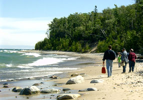
Twelvemile Beach – Noted for its white sand, Twelvemile Beach is one of the park’s more secluded spots on Lake Superior. It’s a wonderful place for a long walk, and author Loreen Nieuwenhuis picked this as one of her favorite things about Pictured Rocks National Lakeshore, when she joined us for My 5 Favorite Places in Michigan.
Sand Point Beach – The waters at this shallow bay are often warmer than other spots on Lake Superior. It’s also an excellent spot for catching sunsets. Four miles northeast of Munising, at the end of Sand Point Rd. (starts as Washington St.)
Mosquito Beach – This secluded beach is a favorite for those that reach it after a few miles of hiking. Views in each direction showcase everything visitors love about the lakeshore – undisturbed beach, rocky shoreline, and powerful waters. The trail passes Mosquito Falls on the way to Lake Superior, and the Mosquito River makes a few more small drops as it reaches the lake.
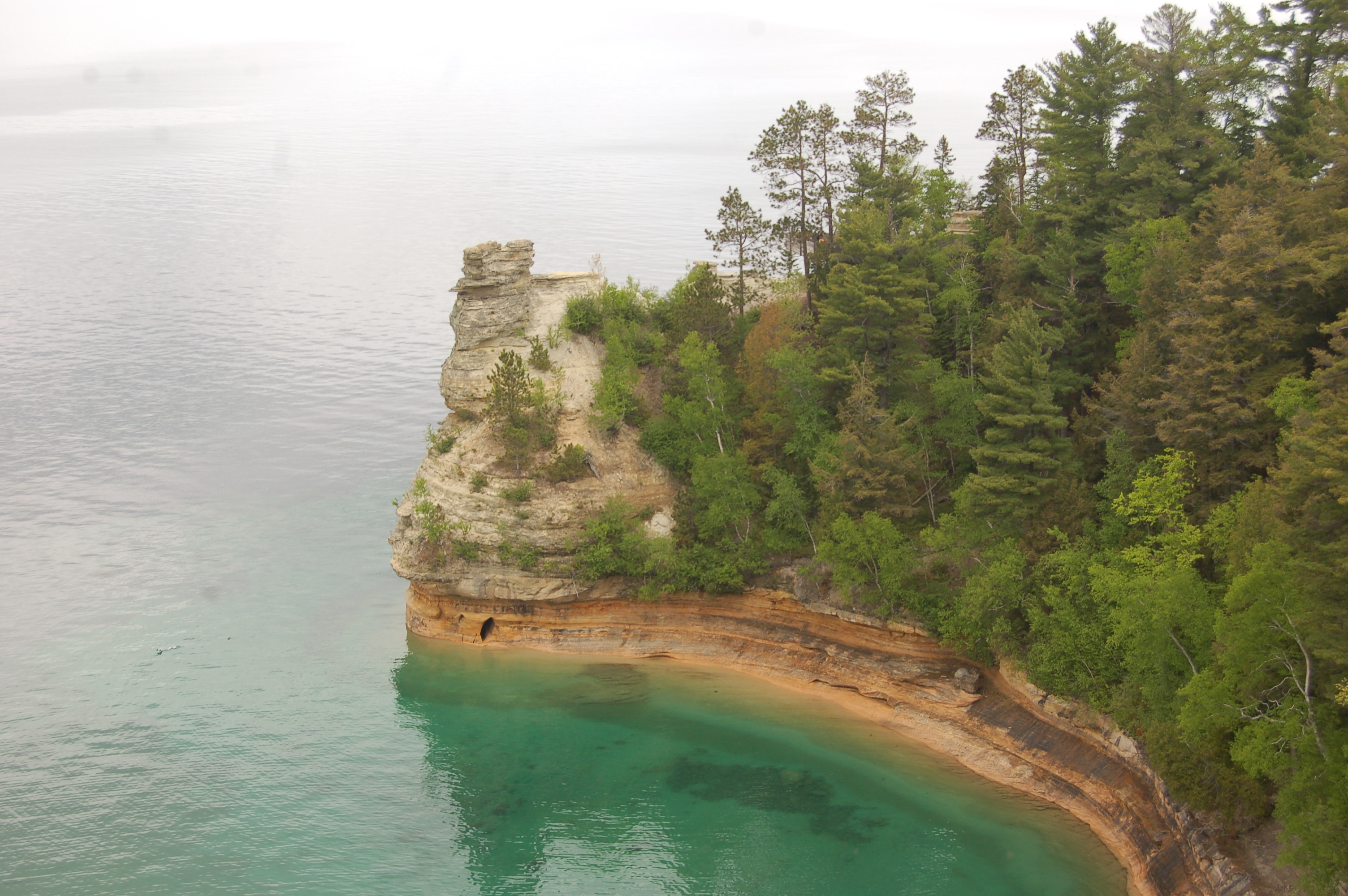
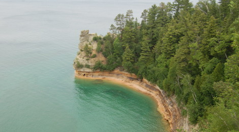
Miners Castle – The most iconic landmark at Pictured Rocks, Miners Castle is a sandstone formation that resembles a castle turret atop a towering cliff on Lake Superior. At one point there were two turrets, but the second was lost to erosion in 2006. There are two universally accessible overlooks here, and another platform leads right up to Miners Castle (steep, some stairs). Take H-58 east from Munising, then head north on Miners Castle Rd., taking the left fork when it splits after about five miles. There is plenty of parking, restrooms, and a picnic area at this well-signed destination.

Grand Sable Dunes – On the eastern end of Pictured Rocks National Lakeshore you will find the Grand Sable Dunes, a perched dune formation that covers five miles along Lake Superior. These dunes rise as high as 300 feet above the lake at a 35-degree angle. They can be seen from the Log Slide Overlook and from Grand Sable Lake, and a hiking trail leads to the top of dunes near Sable Falls.

Log Slide Overlook – In the 19th century this area was logged heavily, and a wooden slide here west of Grand Marais helped get logs down to Lake Superior where they could be floated to the harbor. A short trail leads to amazing views from atop the dunes, and a wooden overlook offers views of Au Sable Light Station to the west and Grand Marais to the east. There are interpretive signs and logging artifacts on display alongside the trail.

Au Sable Lighthouse – A lighthouse was built in 1874 to warn mariners of a dangerous, rocky stretch of shoreline between Munising and Grand Marais. A white tower capped with a black lantern room stands 87 feet tall with a brick dwelling next to it. In the summer months park staff is on hand to lead tours and open the tower for climbing, which prevents stunning views of this amazing stretch of shoreline.
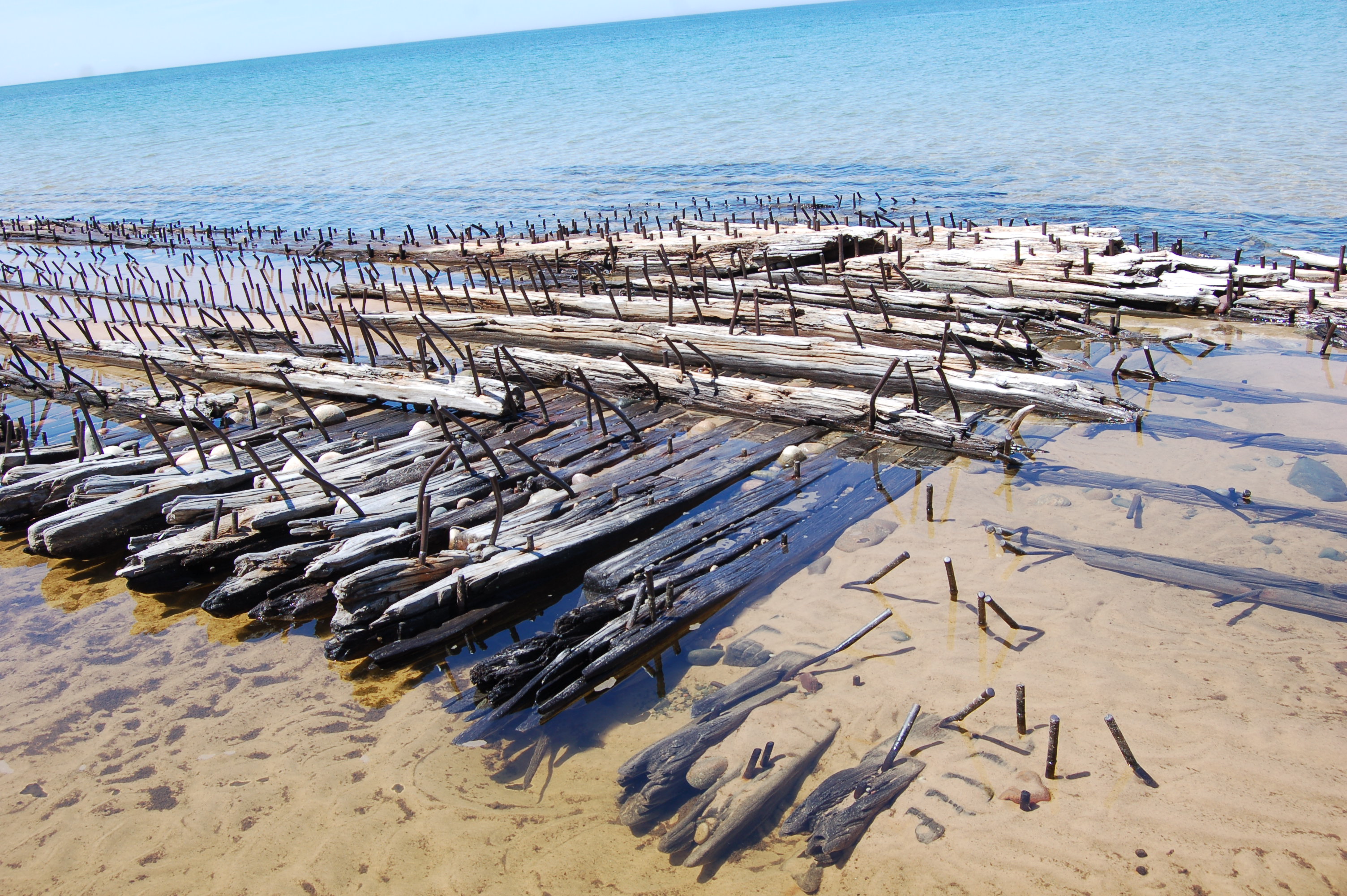
Shipwrecks – The shoreline is beautiful, but it has also been a dangerous one for mariners for many years. There are numerous shipwrecks within the Pictured Rocks boundaries, and even more around Grand Island (you can view them on Glass Bottom Boat Tour) and Grand Marais. Two wrecks are easily viewed on the beach just west of the Au Sable Light Station – the Gale Staples and the Sitka. The Sitka wrecked here in 1904 and the Gale Staples wrecked in 1918, and now the wood and metal bones of their remains are intertwined in shallow water on the beach. More information: http://www.nps.gov/piro/learn/historyculture/upload/Shipwrecks.pdf.
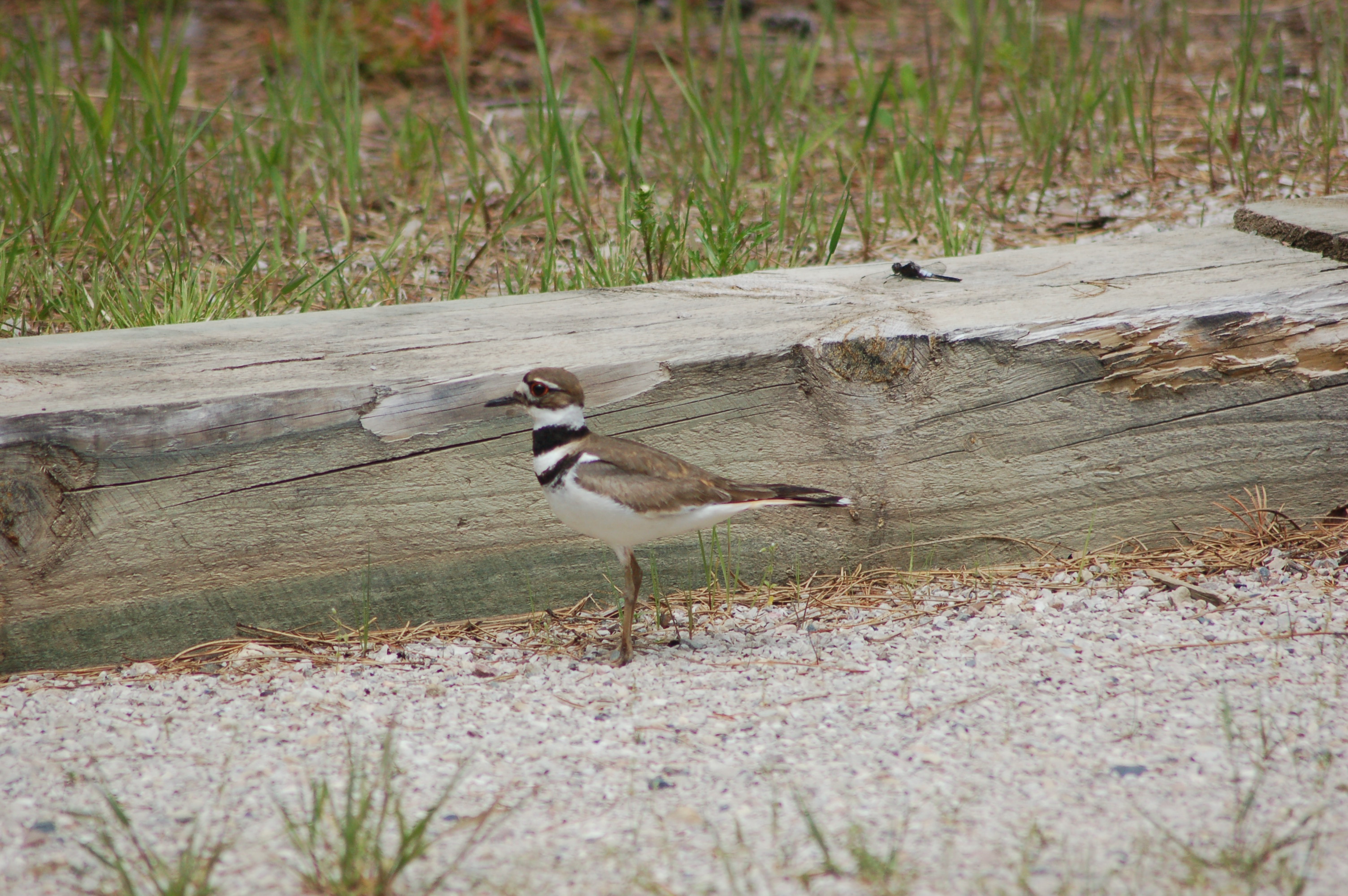
Wildlife – Pictured Rocks National Lakeshore is home to beavers, black bears, whitetail deer, otters and a variety of small mammals. Kayakers and boat cruise passengers might be lucky enough to see bald eagles and peregrine falcons on the cliffs, and there are nearly 50 different species of fish in the water of Lake Superior as well as the inland lakes and rivers.
Visitor Centers – There are six places to get more information on things to do at Pictured Rocks National Lakeshore, including trail maps, current conditions and backcountry camping permits. The Interagency Visitor Center can be found in Munising near the junction of H-58 and M-28, the Grand Sable Visitor Center is on H-58 one mile west of Grand Marais, the Munising Falls Visitor Center is on Sand Point Rd. east of Munising, and the Lakeshore Headquarters are found a little farther down the road near the Sand Point Marsh Trail. Lakeshore information can also be found at the Miners Castle Information Station and at Au Sable Point Light Station.
Indianhead – One of the iconic rock formations comes at a point when the cliffs are at their tallest (close to 80 feet) and make a straight drop down to Lake Superior. The protruding rock is said to resemble the head of an Indian.
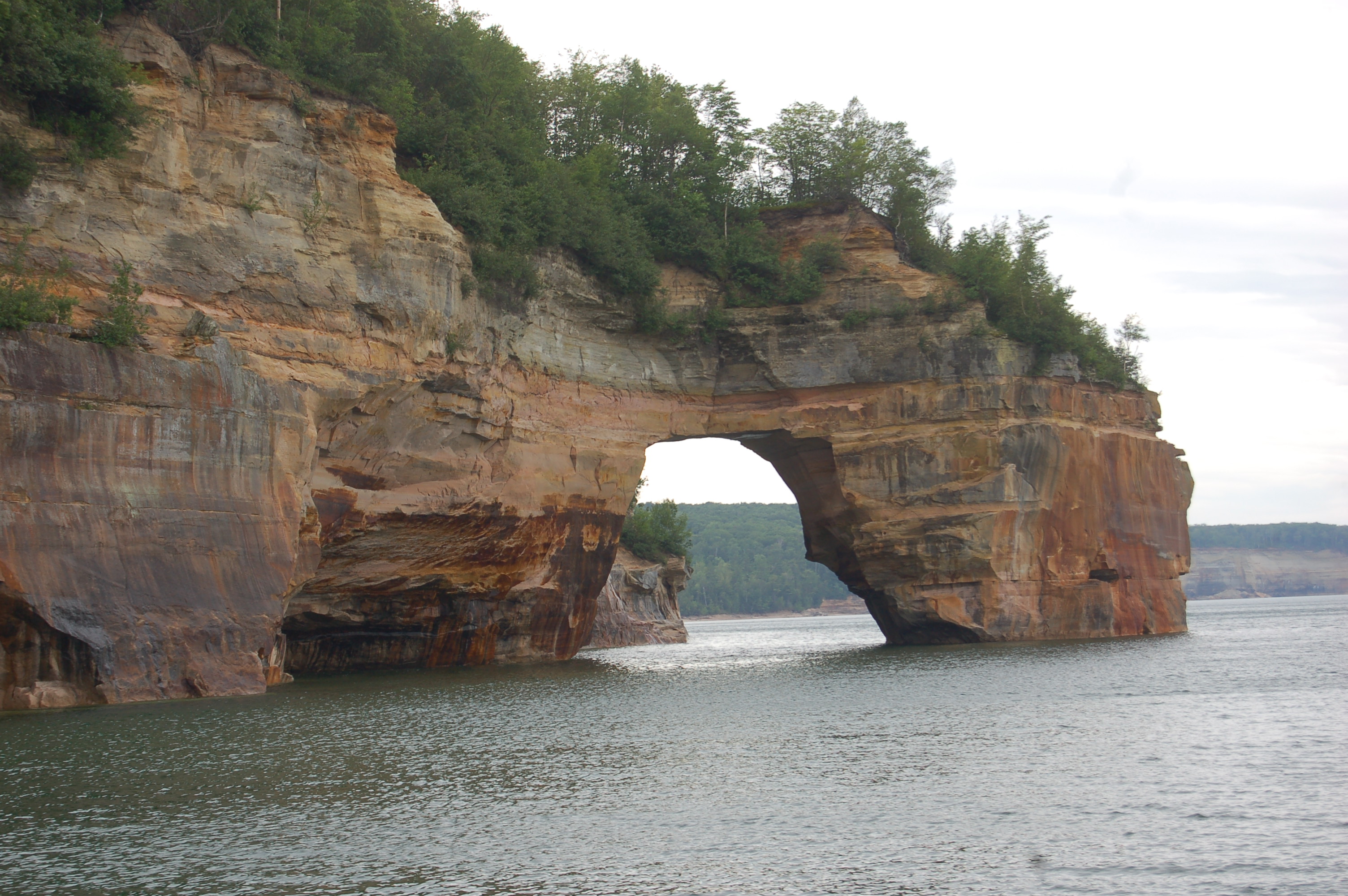
Lovers Leap – Legend says that a couple once jumped off this point to prove their love. This archway is one of the most photographed spots at the lakeshore, and pictures of visitors kayaking under it are frequently used in promotional materials. I’ve also seen this referred to as the Petit (small) Portal.
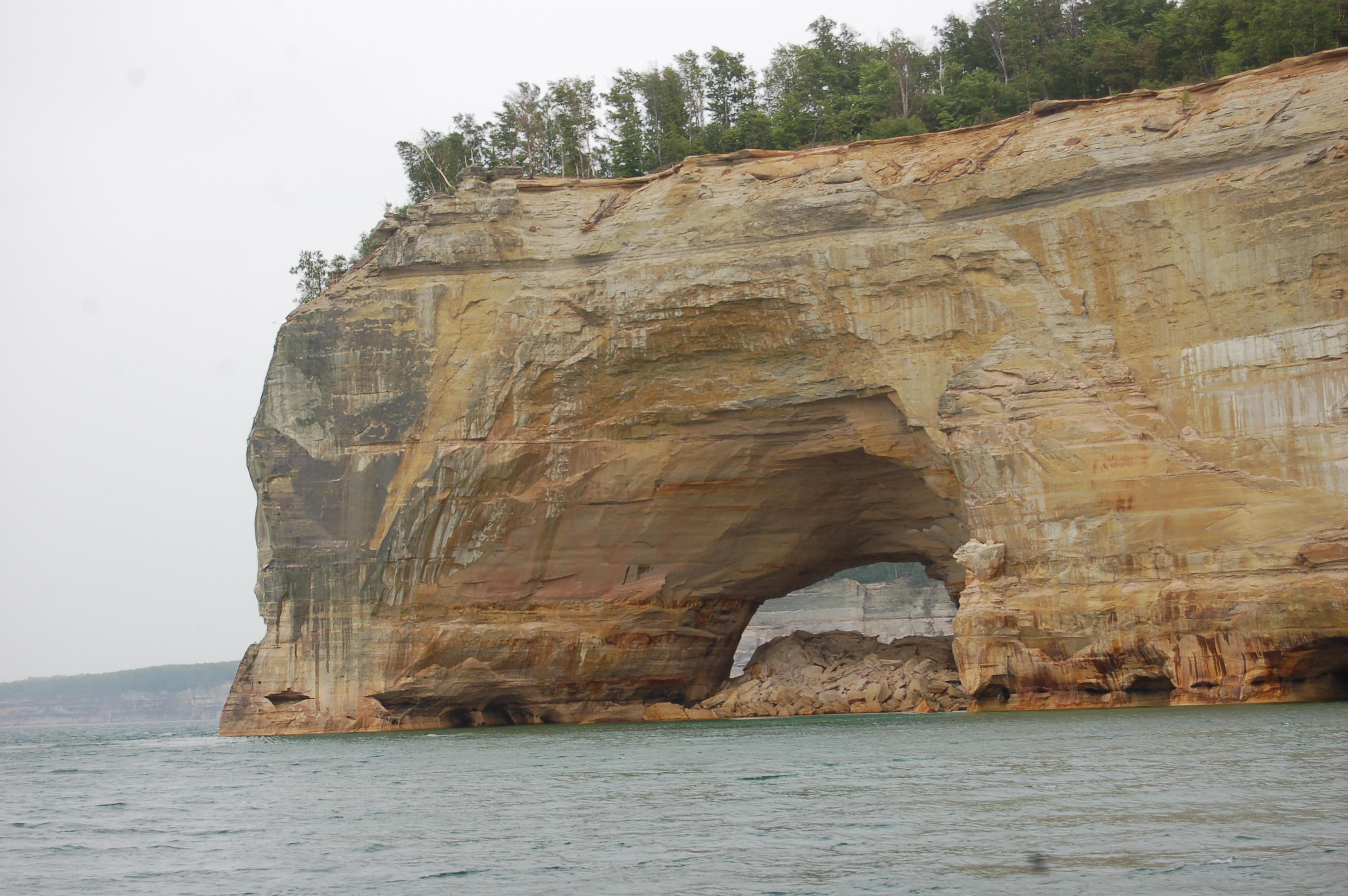
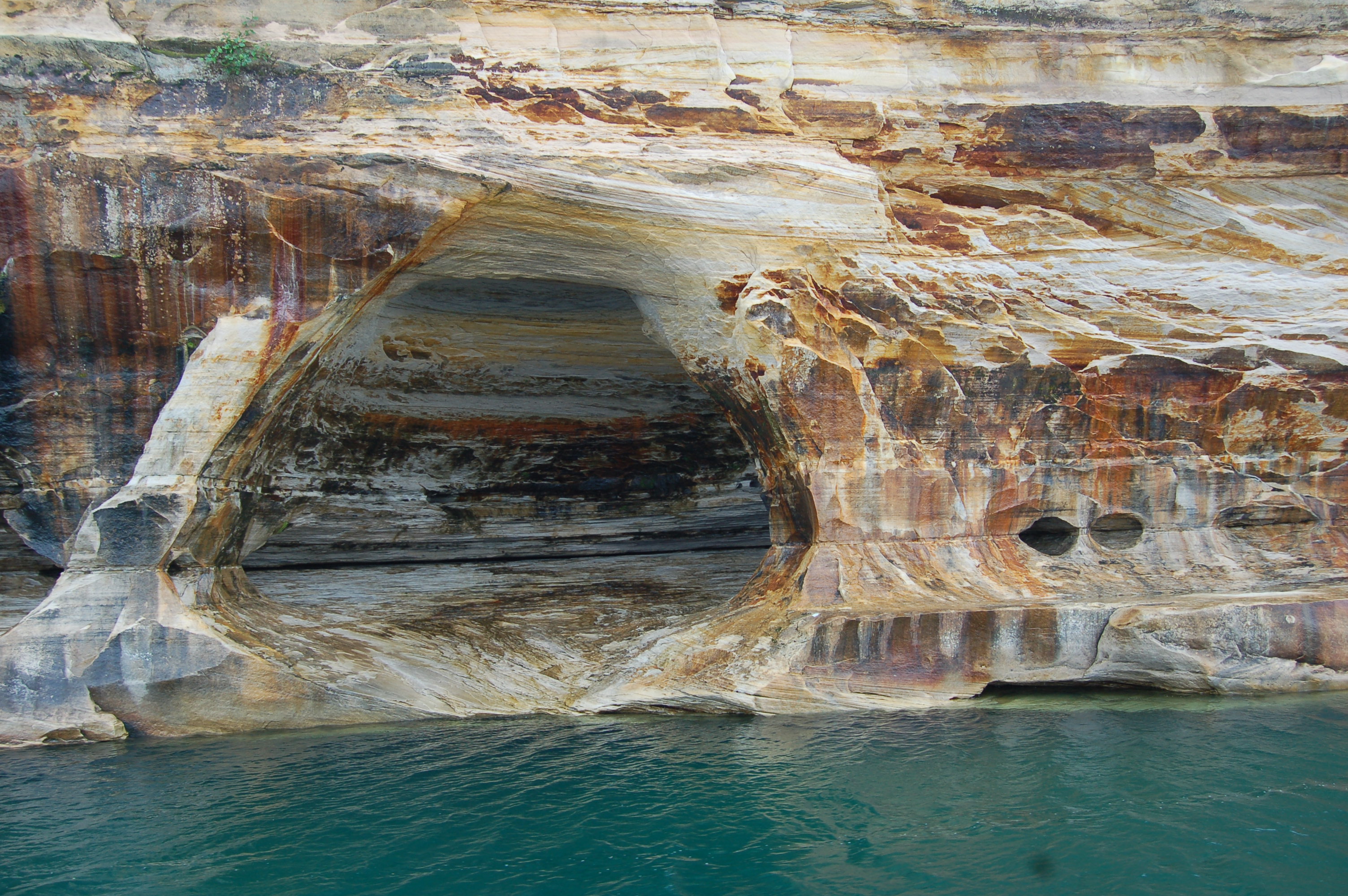
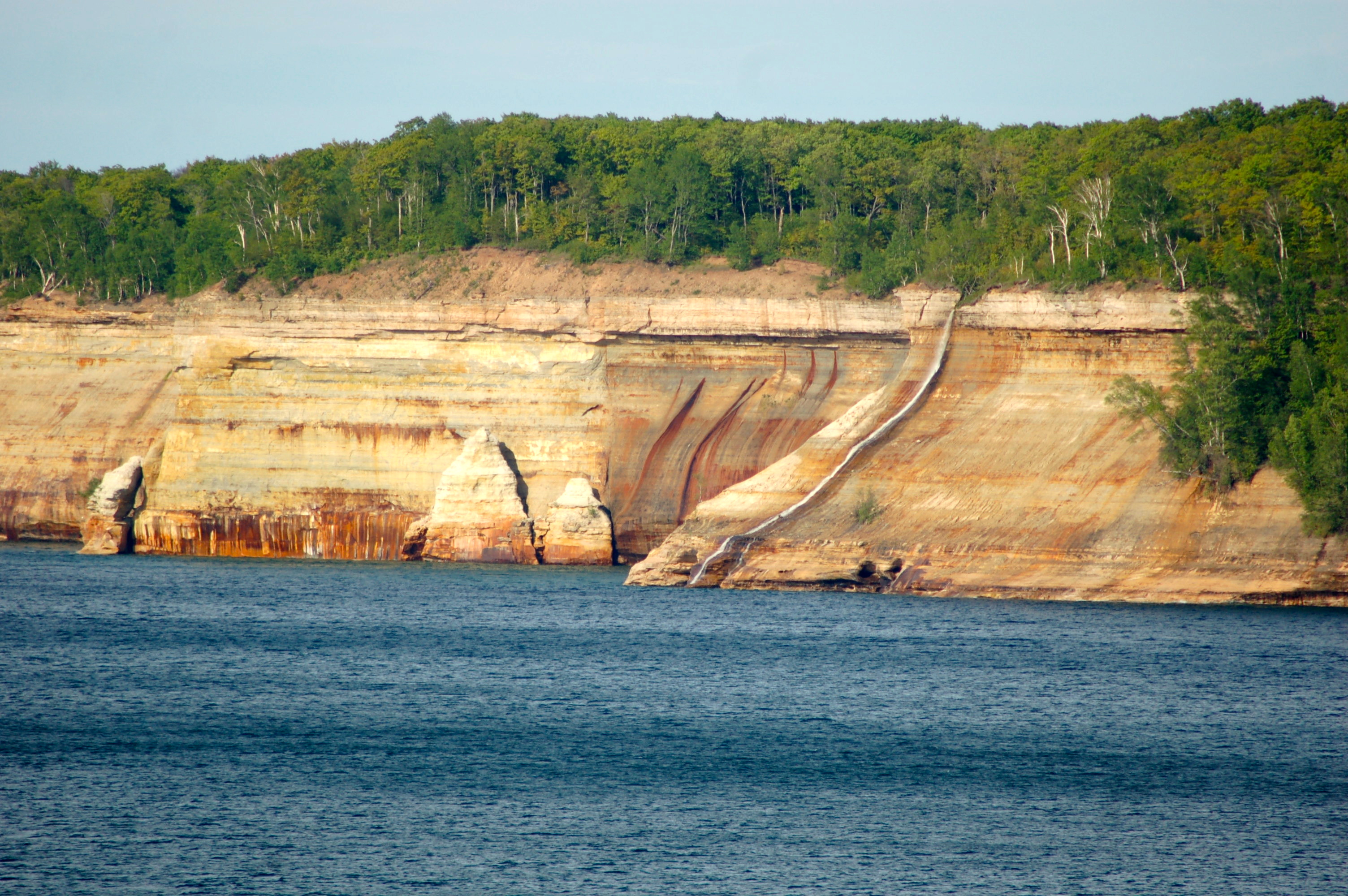
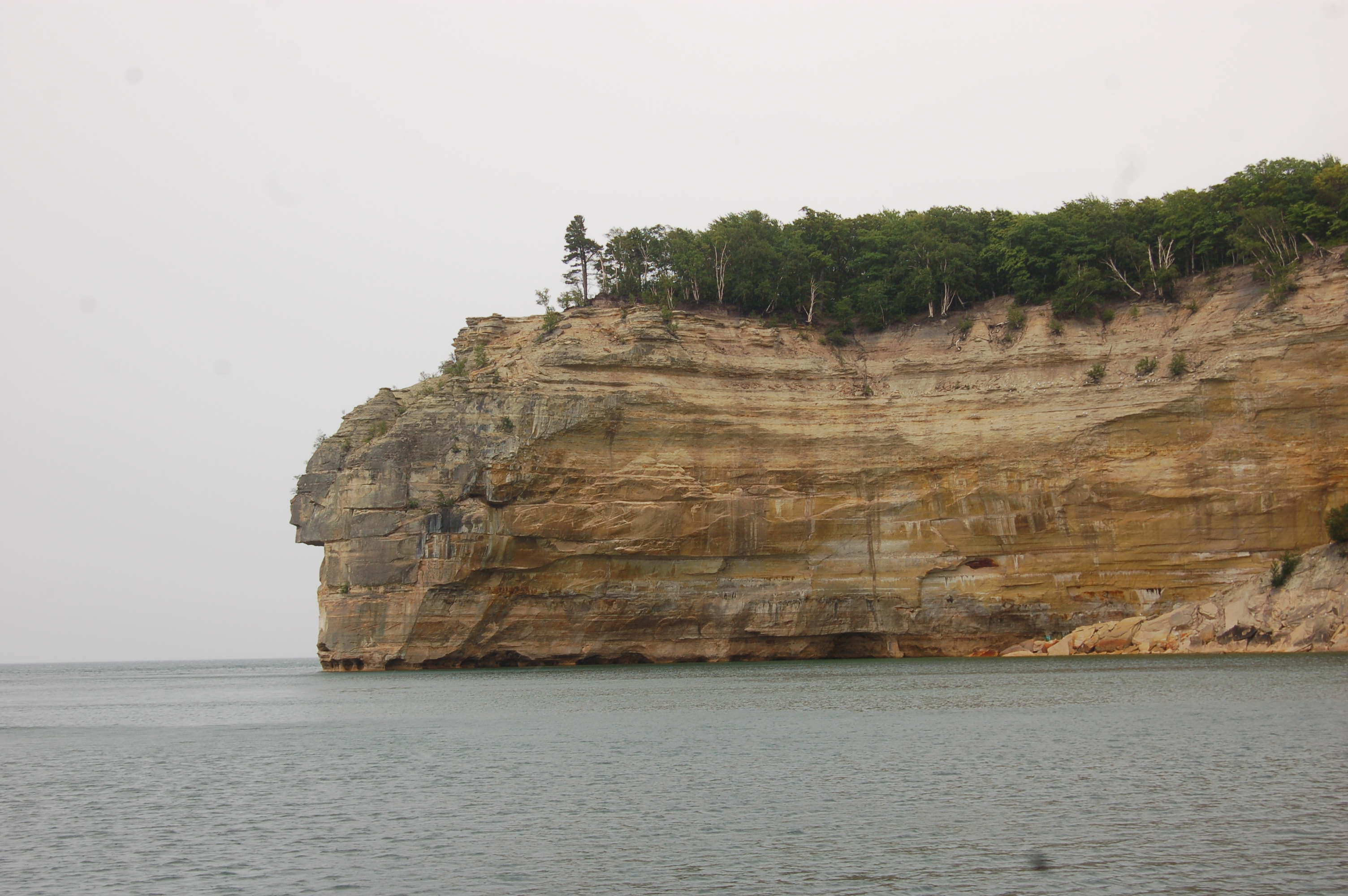
Grand Portal Point – One of the most iconic formations at Pictured Rocks National Lakeshore, the Grand Portal Point arch has been filled in by rockfall over the years but there is still plenty to see. An archway, small caves, and colorful rocks are favorites for kayakers here and the views from above are stunning. The best views come from the water, but it can also be viewed from the Lakeshore Trail.
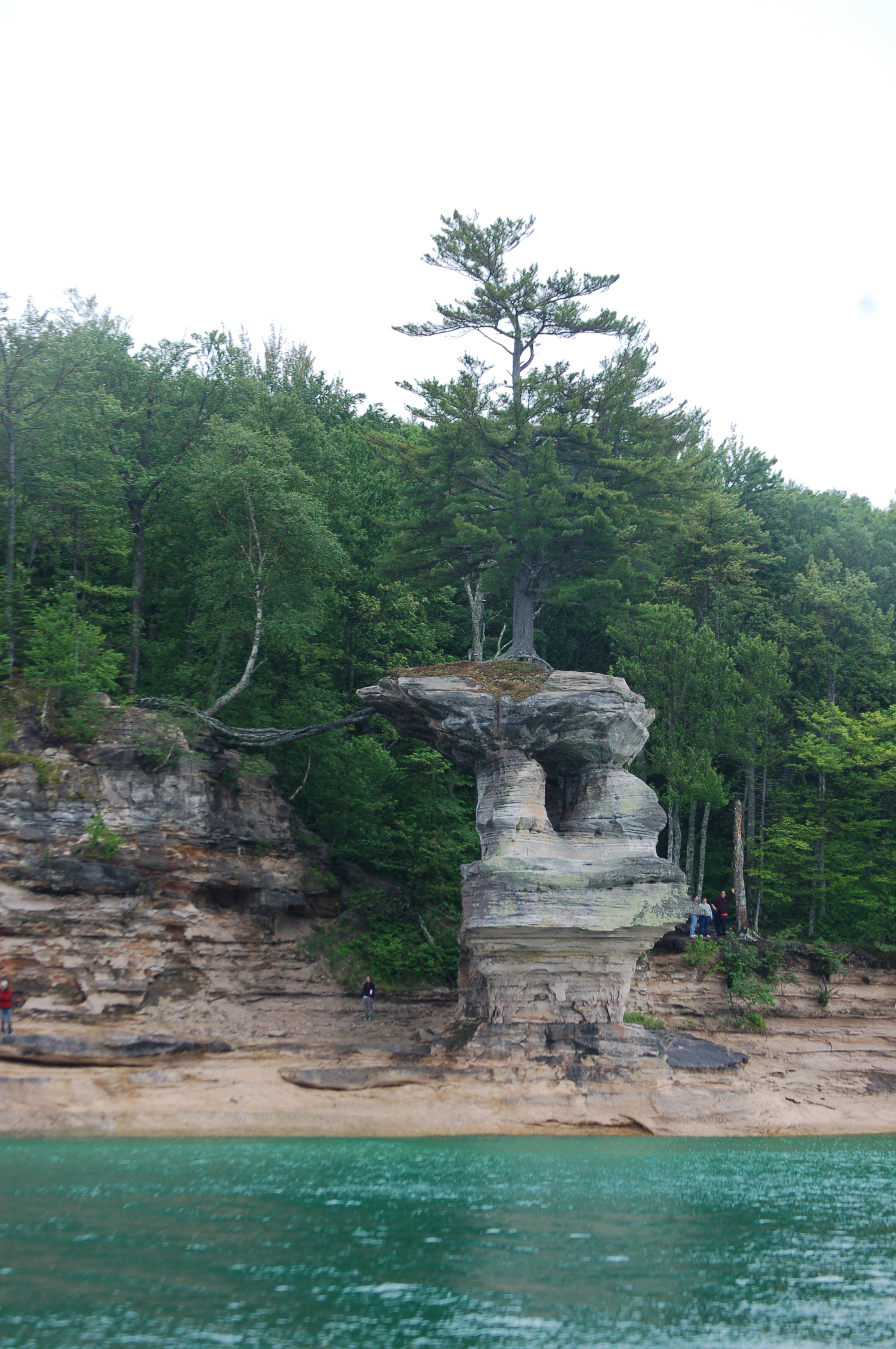
Chapel Rock – There used to be an archway here too, but it collapsed a long time ago leaving only this scenic limestone formation. This is one of the park’s iconic formations, made all the more amazing by the tree that still survives on top of it.
Grand Sable Lake – A sandy beach and picnic area welcome visitors to this lake, and there is a boat launch for those who want to try their hand at fishing. The Grand Sable Dunes are right next to the lake, which is easily accessed from H-58.
Sand Point Marsh Trail – This is a half-mile trail that is fully accessible, and it can be found across from Sand Point beach near the Lakeshore headquarters where a “boardwalk leads you to this interesting wetland area. Interpretive exhibits relate the rich natural and cultural heritage of the area. Old beach ridges, an active beaver colony, white cedar and black spruce swamp communities dominate the scene.”

Sunsets – Michigan is known across the nation for stunning Great Lakes sunsets, and Pictured Rocks National Lakeshore offers more than a few places to catch one over Lake Superior when conditions are right. Beaches and campgrounds are some of the top spots, and Pictured Rocks Cruises offers a sunset cruise option that is incredibly popular.
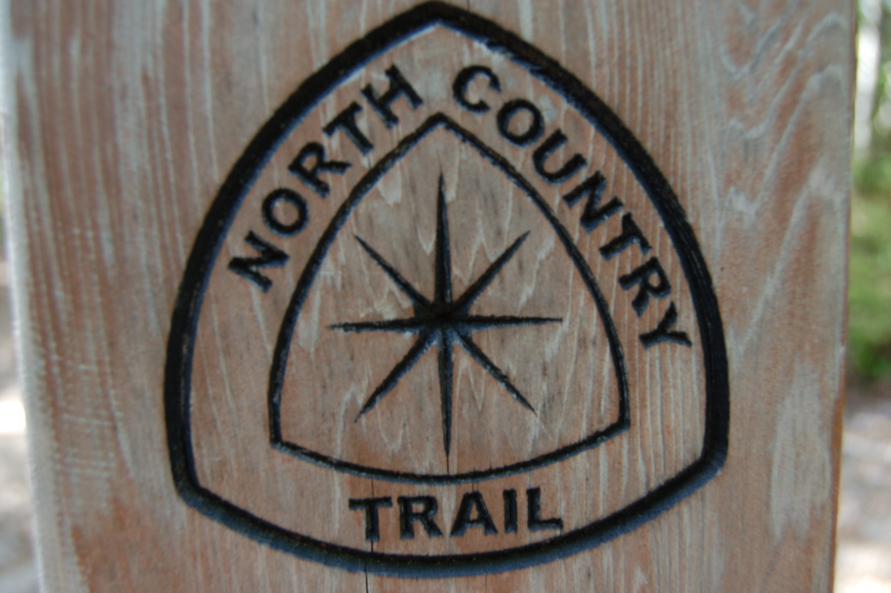
North Country Trail – Of the more than 90 miles of trails at Pictured Rocks, 42 of those miles are part of the North Country Trail. For the most part, it follows the Lake Superior shoreline from Grand Marais to Munising which is one of the most popular thru-hikes for hardcore hikers and backcountry campers.
Schoolcraft Blast Furnace Ruins – The National Park Service has a great write-up on the former blast furnace that operated in Munising in the early 1800s. “Presently, the stack and furnace ruins are difficult to see. They are located across the creek on a level area near the beginning of the trail to the falls. Ruins of what may have been a corduroy road can be seen in the creek as can a large flat deposit of slag angling into the creek. As you walk north on the North Country Trail and cross the creek notice that the soil is black with charcoal. The kilns once stood on the high ground above the old road trace, now used as a hiking trail.” The trail starts at the Munising Falls Interpretive Center.

Drive H-58 end to end – Driving from Munising to Grand Marais used to involve narrow and uneven dirt roads, making access to the park’s interior rough for those visiting in a small car and next to impossible for those visiting in RVs. Now, H-58 is paved the entire way through, and it takes about an hour and a half of driving to travel 47 miles. It is possible for vehicles of any size to reach campgrounds, the Mosquito/Chapel area, Au Sable Point Light Station and more.

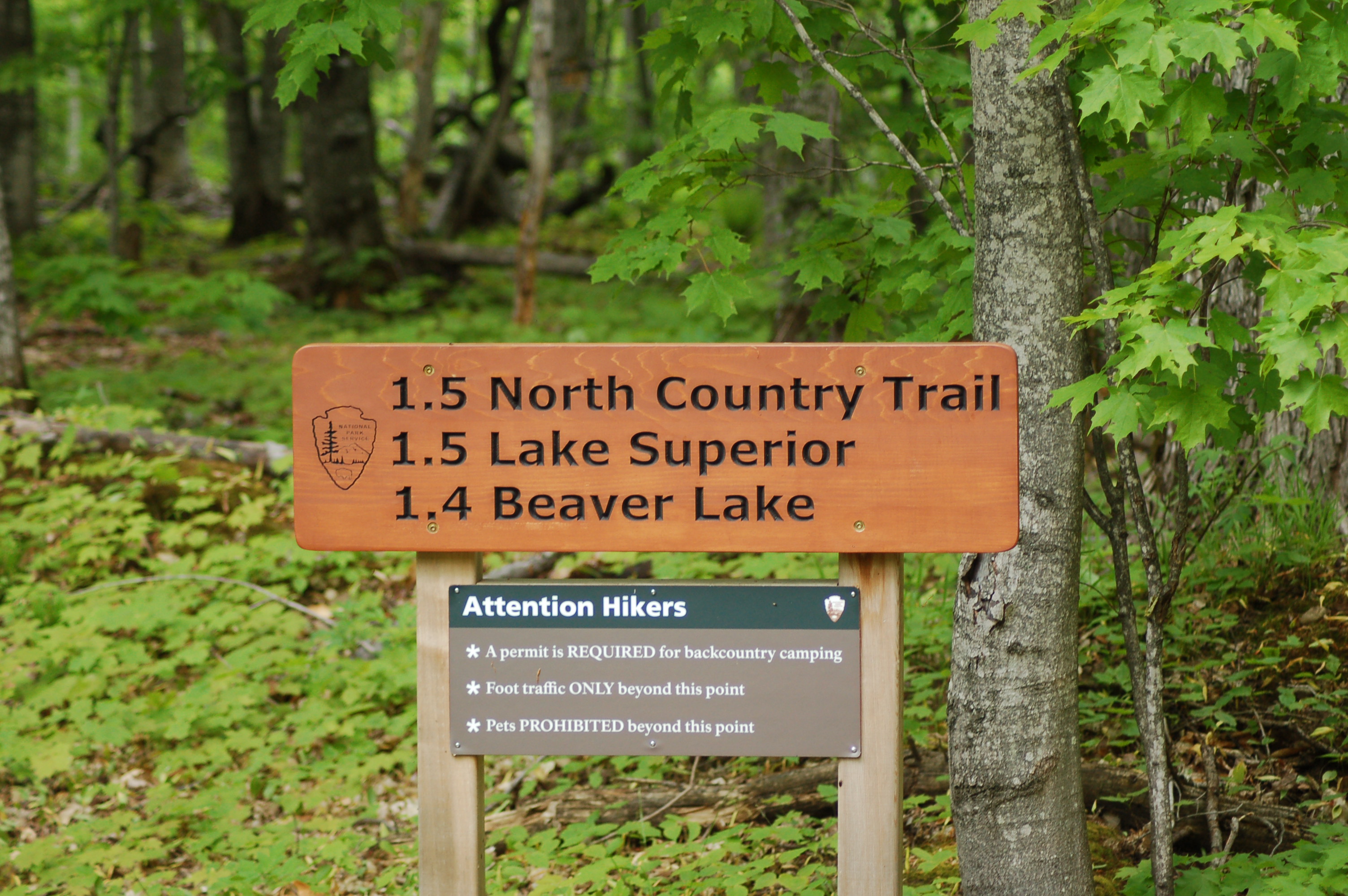
Backcountry camping – Those looking for the truly immersive wilderness experience will enjoy camping away from the crowds at any of the backcountry campsites at Pictured Rocks. These sites offer primitive camping with no water, electric, or restrooms and “leave no trace” is the encouraged motto. Unlike the drive-in campgrounds, these backcountry sites can not only be reserved ahead of time but it is encouraged. There are several group backcountry sites, and at a fee of $5 per person this is a bargain and a memorable experience. Find all the information you could possibly need to know at: http://www.nps.gov/piro/planyourvisit/backcountry.htm.
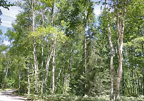
Plants – There are more than 600 plant species that have been identified at Pictured Rocks National Lakeshore, thanks to a variety of habitats that include dunes, bogs, upland forests, fields, and inland lakes. You can find full lists of plants and information on endangered or threatened species at http://www.nps.gov/piro/learn/nature/plants.htm. The Lakeshore Trail, Sand Point Marsh Trail, Miners Falls Trail, and Beaver Lake Loop are great hikes for plant life.

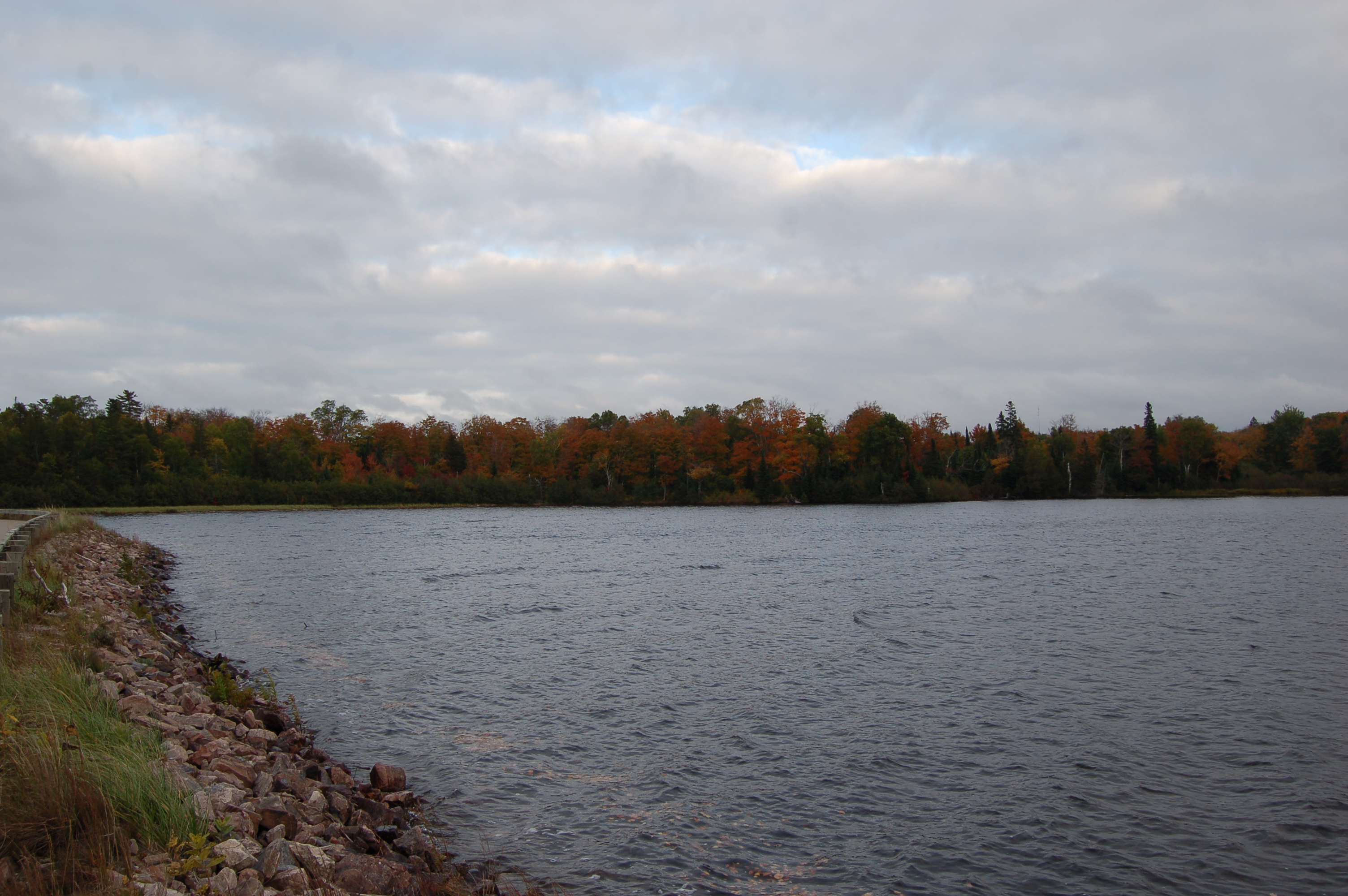
Fall Color – You might think a stunning lakeshore that already featured a ton of color couldn’t get any better, but head back in the fall to see how wrong that line of thinking is. As the leaves on the trees change to orange, yellow, and red they contrast even more with the light colors of the sandstone cliffs, the blue of Lake Superior, and the greens of the forest. Top fall spots include Miners Castle, Grand Sable Lake, the Chapel Loop, Sable Falls, and the drive along H-58 between Munising and Grand Marais.
Fishing – Pictured Rocks offers enough inland lakes, rivers and streams to entice any angler, and offers the chance to catch smallmouth bass, northern pike, walleye, yellow perch, whitefish and more. Beaver Lake and Little Beaver Lake are popular spots and salmon, rainbow trout and brook trout. The Miners River and Hurricane River are also popular and scenic spots to cast a line. Find out more at: http://www.nps.gov/piro/planyourvisit/upload/Fishing2011.pdf.
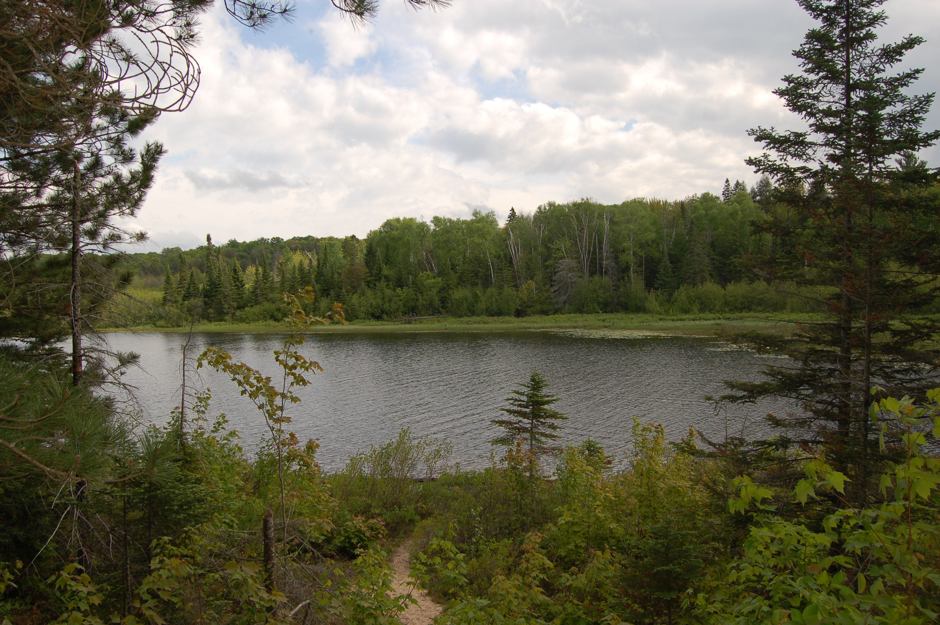
Beaver Lake Loop Trail – There are a few hikes that can be made near Beaver Lake. A circle hike east around Beaver Lake from the campground and then back along Beaver Creek is 3.5 miles. Lake Superior can be reached by a 1.5 mile hike from the campground. All of these trails have the potential for wildlife sightings and are typically less busy than the trails closer to Munising.
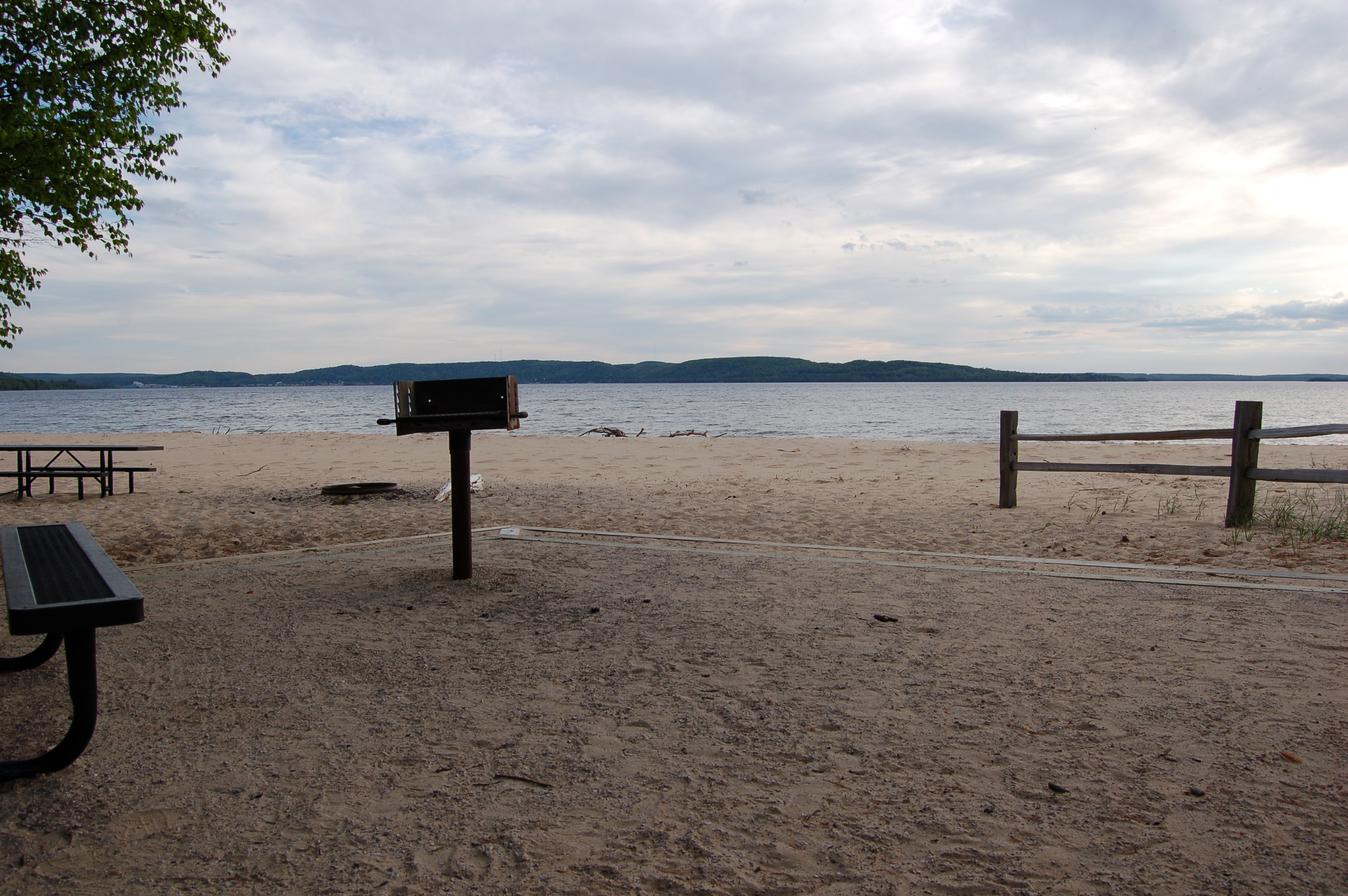
Little Beaver Lake Campground – 20 miles northeast of Munising and three miles north of H-58 is where you’ll find the secluded Little Beaver Lake Campground. There are eight campsites on this beautiful inland lake, and the White Pine Trail and North Country Trail pass by or through the campground. There is also a boat ramp for those wishing to go out on the lake for fishing or other recreational opportunities.
nps.gov/Ed Lasich
White Birch Trail – This two-mile trail can be found at the Twelvemile Beach Campground, and it leads through an upland environment that contrasts with the campground, and Lake Superior shoreline.
Beech Forest Trail – Another two-mile trail, the Beech Forest Trail connects the Sable Falls parking lot with the Grand Sable Visitor Center parking lot. It passes next to old farms, past remnants of an old camp, and through a beech-maple forest.

Hurricane River Campground – Located 12 miles west of Grand Marais on County Road H-58 on the shores of Lake Superior. There are 21 total campsites here, and it’s close to the beach and the Au Sable Light Station.
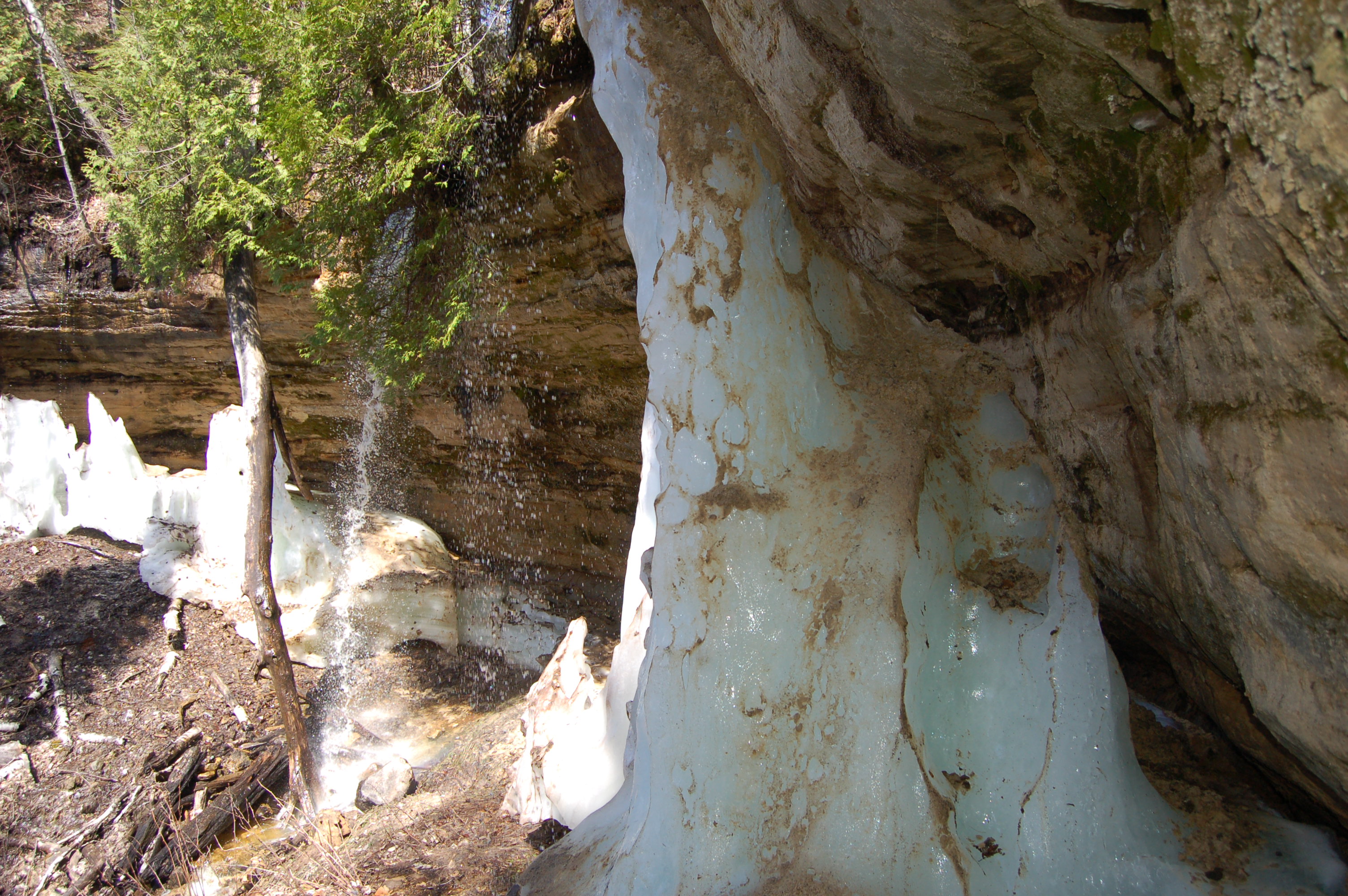
Ice Climbing – The winter activity that Pictured Rocks is known for nationwide is ice climbing, as the sandstone formations provide the perfect curtains for climbing. Sand Point offers 20-50 foot columns, while Miners Falls and the remote Miners Basin Falls are other popular spots. Check out http://www.nps.gov/piro/planyourvisit/iceclimbing.htm for more information.
Twelvemile Beach Campground – There are 36 sites near one of the lakeshore’s most loved beaches, 15 miles west of Grand Marais. Two different trails wind through here: The North Country Trail and the White Birch Interpretive Trail.
White Pine Interpretive Trail – This short trail winds through a stand of white pines that are more than 250 years old. The trailhead can be found at the Little Beaver Lake Campground.
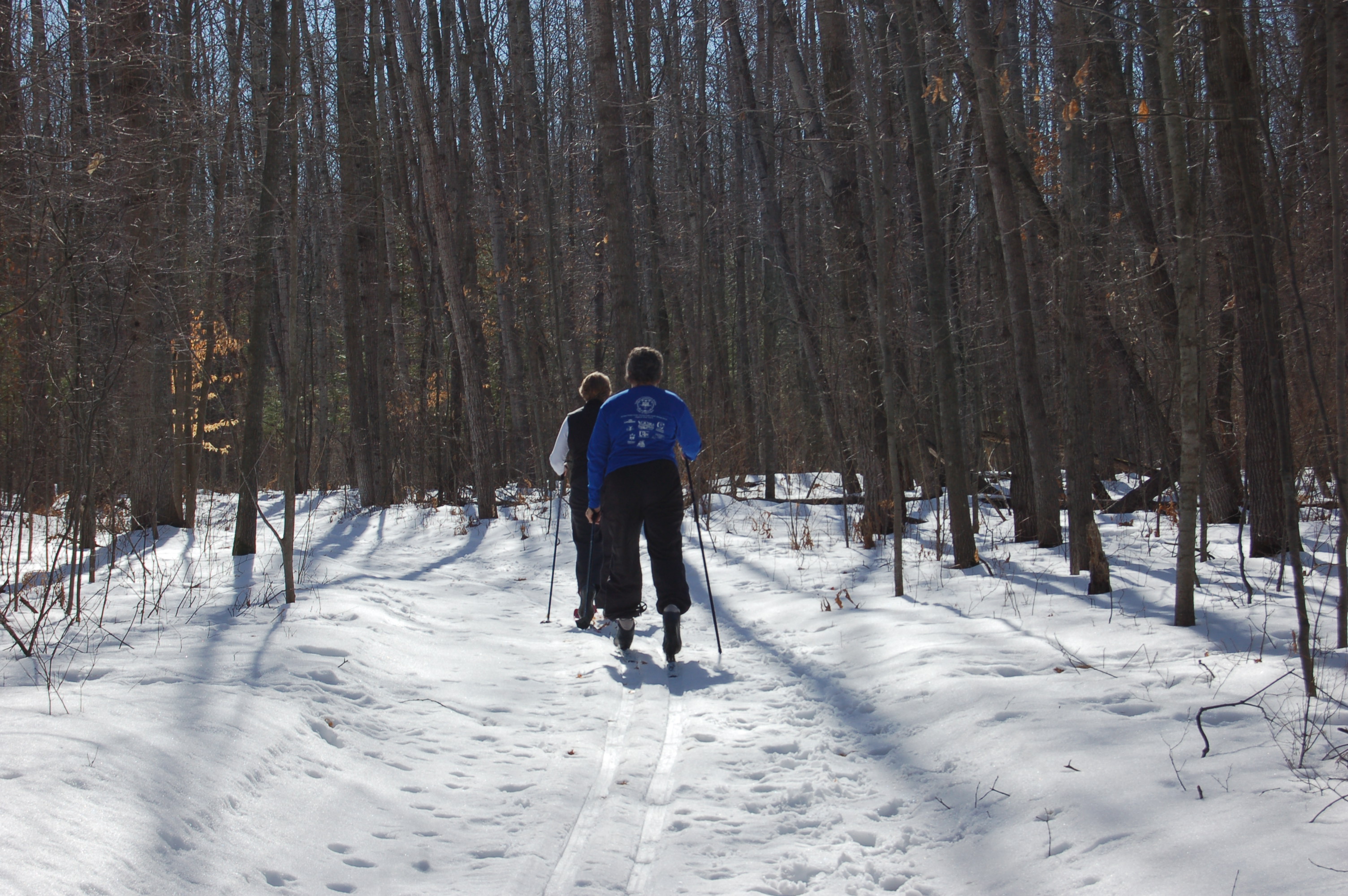
Cross Country Skiing – Pictured Rocks National Lakeshore offers more than 20 miles of trails for cross country skiers. Most of the trail is located near Munising or near Grand Marais, find out more at http://www.nps.gov/piro/planyourvisit/crosscountryskiing.htm.
Snowshoeing – Other than roadways and the cross-country ski trails, the lakeshore is not only open to snowshoeing, it is a paradise for it. Snowshoes make it easier to get to frozen waterfalls, scenic beaches and more even when trails haven’t been cleared.
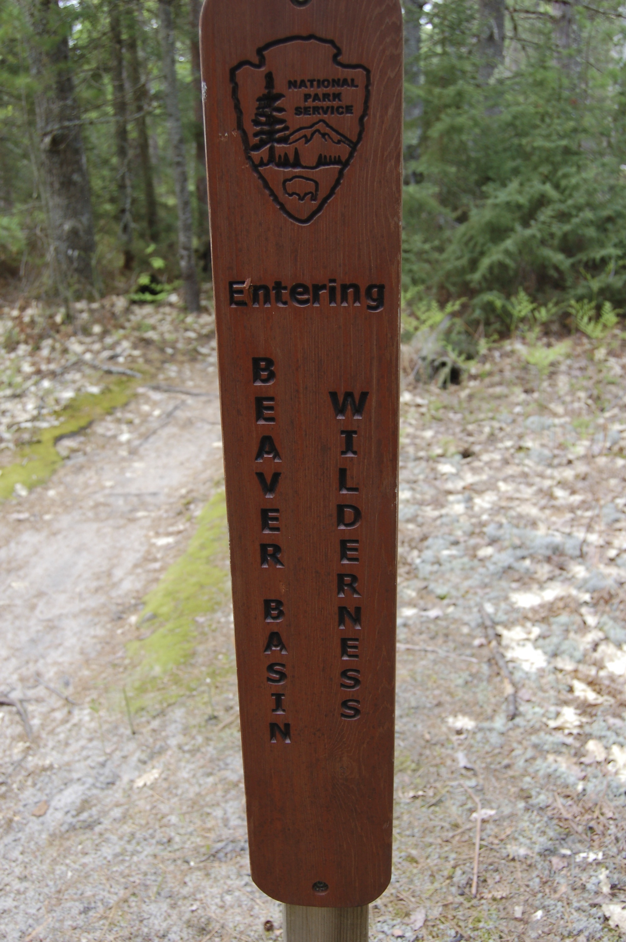
Beaver Basin Wilderness – In 2009, the creation of the Beaver Basin Wilderness added more than 11,000 acres to the national lakeshore and set up protections to keep it preserved for future generations. This area features 13 miles of Lake Superior shoreline, three lakes, five streams, wetlands, forests, and fishing opportunities. If you’re looking for quiet solitude at Pictured Rocks then this is the place for you. Find out more at: http://www.nps.gov/piro/planyourvisit/beaver-basin-wilderness.htm.