Au Sable Point Light Station – Pictured Rocks National Lakeshore
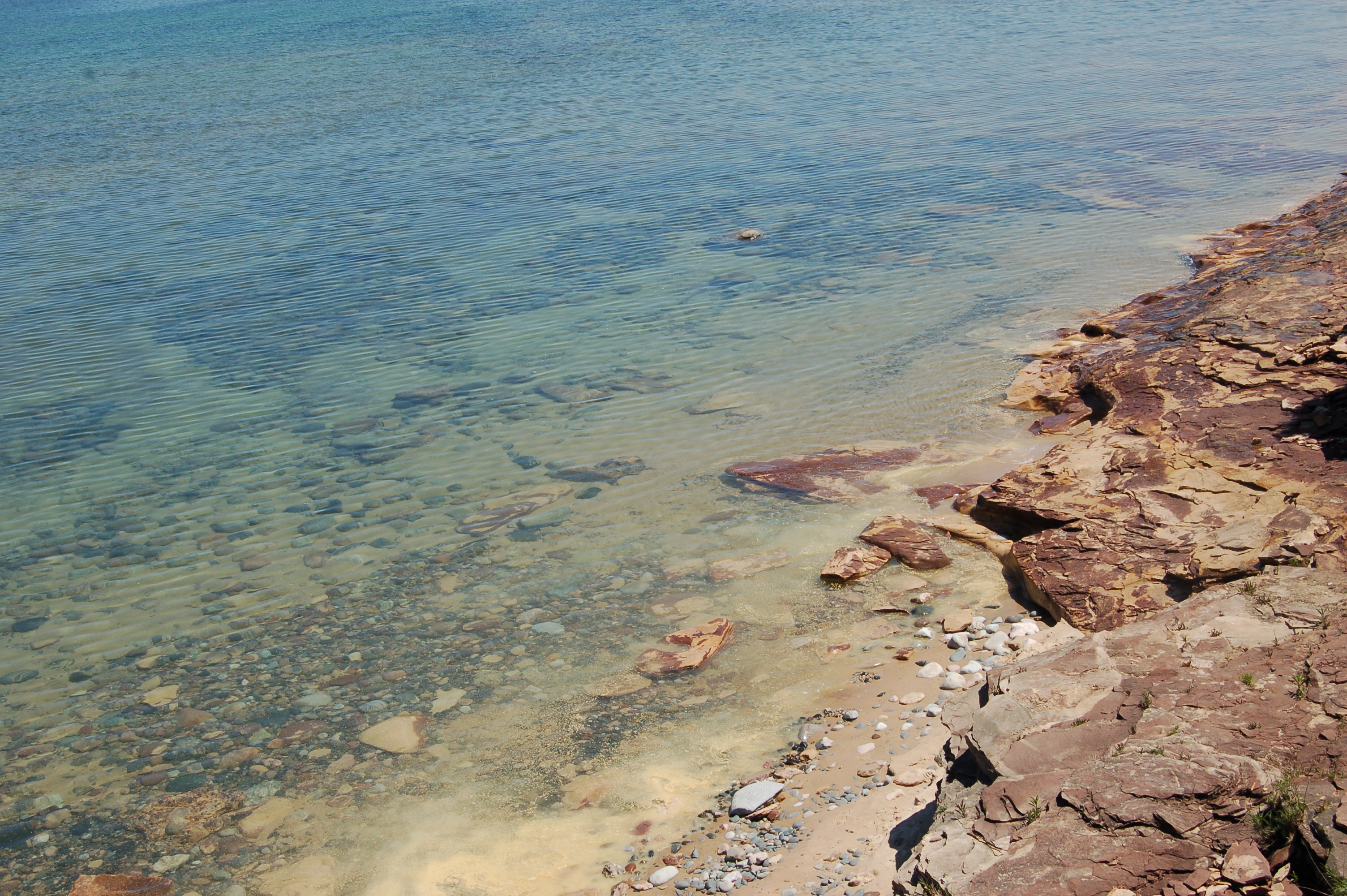
As the only lighthouse within the boundaries of the Pictured Rocks National Lakeshore, the Au Sable Point Light Station has a long a storied history of guiding mariners past miles of rocky shoreline on Lake Superior. Vehicle access to the light is prohibited, but a wide and well-worn path leads 1.5 miles from the Hurricane River Campground to the lighthouse. This is an incredibly beautiful hike as the trail is never more than a few hundred feet away from Lake Superior, and as you get closer to the light there are remnants of several shipwrecks in the sand – an easy reminder of why construction of this lighthouse was necessary.
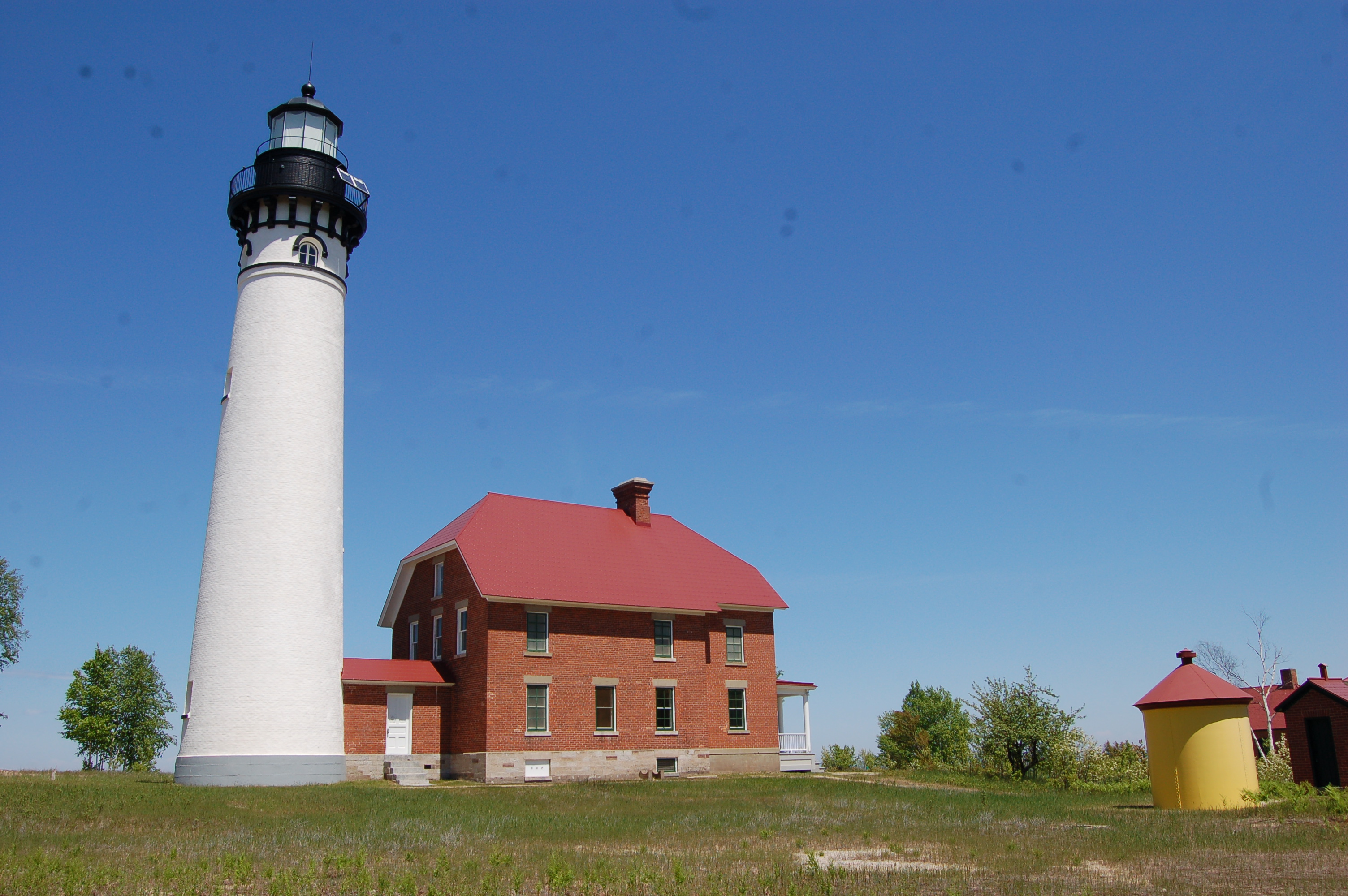
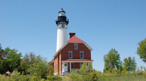
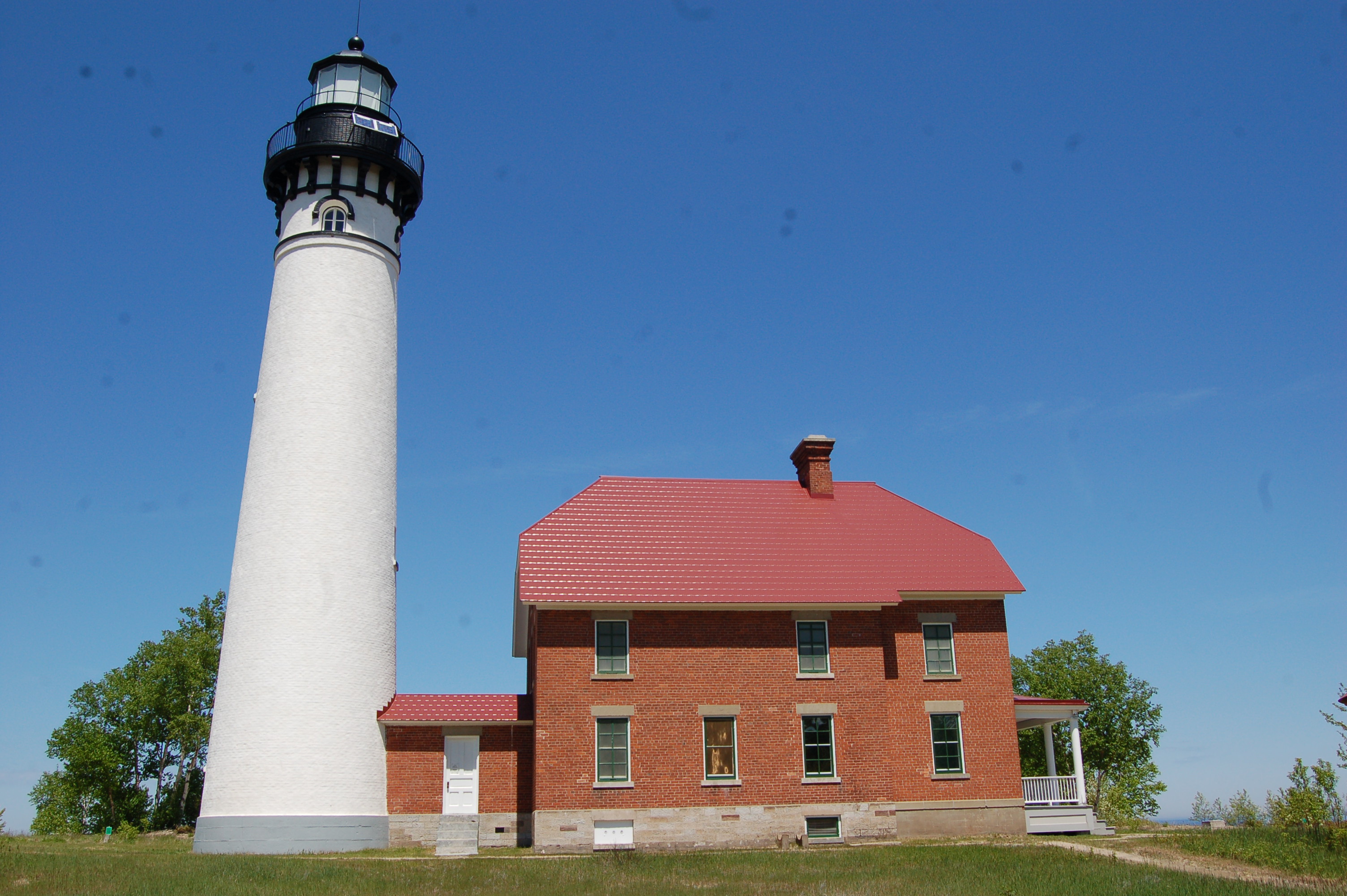
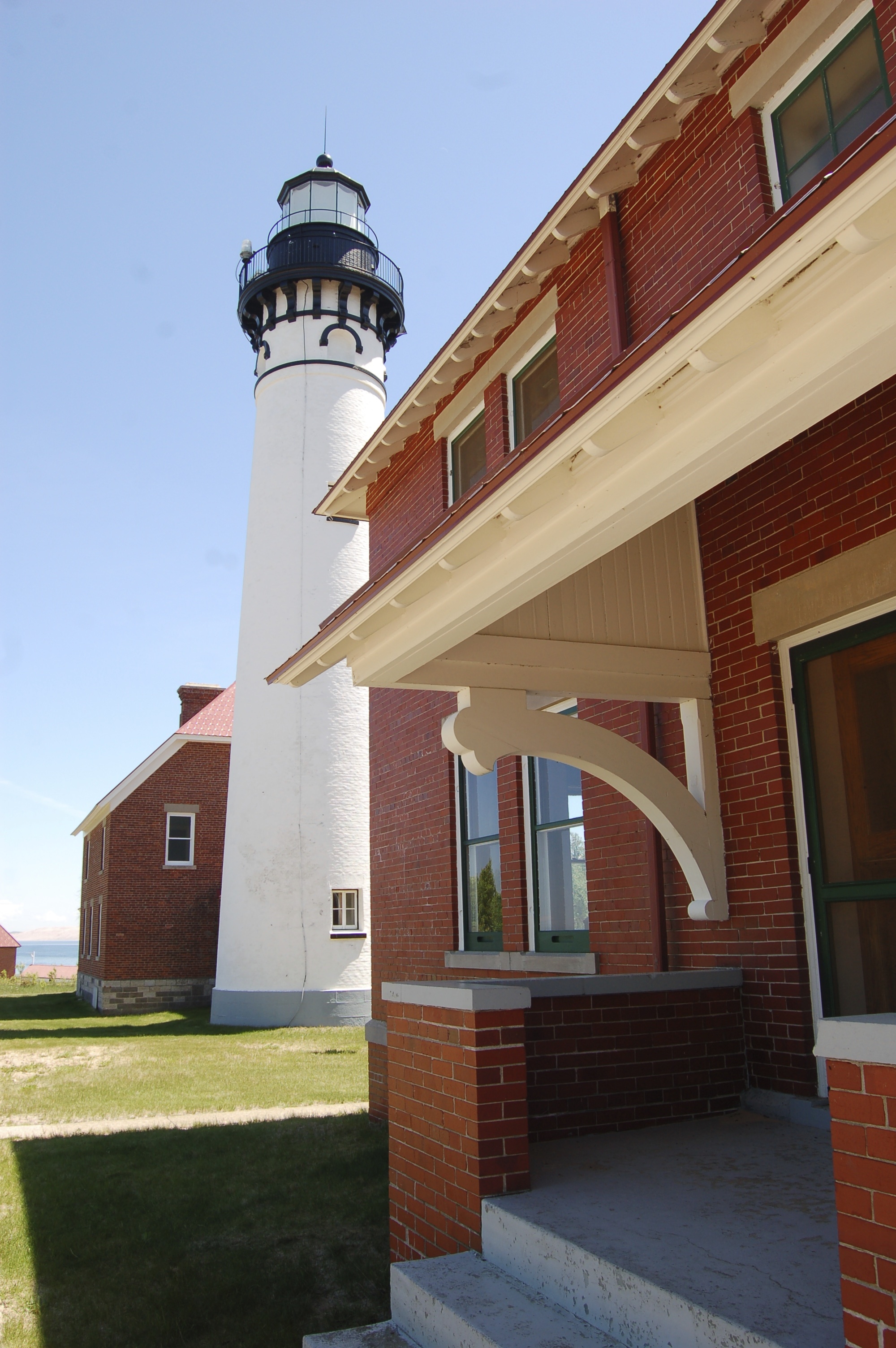
This still-active lighthouse was built in 1874 to help guide ships around a treacherous, shallow shoreline. It’s still easy today to see how shallow it is and how easy it would be to run a boat aground here. The tower is 87 feet tall and painted white with a black lantern room, while the attached keeper’s dwelling is constructed of red brick.
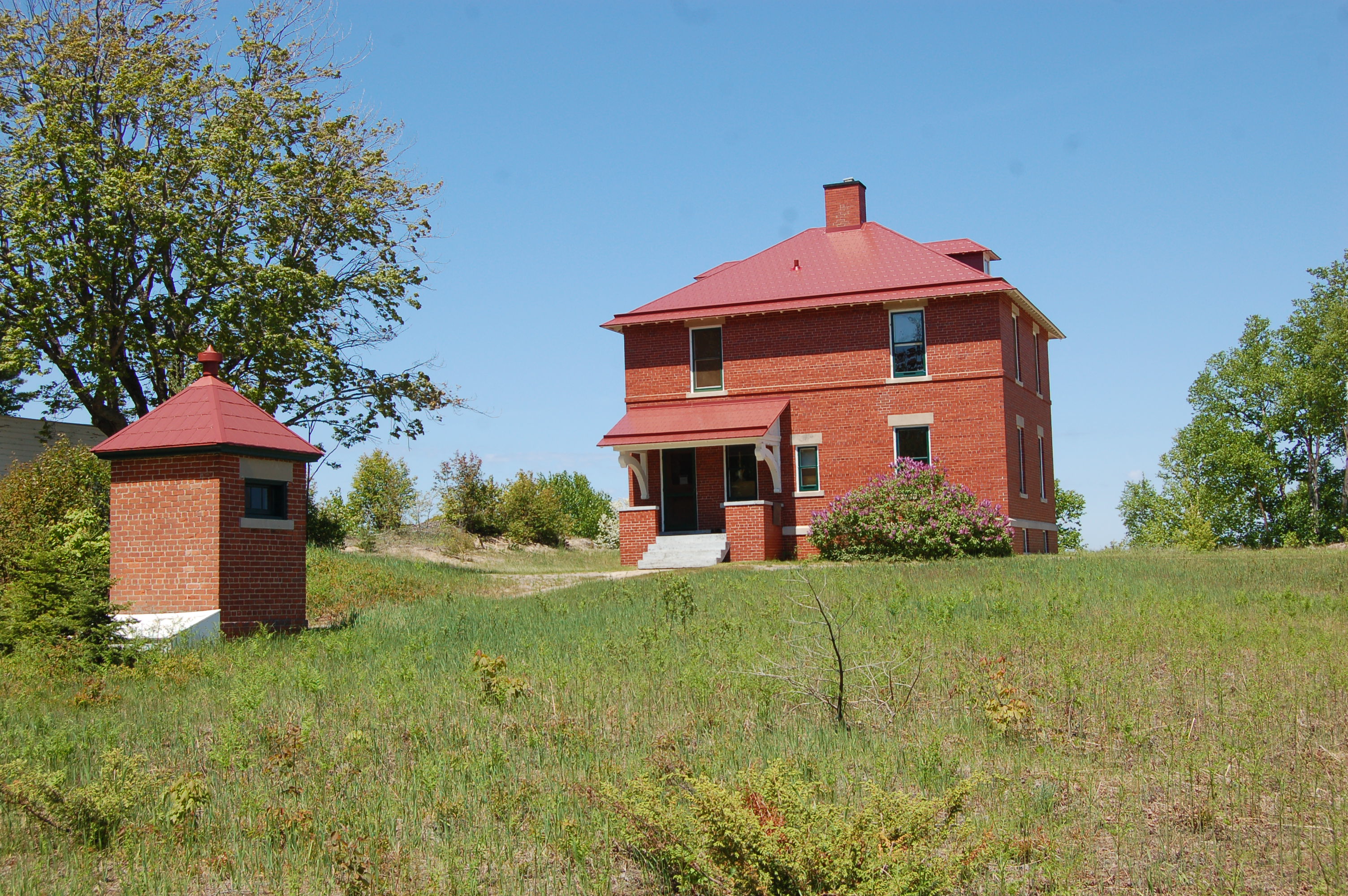
Other surviving structures on the property include the fog signal building, an outhouse, a steel oil house and an additional dwelling. The National Park Service takes care of these buildings and in the summer has the lighthouse open for tours and the tower open for climbing.
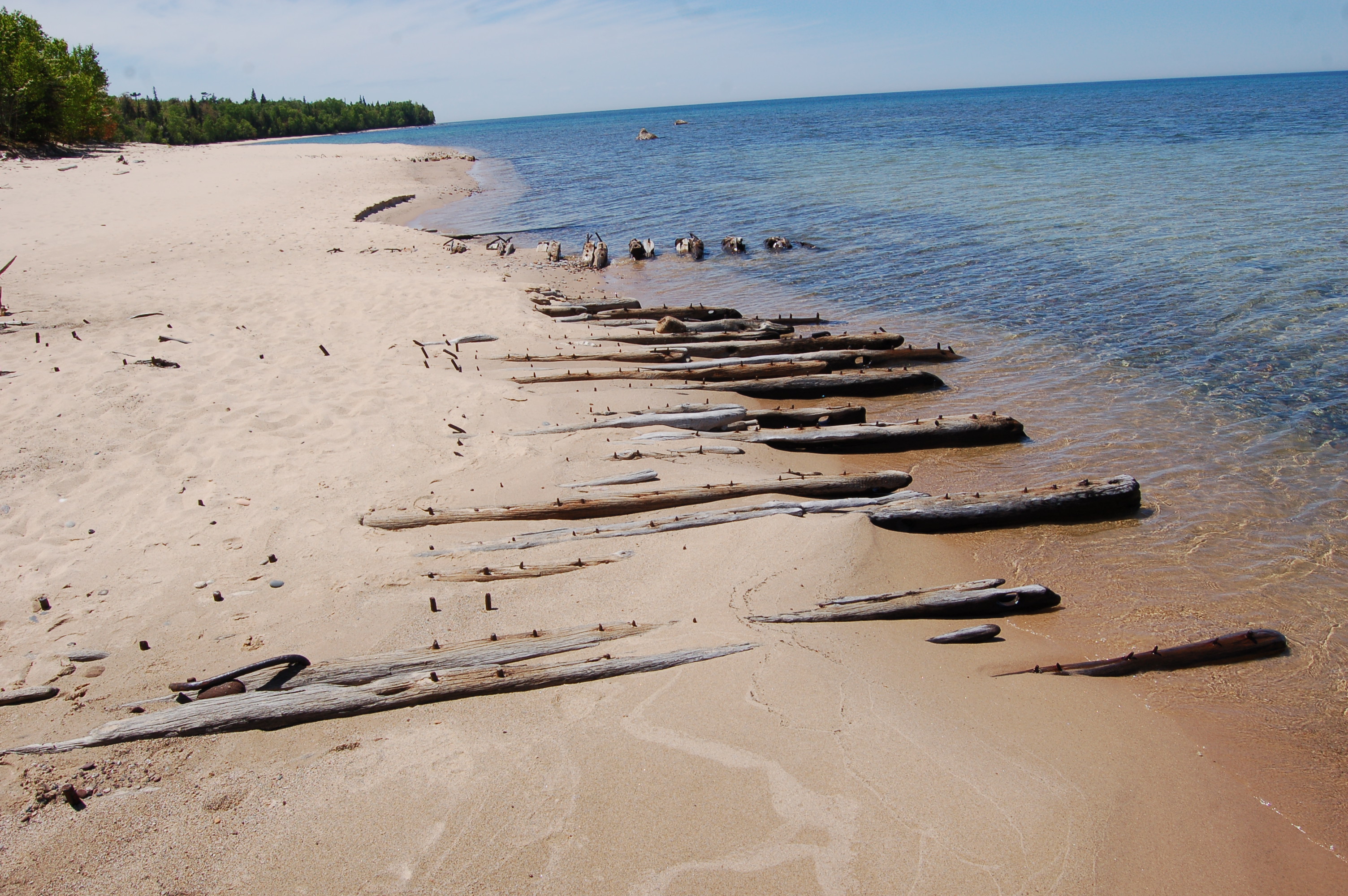
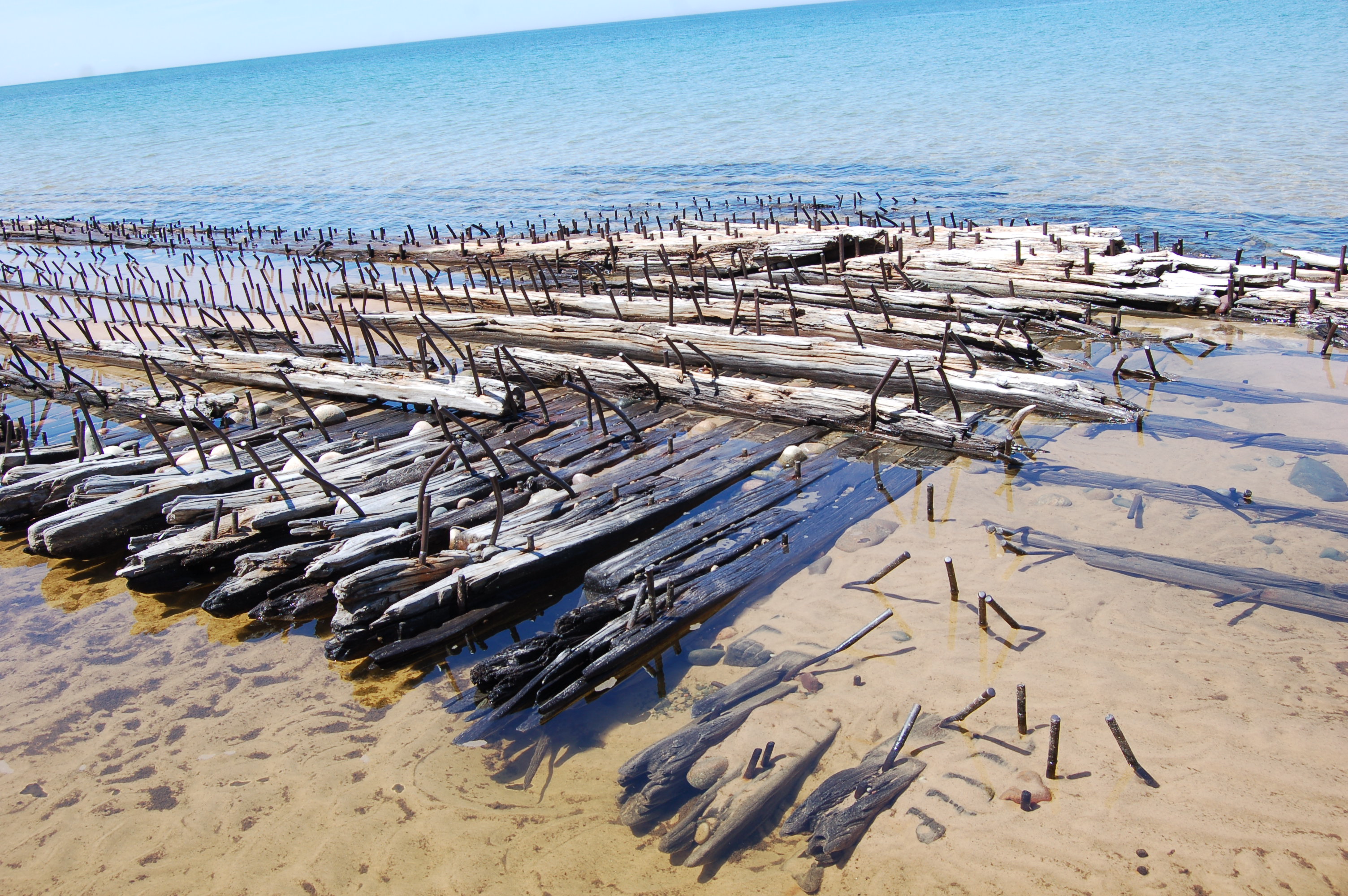
The shoreline here is truly an impressive sight to behold, with its rocky ledges to the east and a sandy, shipwreck-filled beach to the west. Any trip to the Pictured Rocks should include a stop here, as a glimpse into the maritime history of the area helps complete a visit to the beautiful waterfalls and cliffs in the area.
To get to the Au Sable Point Lighthouse, take H-58 west from Grand Marais or head east from Munising for around 35 miles. Turn in at the signs for the Hurricane River Campground and park in the day-use parking lot. There are several interpretive signs to guide you from this point – only foot traffic is allowed on the 1.5 mile path to the lighthouse. A distant view of the lighthouse can be had from the Log Slide overlook a few miles to the east.