
8 Pictured Rocks Day Hikes In Michigan’s Upper Peninsula

The Pictured Rocks National Lakeshore draws visitors from all around the world with its scenic multicolored sandstone cliffs, breathtaking waterfalls and sandy dunes. Covering most of the shoreline from Munising to Grand Marais, this national park is also home to some of the best hiking trails in the state. More than 50 miles of the North Country Trail runs through Pictured Rocks, and while backcountry hiking and camping is a popular option for multi-day trips here, most of the scenic highlights can be reached in an hour or less. We hope you enjoy our suggestions for great Pictured Rocks day hikes, and as always let us know your favorites in the comments or on Facebook. For a list of campgrounds within Pictured Rocks National Lakeshore, head over to http://www.nps.gov/, or check out our posts about nearby Munising Tourist Park Campground and Bay Furnace Historic Site and Campground.
Miners Falls – The Miners River plunges more than 40 feet over an outcropping of sandstone rock, making it one of the tallest and most powerful falls in the park. Reached by a 1.2-mile round trip hike, these falls and near picturesque Miner’s Beach and the always popular Miner’s Castle rock formation. Follow H-58 east from Munising, then follow H-13 north and follow signs for Miners Falls to the parking area. Trail is mostly flat, wide and smooth.
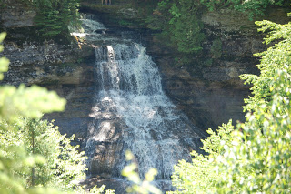
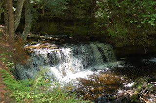
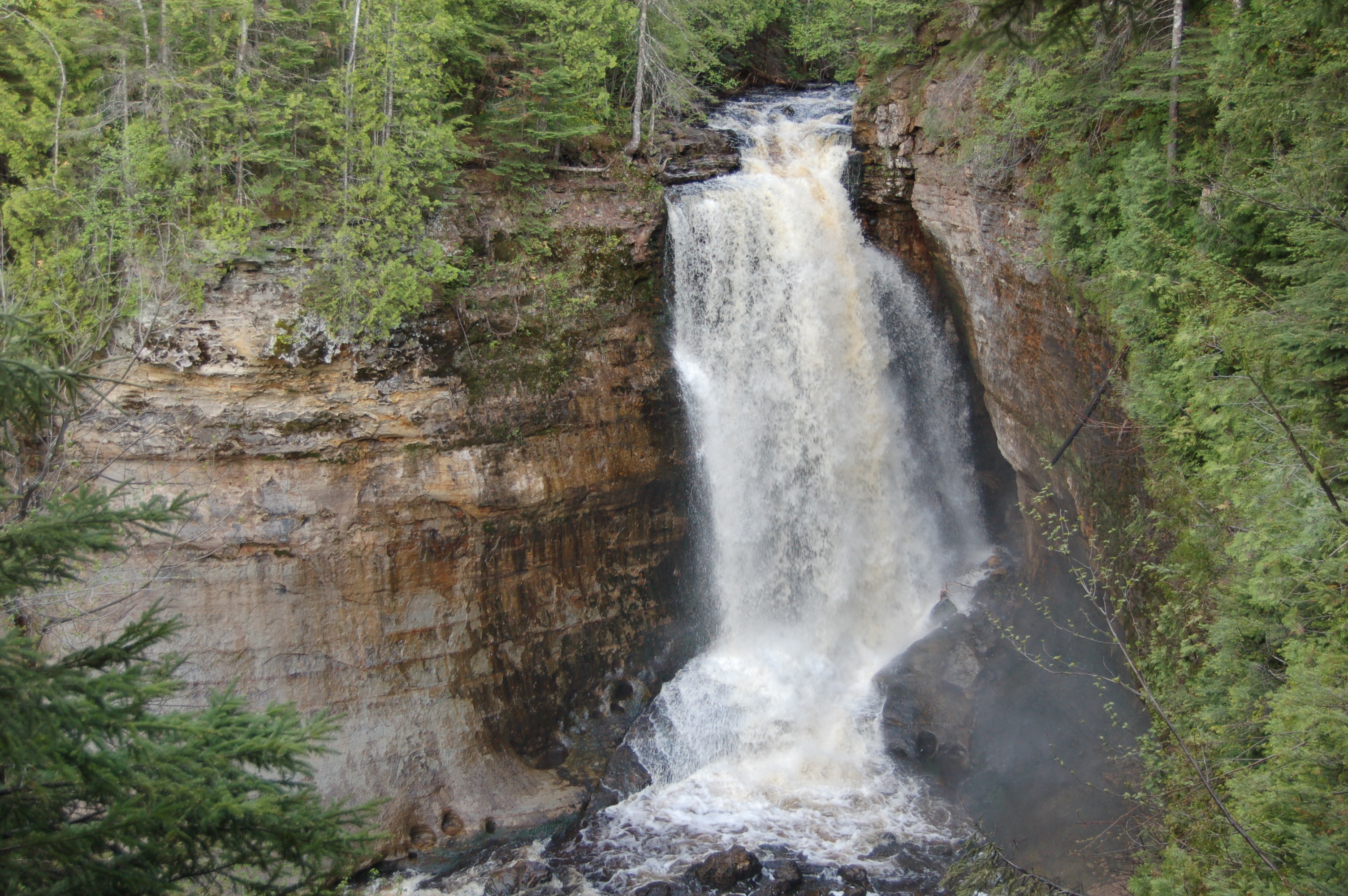
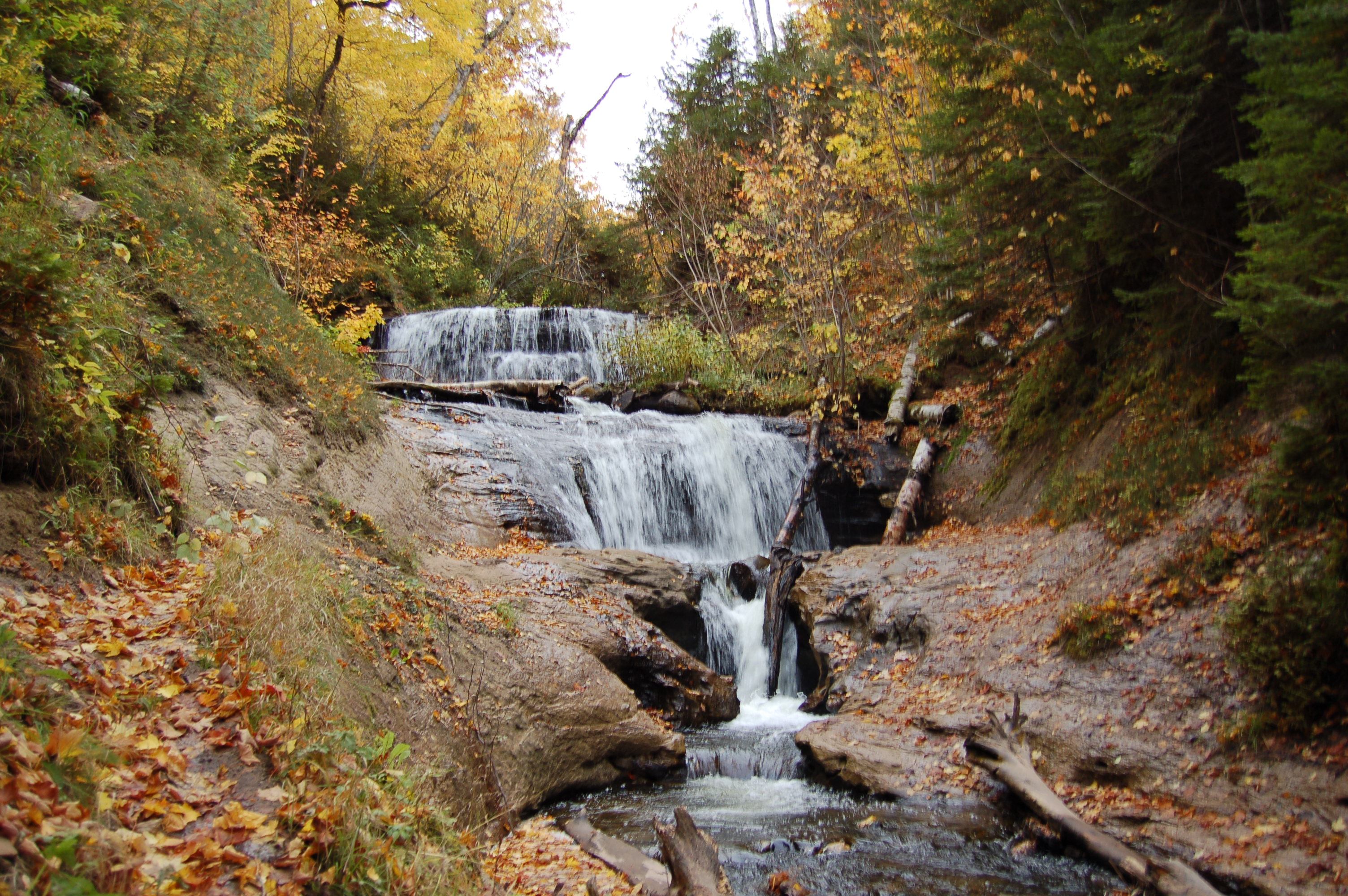
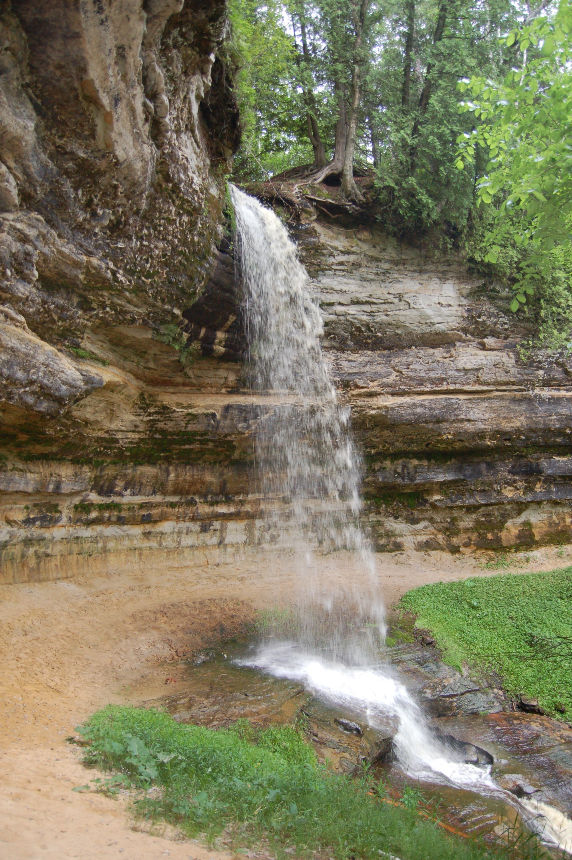
Chapel/Mosquito Area – There’s so much to do here that hikes from this area frequently show up on lists of things not to miss at the park. You can make the 3 mile round trip hike to Chapel Falls (60 feet tall, top photo). Or, you can hike about the same distance to Mosquito Falls (bottom photo). Better yet you can make a loop from Chapel Falls to Chapel Rock and eventually Chapel Beach on Lake Superior. That’s a roughly 9-mile hike, but you can add a mile and stop by Mosquito Falls on the way back to the parking lot. To get to the parking area from Munising, head east on H-58 for about 15 miles, then head north on Chapel Rd. and follow it about 5 miles to its end. http://www.nps.gov/piro/planyourvisit/upload/chapelbasin.pdf
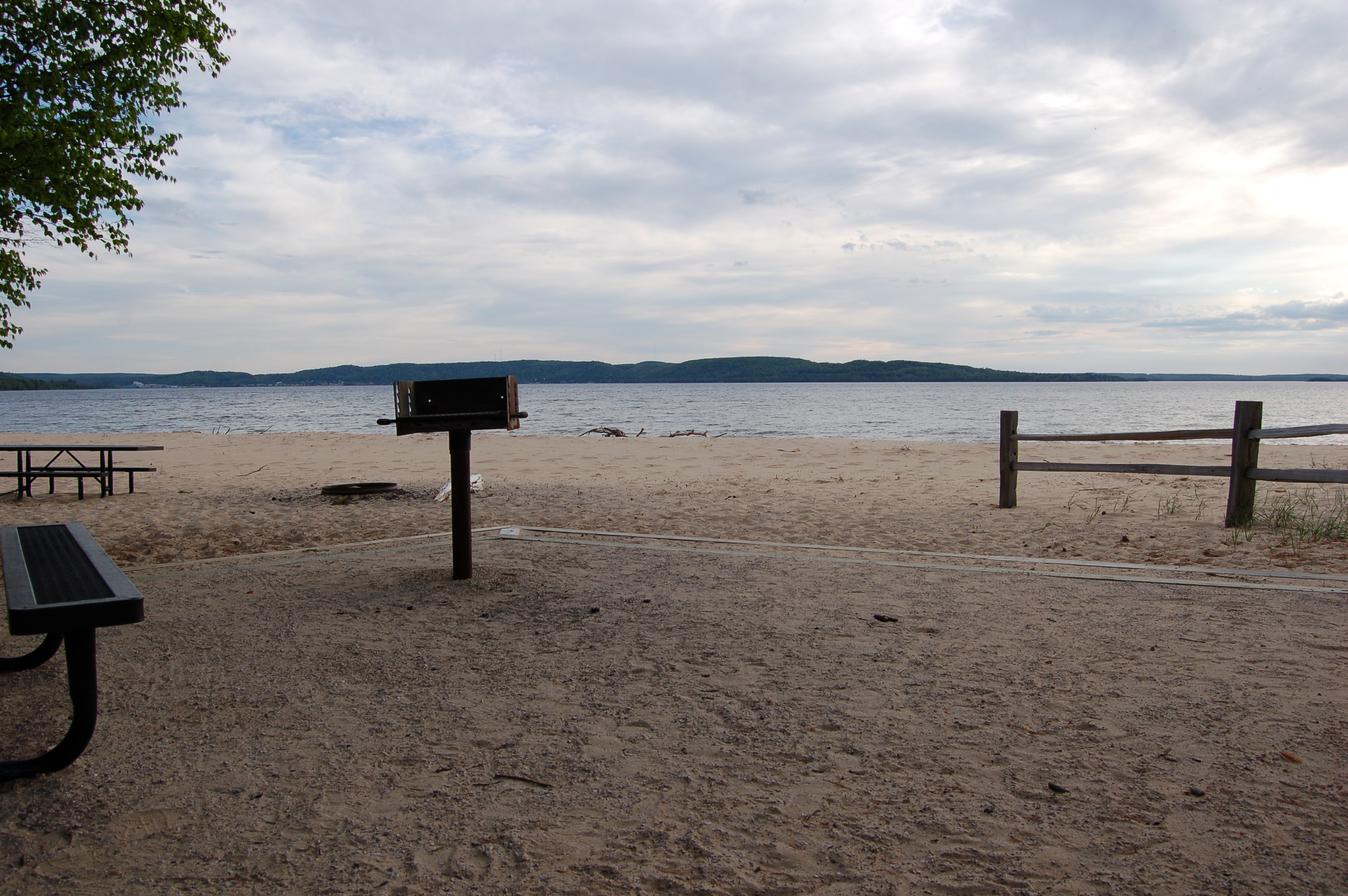
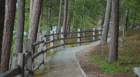
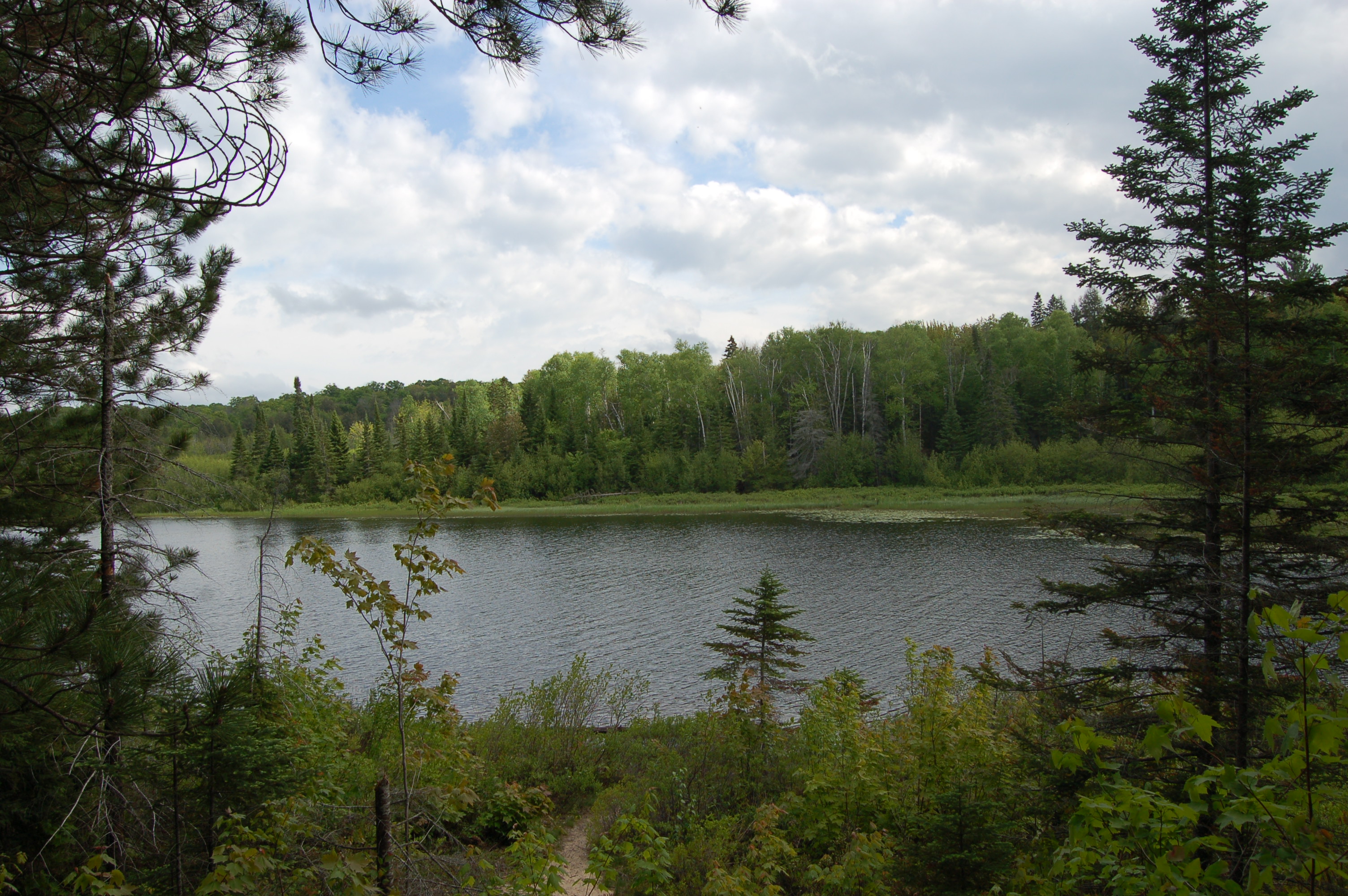
Sand Point Marsh Trail – This half-mile trail is fully accessible and begins across from the parking area for the beautiful Sand Point Beach shown above. Watch for beavers and other wildlife as interpretive signs help guide you through a swamp and past white cedar and black spruce trees. From Munising, head east on E. Munising Ave., then take a left on Washington St. (signed for Munising Falls and Sand Point). Stay on this road until you reach the parking area.
Sable Falls/Grand Sable Dunes – The main attraction on the east end of the park is the towering Grand Sable Dunes, which can be reached from a trail at the Sable Falls parking area. That trail is 1 mile long, while the trail to the falls is shorter but involves many wooden steps. After visiting the falls, the trail continues to Lake Superior and amazing views of the dunes from the shoreline. From Grand Marais, head west on H-58 for about a mile and watch for signs for the Sable Falls parking area before the road curves around Grand Sable Lake.
Munising Falls – One of the easiest waterfalls to get to in the Munising area, this 50 foot plunge is reached after a fully accessible walk of less than a quarter mile. Steps lead up on both sides for better views of Munising Falls, and it’s incredible to see this powerful waterfall, then watch Munising Creek return to calm a few hundred feet downstream. From Munising head east then turn left on Washington St. and go about a mile to the visitor center and parking area (lots of signs).
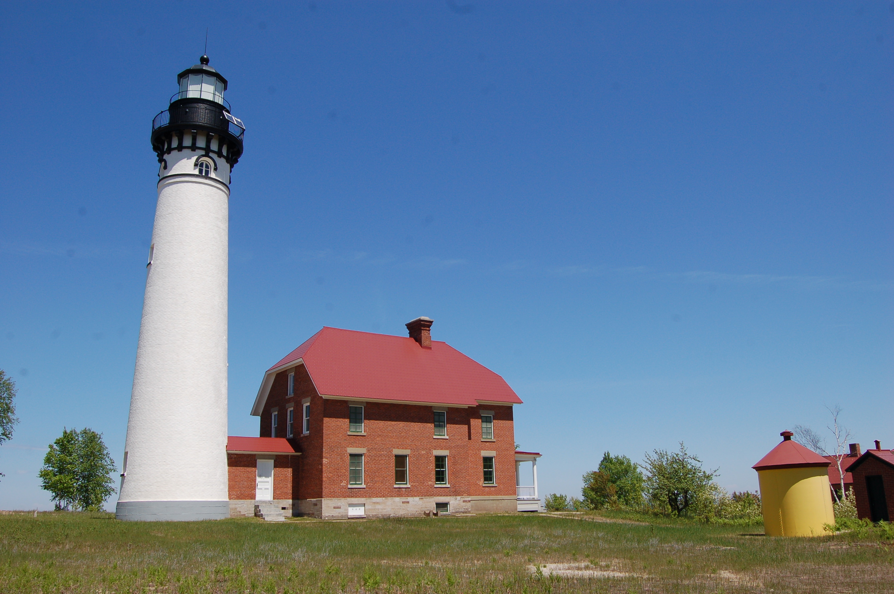
Hurricane River/Au Sable Light Station – There is only one mainland lighthouse located within the Pictured Rocks National Lakeshore, and it can be reached by a 1.5 mile hike beginning at the Hurricane River campground and day use area. There’s reason enough to stop here and check out the small waterfalls, river, campground and beach, but the hike back to the Au Sable Point Light Station is level, scenic, and one of our favorites. Several shipwrecks are visible in the shallow water along the Lake Superior shoreline and many signs along the way point them out and share their history. The lighthouse itself dates back to 1874 and during the summer months park staff offers guided tours and the chance to climb the tower. The parking area is off H-58 12 miles west of Grand Marais.
Beaver Lake Area – We discovered this enchanting area when we hike to Spray Falls in 2014 – take a look at our photo gallery post to get an idea of what this area has to offer. From the campground it is just under a mile to Lake Superior, where you can head east or west for amazing views. The loop around the lake is a 3.5 mile round trip with great chances to spot wildlife. From Munising, head east on H-58 for about 19 miles then turn left on Little Beaver Lake Rd. Follow this road for about 3 miles to the parking area, keep in mind this is a narrow, steep, winding road that can be difficult in the spring or after heavy rain.
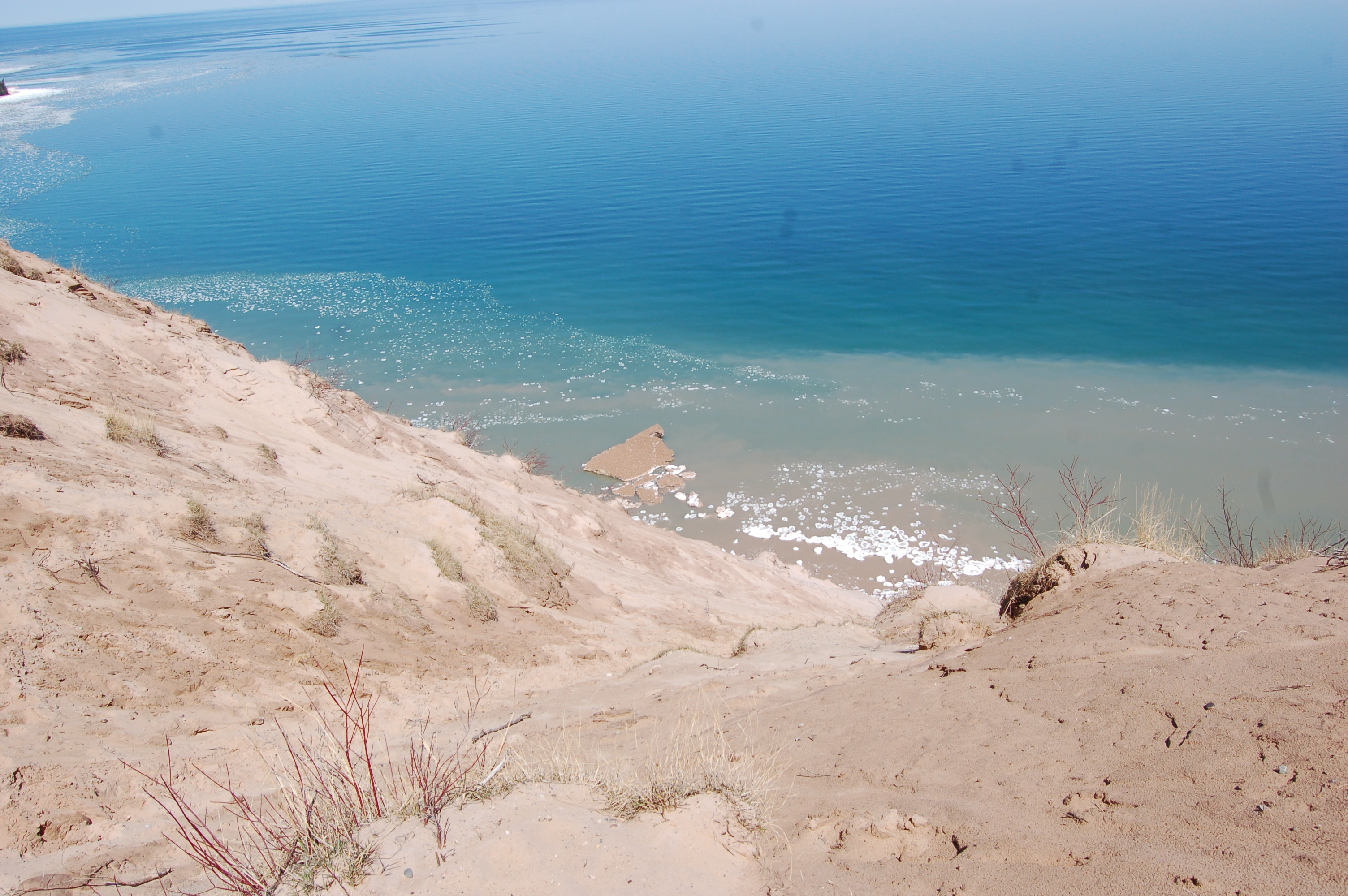
Log Slide Overlook – The short trail here (.4 miles) leads to incredible views of Lake Superior and the Grand Sable Dunes. It’s a long, steep drop down in the sand where logs used to be pushed to the lake, and while it is possible to quickly run down there are signs warning that it may take up to an hour to get back up. Au Sable Point Light Station can be seen to the west from the observation platform, and a trail heads that way if you’re looking for a hike of around 3 miles. The dunes are visible to the east, and so is the town of Grand Marais. About 7 miles west of Grand Marais, then head north on Log Slide Rd. for a mile to the parking area. The “cabin in the clearing” can be seen from the parking area, and you will pass more historical artifacts from the logging era on your way to the overlook.