
12 Places To Check Out In Michigan’s Baraga County
Baraga County is a paradise for those who love outdoor adventure, with abundant opportunities for camping, fishing, hiking and boating. The area is also rich in history, as it is named for a Slovenian missionary priest who became famous for making his journeys on snowshoes in the winter months. Many sites honor or bear the name of Bishop Frederic Baraga, with none more impressive than the Shrine of the Snowshoe Priest – a 35 foot brass statue that overlooks the Keweenaw Bay from atop a cliff. with mountains, rivers, wilderness and plenty of shoreline on Lake Superior, there’s plenty to check out in Baraga County. Keep your eyes peeled for elusive Michigan moose, which are sometimes spotted south of L’Anse and near Skanee. Here’s Travel the Mitten’s list of 12 Places To Check Out in Baraga County:
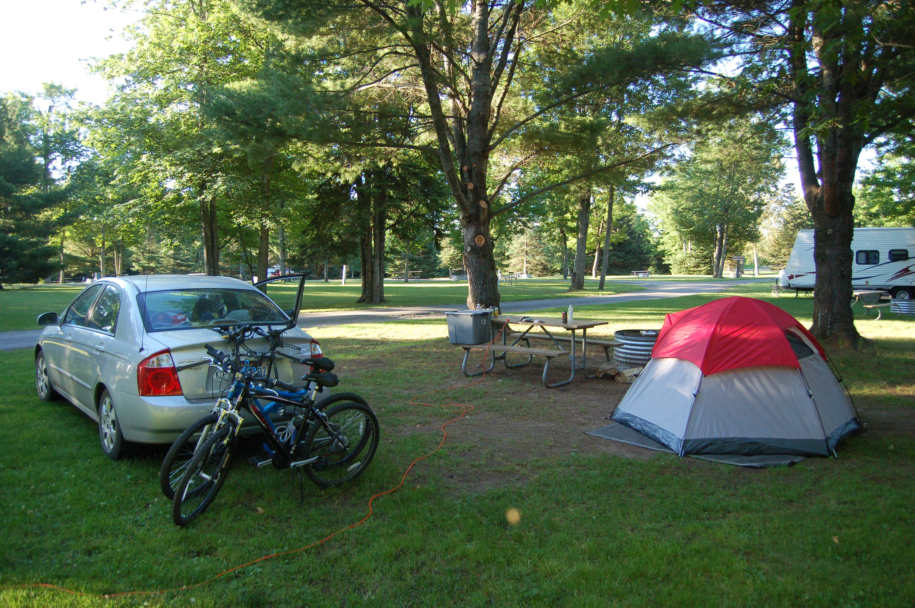
Baraga State Park – This park offers 116 grassy, spacious sites as well as a mini-cabin and a teepee. A playground, hiking trails, picnic area, modern showers and restrooms, and a day use area on the Keweenaw Bay are among the other draws. Baraga State Park can be found on US-41 just south of Baraga. A Michigan DNR Recreation Passport is required for entry. For campground details and reservations visit http://www.michigandnr.com/.
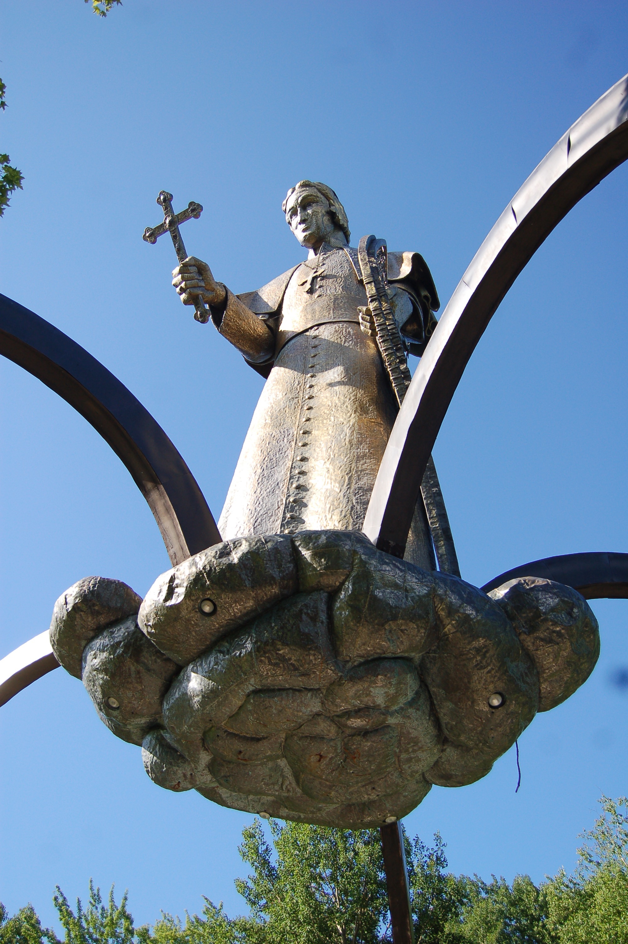
Bishop Baraga Shrine – This 35 foot tall brass sculpture depicts Bishop Frederic Baraga holding a cross in one hand and a snowshoe in the other. The Slovenian-born priest was famous for traveling long ditances in the winter on snowshoes, and he was the first to develop an Ojibwa-English dictionary. The pillars of the “Shrine of the Snowshoe Priest” list the names of the settlements he is credited with founding, and he overlooks the Keweenaw Bay from atop a red rock cliff. This attraction is free, with donations accepted/suggested. Main entrance is on Boyer Rd. off of US-41 near the bridge over the Falls River (there are several large signs that make it hard to miss).
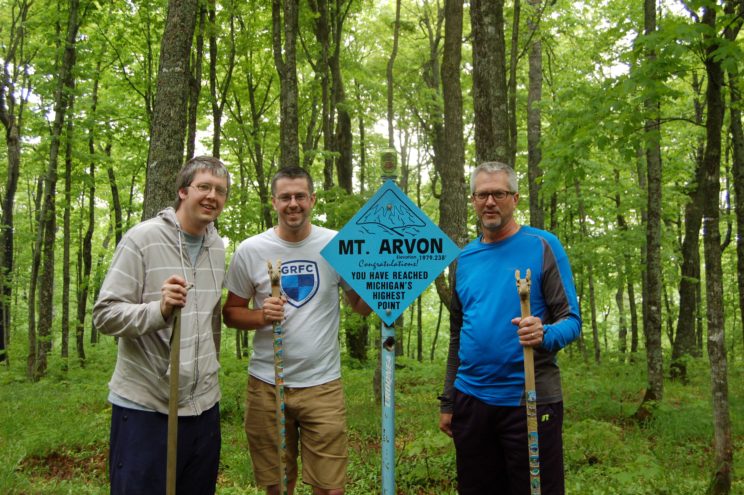
Mt. Arvon – Michigan’s highest point can be found near Skanee, and you can drive to within a few feet of the highpoint sign depending on road conditions. There are great views of the Keweenaw Bay and surrounding forest from near the top, and keep an eye out for wildlife on the way up. From L’Anse take Main St. (which becomes Skanee Rd.) about 15 miles out of town, taking a right on Roland Lake Rd. (there’s a church and museum on the south corners) Take that road to Ravine River Rd, which will be on the right, and get ready to have some fun! While the “main” drag is mostly marked with blue diamond signs and is fairly easy to distinguish, the pamphlet (blue) gives exact mileage for each fork/turn, which will definitely help. Download it here. We’ve made the trip in a Kia Spectra and a Pontiac G6 with no problems, but this is an active logging area and conditions may change – a higher clearance vehicle definitely isn’t going to hurt.

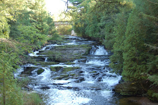
Skanee Waterfalls – The drive from L’Anse east towards the Huron River provides many waterfall viewing opportunities. Many of the streams and rivers on this stretch make significant drops on their way to Lake Superior, making this one of the most scenic stretches in the county. Check out our posts on Big Eric’s Falls, Black Slate and Quartzite Falls and Silver Falls. Other stops include Slate River Falls as well as several other significant drops in the Huron River area. Take Main St. east out of L’Anse and stay on it as it becomes Skanee Rd. Some falls are well marked with signs, others will require the Penrose waterfall book for individual directions.
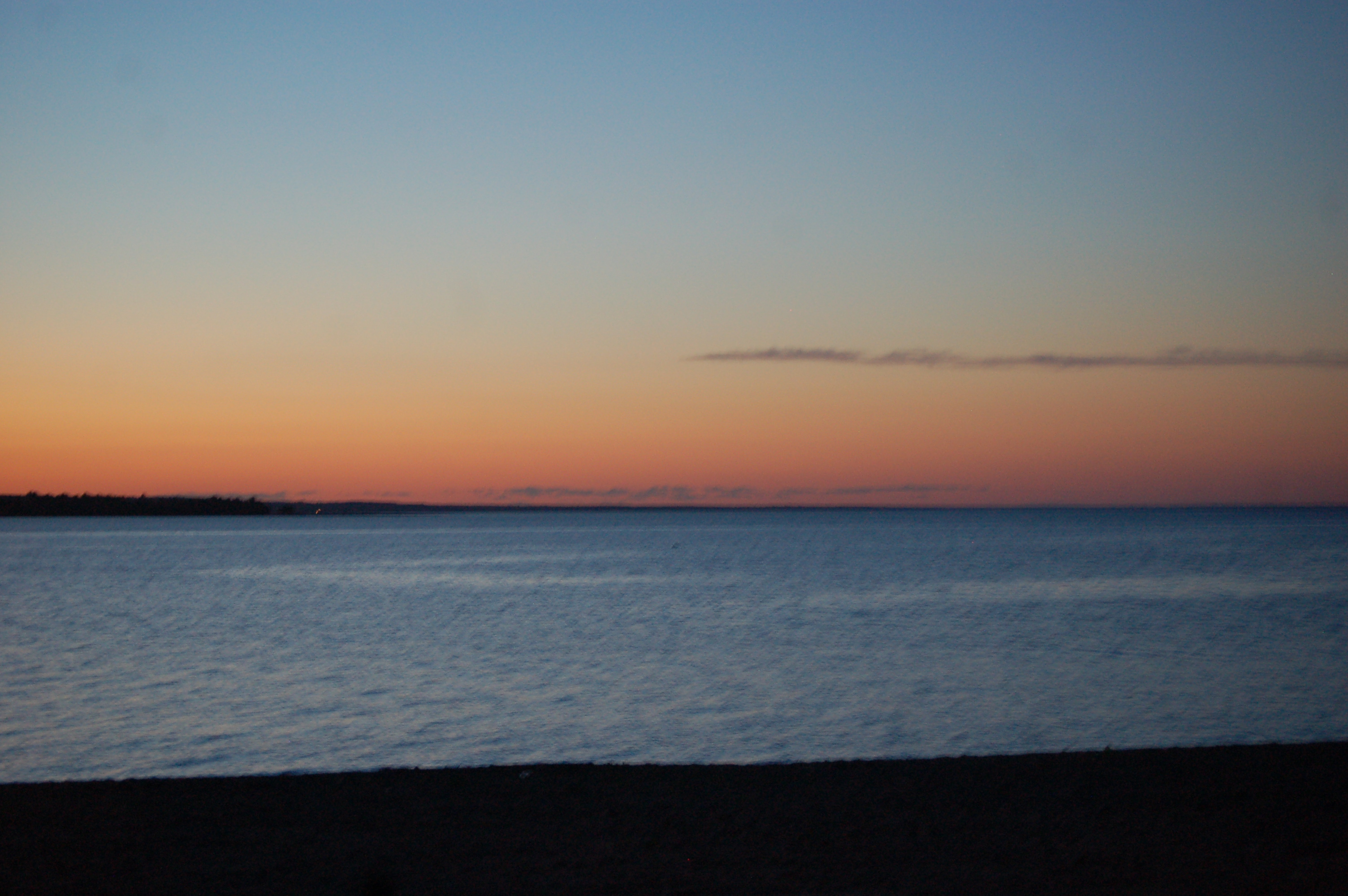
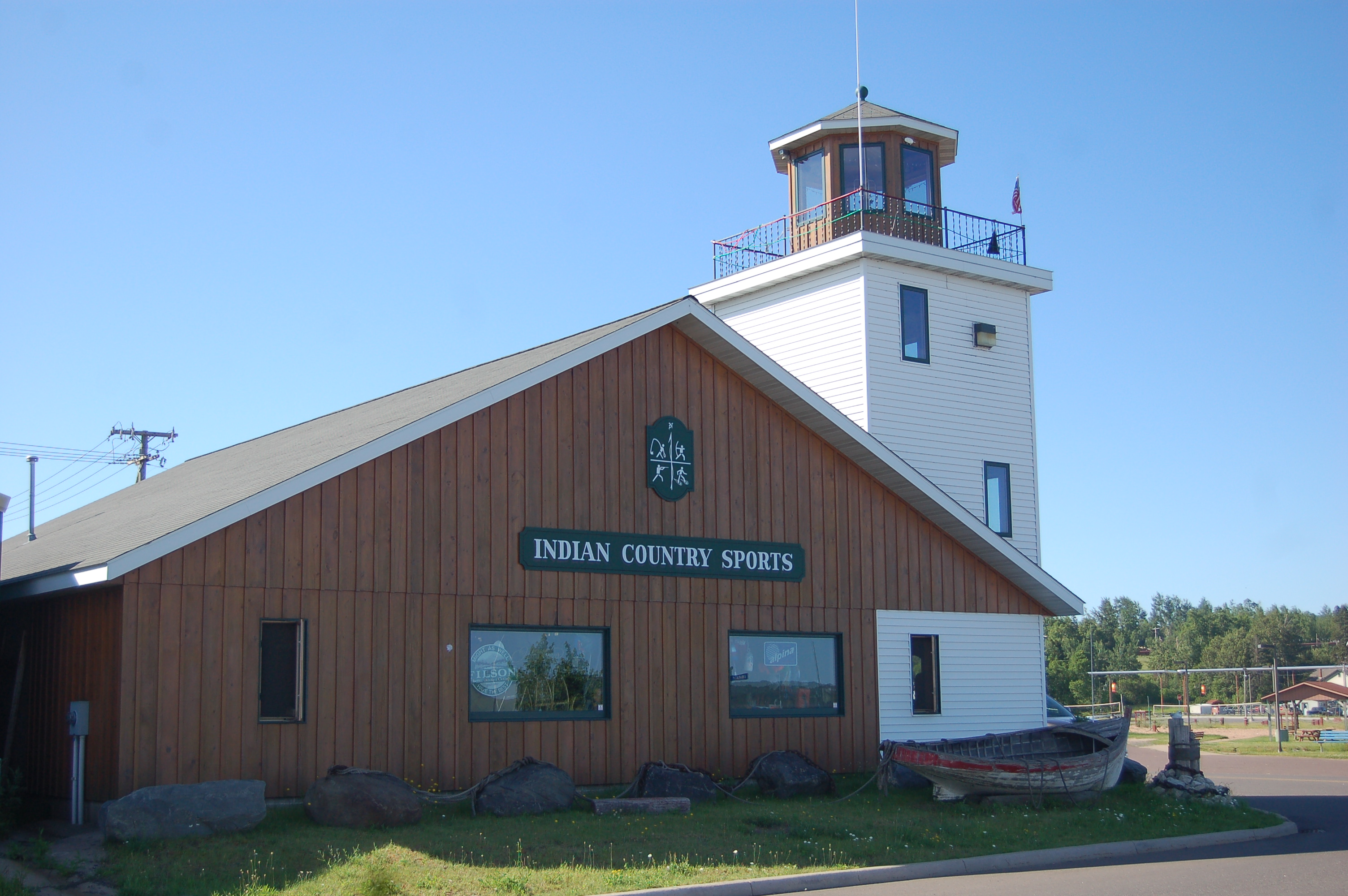
L’Anse waterfront – the L’Anse Waterfront Park features a swimming beach, playground, picnic area and a pavilion where concerts are held in the summer. Take in great views of the Keweenaw Bay from here. The L’Anse Marina is located right next to the park, and downtown’s restaurants and shops (including Indian Country Sports and its replica lighthouse) are a block away. Sunsets here can be truly amazing to behold.
Canyon Falls – A small roadside park on US-41 a few miles south of L’Anse is where the trail to Canyon Falls begins. The main attraction here is a waterfall that drops 15 feet into a gorge that is one of the largest in Michigan. The trail back to the falls is about a mile of level terrain, and there are two other significant waterfalls on the rougher trail that continues from there. Check out our Canyon Falls post for more information and more photos and video.
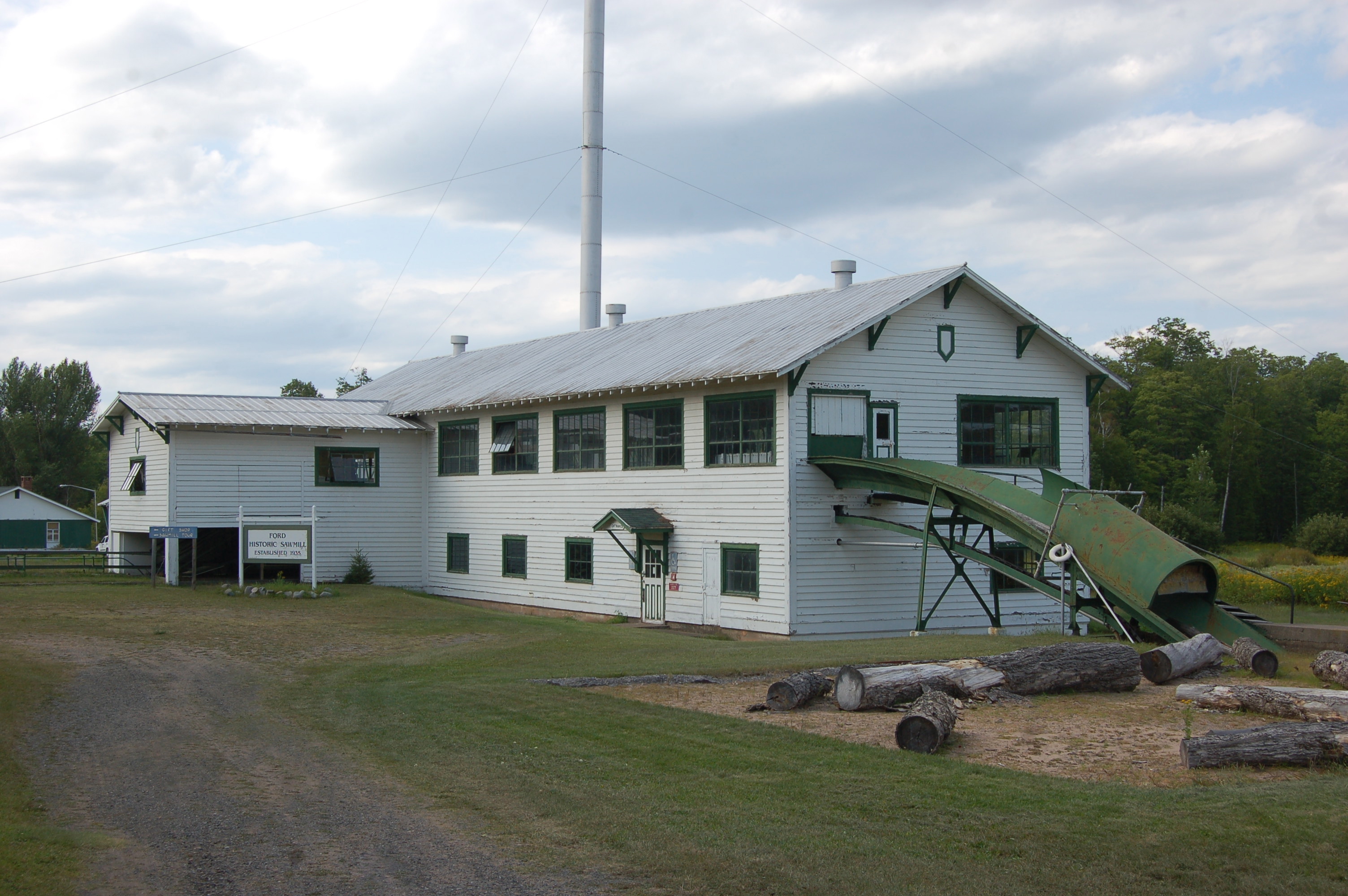
Alberta Museum – A sawmill once owned by Henry Ford is the centerpiece of this complex that now functions as a museum and research facility. This was designed as a model community, with a reservoir created by damming a nearby creek, the sawmill, 12 houses, two school and a modern mill. At peak, it had a capacity of 20,000 board feet per day. Ford donated the property to Michigan Tech in the 1950s. You’ll find it on US-41, about 9 miles south of L’Anse.
Point Abbaye – A great place for those seeking solitude, this rugged, remote tip of a peninsula offers unspoiled views of Lake Superior. The Huron Mountains and Huron Islands can be seen in the distance and there is a short hiking loop. Plan ahead as the road is in rough shape in places and the flies can be nasty in the summer. Photo is from http://arvontownship.org/ which has more information. From L’Anse head east on Main St./Skanee Rd. and follow it to Townline Rd. Take Townline Rd. north to Point Abbaye Rd., turn right on that road and follow it about 13 miles to its end.
Assinins – One of the earliest Catholic missions in the Upper Peninsula, Assinins was founded by Bishop Frederic Baraga in 1843. Baraga wrote a book on Chippewa grammar and a Chippewa dictionary while staying here. All that survives today is a house, an orphanage, and the cemetery where several early missionaries are buried. From the intersection of US-41 and Old US Hwy 41 north of Baraga, head south on Old Us-41 for about a mile. Photo from Wikimedia Commons.
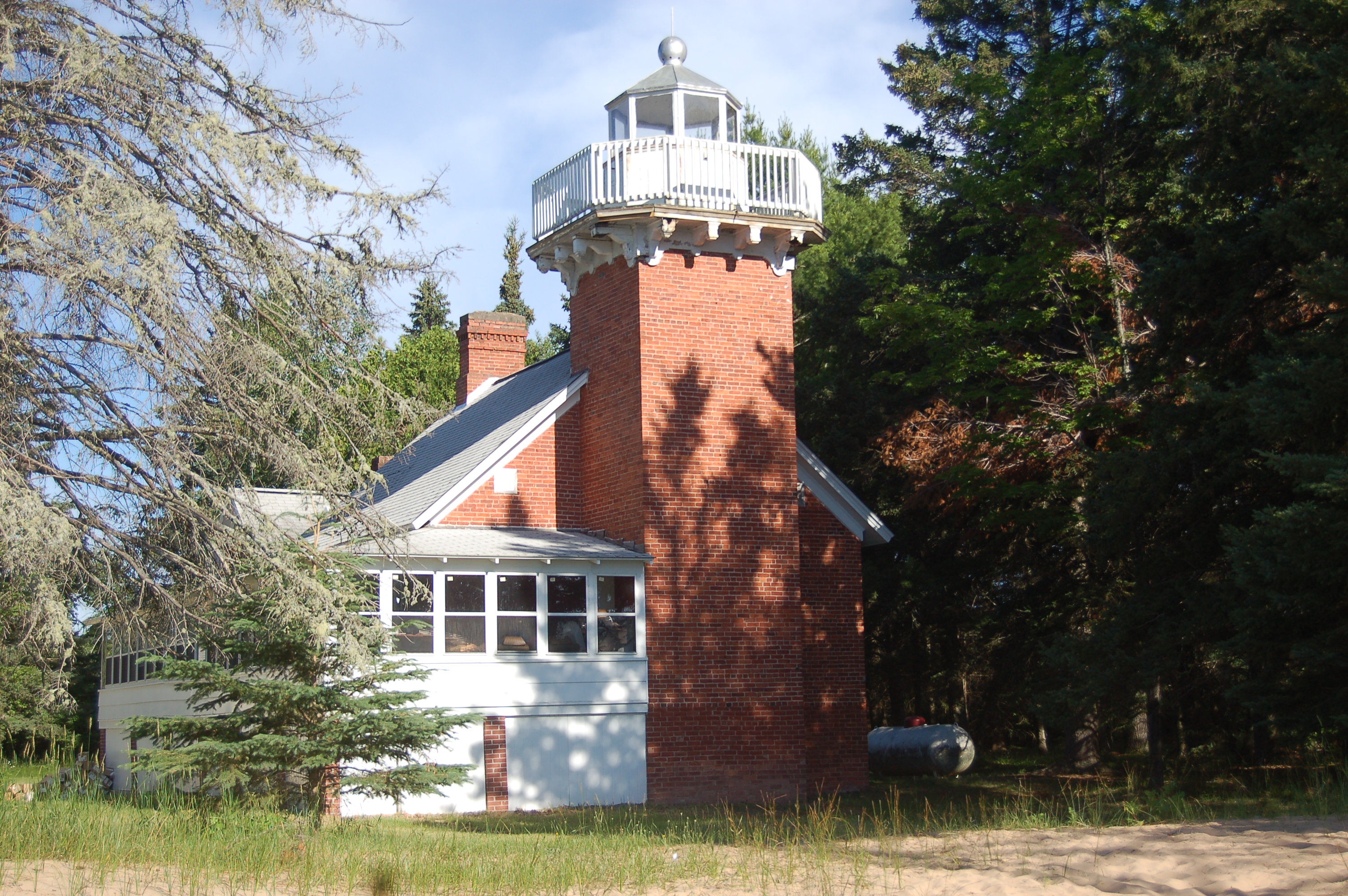
Sand Point Lighthouse – This lighthouse dates back to the 1870s and while it is not open to the public today the surrounding grounds are. Head north out of Baraga on US-41 and just past the DNR offices watch for signs for the Ojibwe Recreation Area. Turn in here, and take a left when the road forks and follow it to the lighthouse. Be respectful of the property so that all can continue enjoying permission to view the lighthouse up close.
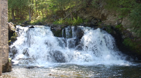
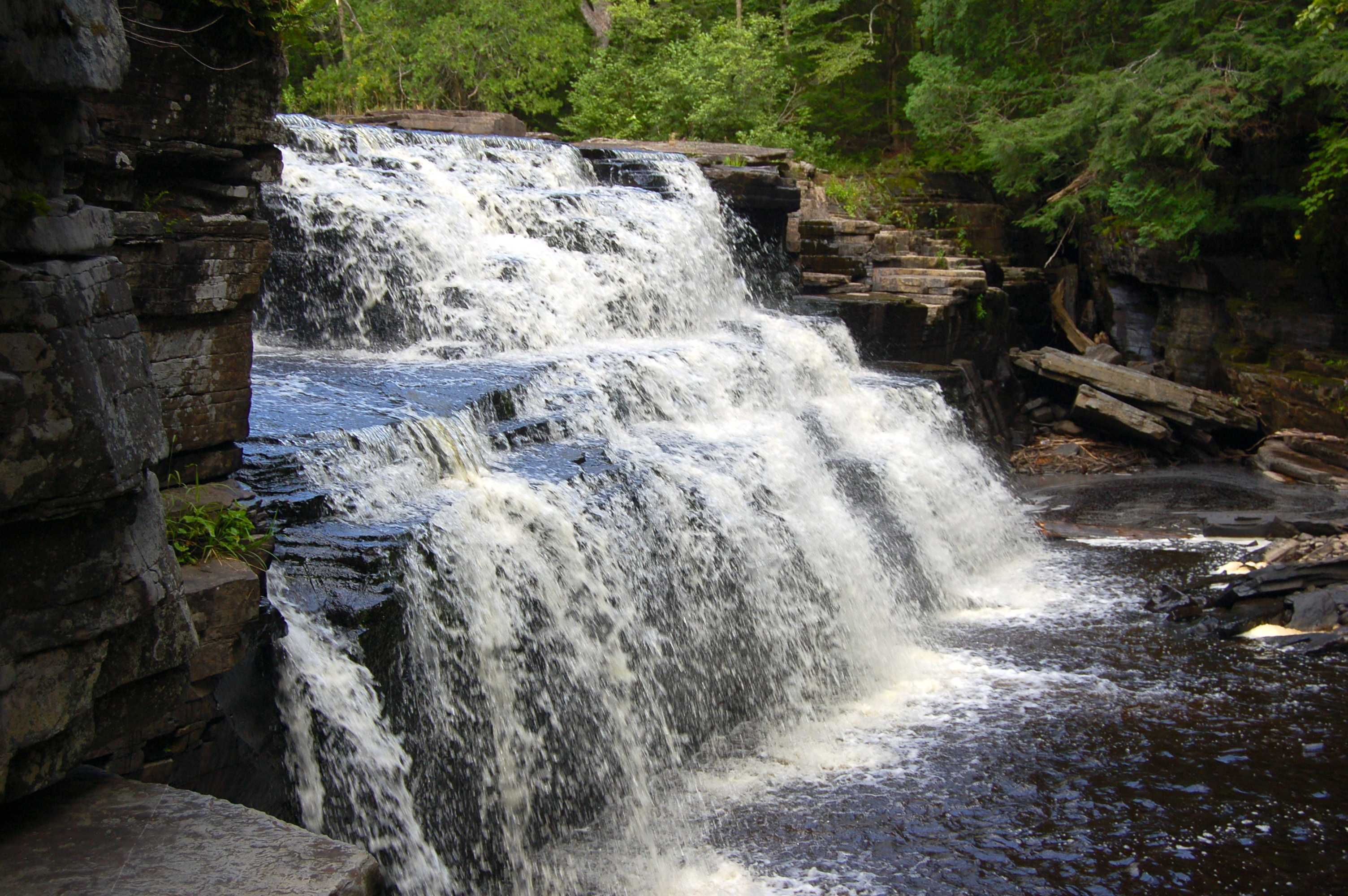
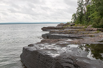
Falls River Falls – The Lower and Middle (pictured) Falls on the Falls River can be reached . Another unnamed drop can be seen above the railroad bridge and can be reached by following the trails from Middle Falls. Upper Falls is on private property, but you can head to Power Dam Rd. to view Powerhouse Falls and Power Dam Falls.
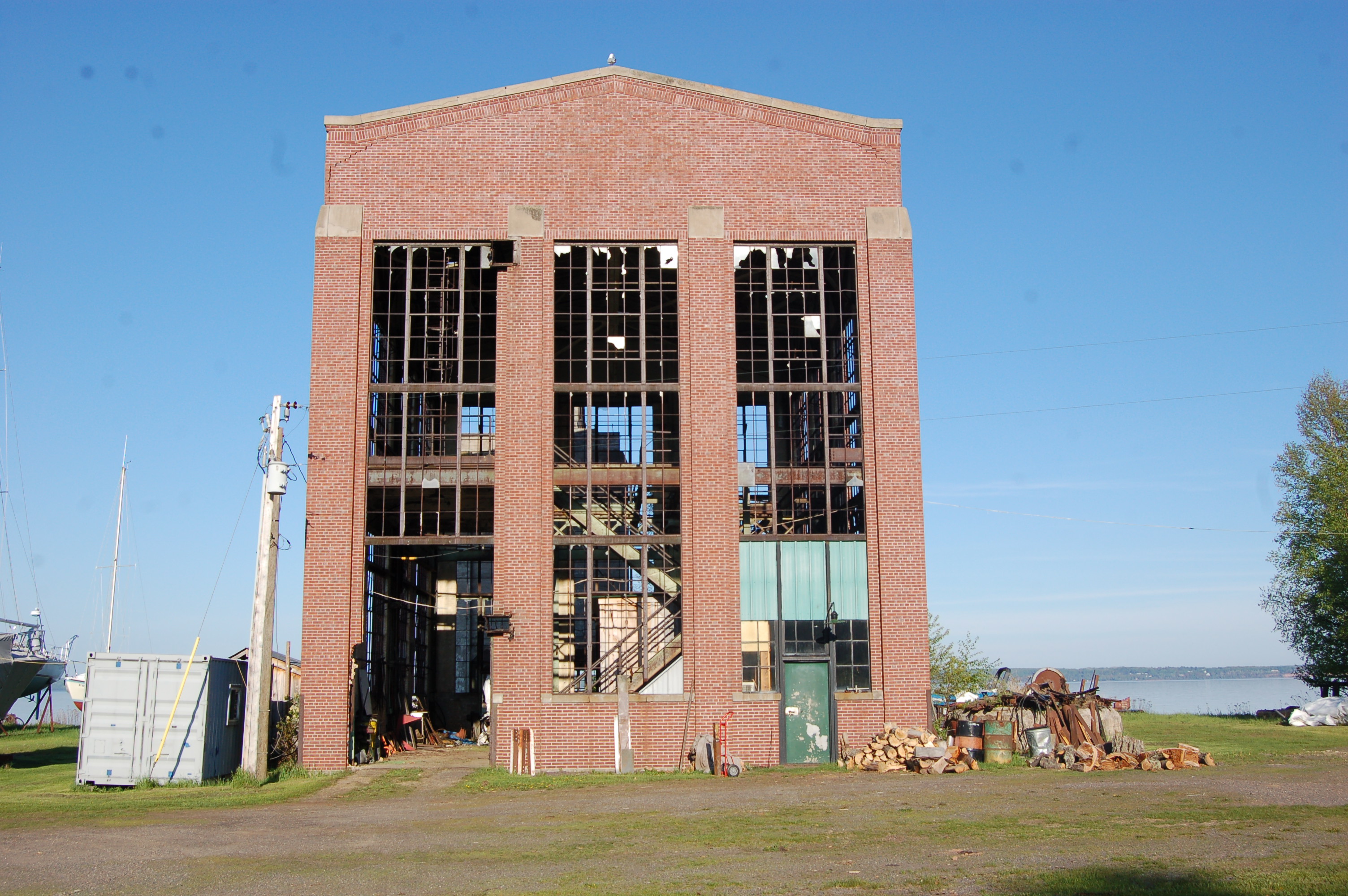
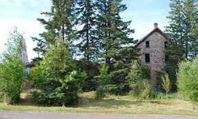
Pequaming – Now home to vacation homes and cottages and few year-round residents, Pequaming was once the site of a Ford plant. Remains of several buildings still stand, and it’s hard to miss the Ford water tower that can be seen from anywhere in the community. This is where the wood paneling for Ford vehicles in the 1920s and 1930s was made. From L’Anse take Main St./Skanee Rd. out of town. Just after the township park and campground, make a left on Whirl-I-Gig and follow it to Bayshore Rd. Take a right on Bayshore, which becomes Pequaming Rd. and follow it around the bay to the village.