Michigan Trail Tuesday: Presque Isle Waterfalls Loop at Porcupine Mountains Wilderness State Park
Michigan Trail Tuesdays is a new feature that will showcase a different trail or trail segment each week. The Mitten State is home to thousands of miles of trails, including the new Iron Belle Trail that runs from Detroit in the southeast to Ironwood in the western Upper Peninsula.
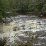
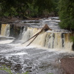
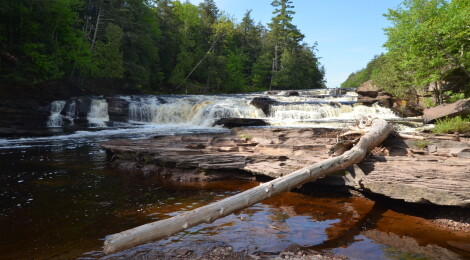
Michigan’s Porcupine Mountains Wilderness State Park has almost 90 miles of hiking trails that run through its 60,000 acres. Trails run along the Lake Superior shoreline, past inland lakes and rivers, to the tops of mountains, and past wildlife and waterfalls. One of the easier hikes in the park takes visitors to four waterfalls on the Presque Isle River, which is one of the main attractions on the western end of the park. A hike of between two and three miles begins near the Presque Isle campground and covers both the east and west sides of the river, providing excellent views of Manabezho Falls, Manido Falls, Nawadaha Falls, and the “pothole” falls near the rivermouth. Here is our guide to the Presque Isle Waterfalls Loop hike!
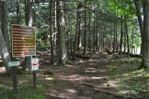
**IMPORTANT – Use caution when hiking near waterfalls, as the posted signs note, “Waterfalls and swift currents create dangerous undertows and deep holes in the river bottom. Stay on trails. Rocks are slippery when wet. Even the best swimmers can drown if they fall in the river. There was a death here in August 2020 when a Wisconsin man fell into the river.
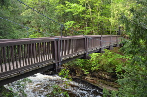
We like to start this hike from the day-use parking lot that is right next to the campground (you’ll pass a separate lot on the way in that is used mostly for parking for overnight hikers). The trail heads into the woods for a few hundred feet before it meets the boardwalk that runs between the falls on the western bank. From here the trail continues towards Lake Superior, and the next thing you’ll encounter is a wooden suspension bridge.
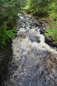
From the middle of the suspension bridge you have a great view of the “Potholes,” a section of small yet photogenic cascades. As the river makes its way over the potholes formed by years of water and rock wearing away the rock in the river, this small waterfall is framed beautifully in a small gorge. After crossing the bridge you are on a small peninsula and you can make the short side trip out to Lake Superior (shown below) or continue on your way.
The main trail heads across the peninsula and puts hikers right at water level before it connects to the East River Trail. This is an amazing spot to stop and soak in the scenery as you look upstream at the large waterfalls and unspoiled beauty.
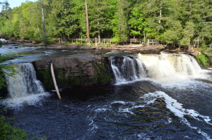
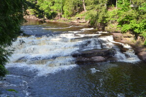
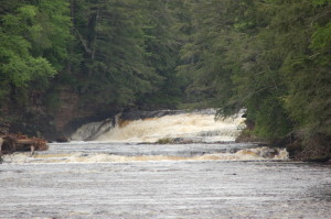
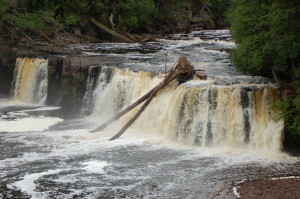
A short hike on the eastern bank leads to Manabezho Falls. This 25 foot tall, 150 foot wide (at times) waterfall is the biggest in the park and the view from this side presents it in a much wilder setting from a closer vantage point than the platforms on the river’s west side. Use caution here as there are no fences or barriers, and it is a long drop down!
Another short hike brings you to Manido Falls. When the river is really flowing this waterfall can be almost as wide as Manabezho Falls. It gradually drops 10-15 feet, and from the east side of the river it is fairly easy to get down to river level below the falls.
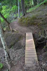
From Manido Falls, it is a hike of less than a half mile to get to the next waterfall. The trail on the east side is well-worn and easy to follow, and while it has some climbs and difficult spots it has bridges and boards in place on wetter sections and over gaps. A good pair of hiking boots will be helpful for this trail unless it has been a long time since the most recent rain.
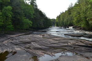
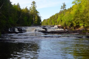
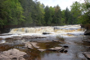
Next up is Nawadaha Falls. This waterfall was the reason we first did this hike in 2010. There is a short path behind the ranger station on the west riverbank that provides a side view of Nawadaha Falls, but is hard to get a full view of the entire thing. As you can see above, the view from the east side is much, much better. This 15 foot waterfall covers the entire width of the river, dropping in three to four steps as it continues downstream. From the East River Trail there is a great opportunity to carefully get down to river level to see this cascade.
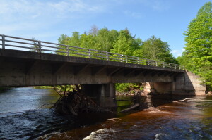
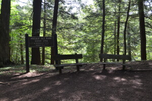
After Nawadaha Falls, it is a short hike on the east side of the river to South Boundary Rd. (the main road that connects the two ends of Porcupine Mountains Wilderness State Park). You will cross the bridge here, then look for a trail that heads back into the woods on the west bank of the river (see the sign at the top of this post).
After hiking between a quarter-mile and half-mile, you will have reached Nawadaha Falls again from the west side. At this point you should be able to see why we prefer the view from the East River Trail compared to the one here. If you prefer to head out to the road and finish your hike early, a trail that heads to the ranger station from here will allow you to do so.
Next up on the West River Trail is Manido Falls. There is a viewing platform here and a boardwalk with stairs that runs all the way to Manabezho Falls. A full, but distant view of Nawadaha Falls can be obtained from the top of the Manido Falls viewing platform.
The trail will pass along within a stone’s throw of the brink of Manabezho Falls, before climbing some stairs and reaching the T intersection that leads back to the parking lot or north to Manabezho Falls.
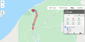
The view of Manabezho Falls from the west side is pretty spectacular. It comes from a distance and from higher up than on the east side. Below is a map of our trip around the Presque isle waterfalls courtesy of MapMyRun:
There are plenty of other things to see and do while at Porcupine Mountains Wilderness State Park. Following South Boundary Rd. to the east will take you past Overlooked Falls and Greenstone Falls, the Union Mine Trail, Nonesuch Falls and Mine Ruins, Summit Peak Overlook, and many more trails.

