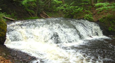
Overlooked Falls and Greenstone Falls – Porcupine Mountains Wilderness State Park
When it comes to waterfalls in the Porcupine Mountains, the big falls on the West end of the park – Manabezho, Manido, and Nawadha Falls – tend to get all the glory, but there are many more beautiful falls inside the wilderness state park. As part of our 2014 Lake Superior Circle Tour, we finally made the hike to Overlooked Falls and Greenstone Falls, two waterfalls that are not that difficult to get to yet aren’t visited as often as others. Both are reached from the same parking lot at the end of Little Carp River Rd. off of South Boundary Rd.
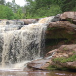
Overlooked Falls is reached in a few hundred feet, and there is a trail down each side of the river, offering pretty similar views. It’s a set of 3-5 foot drops on the Little Carp River, but the scenery here is spectacular.
Continuing downstream, the river continues to drop and provide sets of little falls that make the half mile hike go by a lot faster than it should.
Greenstone Falls are wider, and a bit taller. It may take a bit of work to get down to river level for photos, but you’re not too high above the river to start with and there are a few paths.
This area is also home to the Greenstone Falls Cabin, which can be rented from the state park.
One of the neat features of this trail is that there are several boardwalks in place for crossing to the other side – this gives the option of taking one path downstream and another on the trek back to the car:
You may notice in the photo above that my dad has on mosquito head netting – this should be considered a must-have for this hike. We only took them off briefly to take pictures, and we kept moving as much as possible.
This is a sample of one of the additional falls on this river. Take your time and enjoy everything the “backcountry” has to offer! There are many drops on this river of various heights.
Directions: The road to the parking area for the falls is called Little Carp River Rd. and it is marked for Greenstone Cabin and several other sites, it is off of South Boundary Rd. From M-107 head southwest on S. Boundary for about 18 miles and watch for the road on the right (this is pretty close to being the halfway point of S. Boundary Rd. as it stretches from the west to east ends of the park).
Be prepared for: mosquitos, flies, etc. as well as wet, sloppy terrain (especially after rain) and moderate difficulty hiking


Great shots! Everything looks so green and beautiful!