
Michigan Lighthouse Guide and Map: Alger County Lighthouses

Michigan is home to more lighthouses than any other state, with more than 120 beacons still standing along the shores of Lake Superior, Lake Michigan, Lake Huron, and Lake Erie. Many of these historic structures are popular destinations for tourism, as their locations provide for great photo opportunities. Some lighthouses are open to the public as museums, some have their grounds open but are closed to interior visits, and others are owned as private residences. As part of our continuing and comprehensive Michigan lighthouse coverage, we will be breaking down our mitten state beacons by county, providing maps and visitor information. First up in this series is our Michigan Lighthouse Guide and Map: Alger County, which provides information on nine Lake Superior lighthouses.
Alger County is Michigan’s second-largest county by area (82% of that is water) and is 77th in population (out of 83). Its largest population centers are Munising and Grand Marais, and its main tourism draws are the Pictured Rocks National Lakeshore and the Grand Island National Recreation Area. Seven of its nine lighthouses are on the mainland; two are on Grand Island but can be seen from various boat cruises. Let’s take a look at Alger County’s lighthouses, starting in the east and working our way west.
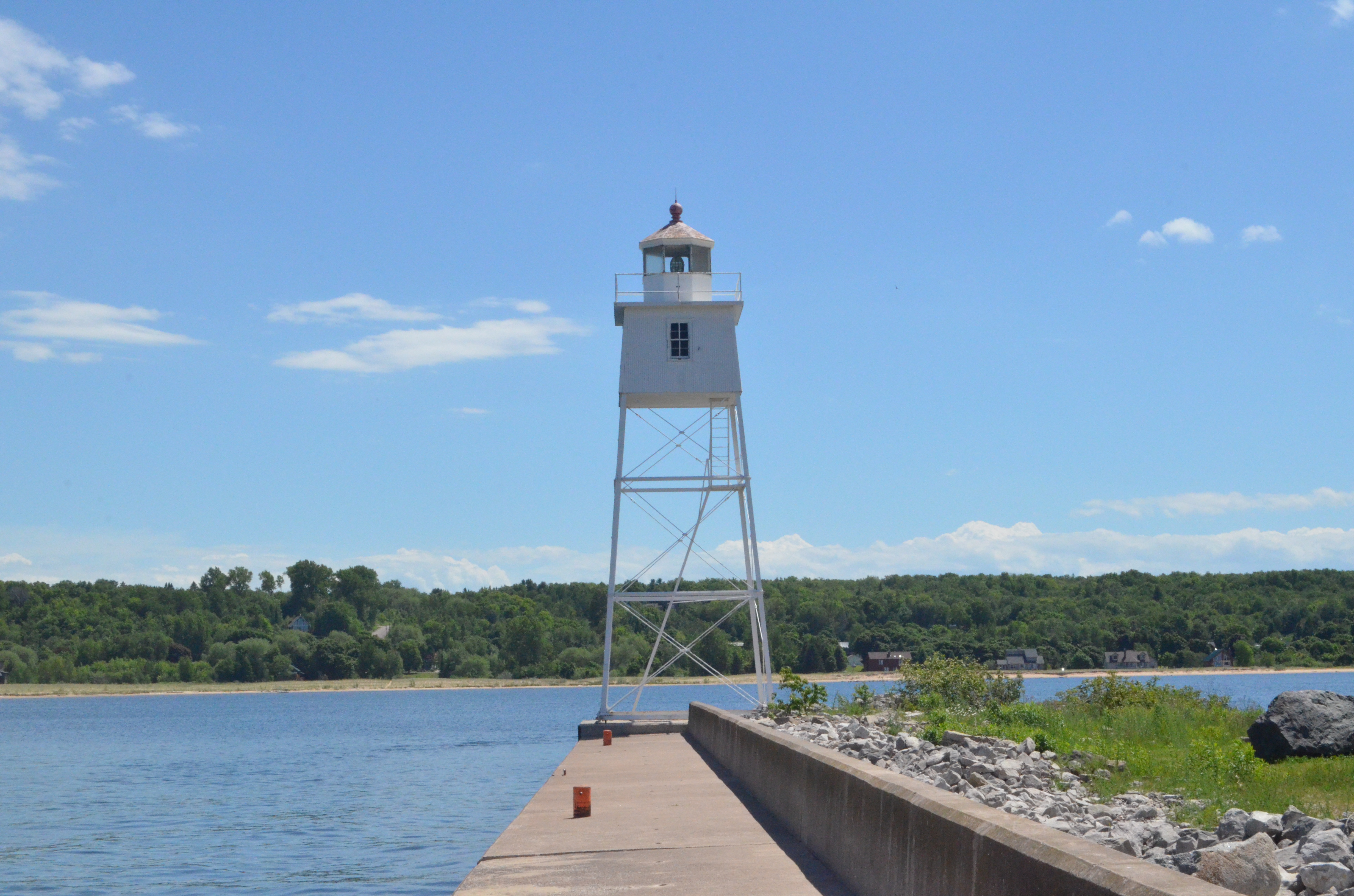
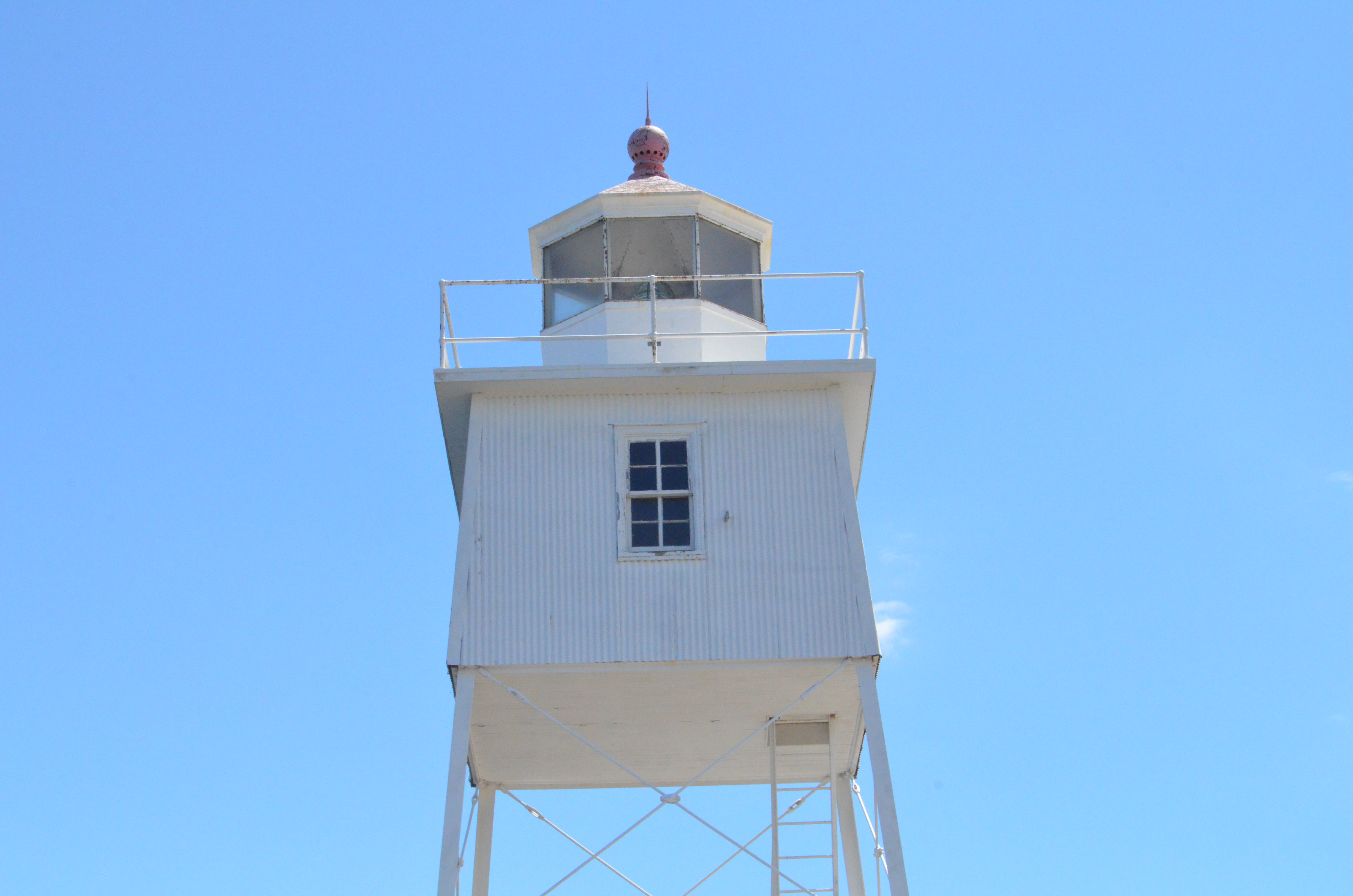
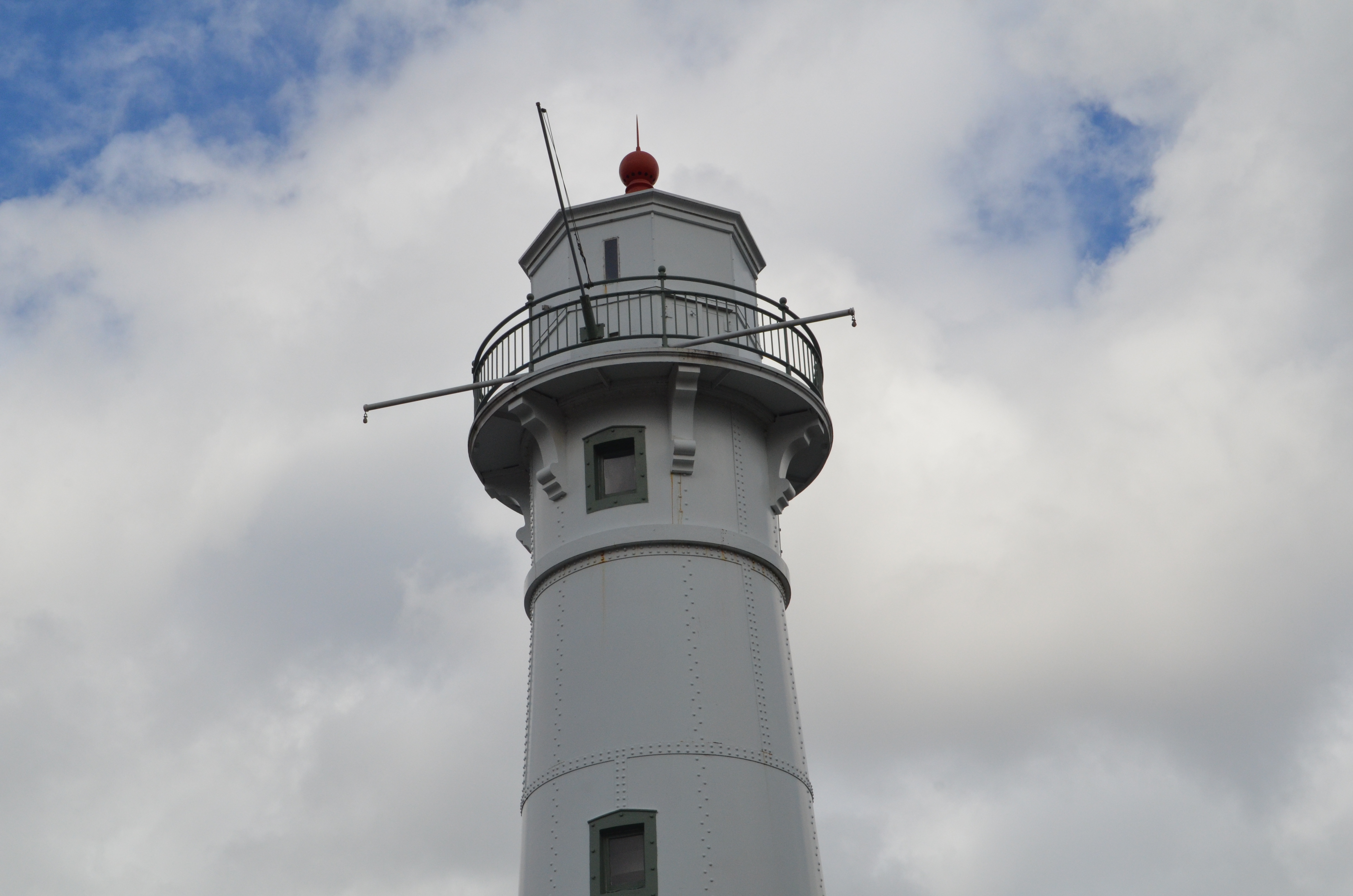
1 and 2. Grand Marais Harbor of Refuge Inner and Outer Lights – We start things off in Grand Marais, a harbor of refuge on the eastern end of Alger County. The harbor of refuge here dates back to the 1880s and was vital to early Lake Superior shipping as it provided a harbor between Whitefish Point and Grand Island. The two lights here date to the 1890s and while they won’t top anyone’s list for their aesthetics they still played a vital role over the years. The inner light stands 55 feet tall while the outer light stands 34 feet tall. Both are steel skeletal towers that are painted white. You can visit both these lights (and walk the 2,000+ foot pier between them) by parking at the end of Coast Guard Point Rd. near the Lightkeeper’s Museum.
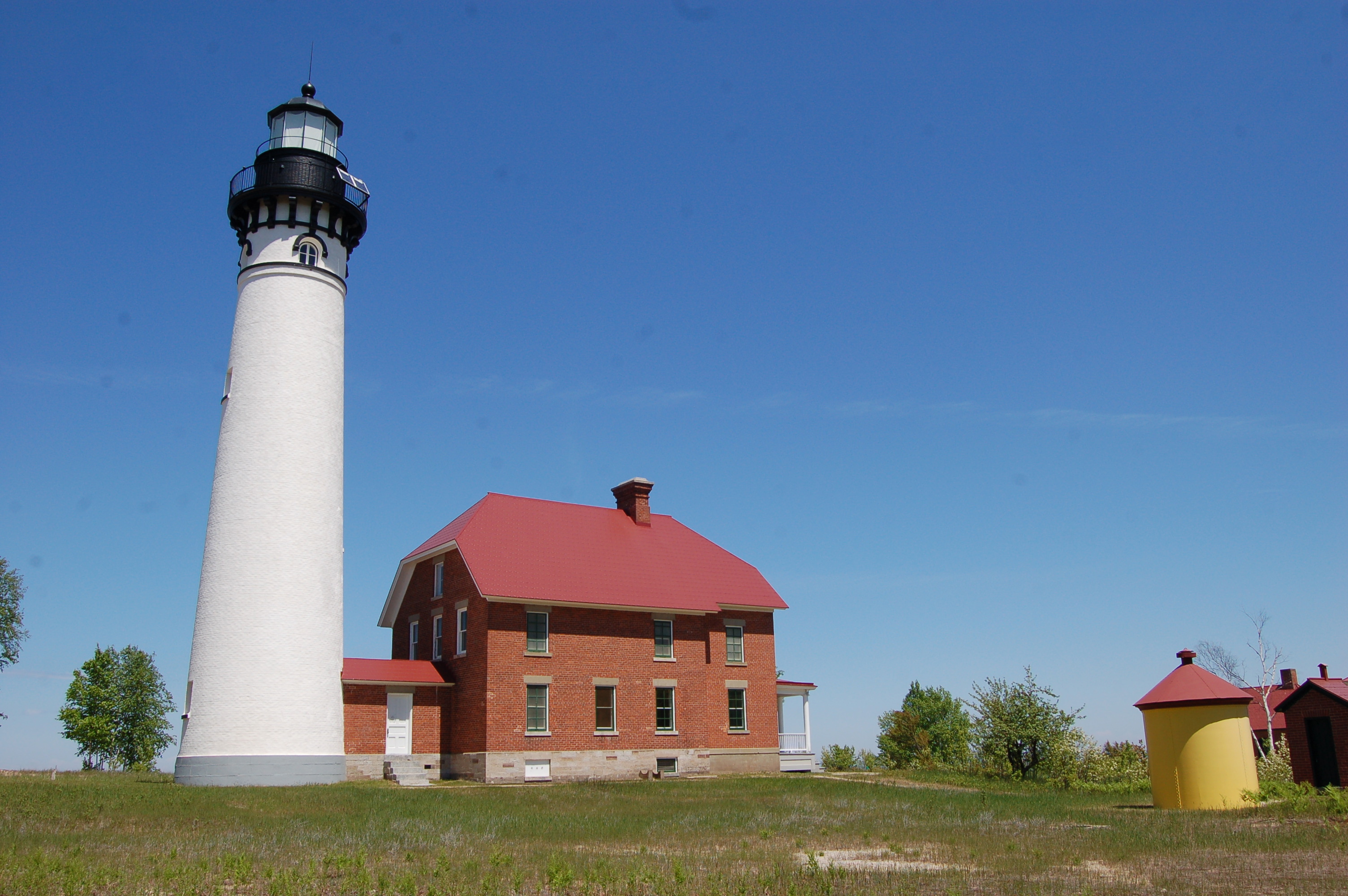
3. Au Sable Point Light Station – From Grand Marais we head west on H-58, entering the Pictured Rocks National Lakeshore just west of town. One of Alger County’s most picturesque lighthouses is also the one that requires the most work to get to. From the Hurricane River day use area in the Pictured Rocks National Lakeshore, it is a hike of about a mile and a half to get back to the Au Sable Point Light Station. This 1874 lighthouse features an 87 foot tall tower and an attached red brick keeper’s dwelling. In the summer, park rangers are occasionally here for tours and tower climbs. Be sure to check out the shallow water shipwrecks nearby on your hike out or back!
4 and 5. Munising Front and Rear Range Lights – From the Hurricane River parking are we head east on H-58, passing Pictured Rocks National Lakeshore sites like Chapel Falls, Mosquito Falls, Miners Castle, Miners Falls, and Munising Falls. This is an incredibly scenic 40+ mile drive. On the west end of downtown Munising we come to our next two lights – the 1908 Munsing Front and Rear Range Lights. At the intersection of M-28 and Hemlock St. the white, steel plated Munising Front Range Light stands 50 feet tall. The Munising Rear Range Light is 30 feet tall and is located two and a half blocks up the hill on Hemlock St. Mariners could line the two light up from the water to help guide themselves into the harbor. There are a few parking spots by the front range light and the rear range light can easily be photographed from the road. Both towers are closed to the public, but the hope is that since they are now owned by Pictured Rocks National Lakeshore they may one day be open to visitors.
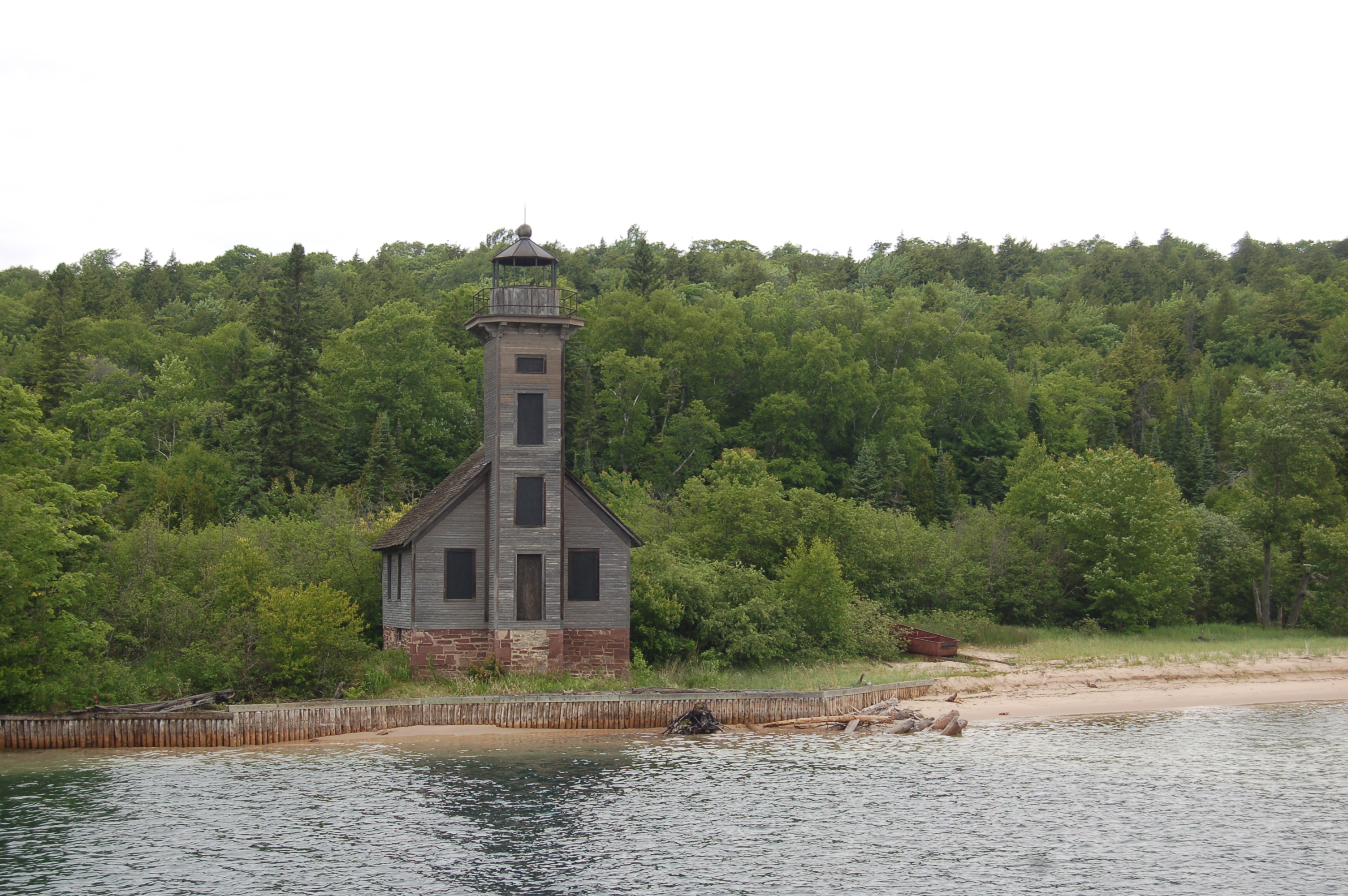
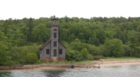
6. Grand Island East Channel Lighthouse – One of Alger County’s most photographed lighthouses can be seen from three different cruise tours in the area. Pictured Rocks Boat Tours, Glass Bottom Shipwreck Tours, and Riptide Ride all pass by this 1868 wooden lighthouse. Deactivated in the early 1900s, this picturesque structure has somehow withstood the fury of Lake Superior for another 100+ years. A seawall added in 2000 and restoration efforts since then have helped ensure that this light will still be there for visitors. There is no public access to this lighthouse from on Grand Island as it is privately owned, the best views come from the water on one of the cruises mentioned above.
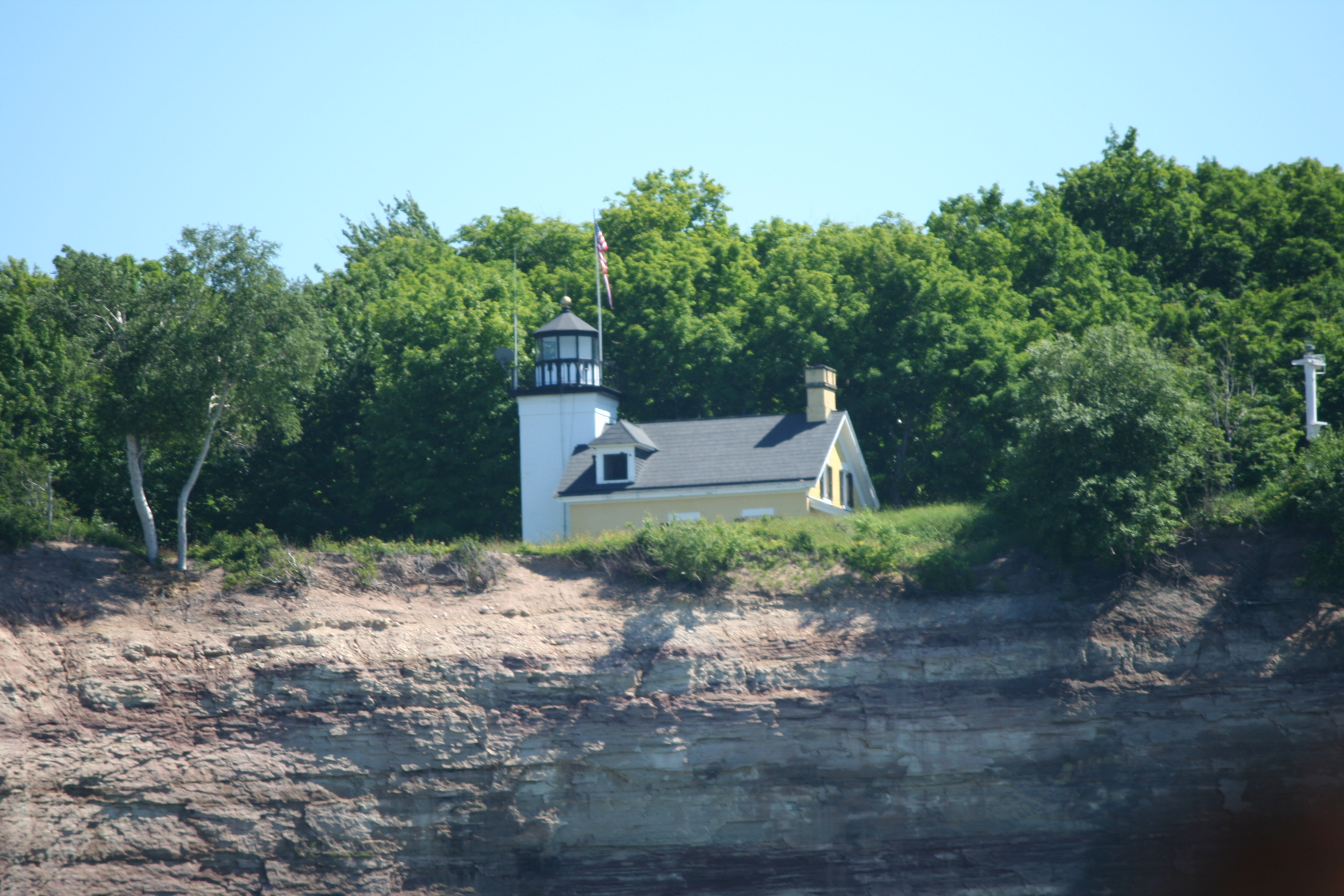
7. Grand Island North Lighthouse – This 1867 lighthouse is notable in that it is the highest lighthouse above sea level in the country. The three-story tower is 40 feet tall and attached to a two-story dwelling. The best way to see the privately owned beacon that sits on the top of a 175 foot tall cliff above Lake Superior is from the Riptide Ride. This hour and half trip circles Grand Island and is a thrill for all ages. There is no public access to the Grand Island North Lighthouse from on the island.
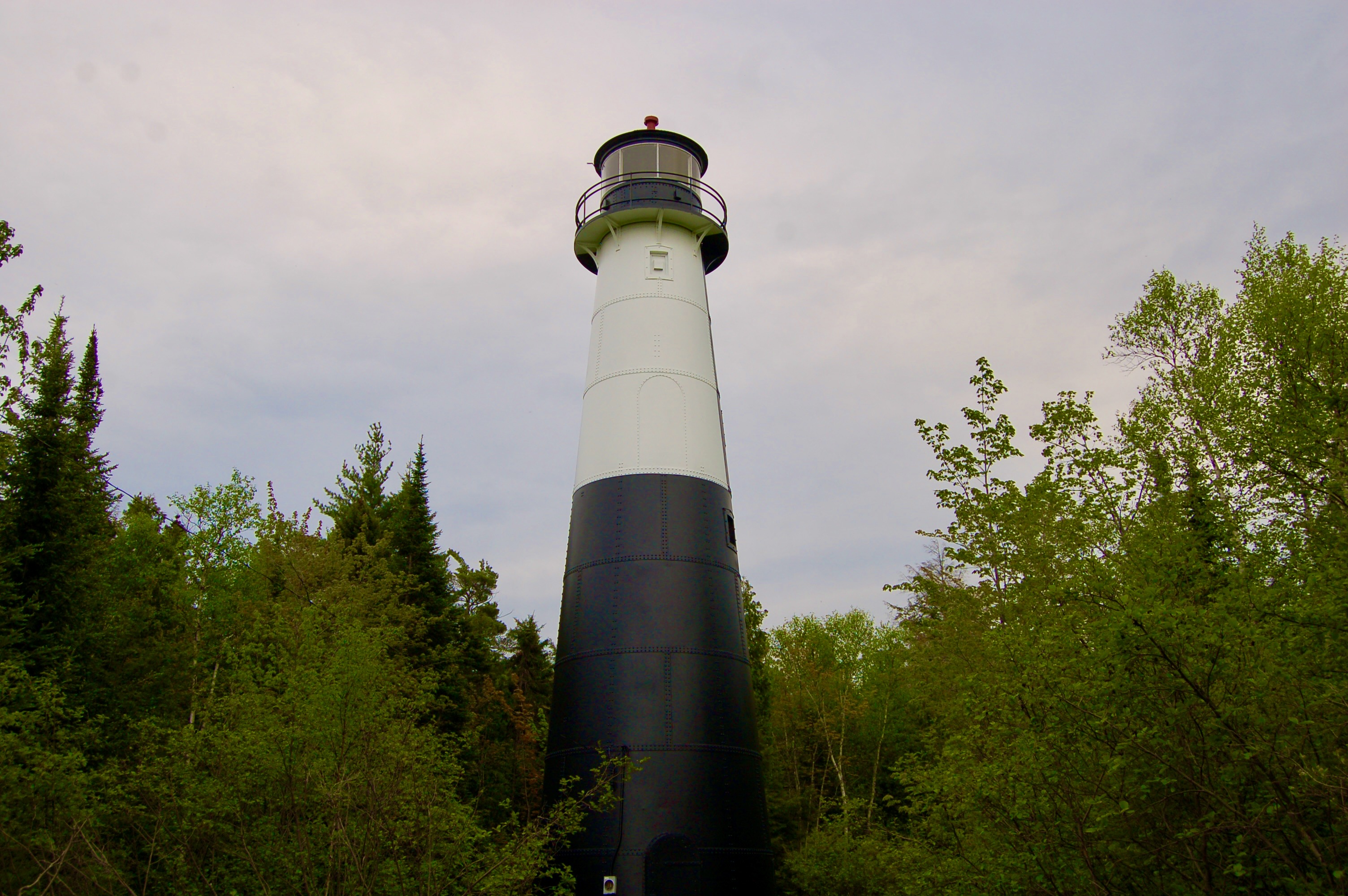
8 and 9. Grand Island Harbor Front and Rear Range Lights – Two easy to visit lights in Alger County that many people pass by while driving on M-28 are the Grand Island Harbor Range Lights (also known as the Christmas Range Lights or the Bay Furnace Range Lights). The 64 foot rear range light dates back to 1913 and is a black and white steel plated tower. The current front range light is a modern white cylindrical tower that stands 20 feet tall with a light on top. To visit these two lights park at the “Welcome to Christmas” sign as you enter this town from the east.
We hope you enjoy visiting all of these Alger County lighthouses! Look for more county by county Michigan lighthouse guides coming soon!