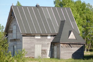
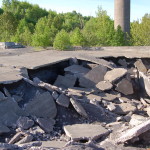
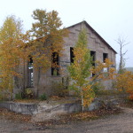
The Life Saving Station at Vermilion Point was once one of the ghost towns of the Eastern Upper Peninsula, but recent work by the Little Traverse Conservancy has restored some of the buildings to better condition and helped preserve the surrounding landscape. Facing the ever-dangerous waters of Lake Superior and butting up against a cranberry bog, this can be both an enchanting and eerie place to visit – and it takes some work to get to. My dad had found this info online, and we printed off a map of the area and did our best to find it. We succeeded on the first try, and I’m pretty sure our familiarity with Crisp Point and Whitefish Point helped. Here’s a look at a few of the buildings:

There is a trail that leads to the shore, and signs encourage visitors to be mindful of the fact that this beach is one of the spots that the piping plover has thrived. The view of the lake is powerful and rather lonely looking in either direction.
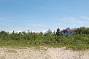
The station here was in operation from the 1870s to the 1940s and was credited with assisting in the rescues of many vessels. On the way in it is easy to notice all the wetlands and bogs in the area; apparently this was once a prime area for harvesting cranberries. Knowing a place like this was once pretty busy and full of activity and then seeing it completely empty is efinitely an interesting feeling. Finally, here is a view from the beach looking back to the station:
This was a fun side trip, and something new that rewarded the effort we put in. After visiting the ghost town in Jackfish, Ontario earlier in our trip I was almost a little disappointed that Vermilion was less of a ghost town anymore. There’s a lot of great area to explore here, and it seemed like a perfect spot to wait and watch for wildlife, especially birds.
From Whitefish Point Rd. heading towards the lighthouse and shipwreck museum, we turned and headed west on Vermilion Rd. This road is paved for a few miles, then turns to a mess of two-track and ATV trails that are not well marked. We stayed on what we considered the obvious main track, knowing we needed to be almost 10 miles from Whitefish Point and near the shore. Here’s a link to the
information the Little Traverse Conservancy offers.

 There is a trail that leads to the shore, and signs encourage visitors to be mindful of the fact that this beach is one of the spots that the piping plover has thrived. The view of the lake is powerful and rather lonely looking in either direction.


