
Michigan Trail Tuesday: Summit Peak, Porcupine Mountains Wilderness State Park
Michigan Trail Tuesdays is a new feature that will showcase a different trail or trail segment each week. The Mitten State is home to thousands of miles of trails, including the new Iron Belle Trail that runs from Detroit in the southeast to Ironwood in the western Upper Peninsula.
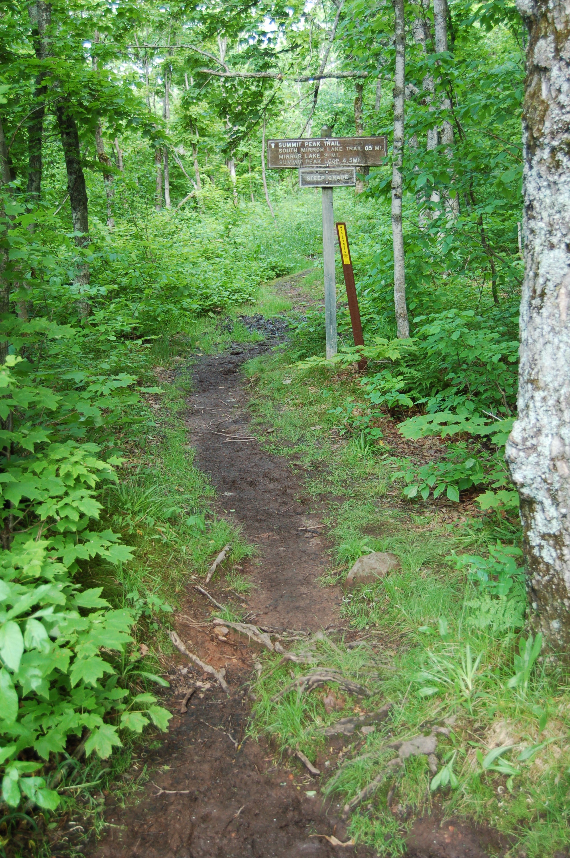
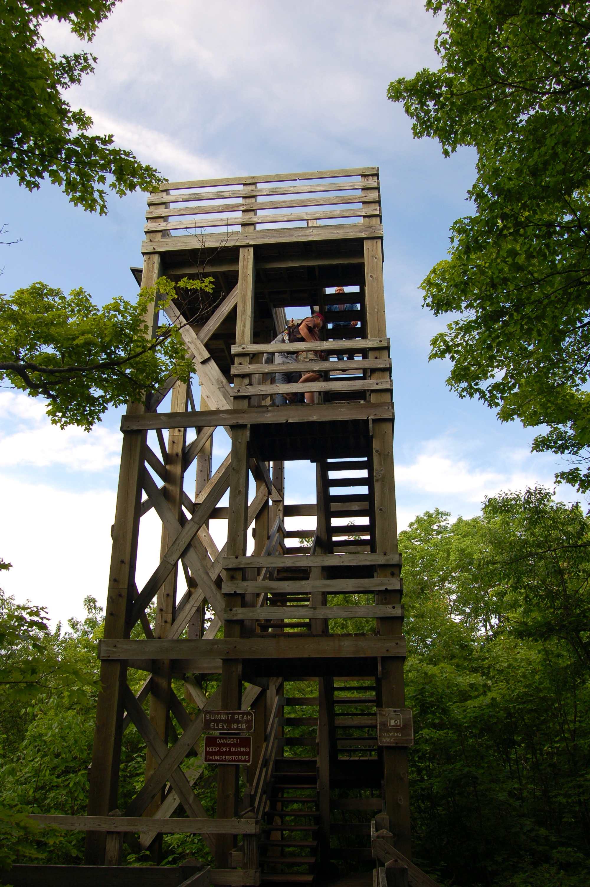
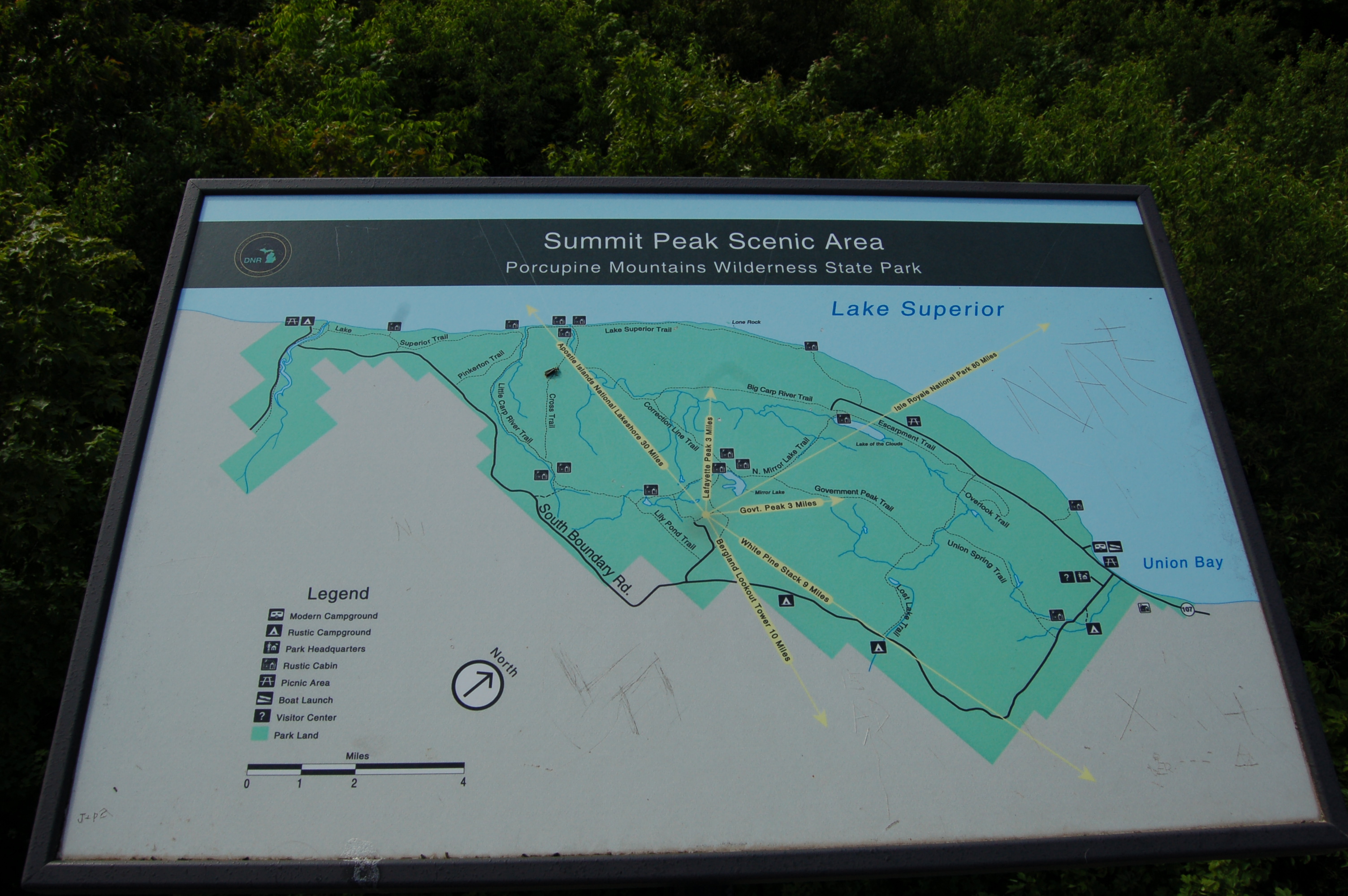
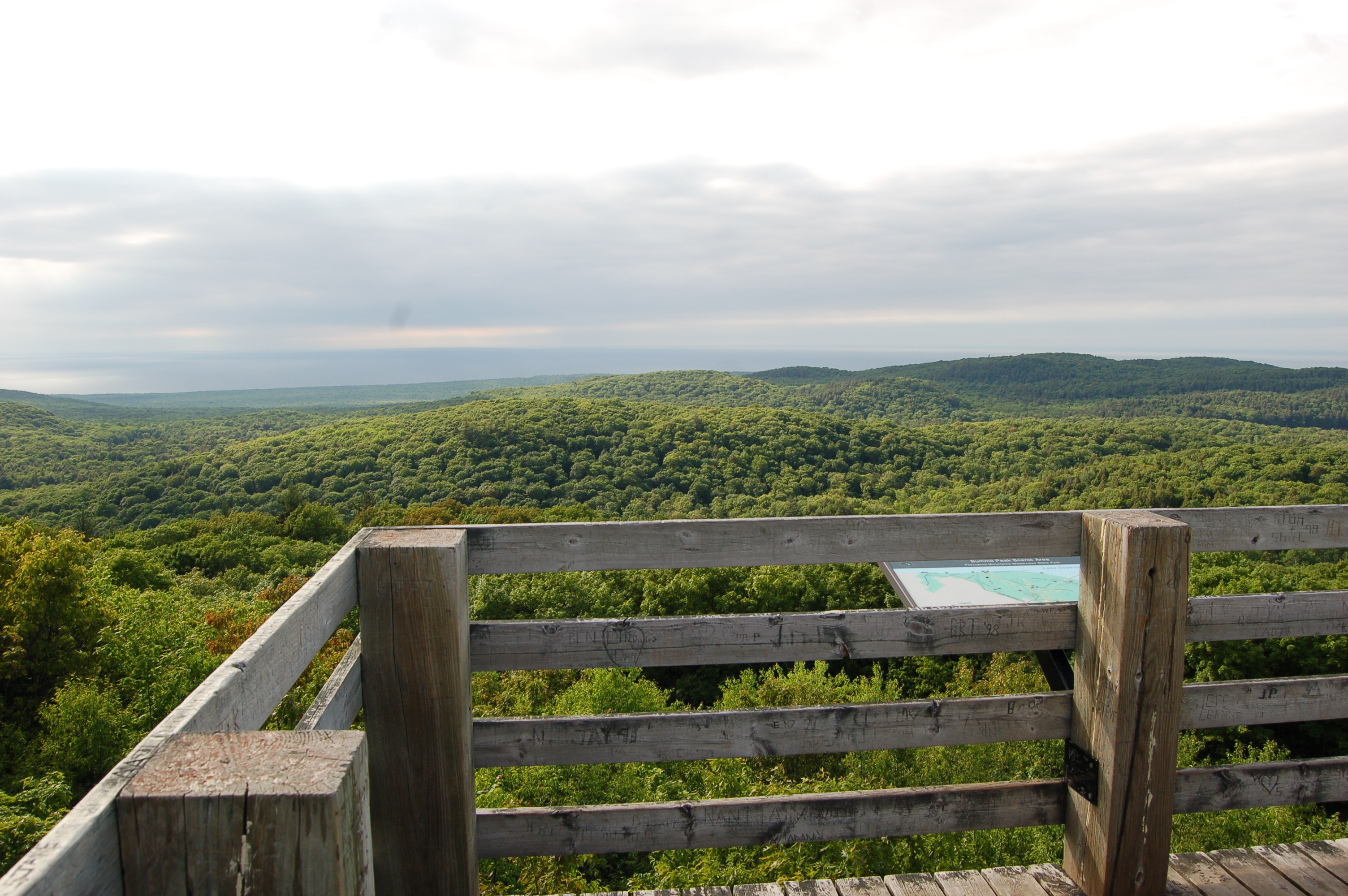
Michigan’s Porcupine Mountains Wilderness State Park is home to more than 85 miles of hiking trails, and one of the shortest and most accessible trails leads to the Summit Peak observation tower with stunning views from 1,958 feet. An access road leads from S. Boundary Rd. to a parking area near the peak, and the trail begins next to a pair of restrooms. The trail is smooth and climbs uphill at a moderate pace, with benches along the way for resting. A wooden boardwalk helps finish off the hike and it splits to lead visitors to both an overlook and the viewing platform.
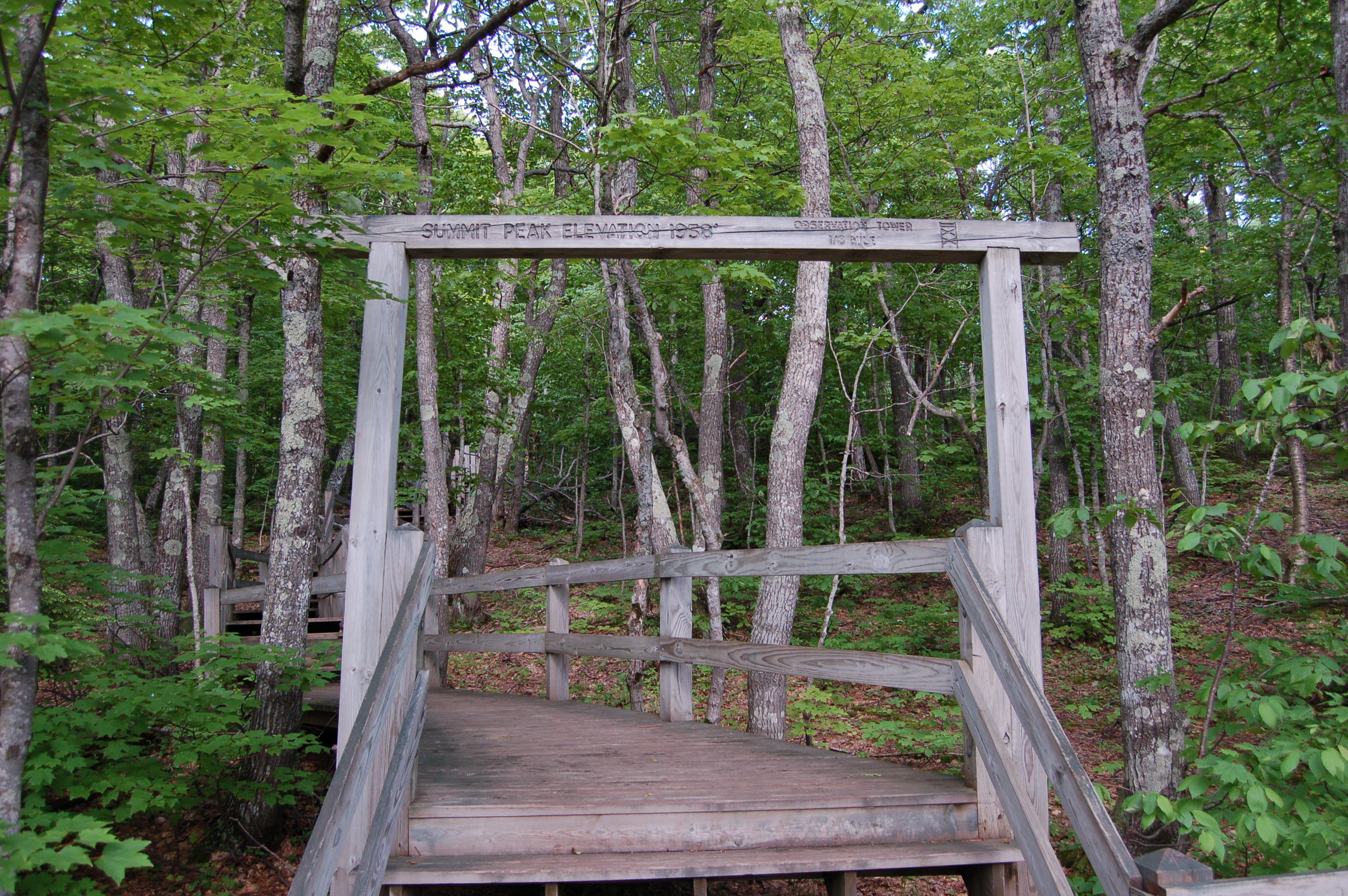
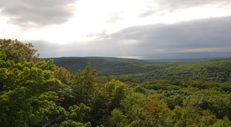
Not only is Summit Peak the highest point in the Porcupine Mountains, it is the third-highest point in Michigan. Mt. Arvon, the state’s highpoint, is only 21 feet taller. A wooden observation rises 50 feet above the peak to offer a panoramic view of the Porcupine Mountains. From this vantage point you a view opposite the Lake of the Clouds overlook, and on a clear day visibility is up to 50 miles.
We visited in June, and while we were in awe of the views of unspoiled wilderness, I couldn’t help but wonder how stunning this area would look in the fall. Once autumn rolls around there really isn’t a bad view in the entire Porcupine Mountains Wilderness State Park, but this spot has to rank as one of the best. Those looking for an easy hike to start their visit at the park will find Summit Peak the perfect spot. For a longer adventure, the full Summit Peak loop is 4.5 miles and other trails lead to Mirror Lake, the South Mirror Lake Trail and the Little Carp River Trail. From the visitor center on South Boundary Rd. just south of the 107th Engineers Highway, follow South Boundary Rd. for 13 miles and follow signs to the parking area.
You can check out our Photo Gallery Friday: Porcupine Mountains Wilderness State Park post for more great views, as well as our posts about Manabezho Falls, Manido Falls and Nawadha Falls on the Presque Isle River on the western end of the park. The parking area from which Greenstone Falls and Overlooked Falls are reached is just a few miles away.