
Michigan Trail Tuesday: Sugarloaf Mountain, Marquette

Michigan Trail Tuesdays is a new feature that will showcase a different trail or trail segment each week. The Mitten State is home to thousands of miles of trails, including the new Iron Belle Trail that runs from Detroit in the southeast to Ironwood in the western Upper Peninsula.
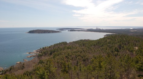
Sugarloaf Mountain north of Marquette is not the tallest peak in the state (it’s not even the tallest in the county), but what it lacks in height it makes up for with its stunning panoramic views from the overlook at its summit. The trail is only .6 miles, but due to the terrain and uphill climb it seems longer and can be a bit challenging for some visitors. The views from the top – at 1,040 feet above sea level and nearly 500 feet above Lake Superior – immediately make the hike worthwhile. Once you enter the trailhead from the parking area, you’ll immediately be faced with a decision: easy trail or difficult trail?
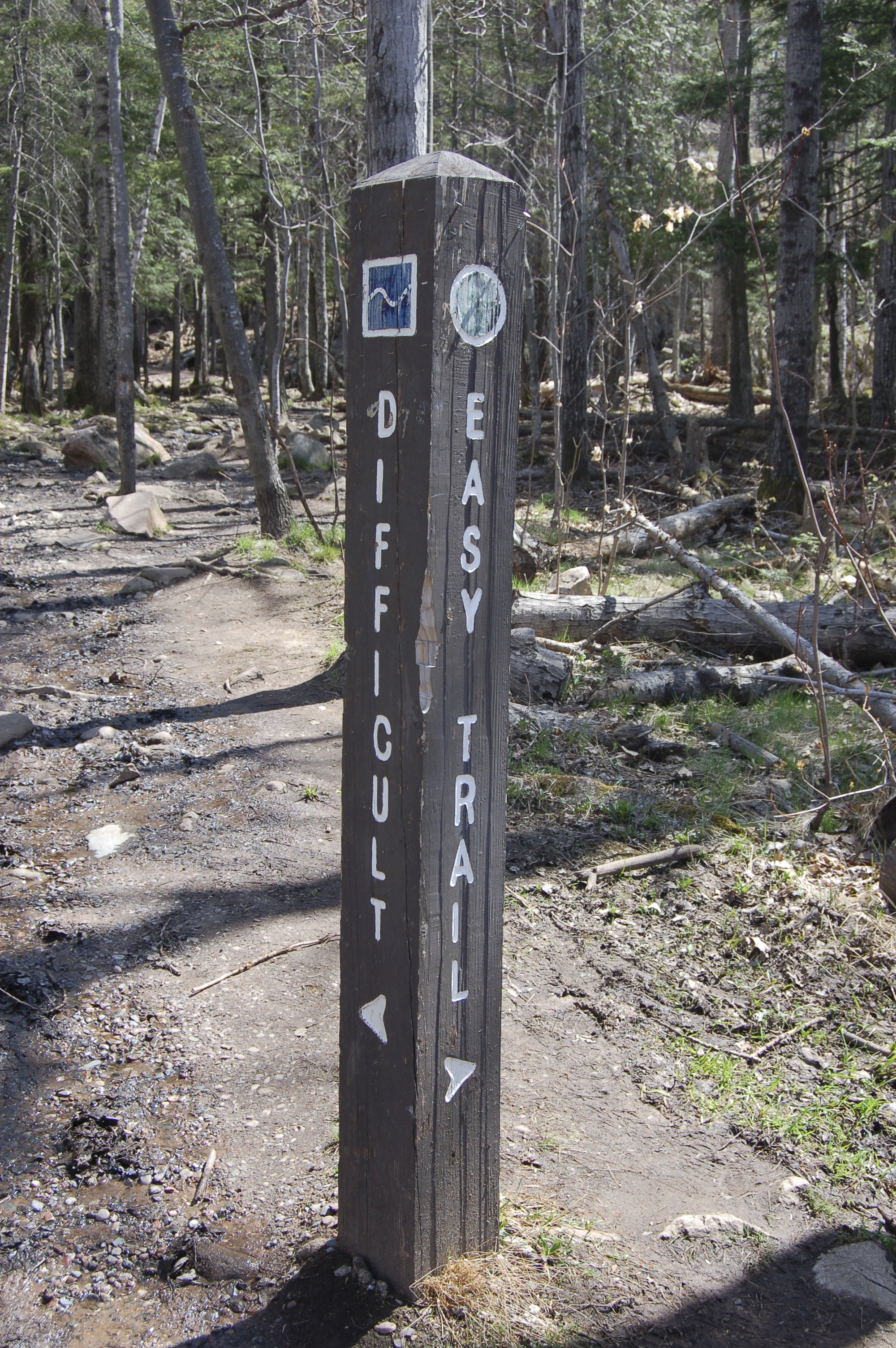
The “easy” trail takes a much flatter and smoother route to get to the start of the stairs that lead to the top of the mountain, while the “difficult” trail gets right to it and heads up the mountain over a path that is littered with rocks and protruding roots. We’ve taken the difficult route on both of our recent visits, and while it was definitely a workout it wasn’t too hard to handle in a pair of sturdy hiking boots.
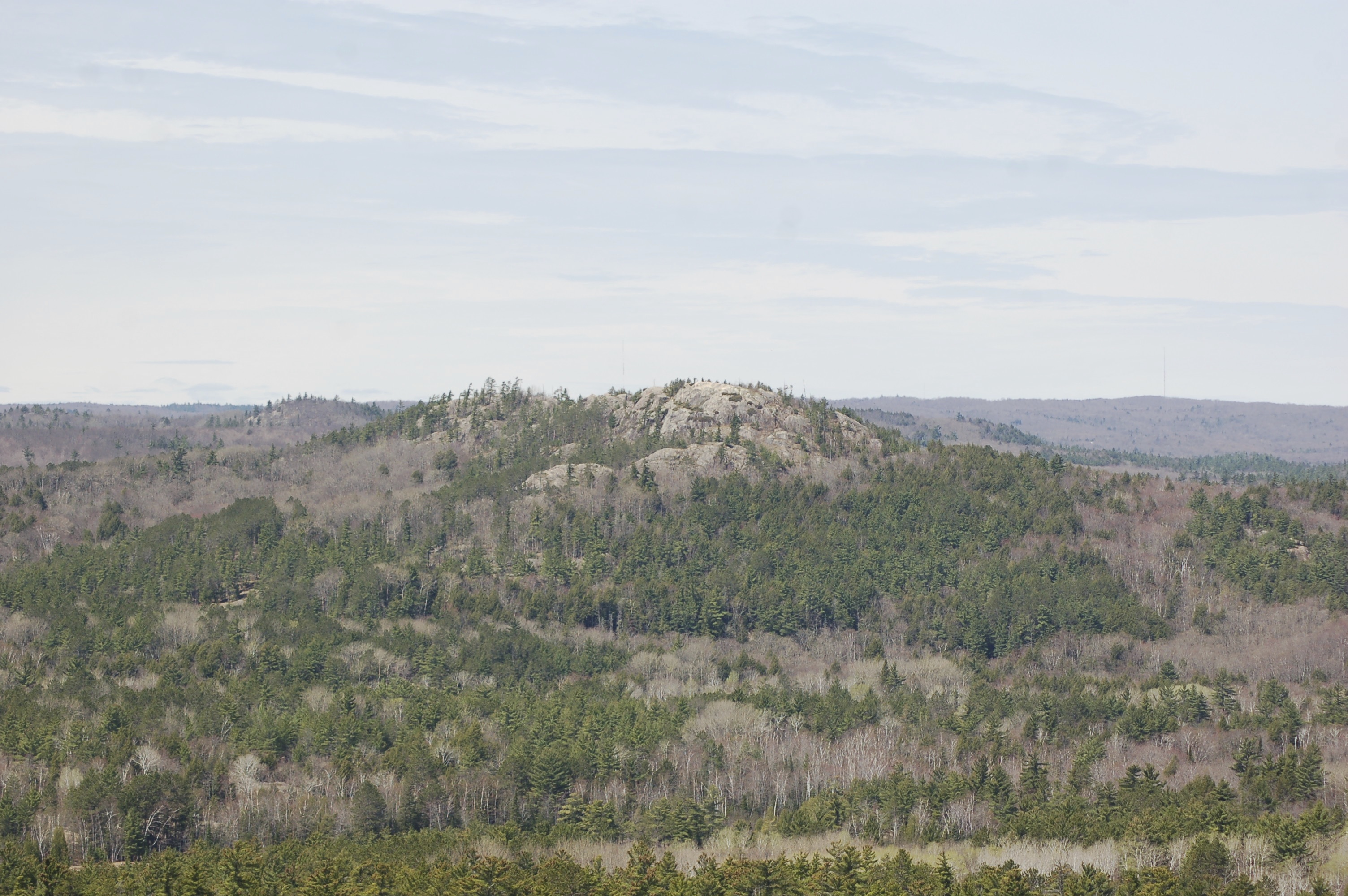
After climbing several flights of stairs you will have reached the summit, where three overlooks provide amazing views. One looks along the Lake Superior shoreline with views of Little Presque Isle Park, another looks towards Hogback Mountain (shown above), and the other looks back towards the harbor and ore docks. Our most recent visit was in October and we were able to observe quite a bit of outstanding fall color looking to the north toward Big Bay and the Huron Mountains.

One thing that will stand out while you’re at the summit is a tall rock cairn. It was constructed here by the local Boy Scout troop as a memorial to a former Boy Scout from Marquette who died during service in World War I, with the hope that his mother would be able to see it from her window at their house in Marquette. To learn more about its history, head to http://www.co.marquette.mi.us/departments/planning/docs/Sugarloaf_Obelisk.pdf.
[slideshow_deploy id=’9969′]
To reach the parking area, take Washington Ave. out of Marquette. Head north onto Fourth Ave. and follow it as it changes to Presque Isle Ave. Turn west onto Hawley St. and follow as it becomes CR-550 heading toward Big Bay. The parking area is roughly seven miles from downtown Marquette (map below).