
Michigan Lighthouse Guide and Map: Manistee County Lighthouses
Manistee County is home to more than 25 miles of Lake Michigan shoreline and some amazing sand dunes and beaches. Located south of the Sleeping Bear Dunes National Lakeshore and north of Ludington, Manistee County’s shoreline is home to the Arcadia Dunes Preserve, the legendary Arcadia Bluffs golf course, Orchard Beach State Park, and of course the port city of Manistee. The county is home to one lighthouse, and today we will tell you how to visit and about some exciting changes that could be coming in the next couple years. We also threw in a bonus lighthouse to this post and it’s easy to visit if you’re heading north on M-22 to Frankfort.
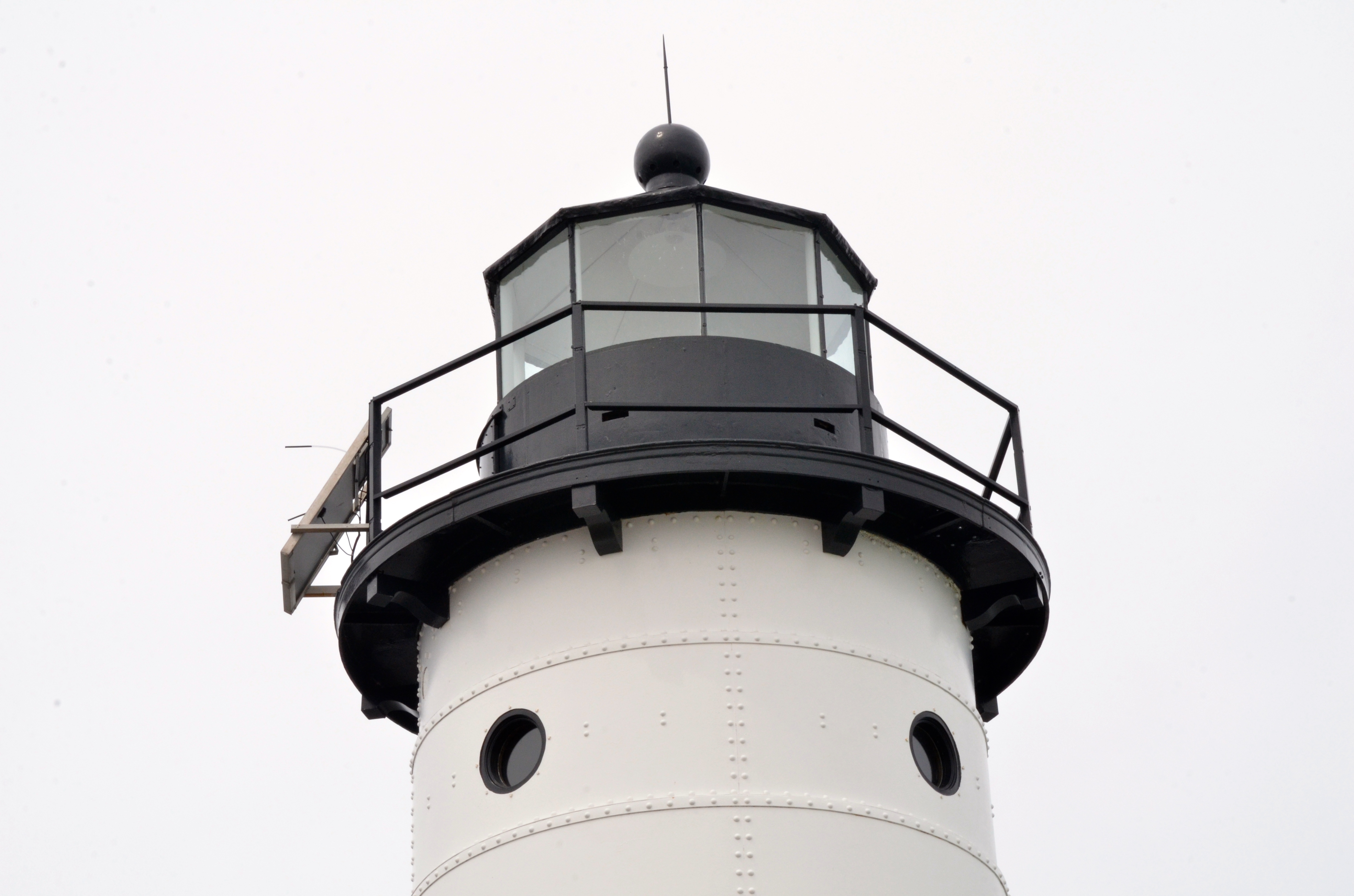
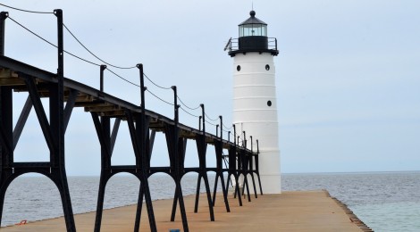
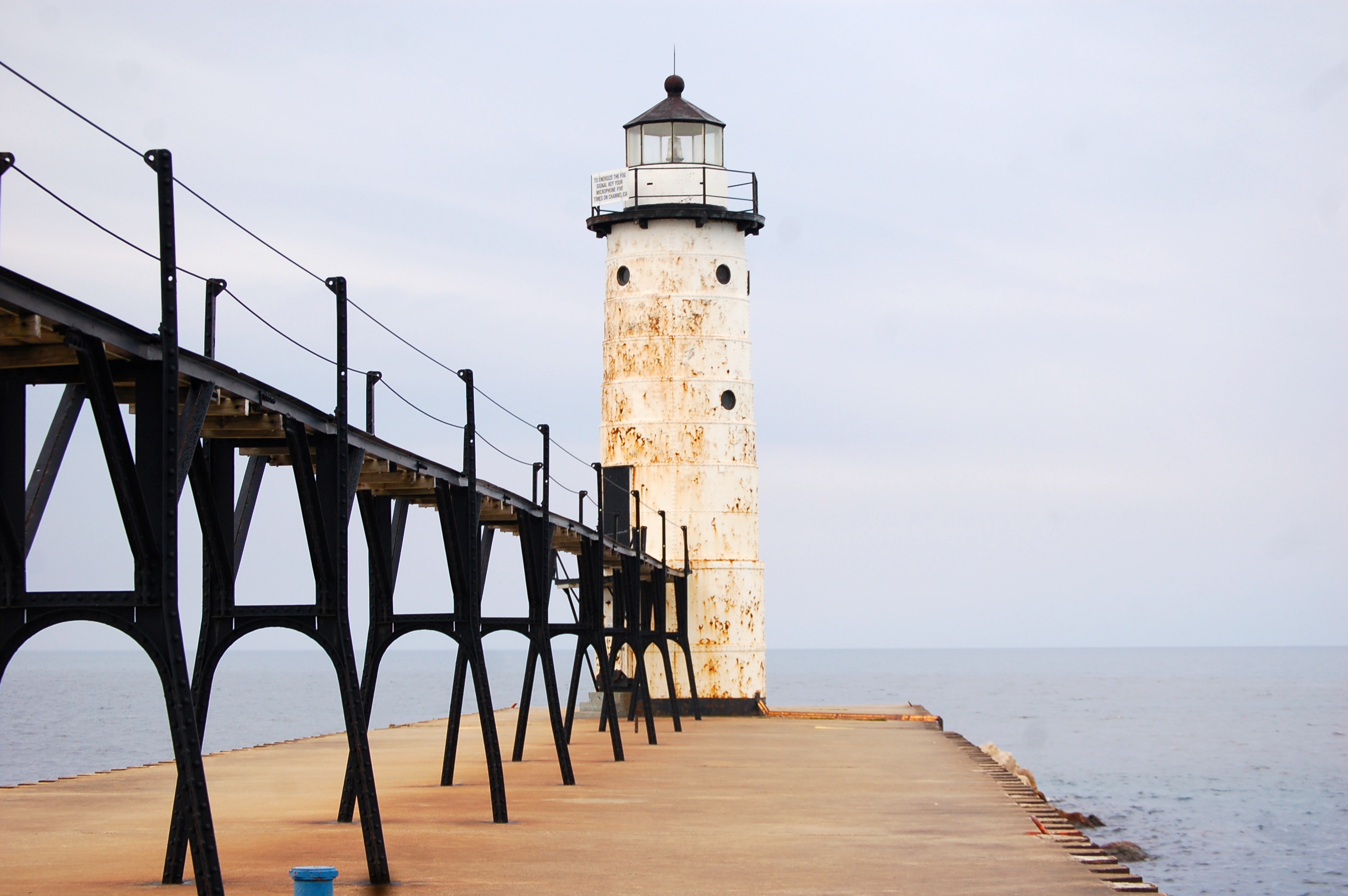
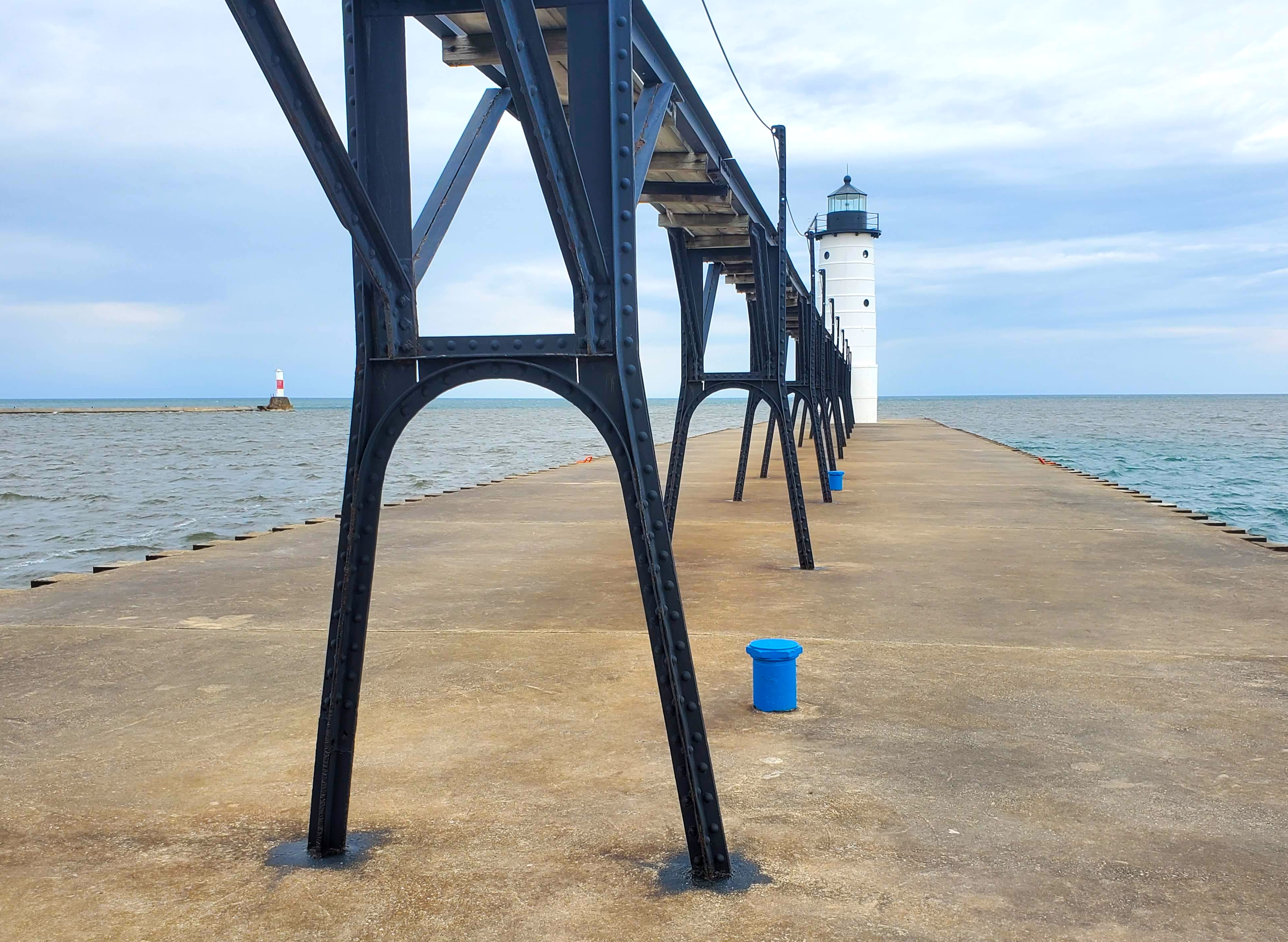
Manistee North Pier Lighthouse – Located at the end of a concrete pier that extends out a quarter mile, this cylindrical steel tower was constructed in 1927. Painted white with black trim and lantern room, it stands 38 feet tall. Its position on the pier gives it a focal height of 55 feet and its beacon can be seen for 12 nautical miles if the weather is clear. This is one of only four Michigan lighthouses with a surviving catwalk (Grand Haven, South Haven, St. Joseph) from the days when keepers had to avoid high waves while still making it out to the lighthouse. You can easily view and visit this lighthouse from Fifth Avenue Beach.
Some exciting news came out last year and we hope to hear more soon about it. The Sable Points Lighthouse Keepers Association is looking into the possibility of partnering with Manistee to get the lighthouse ready for public tours. The group currently does a great job of managing the Little Sable Point Light, Big Sable Point Lighthouse, White River Light Station, and Ludington North Breakwater Light and it would be awesome to get to climb the tower here in Manistee as this light’s 100th anniversary approaches.
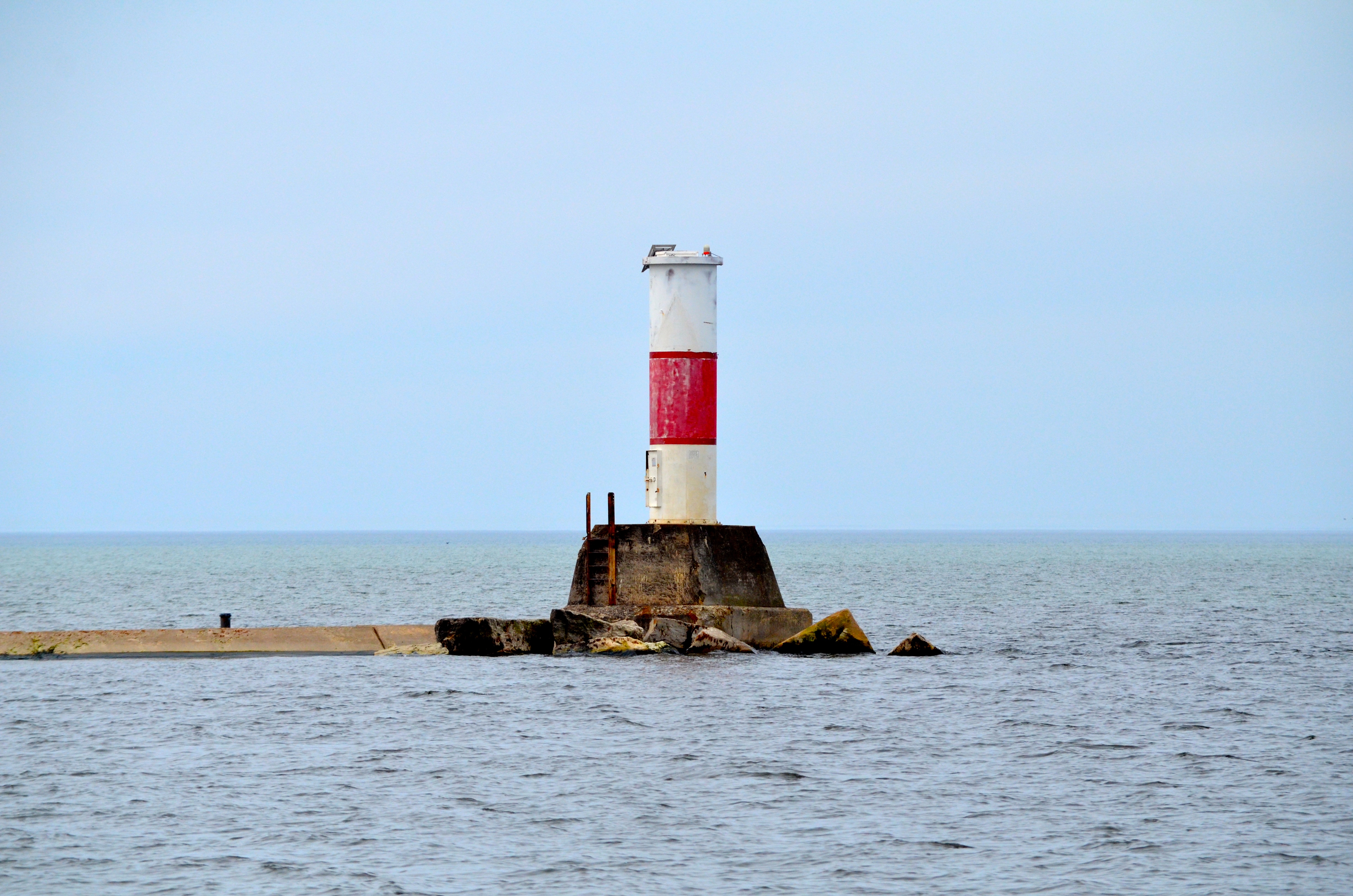
A small beacon sits on the south pier. It is a basic cylindrical tower painted white with a red stripe and it stands around 30 feet tall. Our best directions to the Manistee North Pier Lighthouse are: from US 31/Cleveland St. north of the river head west on Memorial Ave. which will become 5th Avenue. Follow 5th Avenue for several block, then head north on Monroe St. (at Red Szymarek Park). Follow Monroe to the roundabout, turning off on Lakeshore Dr. There is parking available at 5th Avenue beach as well as by the Coast Guard Station.
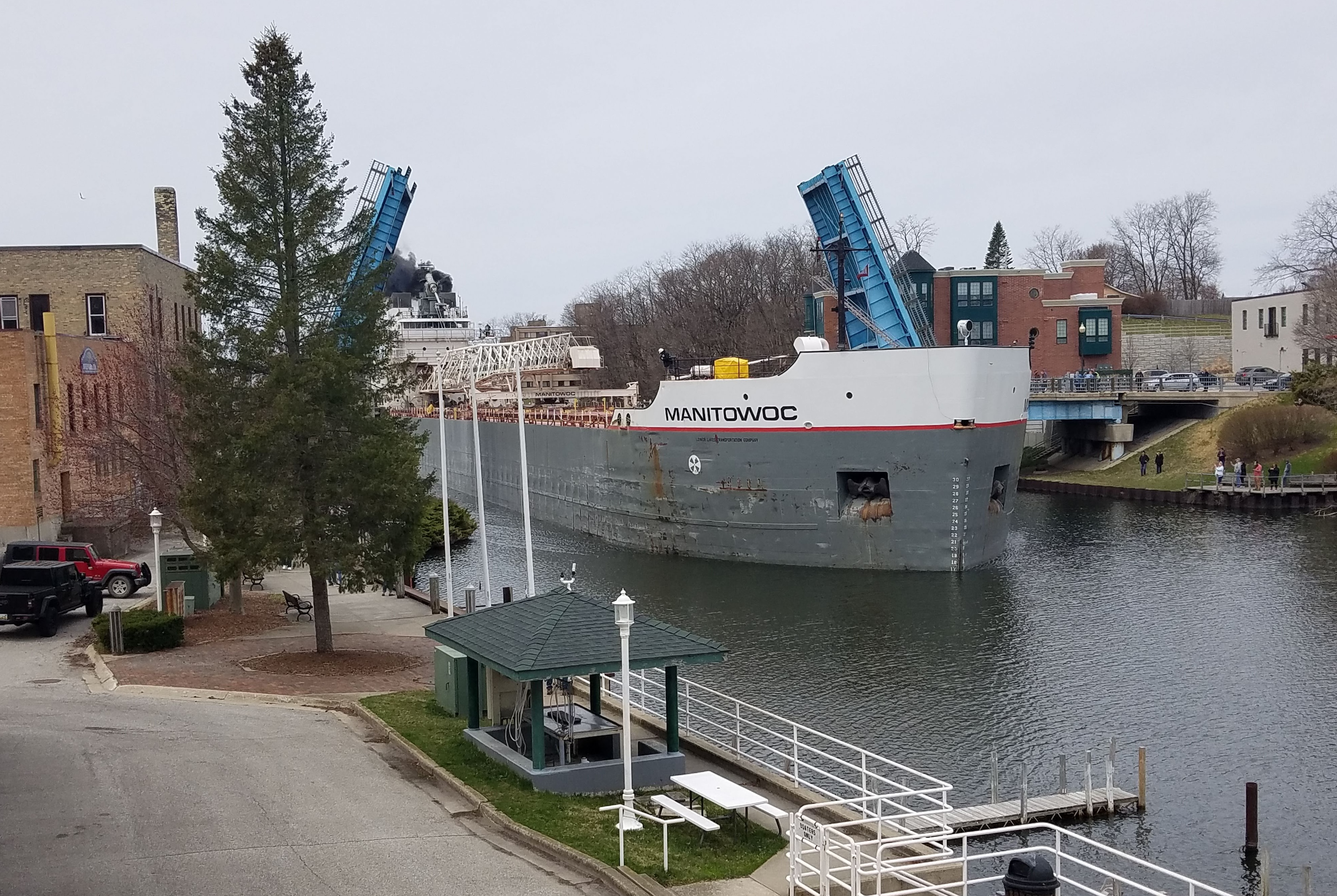
Manistee still sees a fair amount of freighter traffic and it is awesome to watch these large ships pass through downtown. We hope to one day get lucky and catch one arriving or departing at the lighthouse!
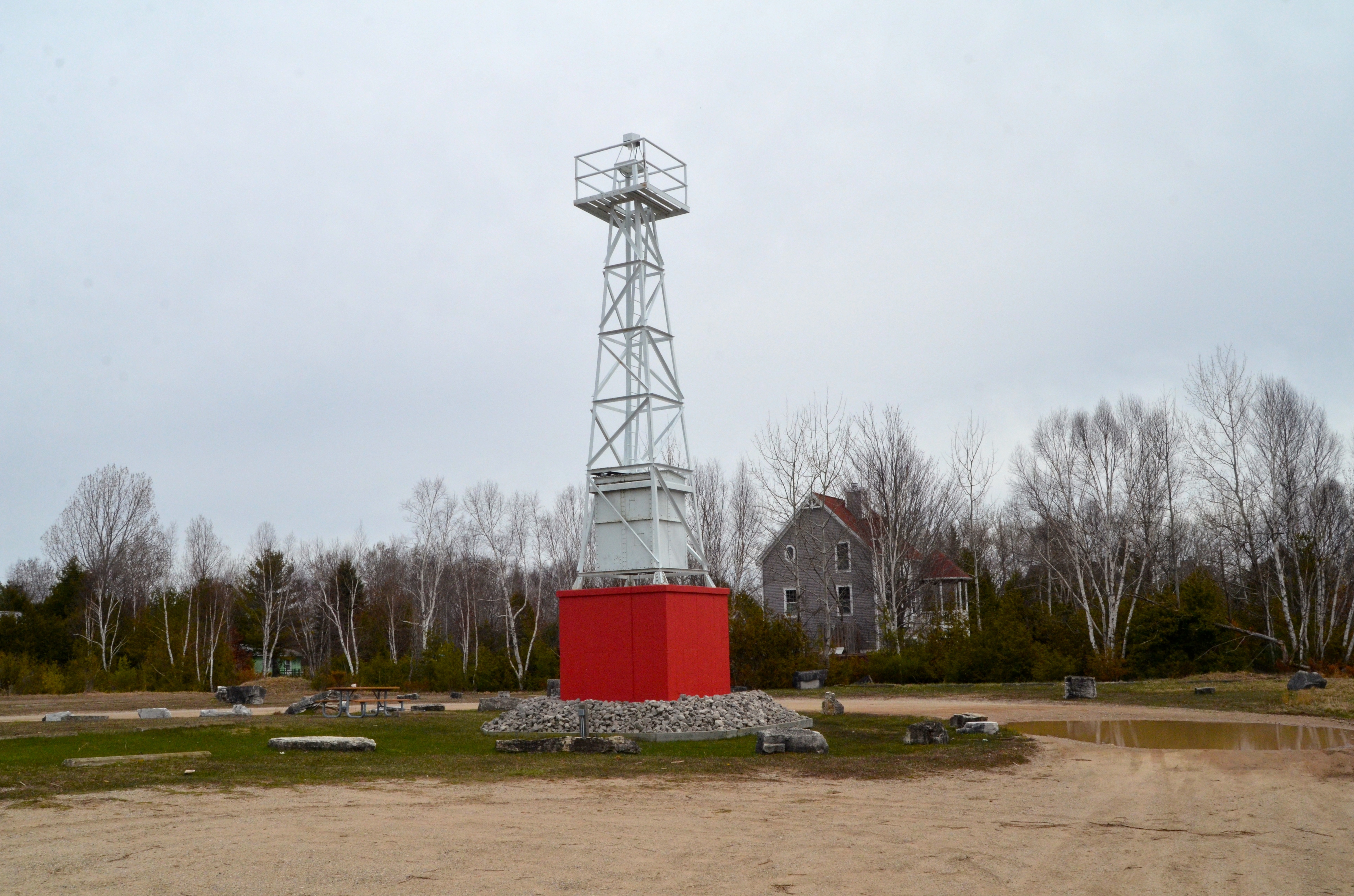
Bonus: Portage Lake Pierhead Light in Onekama – In Captain John Langland Park on the side of Portage Lake a metal plaque stands next to a historic light tower: “The first light at the channel was erected in 1891 at the head of the north pier. It was a wooden structured lighted with kerosene. Captain John Langland was the keeper of the light until 1917, when the wooden light was automated and lighted with acetylene gas. In 1930, the wooden structure was replaced with a steel skeleton tower, with a fuel bunker for its acetylene tanks at its base. The steel skeleton tower was removed in 1985 and replaced with a steel cylinder lighted by solar power. The 1930 light was acquired by the Voyager’s Cove Marina at 43 Arthur Street in Manistee, where it remained until 1997, when the Marina was demolished. The Portage Lake Association then purchased the light, sandblasted and painted it with primer, and stored it while some funds were raised and saved to erect it once more. With additional funding from Onekama Township and donations, the Township’s Portage Lake Harbor Commission, chaired by Jim Mrozinski, spearheaded the effort that led to the light’s erection on July 15, 2011, at the Michigan Natural Resources Launch Site, Lake Park and West Fairway, by Portage Lake.” To visit: from M-22 turn west on Portage Point Dr. for a little more than two miles. Turn left on Seymour Street, and follow it for a half mile to where it meets Lake Park Dr. Turn right on Lake Park Dr. and follow it past its intersection with W. Fairway St. to its end at the boat launch and the lighthouse.