Michigan Lighthouse Guide and Map: Luce County Lighthouses
There’s only one lighthouse in Luce County in Michigan’s Upper Peninsula, but it certainly deserves its own guide due to the adventure involved in reaching it. This has become one of our favorite lighthouses over the years in part due to how hard it was to finally get there. In the decades since our first visit the journey there has gotten a bit easier, and countless hours of restoration work by the extremely dedicated Crisp Point Light Historical Society have made sure this lighthouse will be around for many years to come. Visitors love the amazing views here as well as the solitude, and keep coming back year after year. Today, our lighthouse guide and map series heads to Luce County as we show you how to get to the Crisp Point Lighthouse.
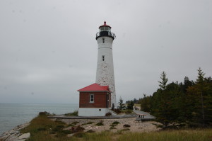
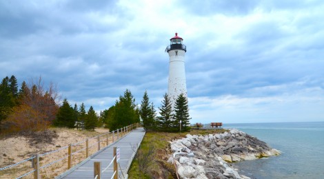
Crisp Point Lighthouse – The Crisp Point Lighthouse’s light was first displayed in 1904. This was the site of a U.S. Life Saving Station (precursor to the Coast Guard) and the lighthouse was added to mark a rough stretch of Lake Superior between Munising and Whitefish Point. The tower stands 58 feet tall and has a small building connected to it. Most of the original buildings were lost to erosion and neglect, and by the end of the 1990s we were in danger of losing the lighthouse as well. The Crisp Point Light Historical Society was formed in the late 1990s to help save this light, and one of their first tasks was to bring in rock to reinforce the shoreline.
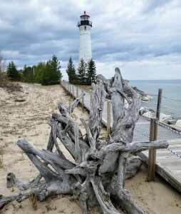
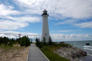
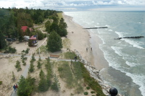
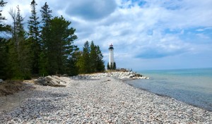
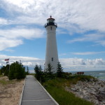
Visitors today will be impressed by the work that has been put in to fix up the tower, add boardwalks, and reinforce the shoreline. Volunteer keepers spend summer weeks here caring for the site and operating a small visitor center (gift shop, museums, restrooms). The views from the top of the tower here are incredible!
Now let’s take a look at how to get to the Crisp Point Lighthouse. A map is available online, and signs are posted at major intersections along the way. It is not recommended that you try to reach this site in a vehicle until after spring as the roads are typically in poor condition and people have gotten stuck along the way. From M-123 near Tahquamenon Falls State Park, head north on on CR-500. Stay on CR-500 past forks with several other roads until you reach the intersection with CR-412 about 12 miles in. Turn right on 412 and follow the many twists and turns as you get closer to the lake and the lighthouse (about another seven miles). This can take about an hour each way in a car or SUV. Drive careful, watch for other drivers, and be mindful of the active wildlife in this area (fox, deer, bear, moose).
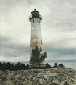
This is how the Crisp Point Light looked in 1997 when we finally reached it for the first time, below is what it looked like during our most recent visit in 2021! What a difference the hard work of a dedicated group of individuals can make!
We encourage anyone who feels up to it to make the visit to this marvelous Lake Superior lighthouse! Have you ever visited? Let us know in the comments section or on our Facebook page!

