10 More Michigan Abandoned Places and Ruins Worth Checking Out
Abandoned places and ruins continue to fascinate travelers, as they provide a window into the past as well as some amazing pictures. Many Michigan abandoned places and ruins sites are easy to find and visit, and we have been fortunate enough to have the chance to see many of them in person. While we are always looking to explore sites we haven’t yet been to, we decided to take a minute to highlight some of the amazing ones we have been to in this list. In January we shared our fist list of 10 Michigan Abandoned Places and Ruins Worth Checking Out and today we will share 10 More Michigan Abandoned Places and Ruins Worth Checking Out, sharing pictures from our visits and letting you know how you can visit too. When visiting any of these sites it is important to respect private property and to “leave nothing but footprints, take nothing but pictures.” We hope you enjoy this list and we hope to be back soon with a list of 10 more incredible sites.
Ahmeek Stamp Mill Ruins (Tamarack City) – It’s almost impossible to miss the ruins of the Ahmeek Stamp Mill as you drive through Tamarack City on M-26. Dating back to 1910 this stamp mill received rock from the mine and then pulverized it into sand. The sand was then processed to separate metal from the rock. Because of the need for water in this process, all of the stamp mills on the Keweenaw are located on the Lake Superior shore or on Torch Lake. We found Tamarack Park to be a great place to view these ruins from, be sure and obey all of the no trespassing signs posted here.
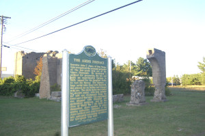
Ardis Furnace Ruins (Iron Mountain) From the Michigan historical marker at this site: “Inventor John T. Jones of Iron Mountain recognized the economic potential of the low-grade iron ore of the Upper Peninsula. He developed a method for processing the ore and built an experimental furnace in 1908, named for his daughter Ardis, to test his theory. The furnace, a huge metal tube lined with firebrick, was placed on an incline and charged with ore. The whole device was rotated with an electric motor, with iron suitable for mill use discharged from the lower end of the tube. The experiment was plagued with financial and mechanical problems, and by the end of World War I the Ardis was dismantled, Jones moving to other mining endeavors.” These ruins can easily be seen behind the Comfort Inn at 1565 N. Stephenson Ave.
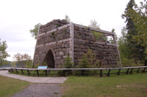
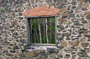
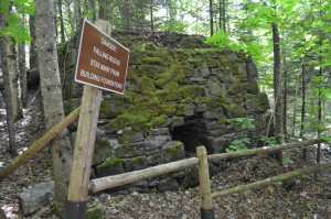
Bay Furnace Historical Site (Hiawatha National Forest) – On the Lake Superior shore just west of Munising, the Bay Furnace Company had a blast furnace for melting iron ore into pig iron in the 1860s and 1870s. A fire destroyed most of the complex, but the remaining ruins have been preserved and are surrounded by interpretive signage. A campground here has 50 rustic sites. Heading west from Munising, go about 5 miles and then look for the campground sign and drive on the right.
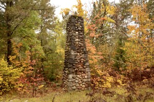
Camp Raco (Hiawatha National Forest) – A chimney and a few building foundations are all that remain of the former Civilian Conservation Corps (and later World War II POW) camp at Camp Raco. This was the first CC camp in the Upper Peninsula, and its workers are responsible for planting many of the forests you see when driving through there today. It was home to more than 250 German prisoners of war during World War II. You can explore this site by heading down USFS Rd 3154 (south of the intersection of M-28/Ranger Rd.) in Chippewa County.
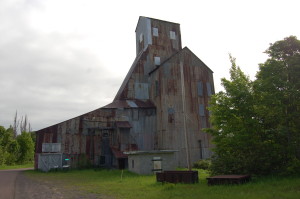
Champion Mine (Painesdale, Houghton County) – The Champion Mine operated in Painesdale for nearly 65 years, and many of its buildings (or parts of them) are still standing. We learned more about this site from a Western Upper Peninsula Heritage Trail sign: “Of the mines that ran from Atlantic Mine to Painesdale, the Champion #4 before you is the only headframe still standing; it is also the oldest shaft-rockhouse remaining in the Keweenaw. Unique in its design, the crushing floor is less automated than later types. It was built in 1902 and enlarged to its present form in 1906, times when hand labor and brute force moved mountains. The Champion #4 embodies the stories of thousands of men who passed through it as they headed to work in the mine below. It speaks of the men that lived and died blasting, tramming, hoisting, and crushing the copper rock that fed the area’s economy.” To reach Champion Mine, turn east onto Hubbard St. from M-26 just south of Painesdale. Follow Hubbard St. to the area around 2nd St. where the remaining structures will be visible.
Delaware Mine (Keweenaw County) – Another Keweenaw mine that is now open for tours, “the Delaware Mine is an authentic mine that operated from 1847 until 1887, during the country’s first major mining boom. The mine was supported by a group of investors, including Horace Greeley. Although the mine didn’t make any money for its investors, it now serves as the perfect example of what the mines in this area were like in the 1800’s. Visitors to the Delaware Mine walk down 100 feet of stairs through the #1 shaft to the first level of the mine, then walk approximately 1700 feet through the original workings to experience a self-guided tour. The length of time the tour takes depends on the visitors’ interest level. Above ground are trails taking visitors past the ruins of two original mine buildings, equipment displays, antique engines, trains and animals.” You will find Delaware Mine on U.S. 41 about 12 miles south of Copper Harbor.
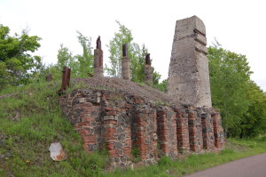
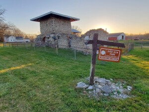
Dyer Kiln Ruins (Bellevue) – In Bellevue you can see the ruins of a kiln that produced limestone used in many sites across the state like the Capitol building in Lansing. “The park contains the remains of the third successful lime kiln to be operated in this area. The first was built west of the Dyer location along the Canadian National Railroad tracks by a Mr. Holden. A second was built east of this location on the same land that would later be used by Michigan Alkali and others in the processing of limestone. Of the three, the Dyer Kiln is the best preserved and the only site accessible by road. The Dyer Kiln was built in approximately 1880 and ran until 1899.” Just west of Bellevue on M-78, head south on Sand Rd. and you will see the ruins on the right side of the road in less than a mile.
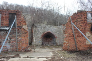
Frankfort Iron Works Ruins (Elberta) – You can’t go in and explore the ruins of the Frankfort Iron Works in Elberta, but you can get some pretty good views from the other side of a chain-link fence that has been put up to help preserve the site. “The first blast furnace of the Frankfort Ironworks fired up in South Frankfort on July 1, 1870. It had 22 kilns to provide charcoal as fuel for the furnace. The iron ore and limestone used for smelting was shipped in from Escanaba. Men worked 12-hour shifts and peak production was 40 tons of pig iron a day, destined for Detroit and Buffalo. In 1883 the ironworks ceased operation as more efficient methods of iron smelting were invented.” From M-22 coming from south of Elberta, head west on Frankfort Ave. and follow signs for Waterfront Park. There is plenty of parking here and the ruins are visible from the parking lot.
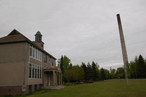
Mohawk Stamp Mill Ruins and Gay Schoolhouse (Gay) – A sign that said “Mohawk Stamp Mill 1900-1932) caught our attention while driving in the area one year, so we stopped to check the site out. This mill once featured three sets of stamps and three crushing rolls, which could produce 500 tons each day. The Mohawk Mill was one of the more profitable during the Keweenaw copper boom, and it was able to pay a dividend for 15 consecutive years. It reached a maximum output of more than 20 million pounds at its peak productivity. Houses and other buildings sprang up around the mill, including a schoolhouse. The town was named for Joseph E. Gay, who was once president of the mining company. The schoolhouse is located at the corner of Lake and Main in Gay, you will be able to see the smokestack that towers over the ruins from there. To get to Gay from M-26/U.S. 41 head southeast on Mohawk-Gay Rd. for about 12 miles.
Nonesuch Mine Ruins (Porcupine Mountains Wilderness State Park) – It’s not often that you can visit some ruins and see a waterfall at the same time, but you can when you visit the site of the Nonesuch Mine in Porcupine Mountains Wilderness State Park. The Nonesuch Mine got its name for the unusual copper that was found there in the sandstone and shale; “none such” ore had been found anywhere else in the U.P. The mine operated from the late 1860s to the early 1910s, but was only profitable for a few years of that time. As many as 300 people once called Nonesuch home, and while little remains of the town there are several mine structures still somewhat intact. The parking area is located off of South Boundary Rd., roughly four miles south of the visitor center and M-107. The hike back to the ruins is between 1/2 and 3/4 of a mile.

