
Sturgeon Falls – A Waterfall in the Sturgeon River Gorge Wilderness
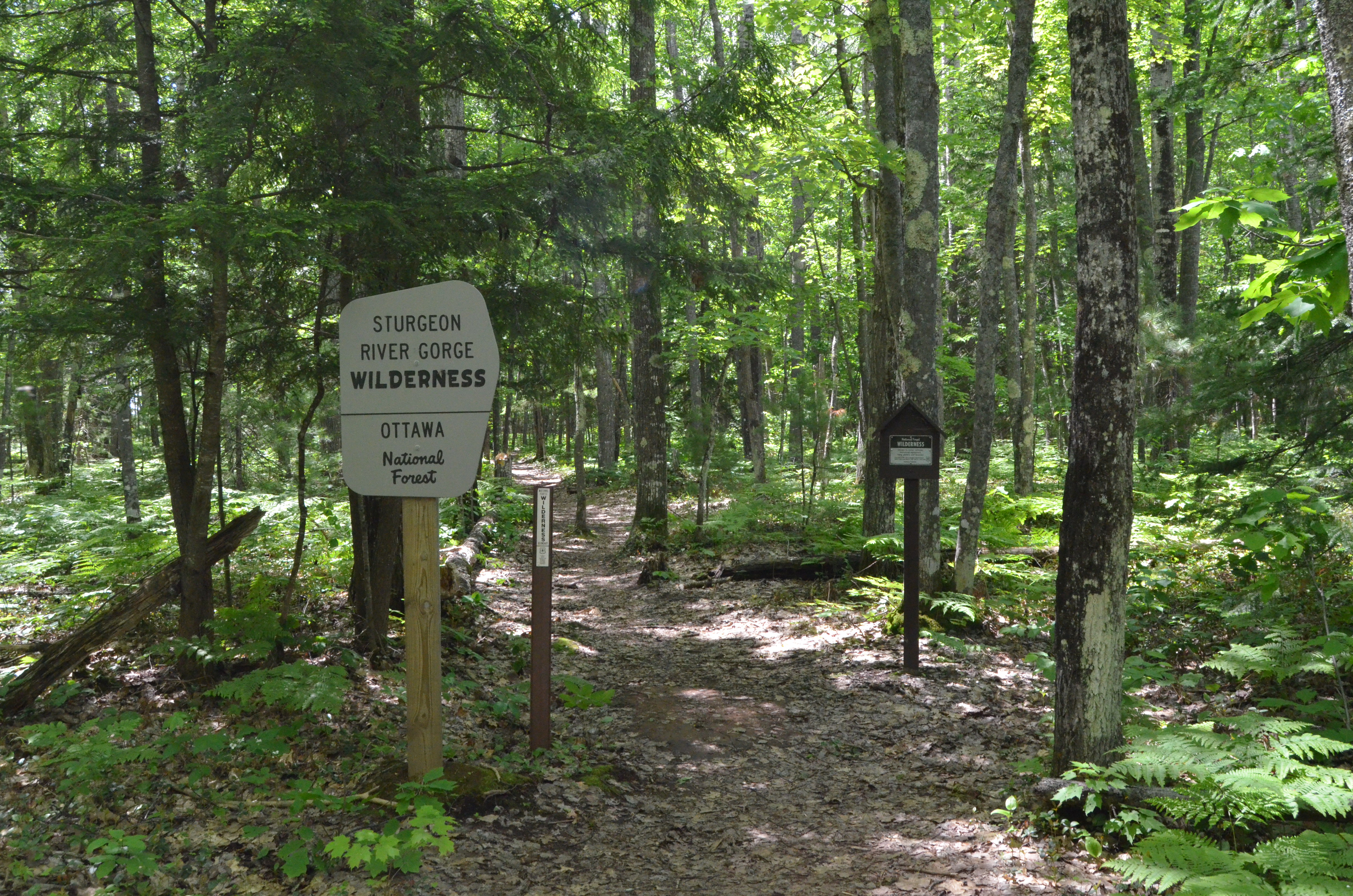
The Sturgeon River Gorge Wilderness in Michigan’s Upper Peninsula is a unit of the Ottawa National Forest that covers more than 14,000 acres, including the wild and scenic Sturgeon River, the Sturgeon River Gorge, and the mighty Sturgeon Falls. Reaching this 25 foot tall waterfall requires a little bit of back road driving and a semi-strenuous 3/4-mile hike, but the reward of having a remote, roaring waterfall all to yourself makes it all worthwhile.
The Sturgeon River is 106 miles long, and it winds through Baraga County and Houghton County before emptying into Portage Lake near Chassell. Other notable stops on or near the river are Canyon Falls, Sturgeon River Sloughs Wildlife Area, the Hanka Homestead Museum, and the Copper Country State Forest.
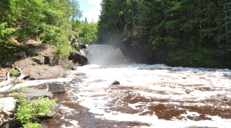
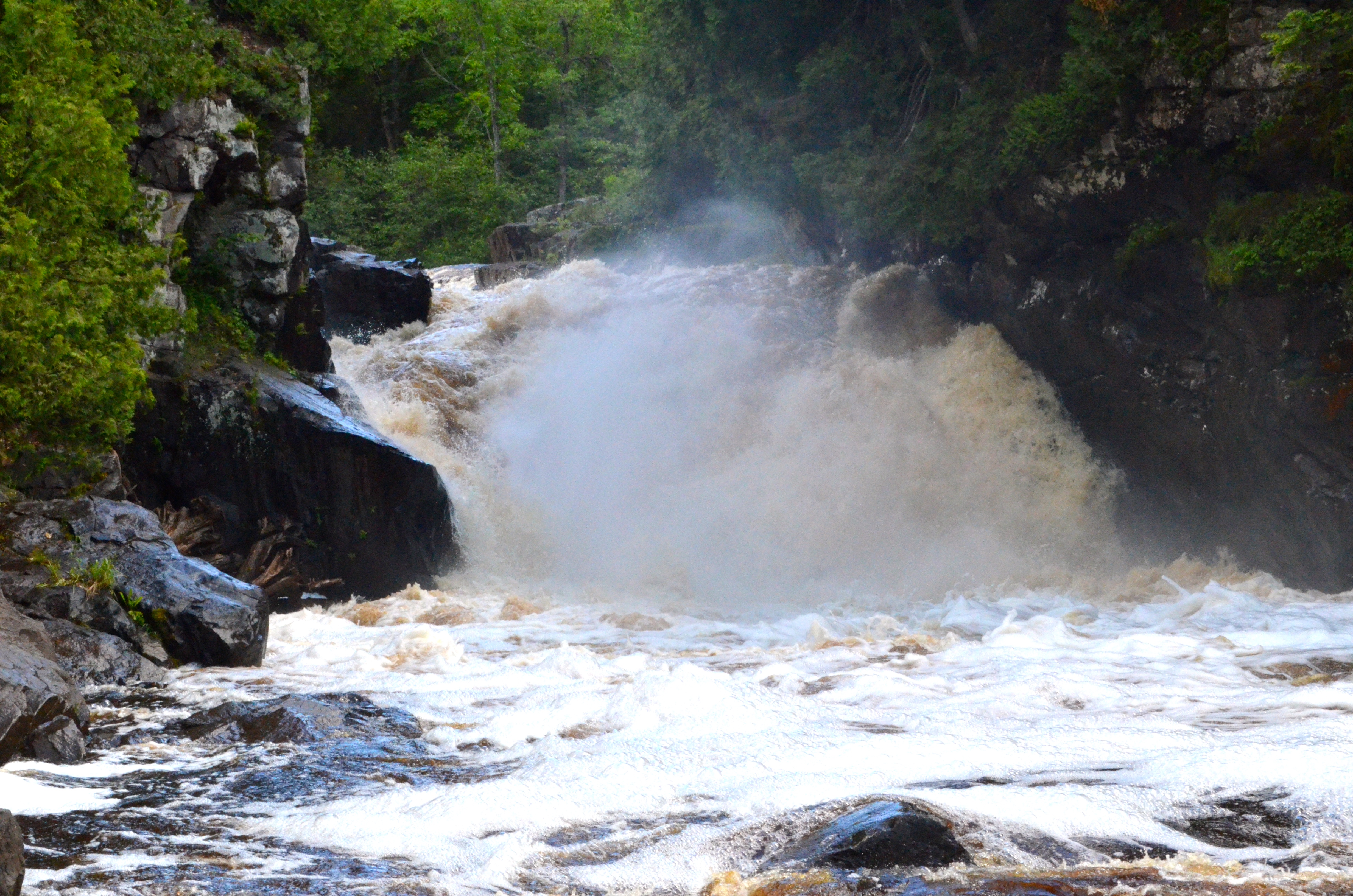
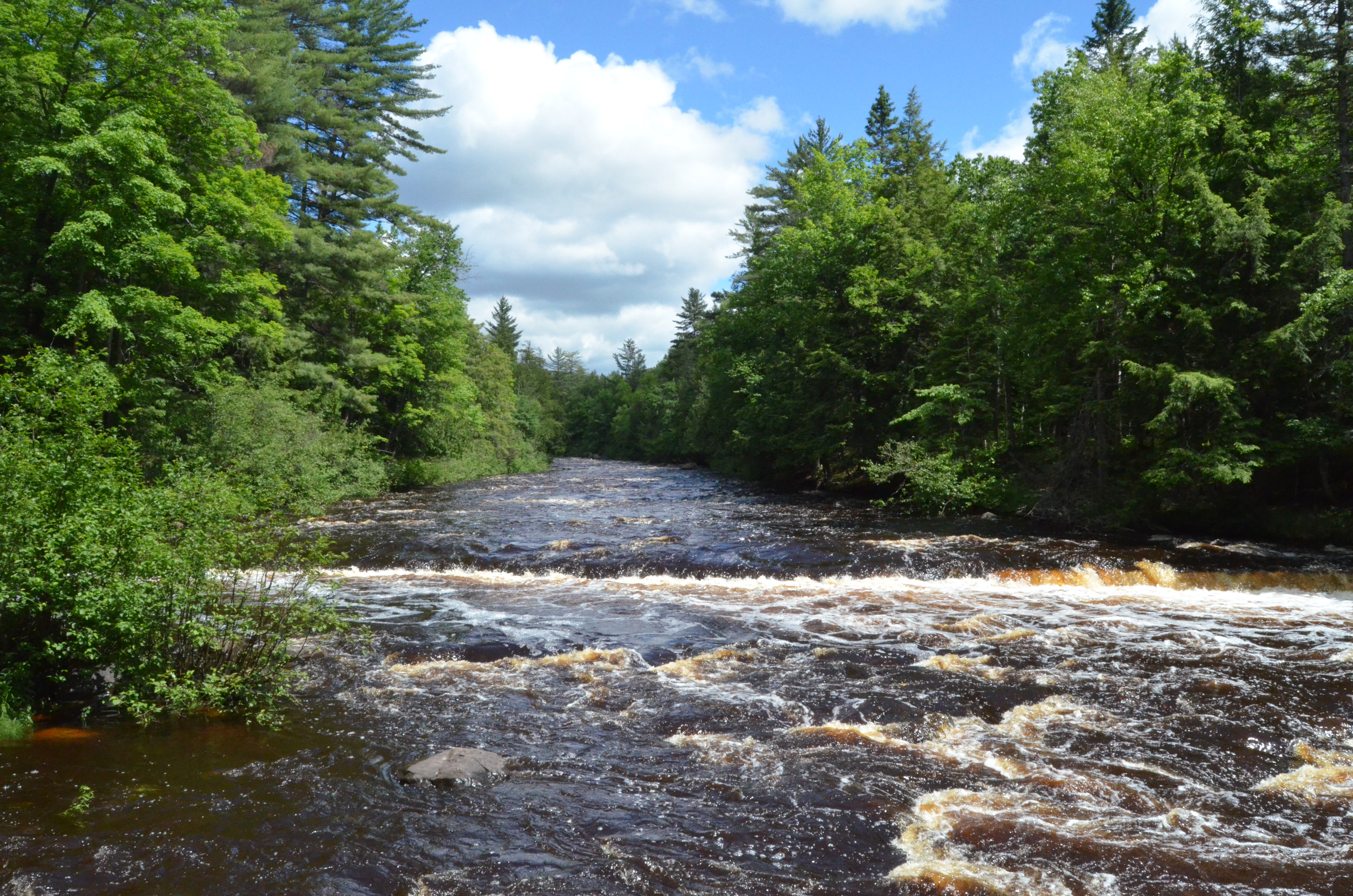
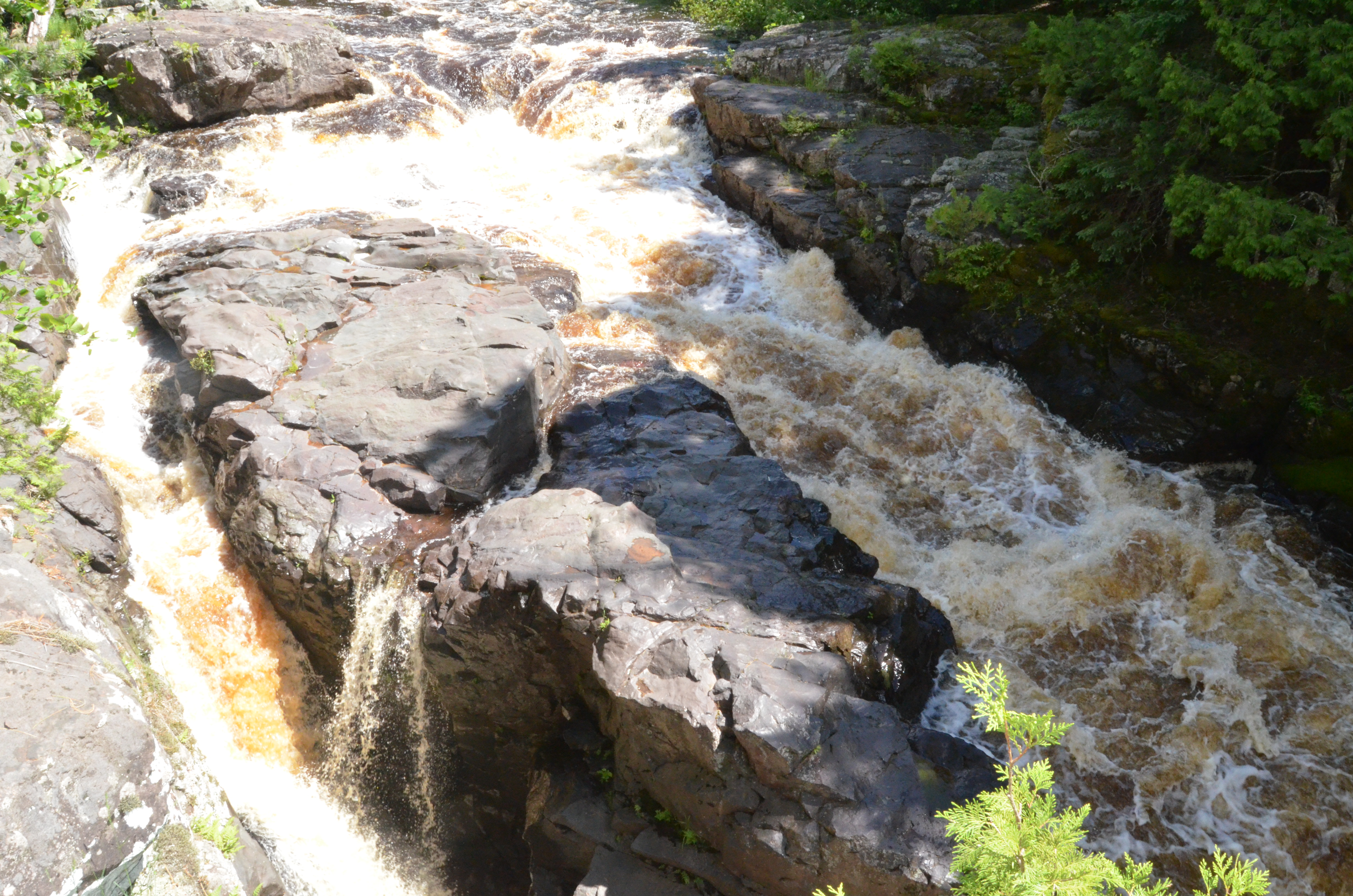
The hike to the falls starts out flat before making a descent into the gorge. The trail is well-maintained for its entire length, and other than a few steep sections it will pose few challenges for the average hiker. The trail ends above Sturgeon Falls where you have a close up view of the river being squeezed down to 20 feet wide after being up to 100 feet wide upstream. Shown below is a photo of the upper rapids/falls where the river is much wider; second photo is of the upper section of Sturgeon Falls.
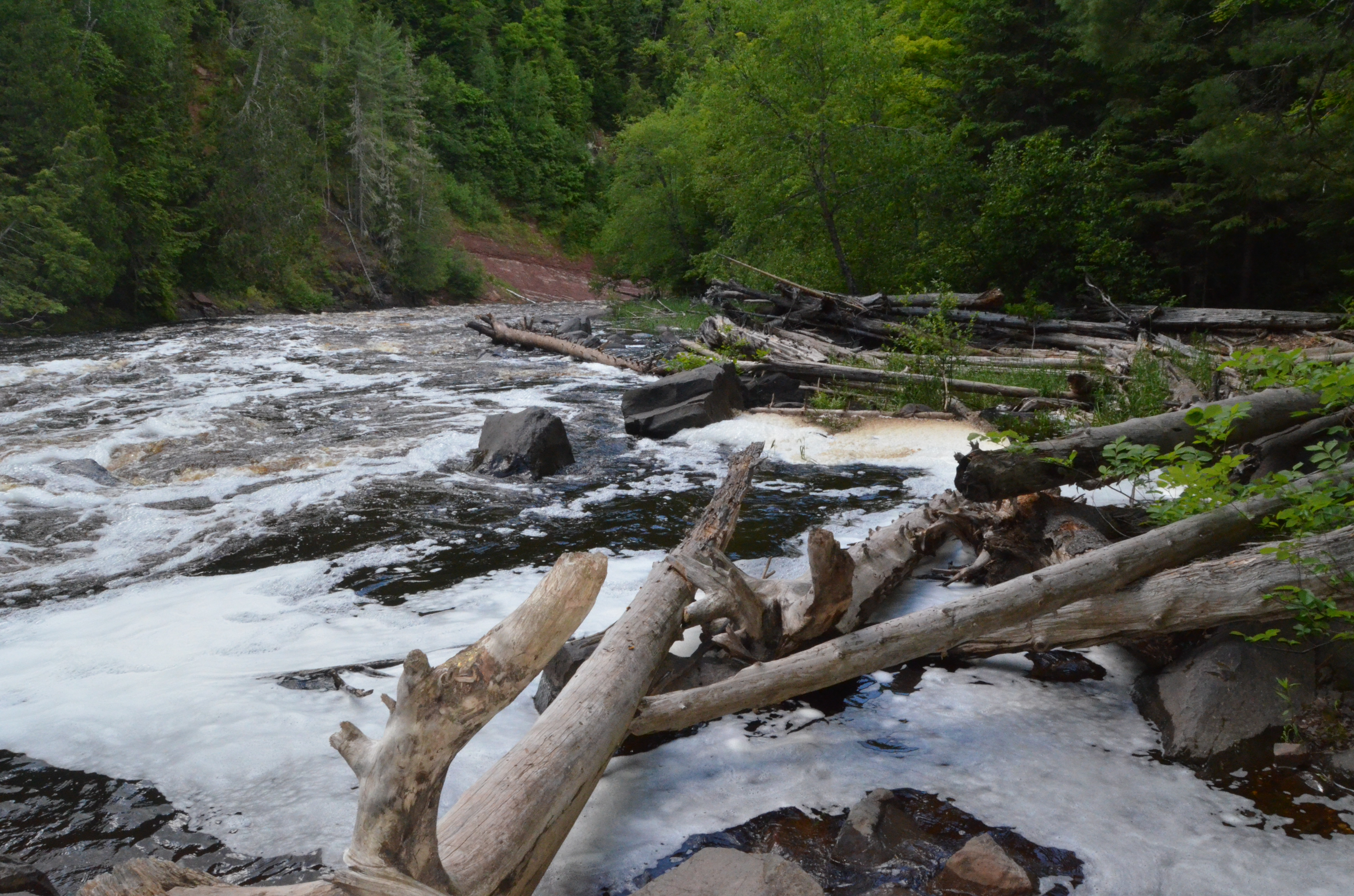
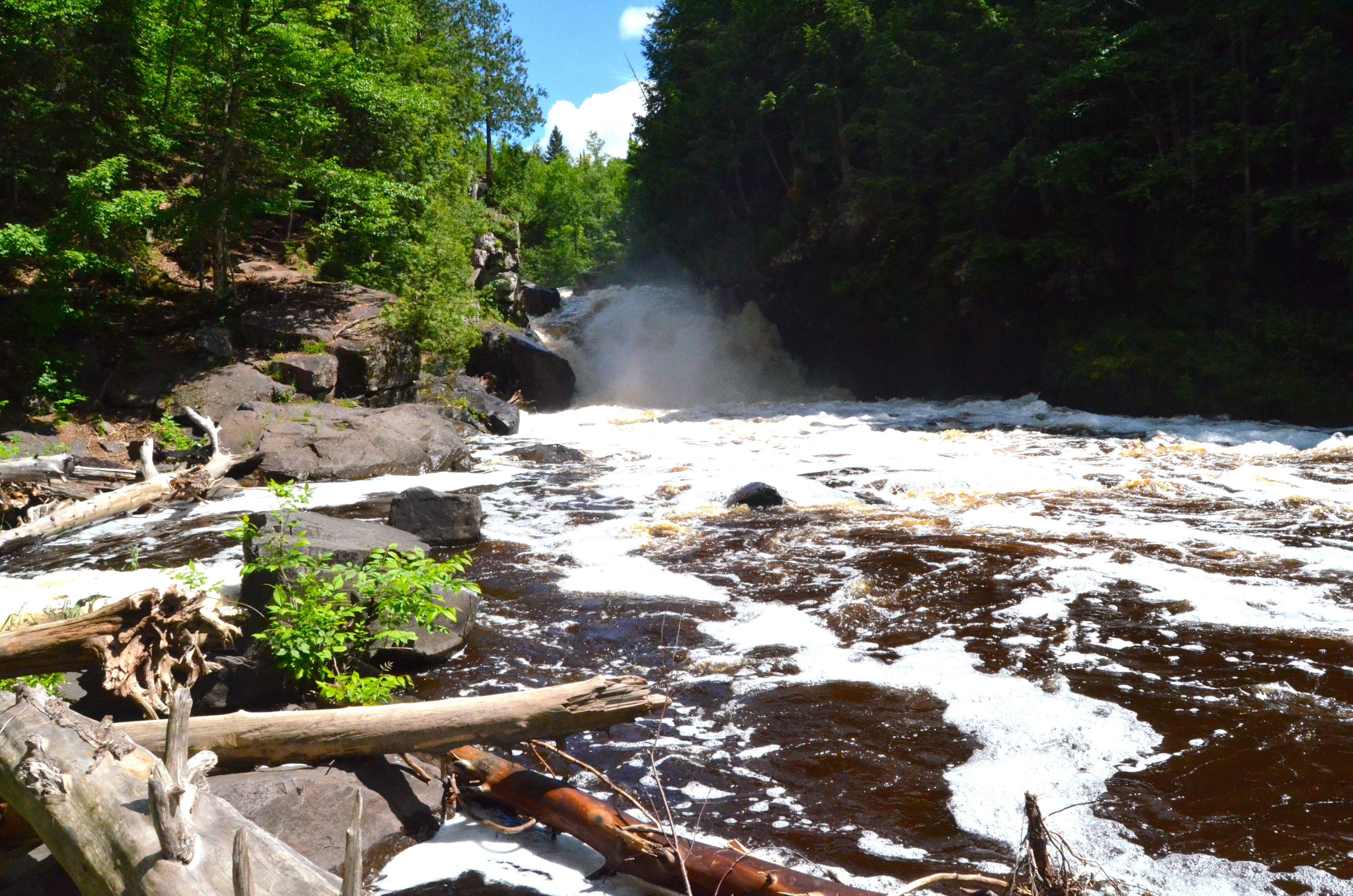
There are more chances to get good views of Sturgeon Falls, we followed the path downstream for another hundred feet or so to a clearing with the view seen below. This is a wild and undeveloped area, so use appropriate caution as there are no fences or handrails near the falls and river.
To get to the parking area for the Sturgeon Falls trailhead, take M-38 west of Baraga for about 15 miles, then turn south on Prickett Dam Rd. (marked with a brown DNR sign for Silver Mountain and the falls) Follow Prickett Dam Rd. and signs for Silver Mountain for roughly eight miles. When the road to Silver Mountain branches off to the right, stay left for another four miles (crossing a bridge over the river at one mile). The parking area will be on the left, while the trail starts on the opposite side of the road. While this is a lot of back road driving, the road is in good shape and navigable with a normal car. From the parking area follow the trail for 3/4 mile to the falls.
Some of our favorite falls in the Baraga area include Slate River Falls, Falls River Falls, Black Slate Falls and Quartzite Falls, Powerhouse and Power Dam Falls, Big Eric’s Falls, and Silver Falls.