
Schweitzer Falls – A Marquette County Waterfall That’s Worth The Extra Effort
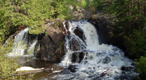
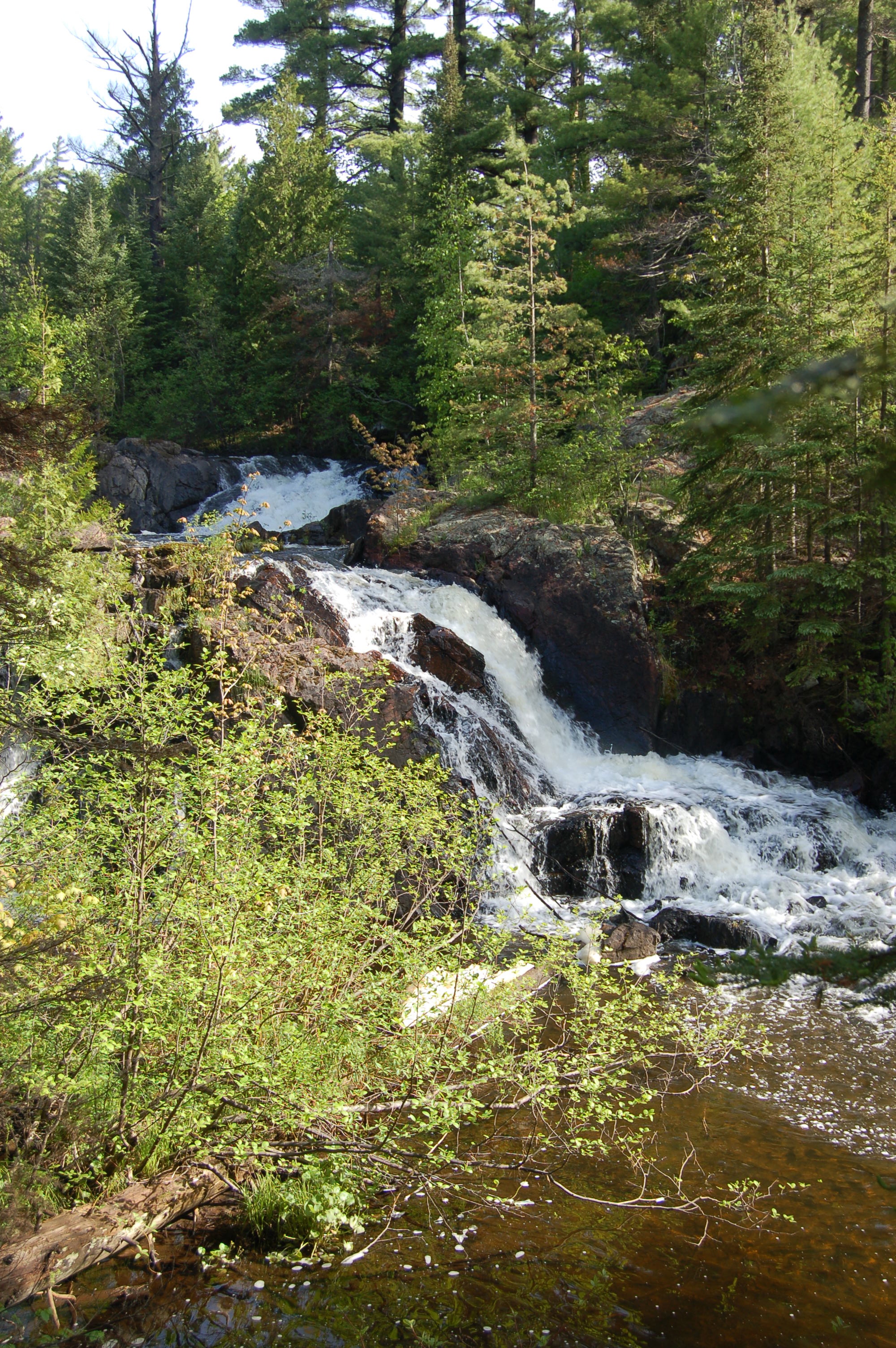
Marquette County in Michigan’s Upper Peninsula is home to a variety of stunning waterfalls, and while some are easy to get to like our recently profiled Warner Falls, others like Schweitzer Falls can be a bit more challenging to get to. Those who do make the trek back to this wild waterfall will be treated to great views of a 20 foot drop (in two sections) on Schweitzer Creek that is surrounded by thick woods.
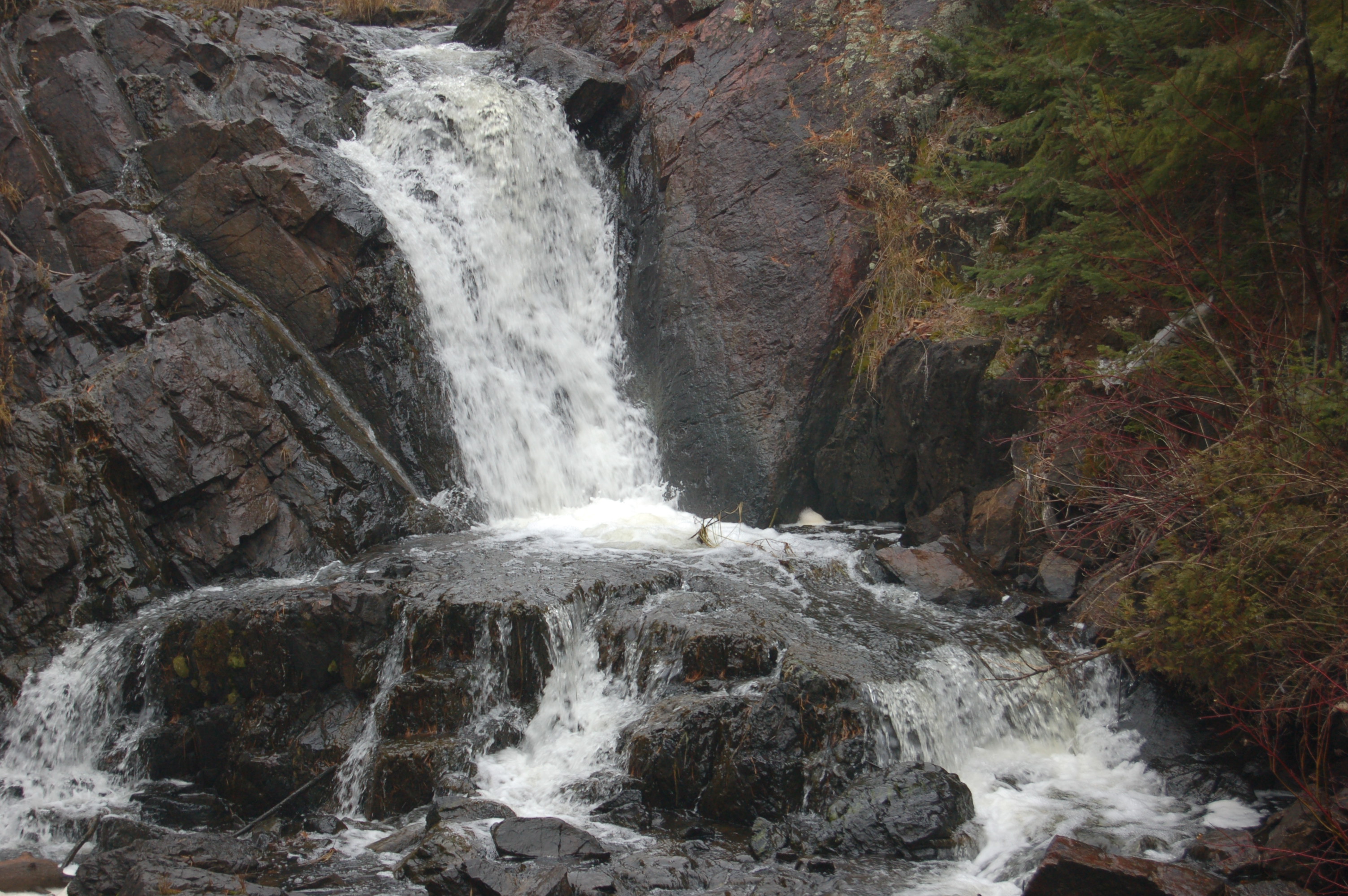
We first made a trip here in the fall of 2008, bushwhacking our way through the woods while following the sound of the creek and the falls. The result was the view seen above this paragraph, the lower drop here at a fairly low flow time. On our recent trip to the Upper Peninsula, we returned to Schweitzer Falls and found a manageable trail with easier access and were treated to a much more rewarding view.
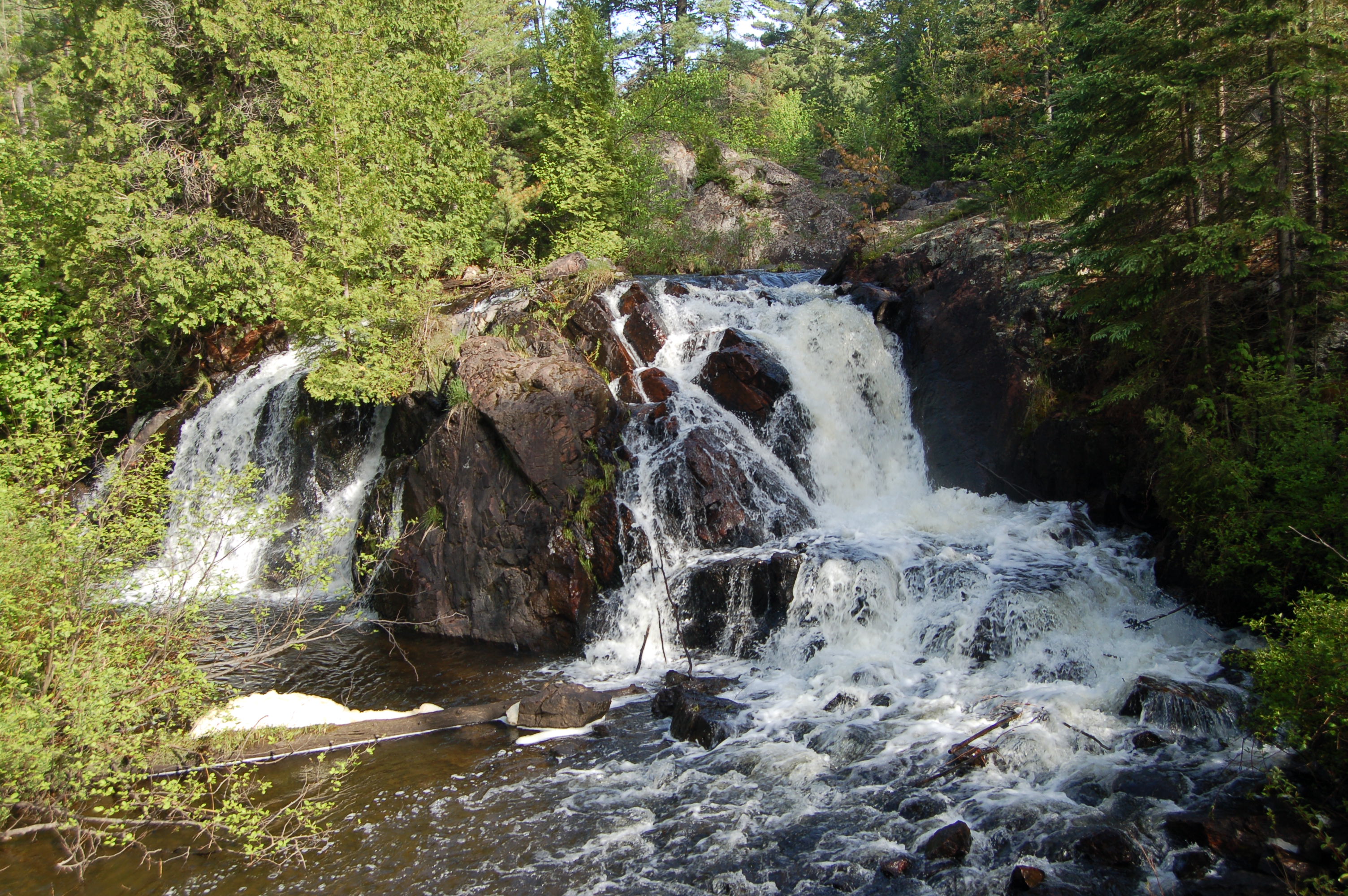
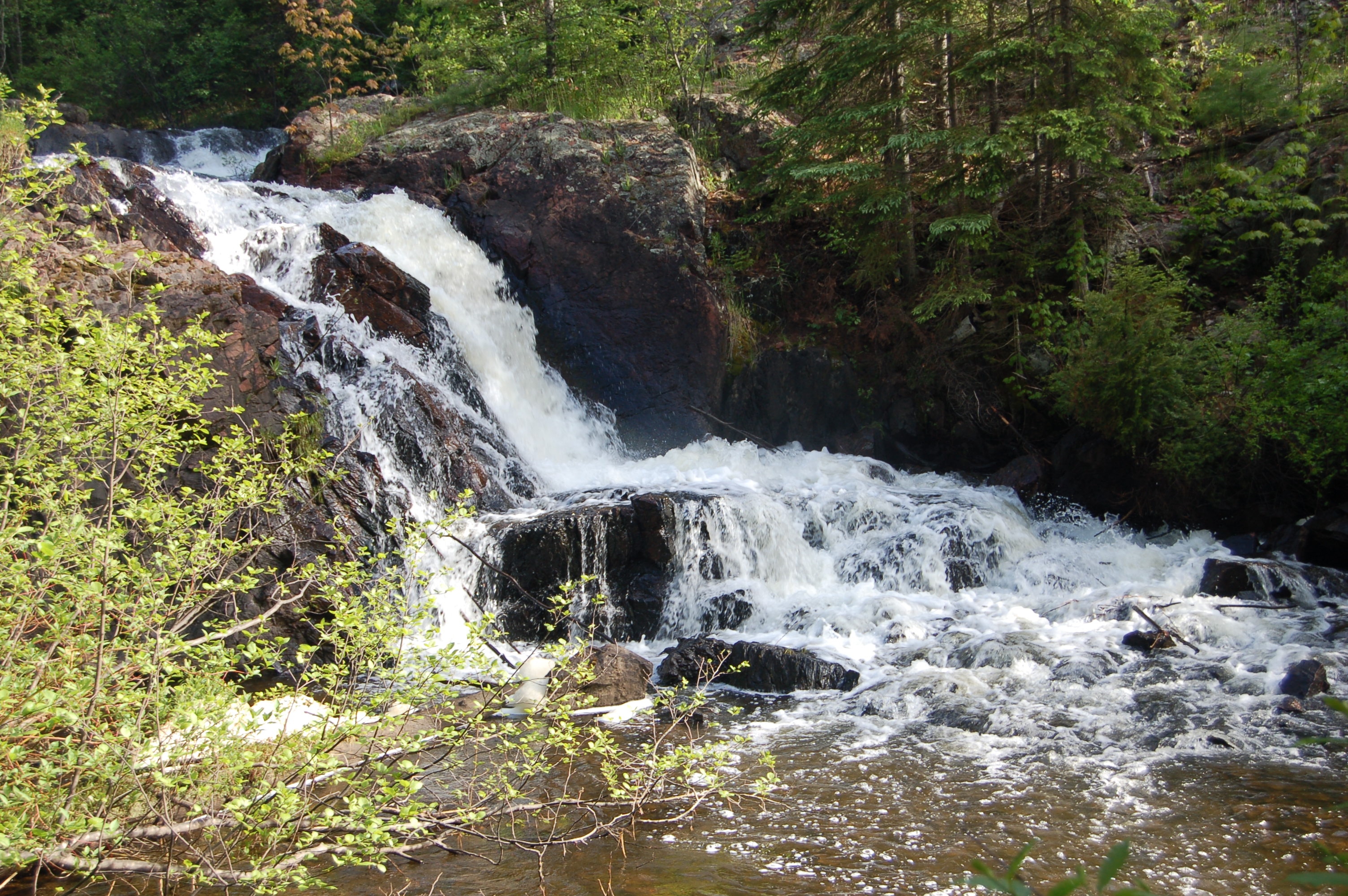
It definitely appears better to visit this waterfalls in the spring or early summer, as we found much better conditions on our second visit. The lower, and larger, drop had fanned out into two sections – a drop of 10-12 feet and 20-30 feet wide. The trade off here seems to be that when water levels are better the woods are more overgrown and access is tougher, while in the fall the water level tends to be lower but with easier access and better sight lines. The upper falls, seen in the photo below, is a drop of 4-5 feet as the creek gets squeezed between the rock on its way downstream.
Directions: Take M-35 south from Marquette, and watch for CR-565 after passing through the small village of Palmer. Take 565 to the southwest (right turn) and follow it to its intersection with CR-476. Take a left to stay on 565, and proceed another 1.5 miles to a bridge over Schweitzer Creek. Just after crossing the creek there is a two-track on the right side of the road. We found it easiest to pull in there then walk that two track to a point where it takes a sharp left turn at the top of a hill – take the faint path to the right instead, following the sound of the creek and the falls, it is around a 1/4 mile hike in total.