
The New Michigan Shipwreck Map and App Will Make You Want to Dive Into the Great Lakes

Michigan Department of Natural Resources
On Monday, January 13 the Michigan DNR announced that the Michigan Shipwrecks Story Map has launched, providing information about hundreds of shipwrecks along our Great Lakes coastline. The Michigan Shipwrecks Public Web App “goes even further, offering users a closer look at shipwrecks as well as the locations of lighthouses and boating access sites. Users can search for shipwrecks by name or location or customize and print their own PDF maps.” In addition to helping those who already dive these underwater historic sites, these new tools will help those venturing out with kayaks or snorkeling equipment to know the difficulty of reaching each wreck as well as a precise location. Head over to Michigan.gov/ExploreShipwrecks to see the Michigan Shipwreck Map and App, and start planning some Great Lakes excursions for the summer months!

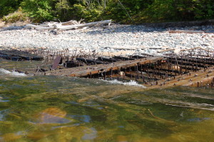
kayaking over a shipwreck on Lake Superior near Au Sable Point in Pictured Rocks National Lakeshore
In our Michigan travels we’ve been able to see several shipwrecks that protrude out on the shoreline at sites like the Forty Mile Point Lighthouse on Lake Huron or Au Sable Point Light Station (Pictured Rocks National Lakeshore) on Lake Superior. Seeing how well-preserved the Munising-area shipwrecks in deeper Lake Superior water are has also been a highlight of our trips with Glass Bottom Shipwreck Tours. The NOAA Great Lakes Maritime Heritage Center is another great spot to check out for shipwreck information, history, models, and more.
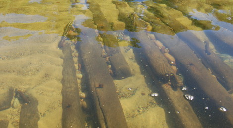
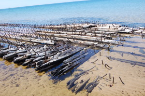
shipwreck view from Glass Bottom Boat Tour, Munising
The Web App allows users to not only find shipwrecks but also identify lighthouses and boat launch facilities nearby, as well as the ability to search for specific shipwrecks. The ability to download data and make customized PDF maps are a few of the other highlights – and this will all continue to get better as more wrecks are identified and added.
Many notable wrecks can be found in Michigan’s 13 Underwater Preserves. These protected sites include Keweenaw, Marquette, Alger, Whitefish Point, DeTour Passage, and Straits of Mackinac in the Upper Peninsula and Thunder Bay (National Marine Sanctuary), Grand Traverse Bay, Manitou Passage, Thumb Area, Sanilac Shores, West Michigan, and Southwest Michigan in the Lower Peninsula.
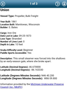
Information provided in the app about each shipwreck (when available) includes the year it was built, who built it, and where it was built. The cargo it was hauling, the date it sank, how it sank, number of lives lost, and how many feet of water it lies in are also included. Two of the most important things included are the difficulty level for diving (beginner, intermediate, advanced) and if it is water sports (kayak, etc.) accessible. As more and more people take to the Great Lakes in kayaks each year, knowing which shipwrecks are visible without diving below the surface has become very popular. The latitude and longitude of each shipwreck’s location is also provided in the app.
It is important to note that each shipwreck is legally protected and visitors are not allowed to disturb them or remove any items. The phrase “take nothing but pictures, leave nothing but bubbles” is used by many preservation organizations the same way that “take nothing but pictures, leave nothing but footprints” is used at state parks and other historic sites on the mainland.
For more information:
Michigan.gov/ExploreShipwrecks
http://www.michiganpreserves.org/