
Michigan Bucket List: Waterfalls
Michigan is home to more than 200 waterfalls, and all but one are found in the Upper Peninsula. Some of these cascades are small and in areas that see minimal visitors, while others are large and stunning drops that are visitor friendly and/or located in state parks. As temperatures turn warmer heading into the spring, the best time to view many of these waterfalls is either already here or will soon be here. The Upper Peninsula remains a popular vacation destination, and these stunning waterfalls are a big draw. Michigan bucket lists continue to be popular, and we put together a list of 25 waterfalls that we consider absolute must-sees. Each waterfall listed links back to a previous post with full directions and more information. For this list, we tried to limit things to waterfalls that were not only impressive, but generally easy to access for just about everyone as well. We hope you enjoy our first bucket list collection, and look for more to come in the next few months. Here it is, Michigan Bucket List: Waterfalls.
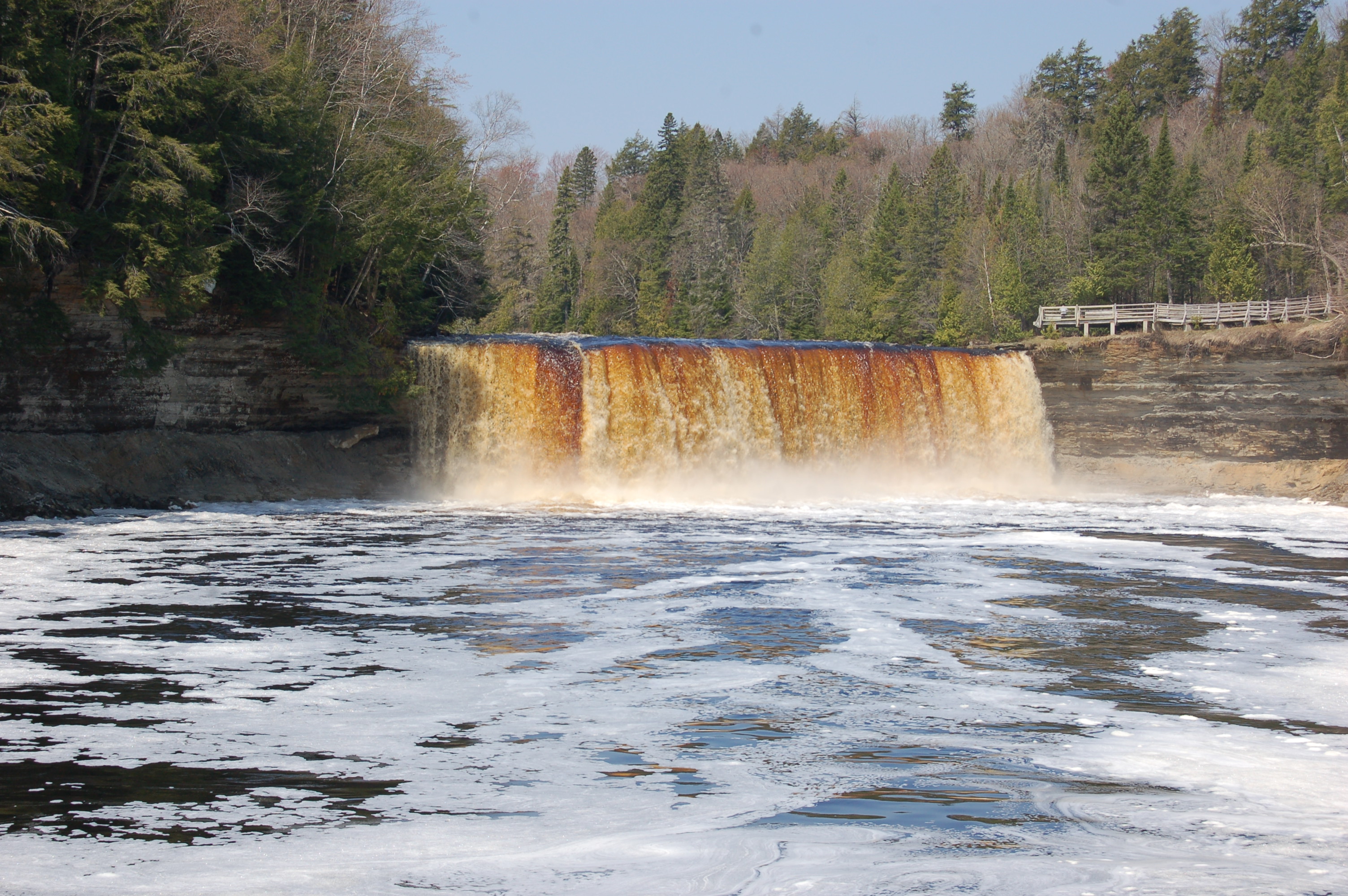
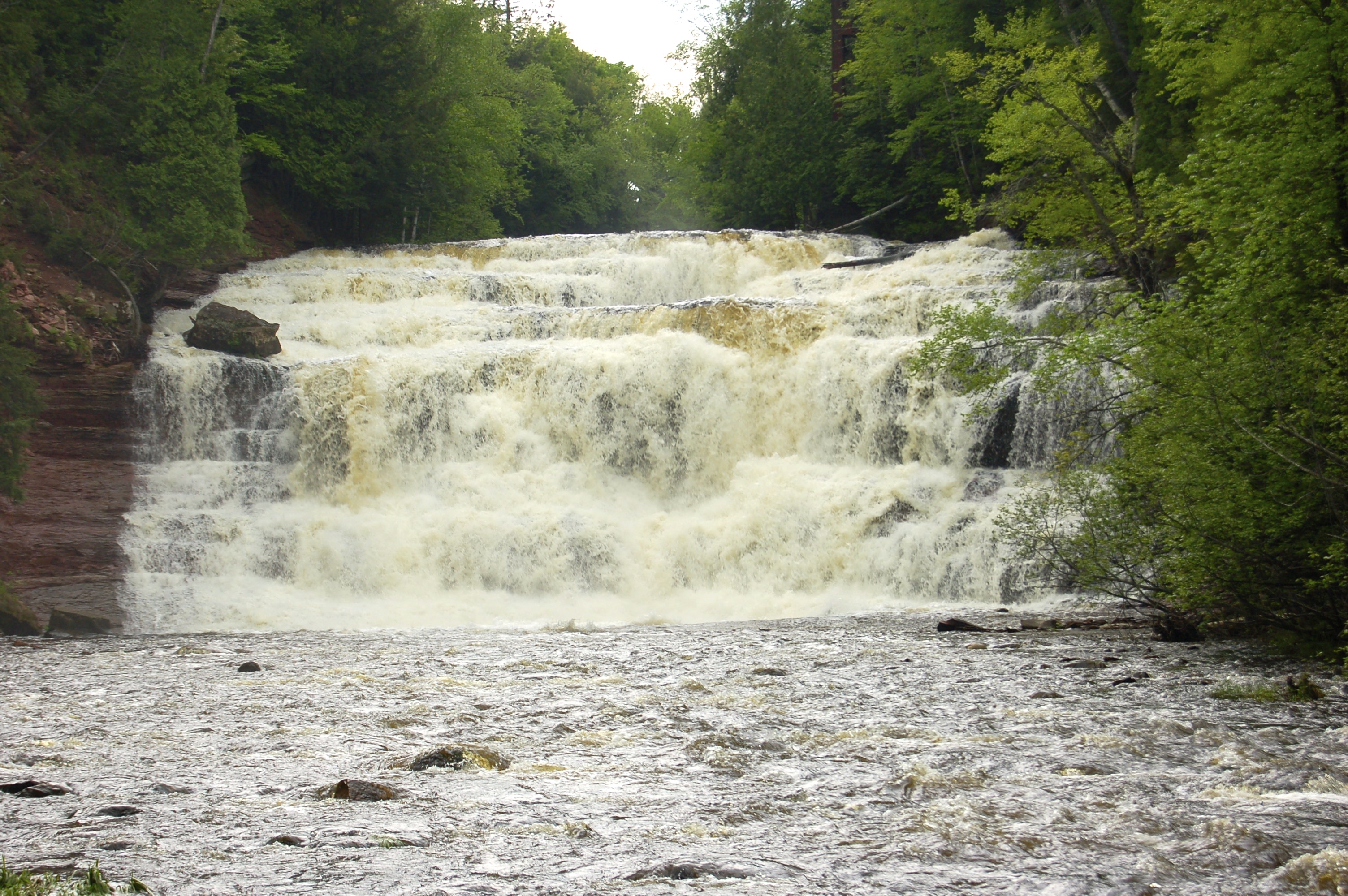
Tahquamenon Falls – The Upper Falls on the Tahquamenon River is the state’s largest waterfall at a width of 200 feet and a height of 48 feet. Access is easy in Tahquamenon Falls State Park via a paved walking path and stairs that lead to the brink. The Lower Falls are a set of five drops around an island in the river, and the park offers rowboats for a small fee so visitors can experience them up close. A paved path turns into a boardwalk and leads to several viewing areas alongside the river. Park headquarters are located at 41382 W. M 123 in Paradise.
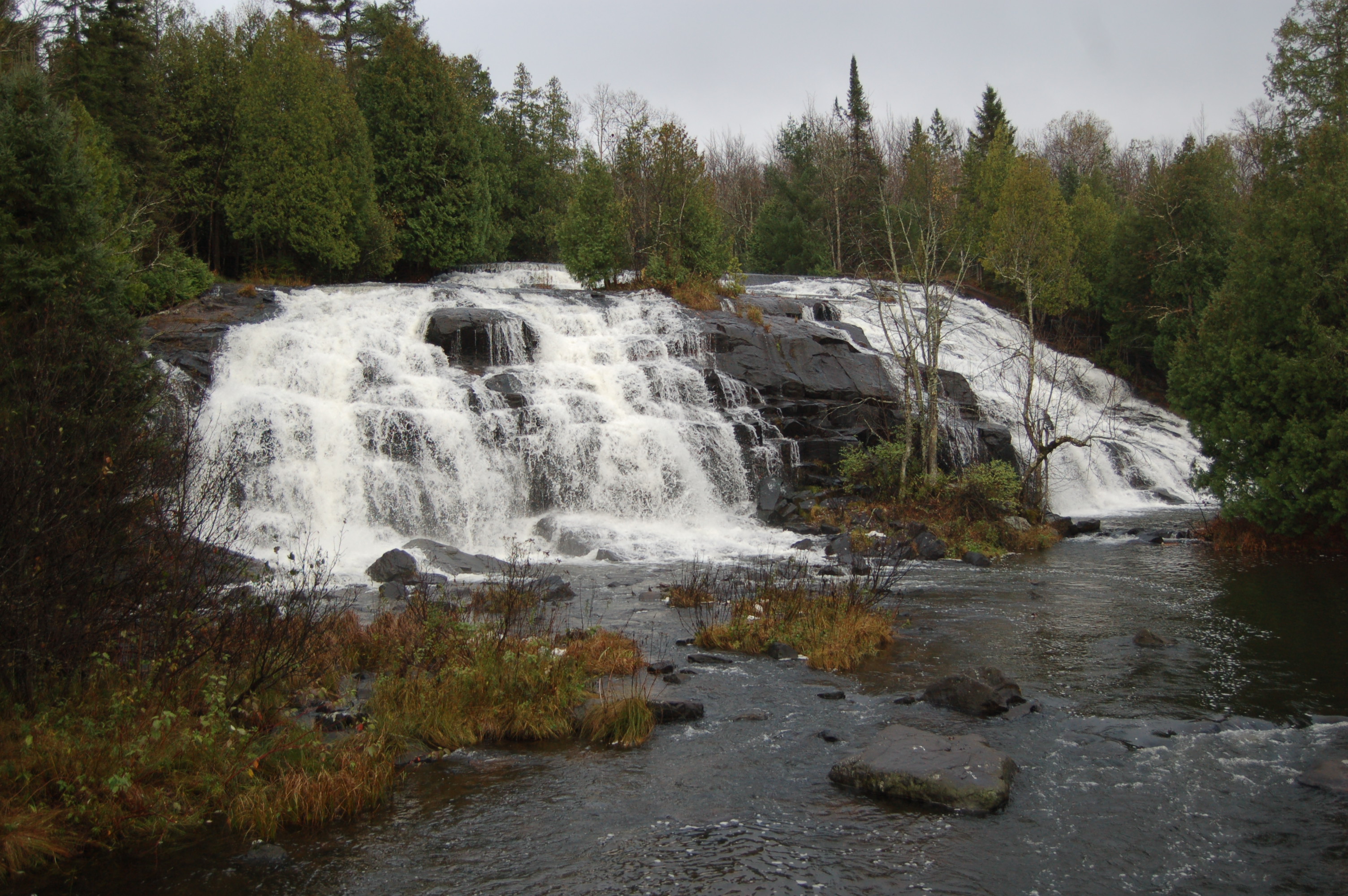
Bond Falls – This is the largest waterfall in the Western Upper Peninsula, and after Tahquamenon Falls it is easily the second largest in the state. The Middle Branch of the Ontonagon River drops 40 feet here, and the falls stretch to more than 100 feet wide. There are a few smaller drops above the main drop, and a dam upstream controls water levels and ensures that this site is a scenic one at all times of the year. A universally accessible pathway and boardwalk leads to great views of Bond Falls from multiple vantage points. This is a State Scenic Site, so a Michigan Recreation Passport is required.
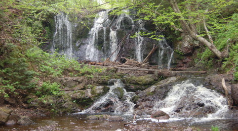
Black River Scenic Byway Falls – As far as the “waterfall experience” goes, it’s hard to top the Black River Scenic Byway and its five major waterfalls in the Ottawa National Forest. Four separate hiking trails lead to five stunning waterfalls, each one beautiful in its own way. Hikes range from 1/8 mile to 3/4 mile and from universally acceptable to moderately challenging. The trailhead parking lots can all be found within a three mile stretch of the byway.
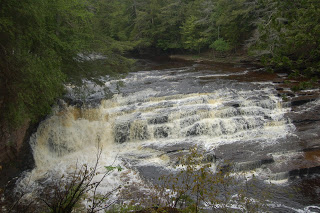
- Potawatomi Falls – This is one of the most scenic falls on the river, and it is reached from the same parking lot as Gorge Falls. The 1/4 mile trail to Potawatomi Falls is universally accessible, and leads to this gradual drop of 30-40 feet on the Black River. At lower water levels, as shown, the water flows to one side as it drops over rock, while at high water it splits into two segments and flows around both sides, and sometimes over the top of, the rock that sticks out in the middle of the river.
- Great Conglomerate Falls – This waterfall draws its name from the large conglomerate rock that splits it into two sections. This is the first cascade reached from the south, and it is a gradual drop of 20 feet at a point where the river is 30 feet wide. It is hard to get a full view of this waterfall from the viewing platform, but there are opportunities to get down below for a better view. The hiking trail to Great Conglomerate Falls is 3/4 mile and mostly smooth.
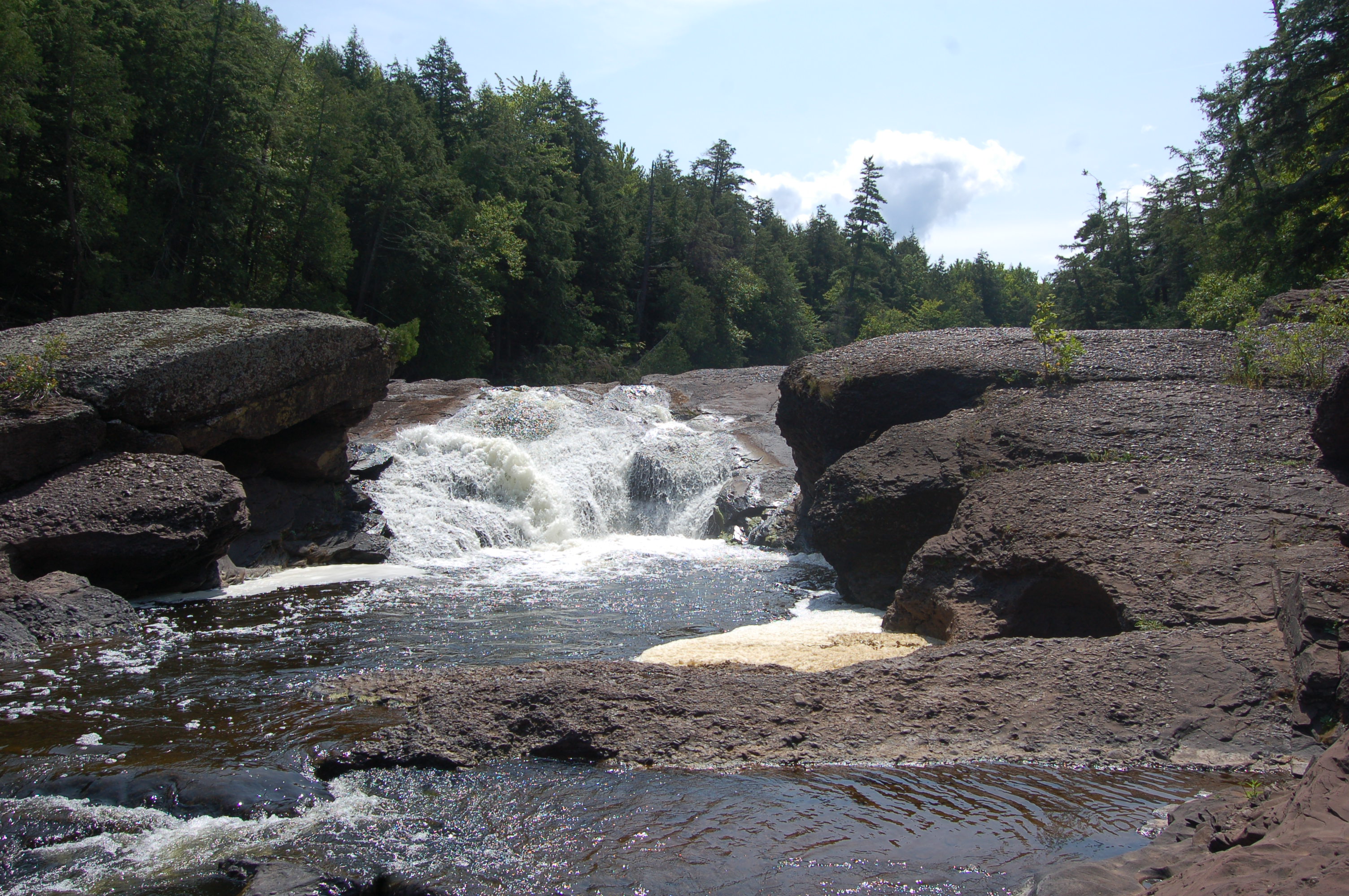
- Gorge Falls – Reached from the same parking lot as Potawatomi Falls, Gorge Falls is the most narrow cascade on the river. This is the third drop of the five (coming from the south), and it is a drop of 25 feet at a point where the Black River is constrained to 10 feet wide as it drops into a gorge. This is an incredibly scenic waterfall, and it retains good flow in all seasons. The hike to Gorge Falls is 1/4 mile, with some stairs as you near the river and the viewing platform.
- Sandstone Falls – This is the smallest drop of the five waterfalls, but I’ve always like the way the Black River is constrained to fit through two large columns of conglomerate rock after it drops 15 feet. The hike back to Sandstone Falls is 1/4 mile, and once you reach the river there are many opportunities for exploring.
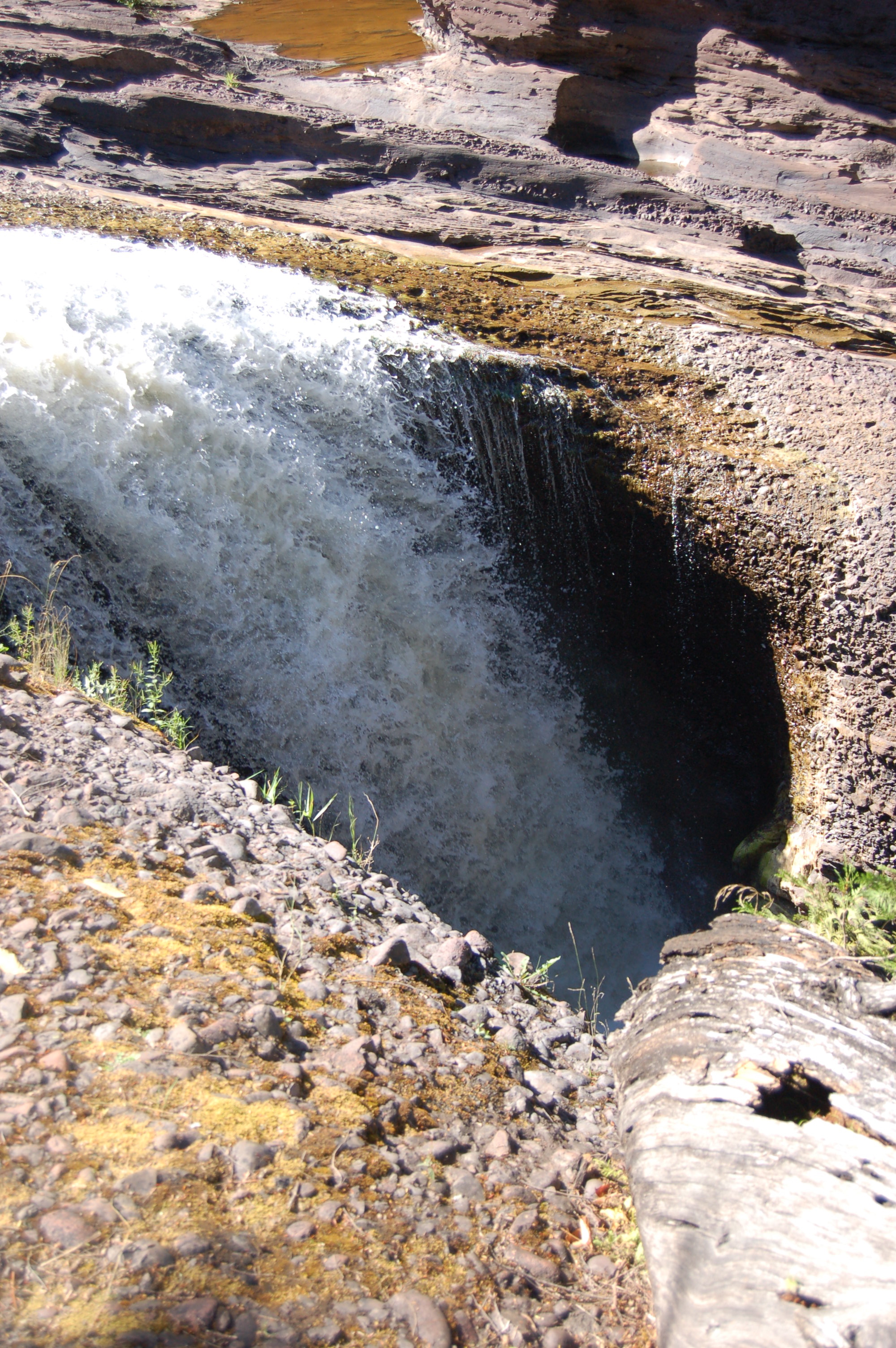
- Rainbow Falls – The Black River makes a 30 foot plunge into a pothole it has carved over the years, forming Rainbow Falls and the last drop before Lake Superior. The hike from the west side is 1/2 mile, but the best views come from the east side. To reach the falls from the east, head to the harbor and cross the wooden suspension bridge to reach the start of a one mile trail to the falls.
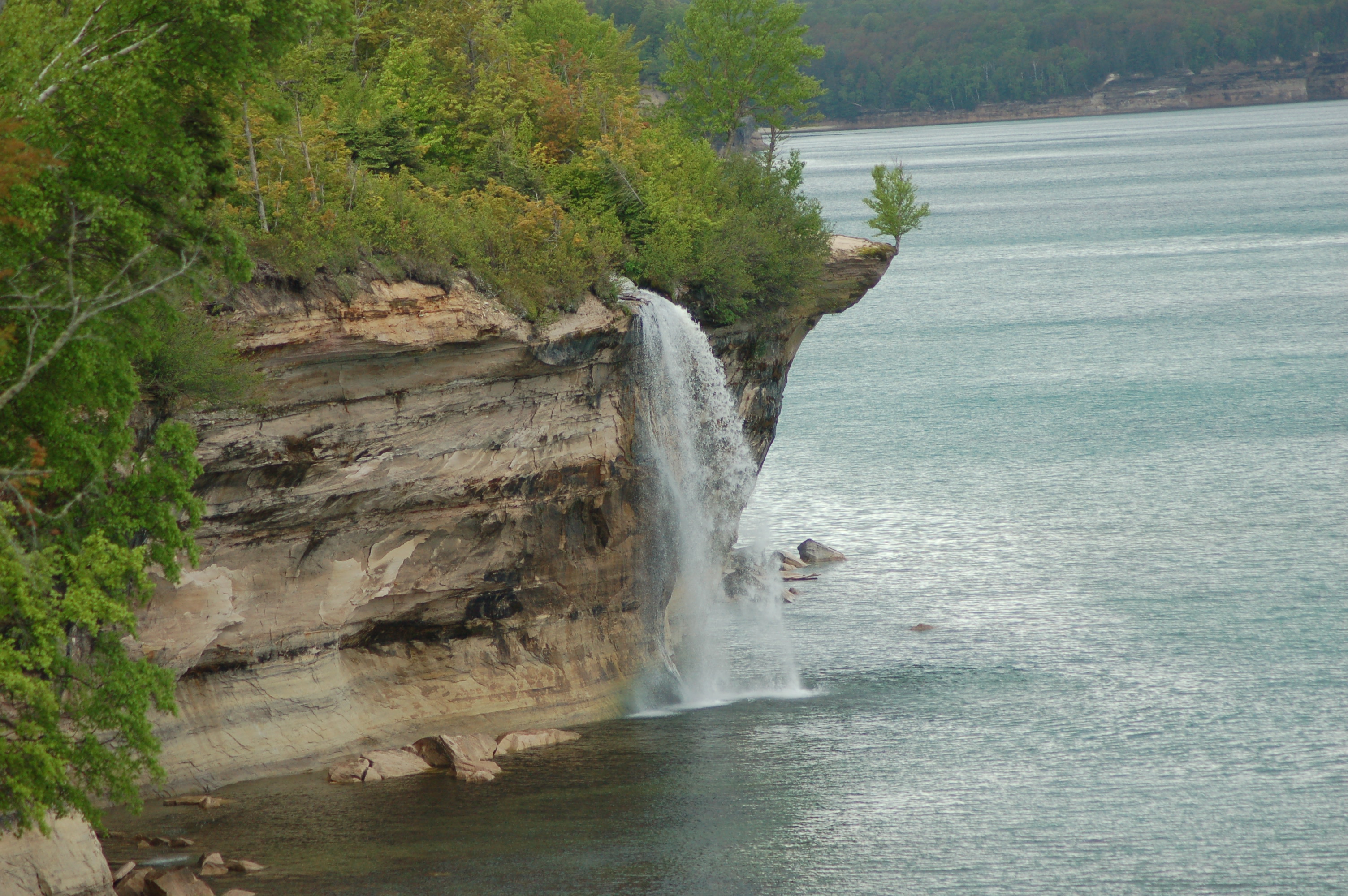
Pictured Rocks National Lakeshore Falls – Waterfalls are just one of the things that draws visitors from around the country to Pictured Rocks each year. Stunning beaches, tall sandstone cliffs, unique rock formations, miles of hiking trails, and dunes are among the other draws to this national lakeshore that stretches from Munising to Grand Marais. While drops like Spray Falls and Bridal Veil Falls are best seen from the water, the three falls below are easily reached and shouldn’t be missed.
- Sable Falls – At the eastern end of Pictured Rocks National Lakeshore near Grand Marais is Sable Falls, a waterfall with an overall drop of 75 feet as Sable Creek falls over sandstone. A hike of 1/4 mile, mostly stairs, takes visitors to the falls. From there the trail follows the creek to Lake Superior and the Grand Sable Dunes.
- Miners Falls – A 3/4 mile hike through the forest leads to Miners Falls, a 50 foot drop on the Miners River as it plunges over a sandstone outcrop. The trail is mostly level and well-worn, and ends with a few steps that lead to an observation platform. In dry conditions there are steep, challenging paths that lead down below. This powerful waterfall is well worth the effort and a memorable addition to any visit to Pictured Rocks.
- Munising Falls – This Pictured Rocks waterfall is located in Munising, and is incredibly easy to get to. A paved trail leads 800 feet to Munising Falls, a 50 foot plunge over a sandstone ledge. This waterfall is most powerful in the spring, but is also a popular spot in the winter when it becomes a frozen column. The trail continues with wooden stairs that lead up on either side for better views.
Wagner Falls – You’ll find this beautiful waterfall just south of Munising near the junction of M-28 and M-94. Wagner Creek makes a 20 foot drop in a shaded, scenic setting that can be easily reached. Wagner Falls is a state scenic site, and the walk to the falls is only 300 yards. The roadside Alger Falls is located nearby.
Laughing Whitefish Falls – A State Scenic Site located a half hour away from either Marquette or Munising, Laughing Whitefish Falls features one of Michigan’s tallest drops. A well-worn trail to the falls is about a mile in length, and leads to a set of stairs that reach a viewing platform at the bottom of the falls. The upper drop is 10-15 feet, and from there the river fans out over layers of limestone and continues its fall for a total of 100 feet.
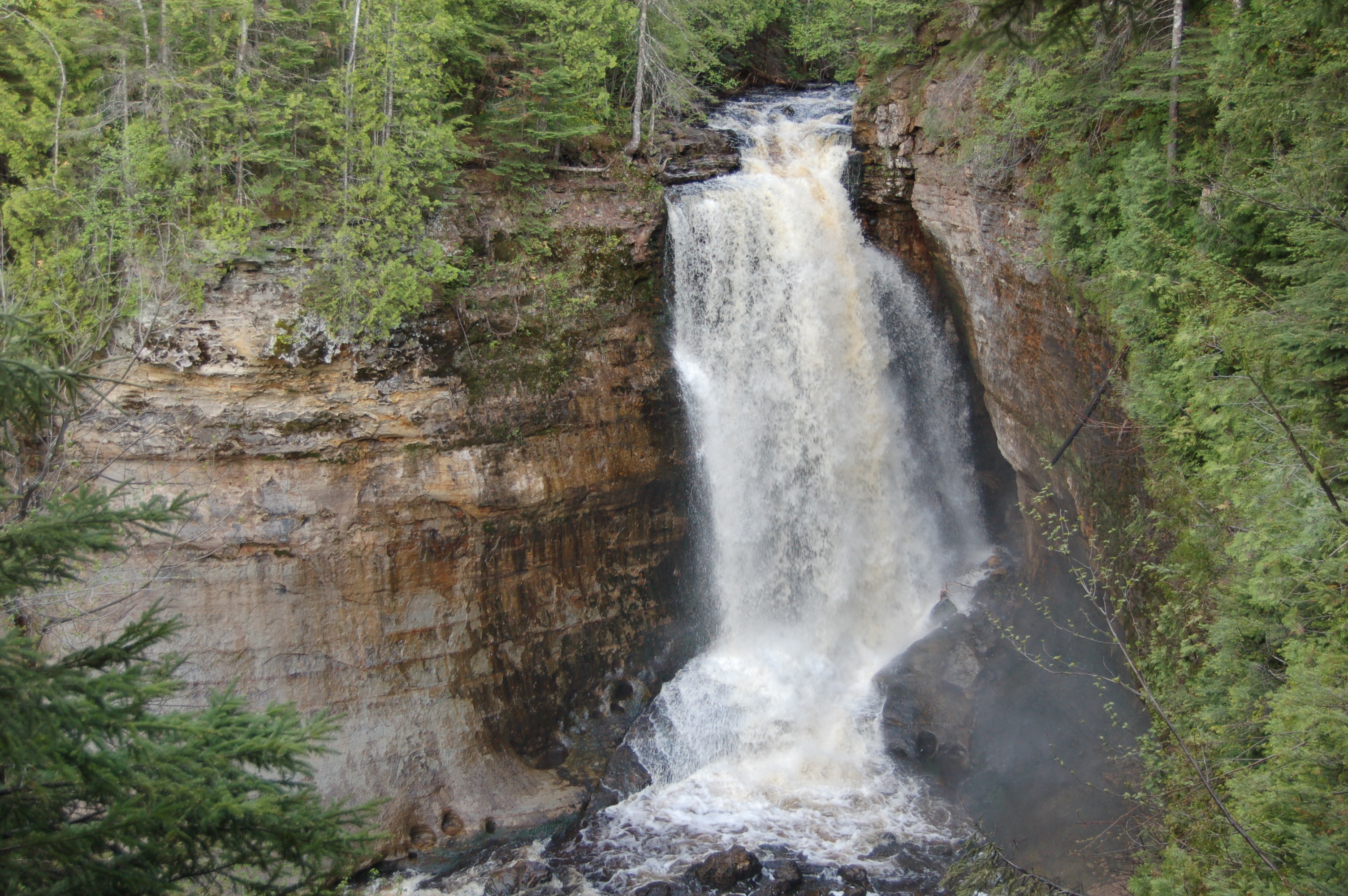
Dead River Falls – A collection of seven drops on the Dead River, this collection of waterfalls is easily accessible and are 10 minutes away from downtown Marquette. The lower drops are only a few feet in height, and from there the trail gets steep and difficult. Those who press on are rewarded with more drops that range from 10-25 feet in height, as the river powers on between dams.
Agate Falls – Another State Scenic Site, Agate Falls is a 40 foot drop on the Middle Branch of the Ontonagon River. The river is 60 feet wide here, and it falls over tiered sandstone. A paved trail leads to a viewing platform at the top of the falls, and a steep, narrow dirt path heads to the base of the falls from there – it’s not for everyone but that is where the best views come from.
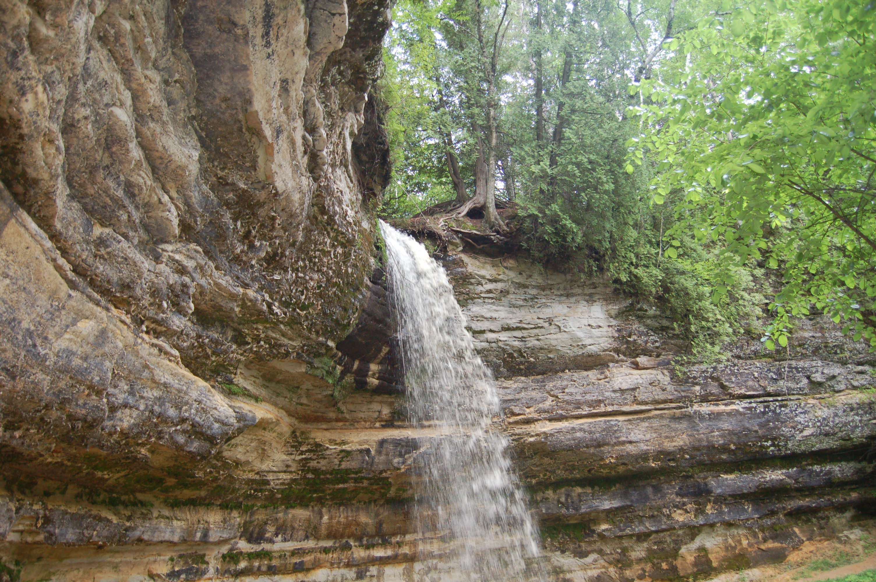
Eagle River Falls – A dam has robbed Eagle River Falls of some of its power, but it remains one of the tallest drops in the Keweenaw as well as one of the easiest to visit. A pedestrian bridge next to M-26 provides a straight-on view of this 40 foot drop, which is best viewed in the spring or after heavy rain. The dam at the top of the falls used to power a safety fuse factory. Eagle River flows to Lake Superior after this drop.

Porcupine Mountains Wilderness State Park Waterfalls – Michigan’s largest state park features more than 60,000 acres of forests, Lake Superior shoreline, miles of hiking trails, scenic overlooks, waterfalls, and wildlife. While many of the waterfalls are located in the backcountry, the most impressive ones can be found on the west end of the park. Greenstone Falls and Overlooked Falls are also worth a visit if you’re making the drive from the west end to the east end, but the three waterfalls listed below are the ones you don’t want to miss:
- Manabezho Falls – The largest and most stunning of the three major drops on the Presque Isle River, Manabezho Falls is a 150 foot wide, 25 foot tall towering drop less than a mile before the river reaches Lake Superior. It is reached by a short hike and several flights of wooden stairs that lead to a viewing platform. Manido Falls is directly upstream.

- Manido Falls – At a height of 10-15 feet, Manido Falls doesn’t impress with the size of its drop but rather with how wide the river is here and the way it works through the rocks. Many potholes are visible from years of erosion, and in multiple visits to Manido Falls we’ve never seen it look exactly the same.
- Nawadha Falls – A distant view of Nawadha Falls can be found from the top of Manido Falls, while a short trail from behind the ranger station leads to closer views on the river’s western side. To truly appreciate this 20 foot tiered cascade, view it from the more primitive trail on the river’s east side.
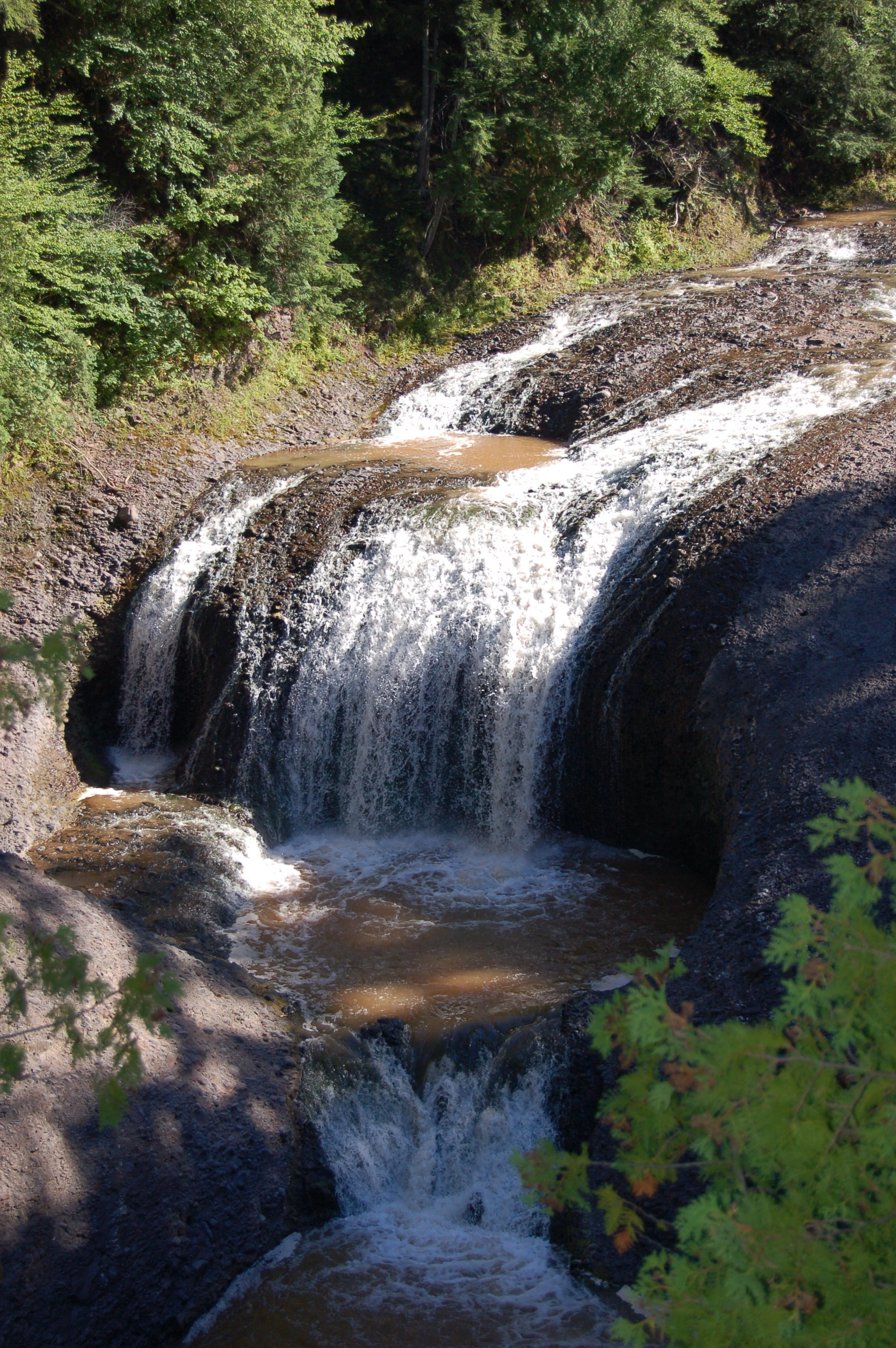
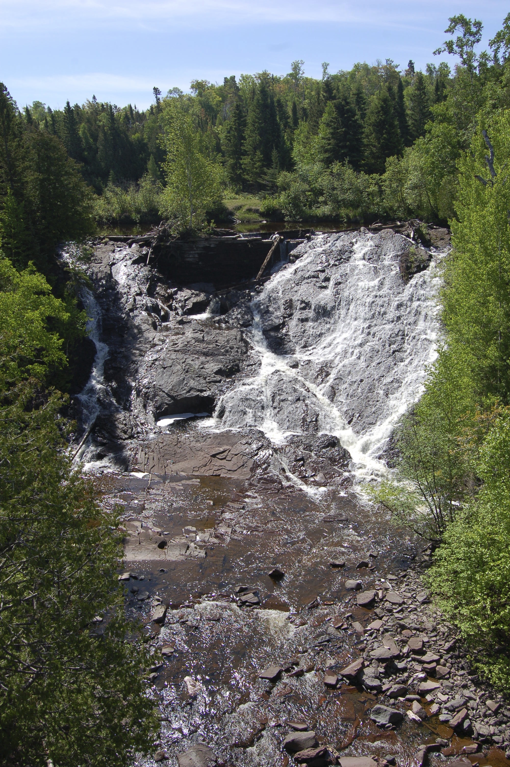
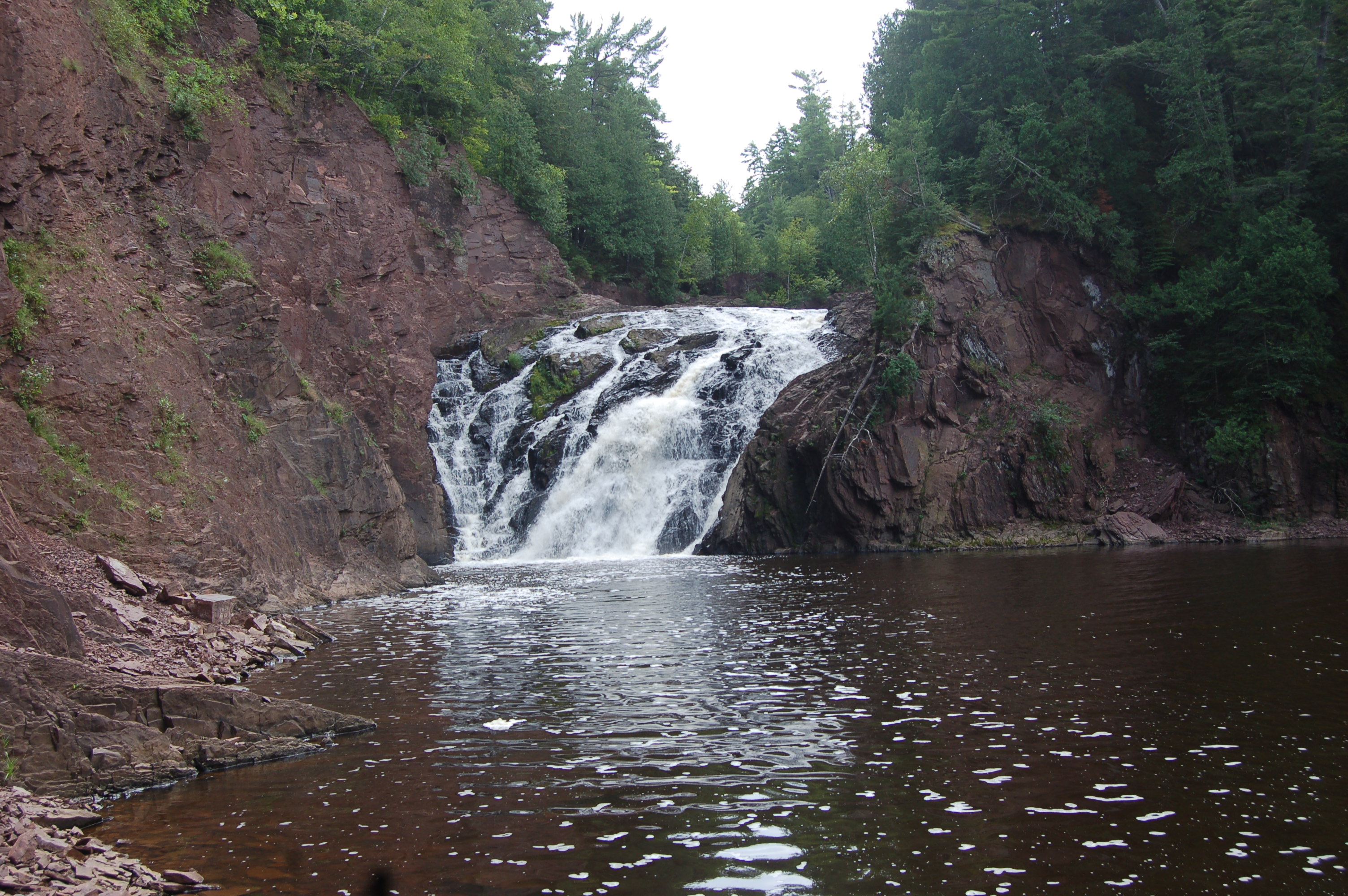
Falls River Falls – The L’Anse/Skanee area is home to many scenic waterfalls, and the collection of cascades on the Falls River is definitely worth visiting. Starting south of L’Anse with Powerhouse Falls and Power Dam Falls, the river then continues to the Upper Falls (on private property), Unnamed Falls near the train trestle, Middle Falls (shown above), and the Lower Falls before the river reaches Lake Superior. The Middle and Lower Falls are easily accessible from hiking trails within the city limits.

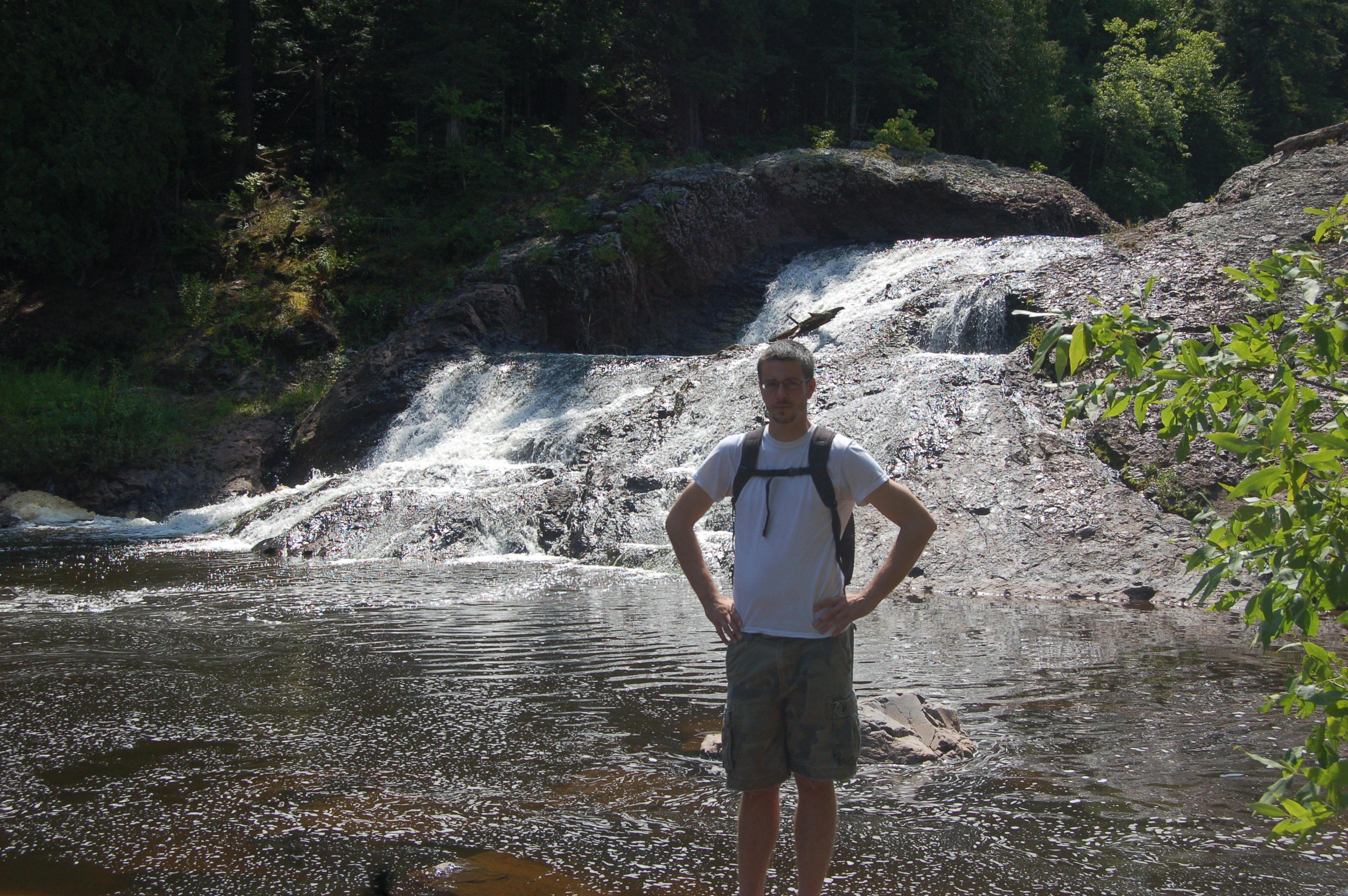
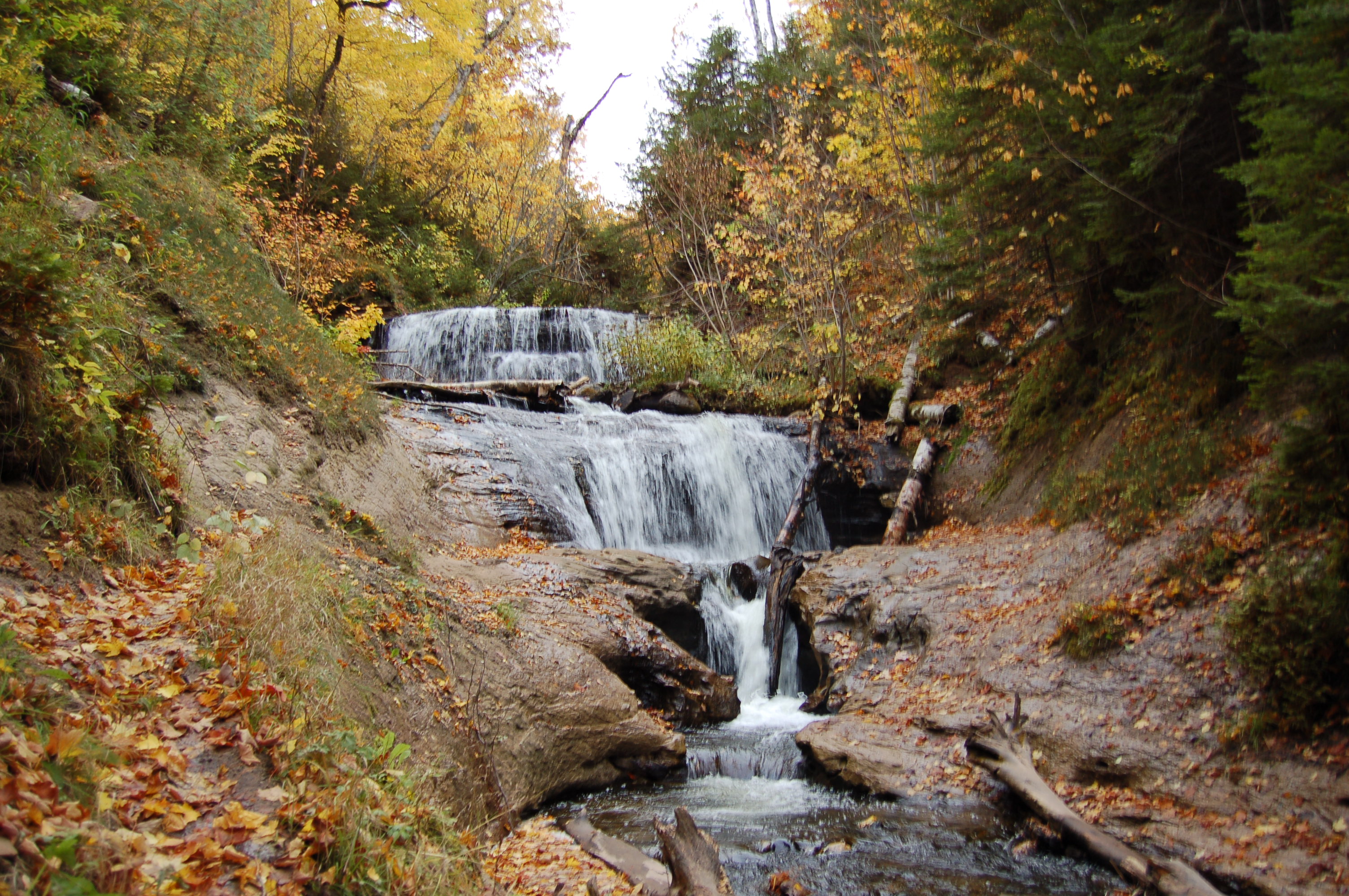
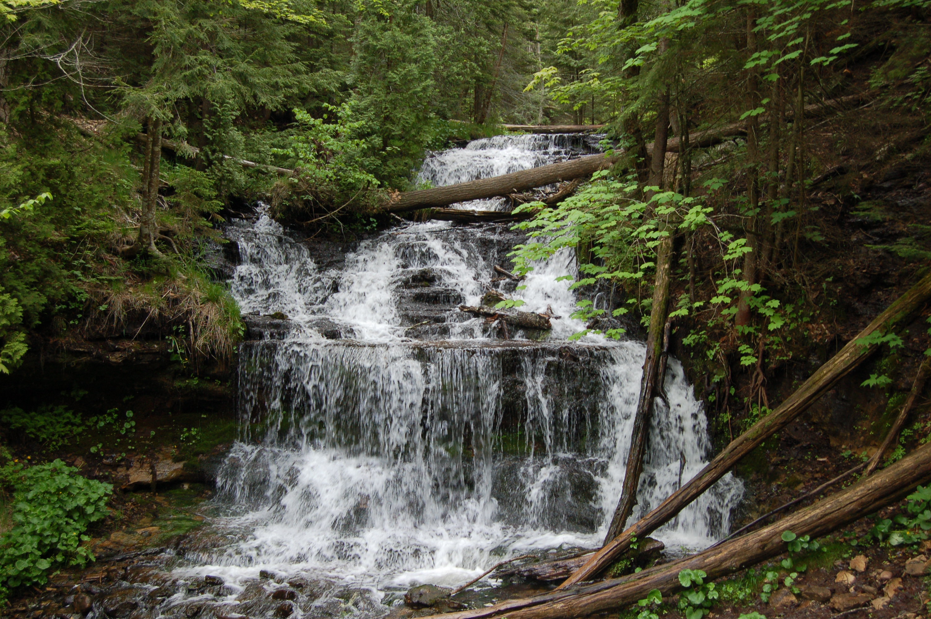
Hungarian Falls – This is one of our favorite stops for the complete waterfall experience, as Dover Creek makes several stunning drops on its way to Torch Lake. The Upper Falls is a 20 foot drop, and from there the creek flows into a man-made reservoir above a dam. The water continues to flow over a spillway and then makes several unnamed drops of up to 20 feet (shown above). The Lower Falls is a stunning 50 foot sheer drop that is difficult to view. The Upper, Middle, and Unnamed Falls can easily be reached by a trail that is mostly flat and well-worn.

Ocqueoc Falls – The Lower Peninsula’s only named waterfall is also one of the first universally accessible sites in the state. Ocqueoc Falls is a popular spot for swimming in the summer and for fishing as well. Several miles of trails converge here, and though the river only drops a total of 10-15 feet it does so in an incredibly beautiful and natural setting.
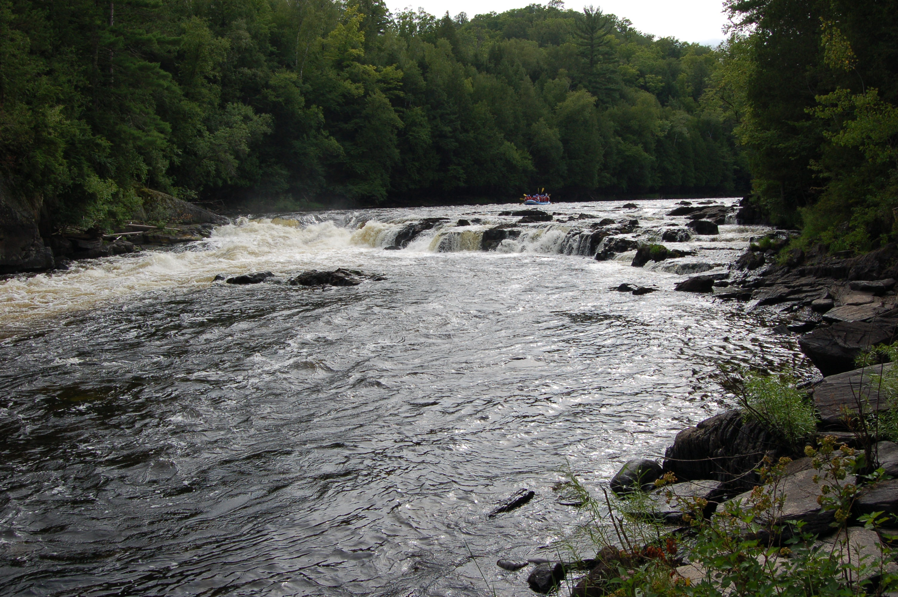
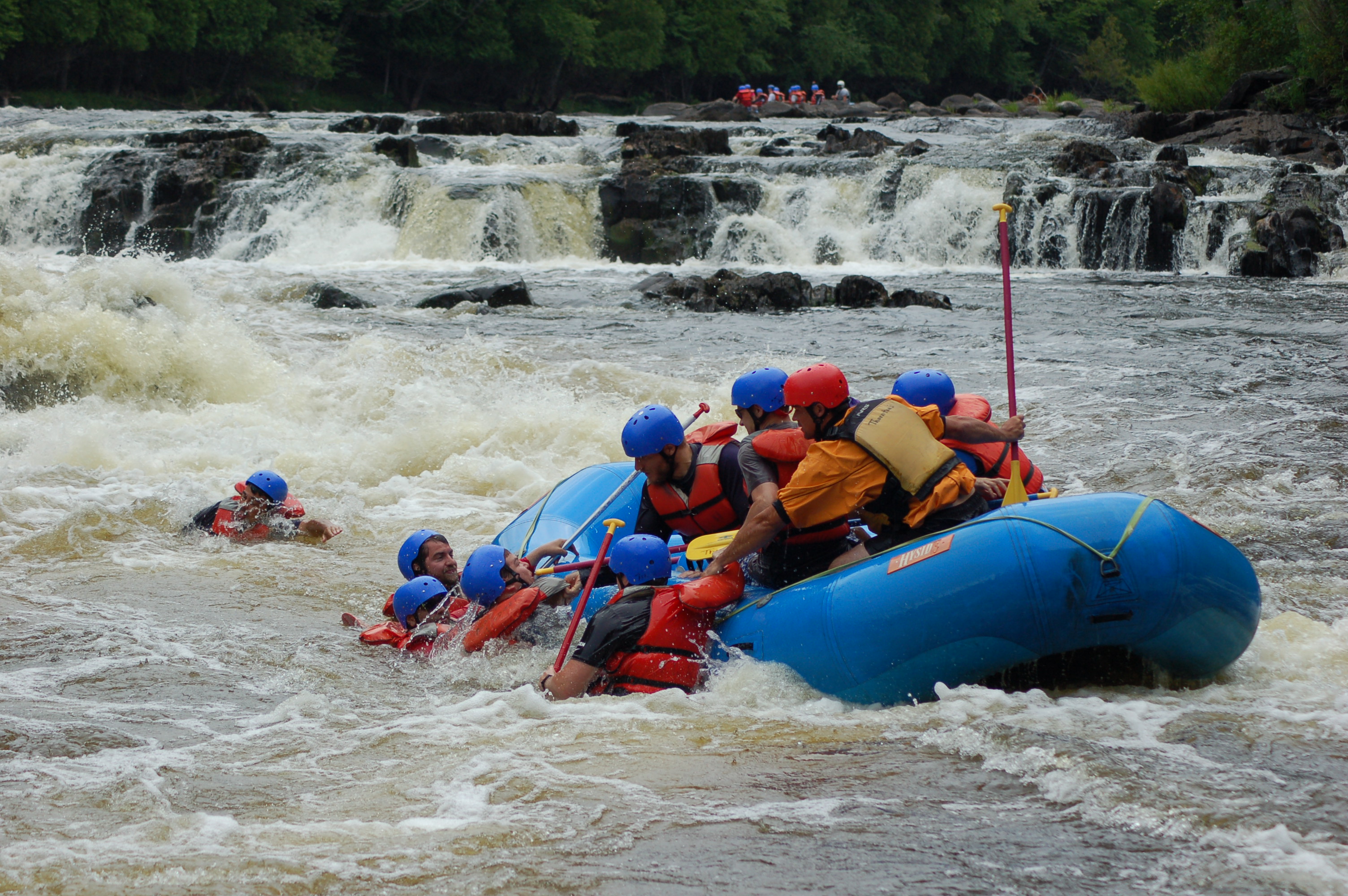
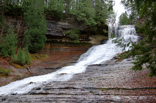
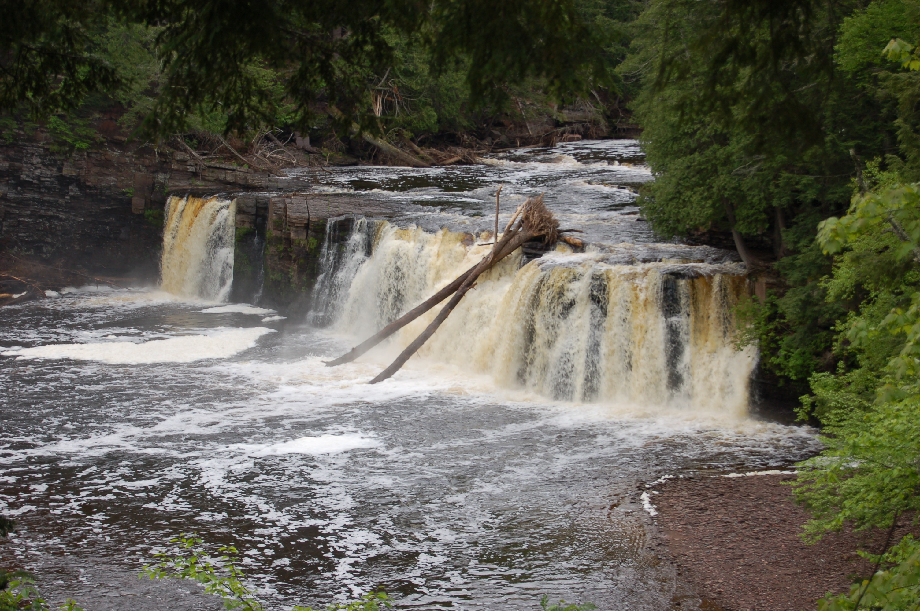
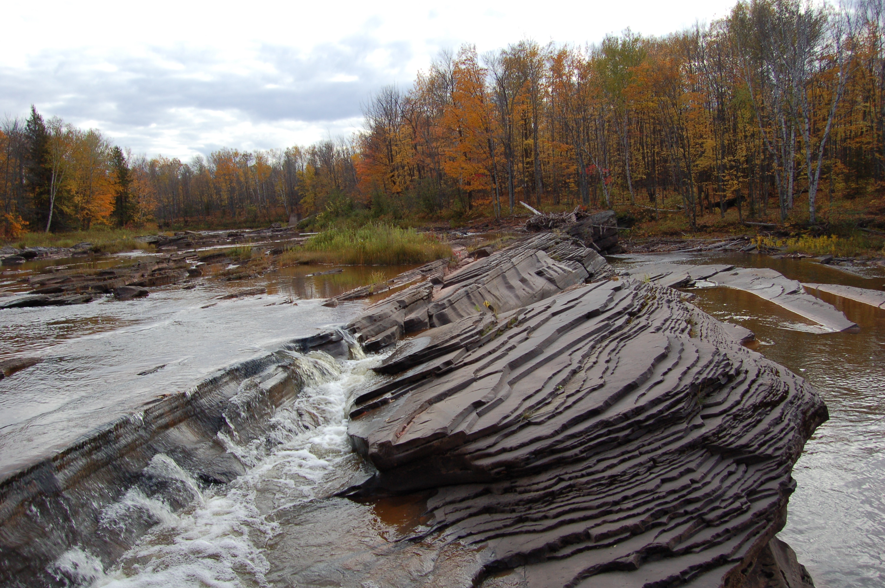
Piers Gorge – The Menominee River forms the border between Michigan and Wisconsin, and a Michigan State Recreation Area provides access to trails that lead to multiple waterfalls. Two sets of lower falls are more like rapids when water levels are higher, but the trail continues on to Misicot Falls. Here, the river drops 15-20 feet over its entire 100 foot width as jagged rocks poke their way to the surface. This is a popular area for whitewater rafting, and you can see pictures of that intense adventure with our Photo Gallery Friday: Piers Gorge post. After Misicot Falls the trail continues for about a mile to Sand Portage Falls, a set of rapids formed as the river splits and works its way around an island.
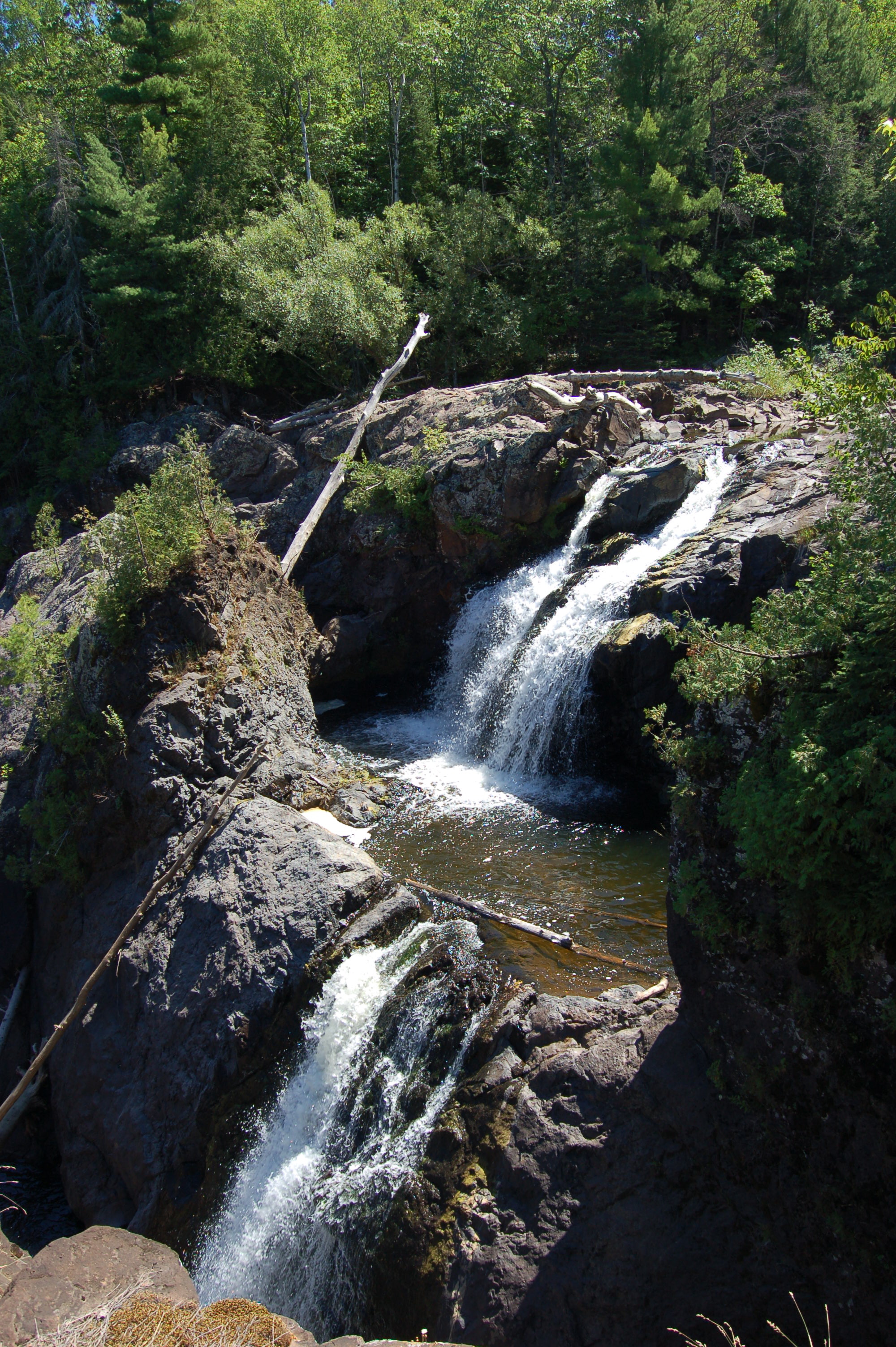
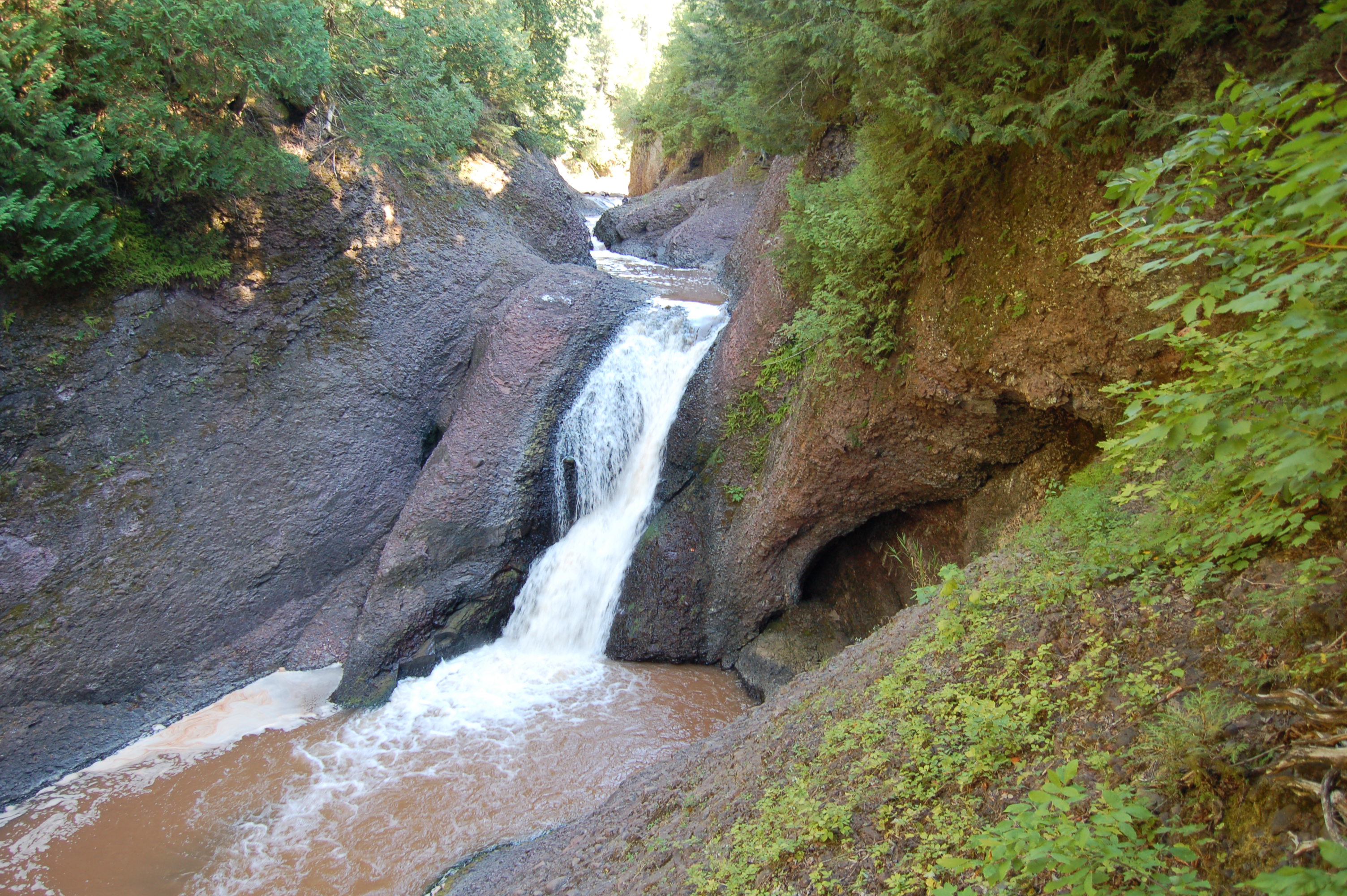
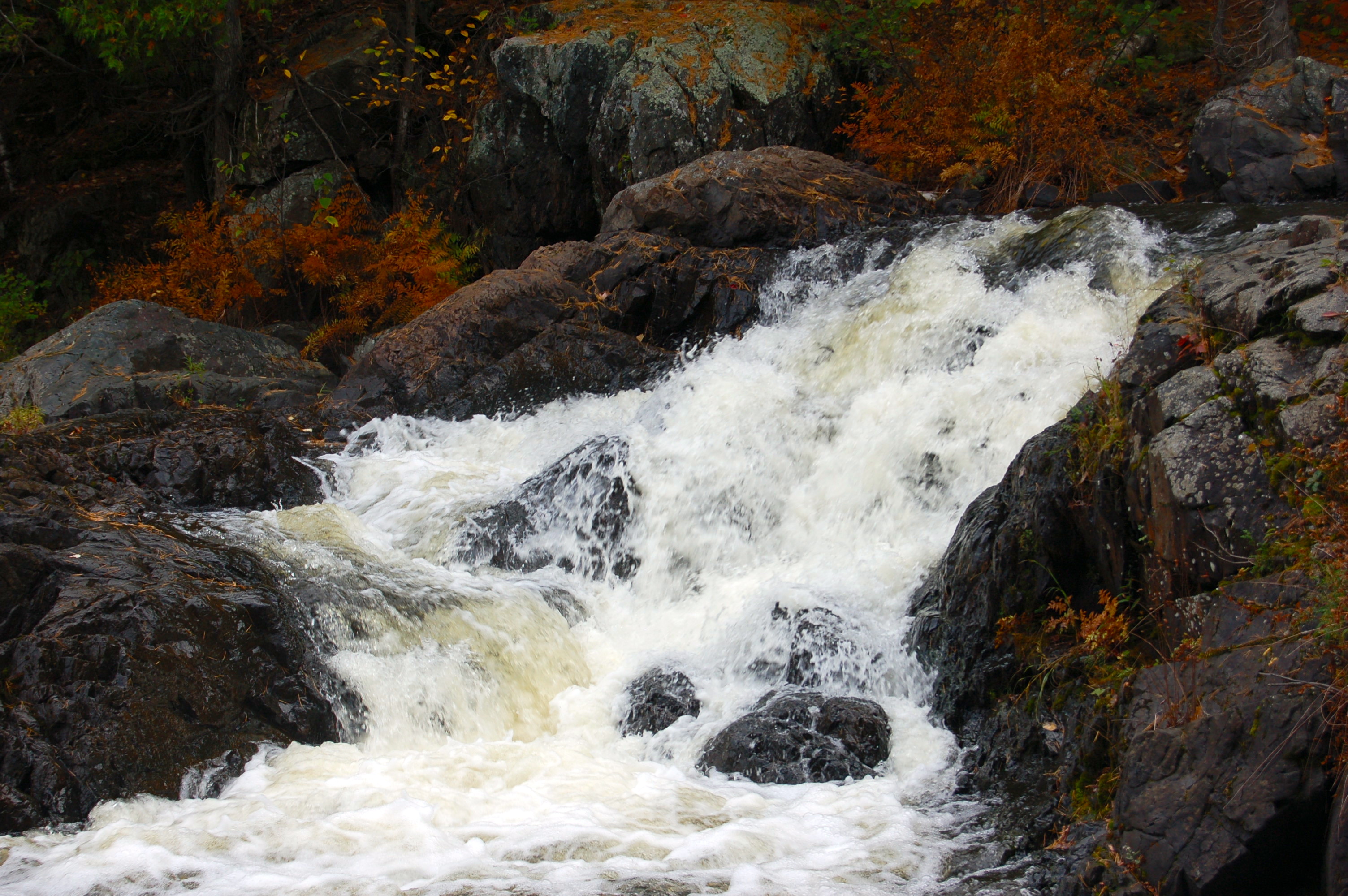
Gabbro Falls – This impressive drop on the Black River is easy to reach, but rarely visited in comparison to the falls found on the scenic byway. Gabbro Falls features an upper drop of five feet before making the double drop shown above (40 feet in total) and plunging into a small gorge. Only two miles from the highway, an unmarked path next to a ski resort leads into the woods and to the top of the falls. A beautiful and unique waterfall, Gabbro Falls is also a great place for peace and quiet.
Superior Falls – The Montreal River forms the border between Michigan and Wisconsin as it empties into Lake Superior, with Superior Falls being the last drop before it gets there. A dam has robbed this waterfall of some of its glory, but XCel Energy has also helped make it accessible for visitors. A steep trail leads downhill to the lakeshore and its towering cliffs. The trail to the falls passes a powerhouse then hugs the side of the gorge before reaching a vantage point for the 60+ foot main drop.
Bonanza Falls – One of our favorite Michigan waterfalls is something of a hidden gem just outside the east boundary of the Porcupine Mountains Wilderness State Park. The Big Iron River is 100 feet wide here and in the spring Bonanza Falls spans that entire width. At lower water it becomes segmented, with several 10 foot drops on the ends and in the middle. The bedrock here tilts up at an angle, making this a unique spot with many chances for exploring. In the spring at high water it is powerful and stunning to behold, in other seasons it is less impressive but the exposed riverbed makes for easy access for swimming, wading, and photography.

There are several falls in the LP, including Swan Falls and Rainy River Falls, both in Presque Isle County.